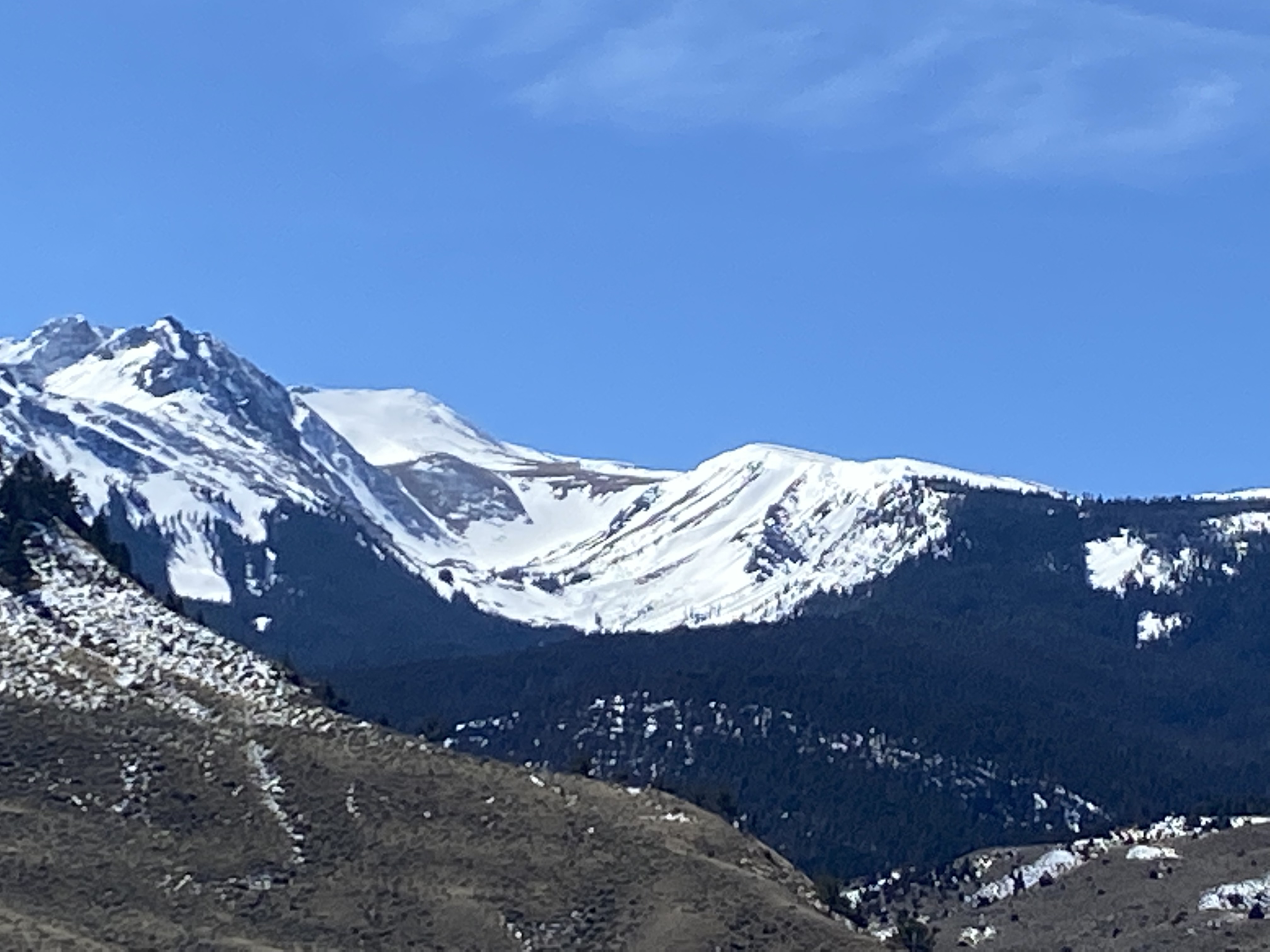
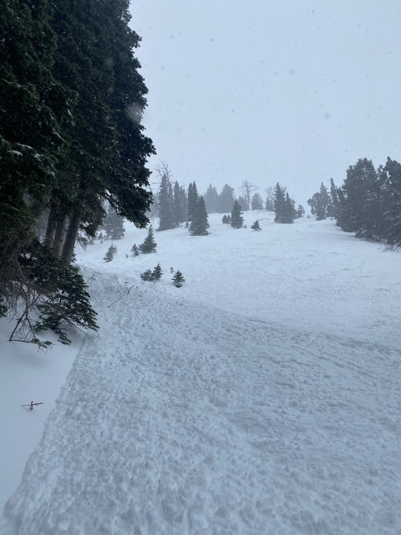
I noticed a couple of wet slides that came off Electric and it’s sun-ridge today. Photo: Anonymous
Trip Planning for Southern Gallatin

Primary Problem: Wind Slab
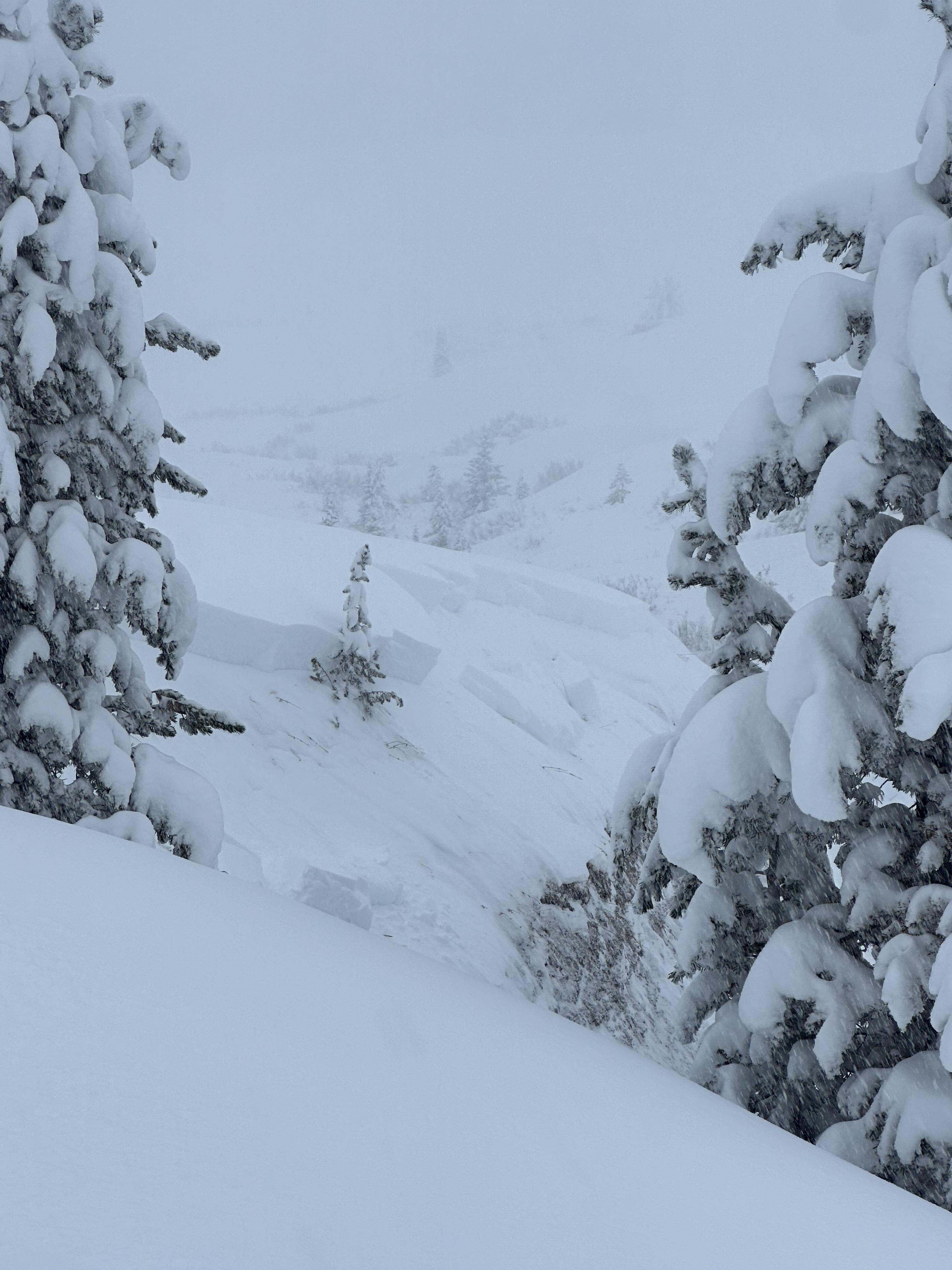
Bottom Line: Avalanche conditions are complicated by a mix of winter and spring weather this week. Rain and snow fell on mountain snowpacks, with the most significant precipitation in the Bridger Range for the start of the week. The more new snow there is, the more likely you are to encounter avalanches and the larger their potential size. If your travel plans take you to slopes steeper than 30 degrees, assess how the new and wind-drifted snow is bonding to the old snow surface by watching for clear signs of instability, such as avalanches and shooting cracks. If rain fell on the snowpack and as temperatures warm, breaking through an unsupportable and slushy snowpack, seeing pinwheels of wet snow and small wet slides are indicators of wet snow instability.Past 5 Days
Sat Apr 19

Moderate
Moderate
Sun Apr 20

Low
Low
Mon Apr 21

None
None
Fri Apr 25
None
None
Mon Apr 28
None
None
Relevant Photos
Displaying 1 - 25
-

-

Understanding Avalanche Safety Preparedness – 5-Minute Survey for Motorized Users
We need your input! Eastern Oregon University is conducting a survey to better understand avalanche safety preparedness among motorized backcountry users like you. Your feedback will help us learn more about who is purchasing and practicing with avalanche rescue gear (beacon, probe, shovel) and participating in avalanche education—and why some riders aren’t. The survey is confidential and anonymous.
Your feedback is invaluable in improving avalanche education and awareness. Please take a moment to share your experience and help us make a difference.
https://eoustmhs.qualtrics.com/jfe/form/SV_3L8QKAuZzcxJBLo
Thank you for your time and for being a part of this important effort!
-

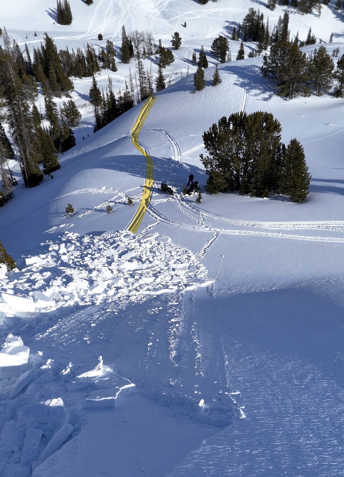
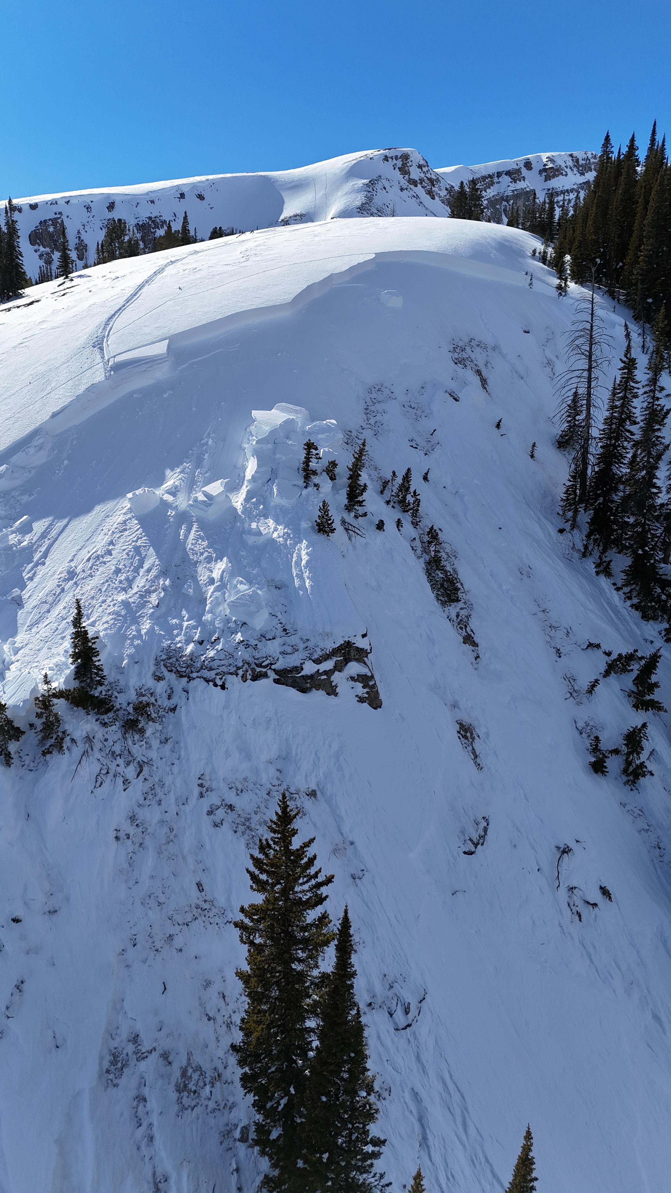
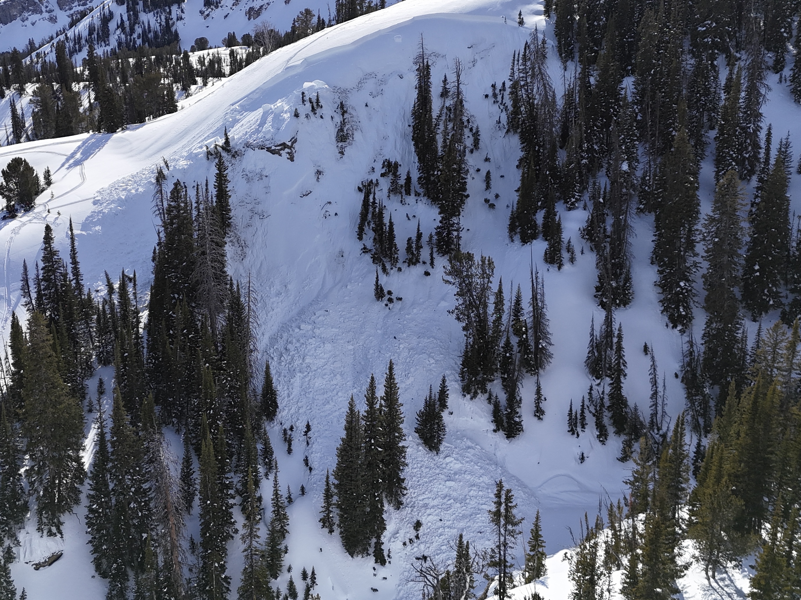
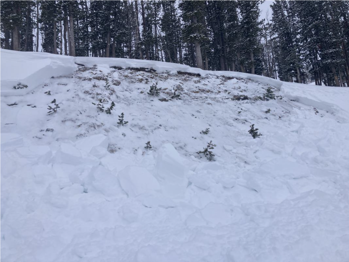
A rider triggered a huge avalanche in the uppermost reaches of Targhee creek on a north facing slope at 9200'
-

A rider triggered a huge avalanche in the uppermost reaches of Targhee creek on a north facing slope at 9200'
-

A rider triggered a huge avalanche in the uppermost reaches of Targhee creek on a north facing slope at 9200'
-

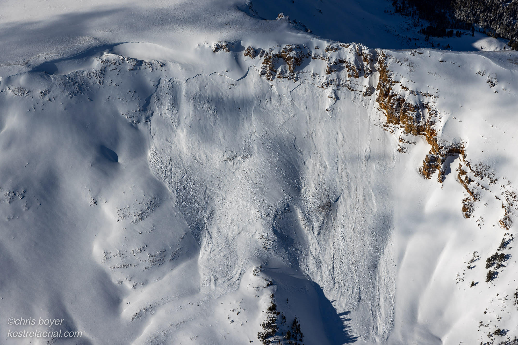
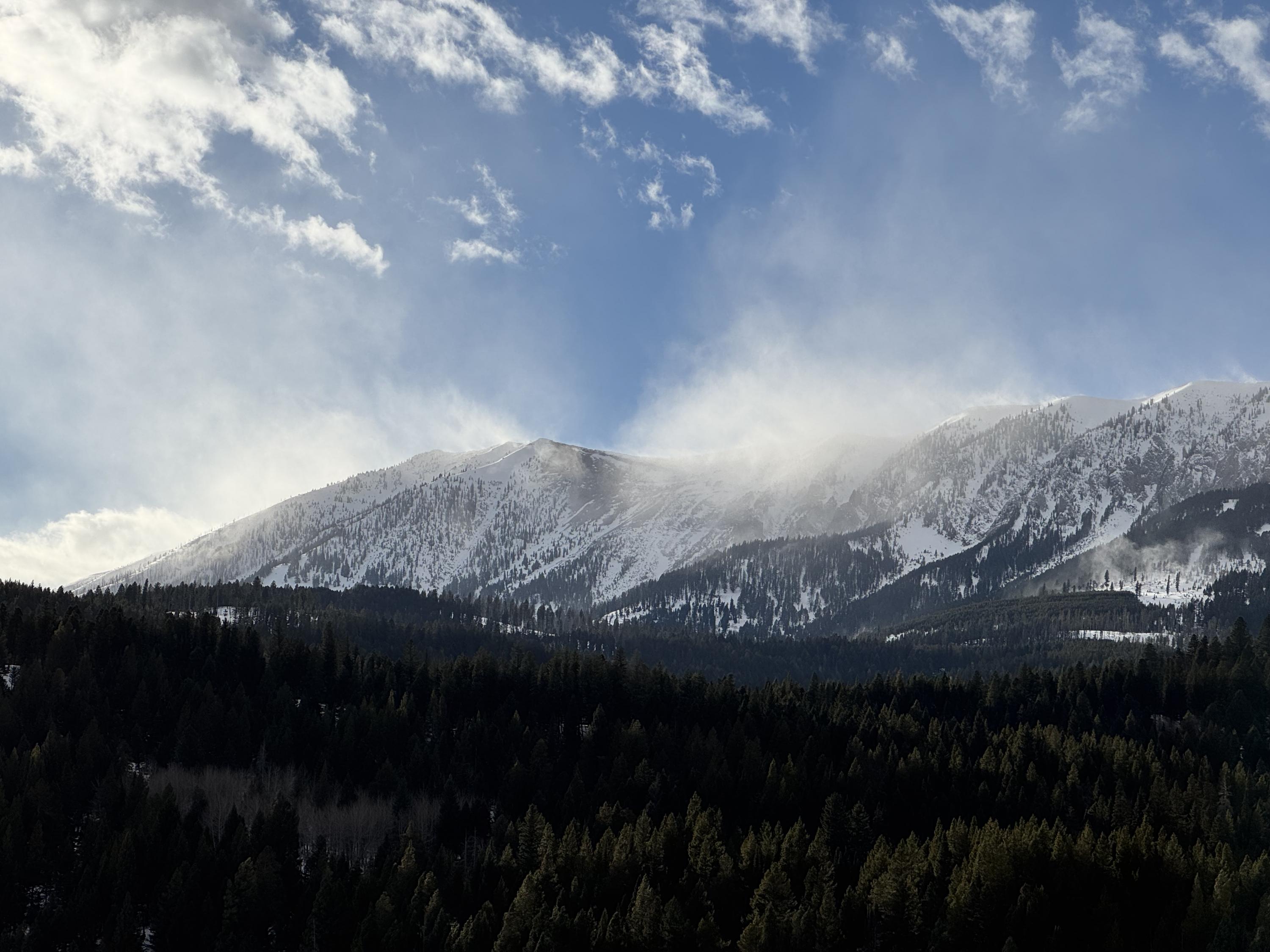
Natural avalanche spotted from the air on Red Mountain, just west of Ernest Miller Ridge
-

-

We experienced a remarkable number of thunderous collapses throughout the day (I lost count), one of which triggered an avalanche into Specimen Creek while we were in the flats. Photo: R Parsons
-

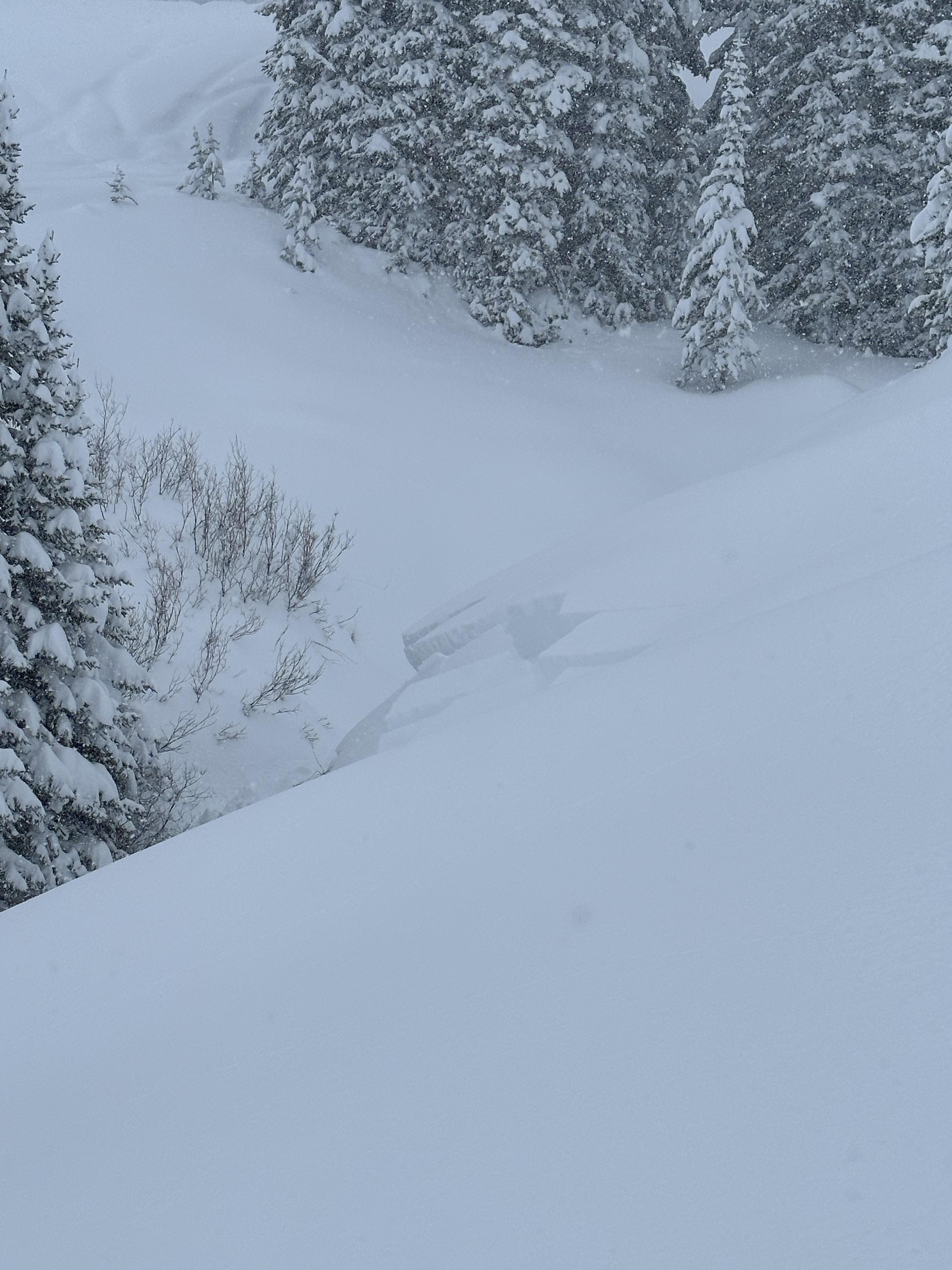
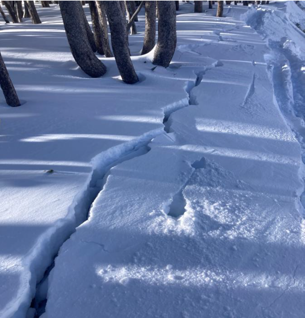
From obs on 12/29: "On our way out near the cabin I cut a line close to a creek to see if I could trigger something."
-

From obs on 12/29: "On our way out near the cabin I cut a line close to a creek to see if I could trigger something."
-

Plumes of drifting snow in the Bridger Range as strong winds blasted the mountains. Photo: GNFAC
-

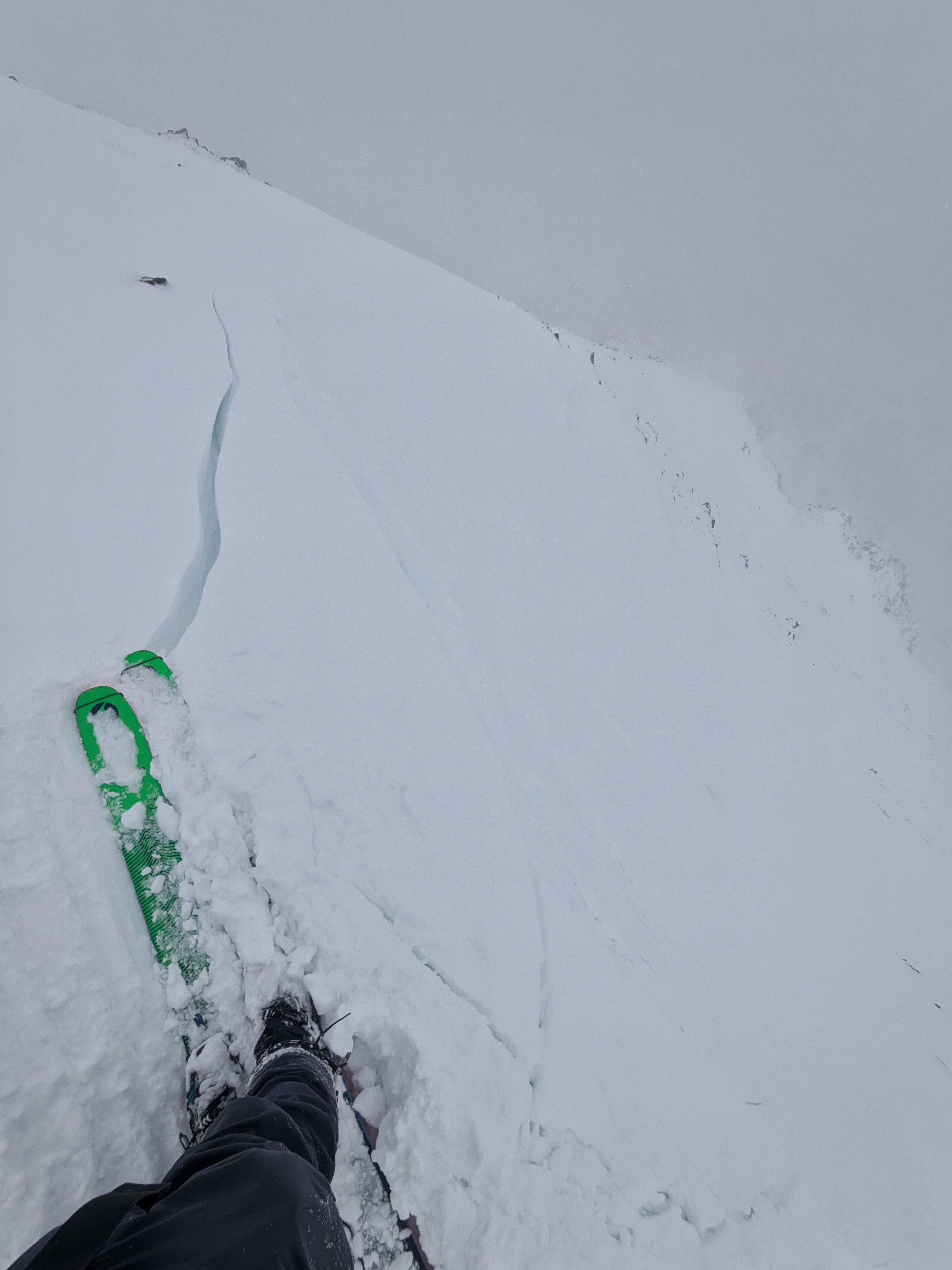
From IG: On 12/15 "Storm slab broke about 200’ above us as skinning up the hallway coming from the north side on the throne." Photo: Anonymous
-

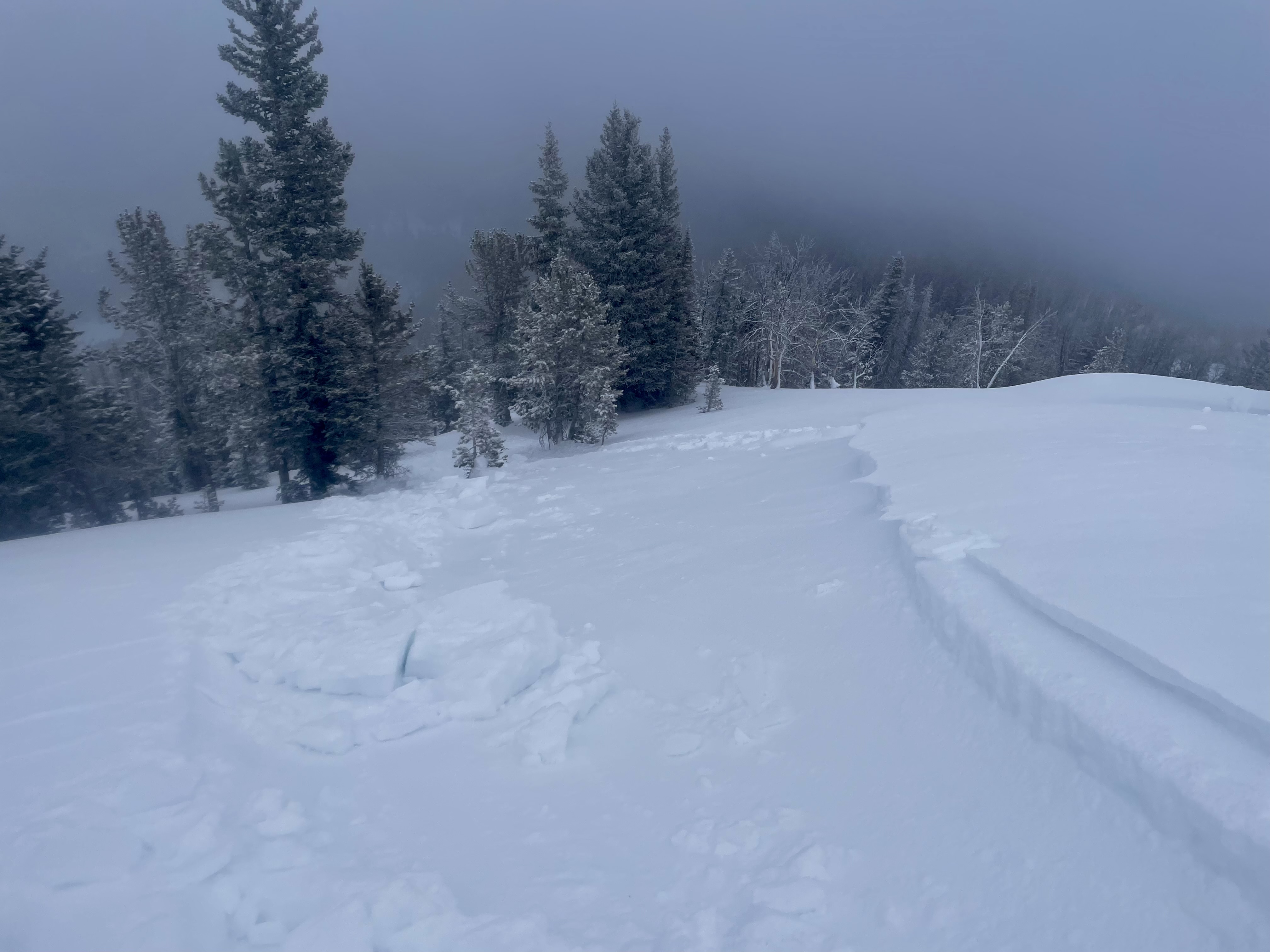
Gusty winds transporting snow in Taylor Fork on Saturday. Triggered a 4-5 inch deep wind slab that propagated about 50 ft at the top of a north east facing slope at 9,500 ft.
Photo: JP
-

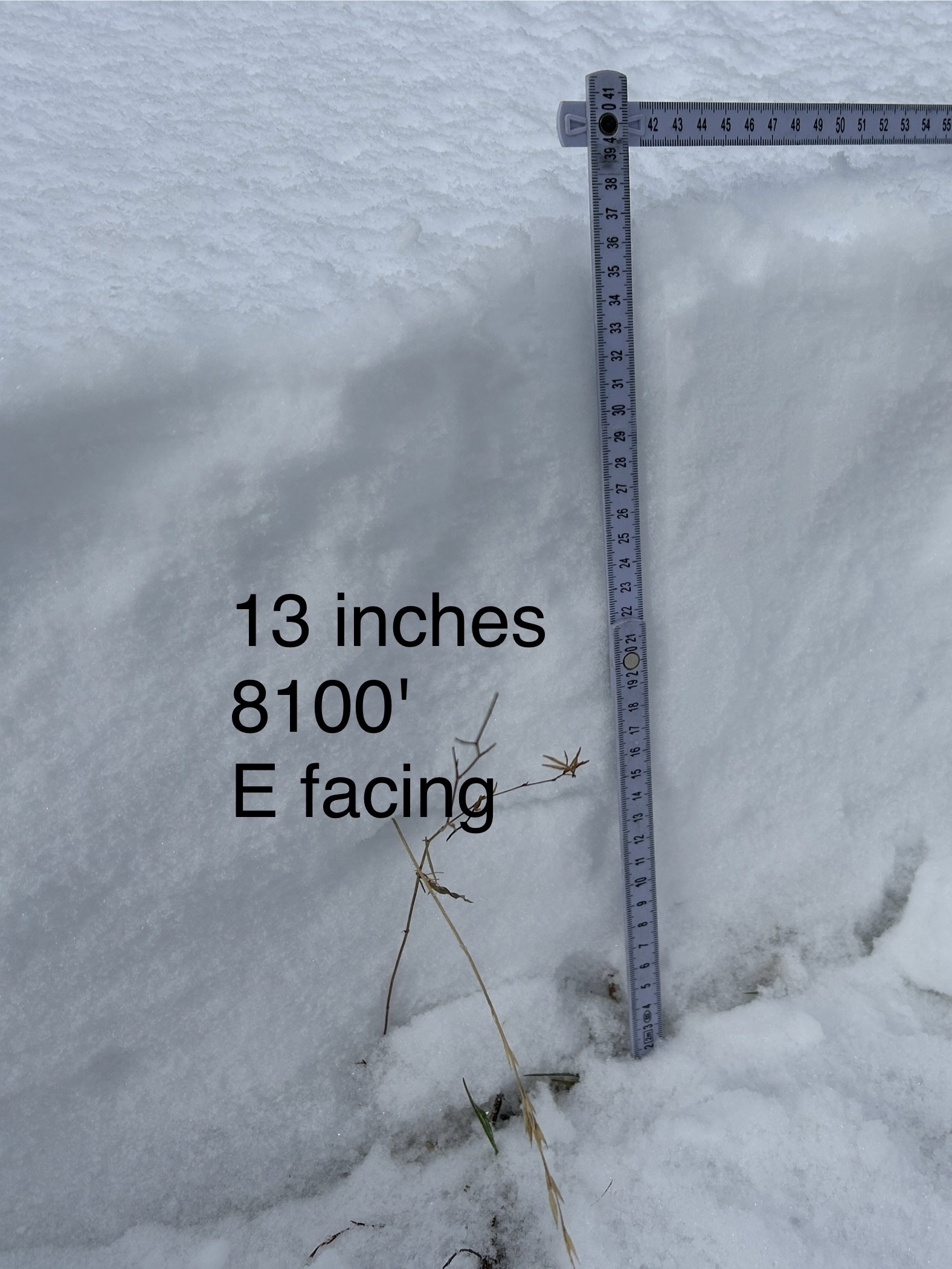
WE facing snow at 8100 ft Cabin Ck
-

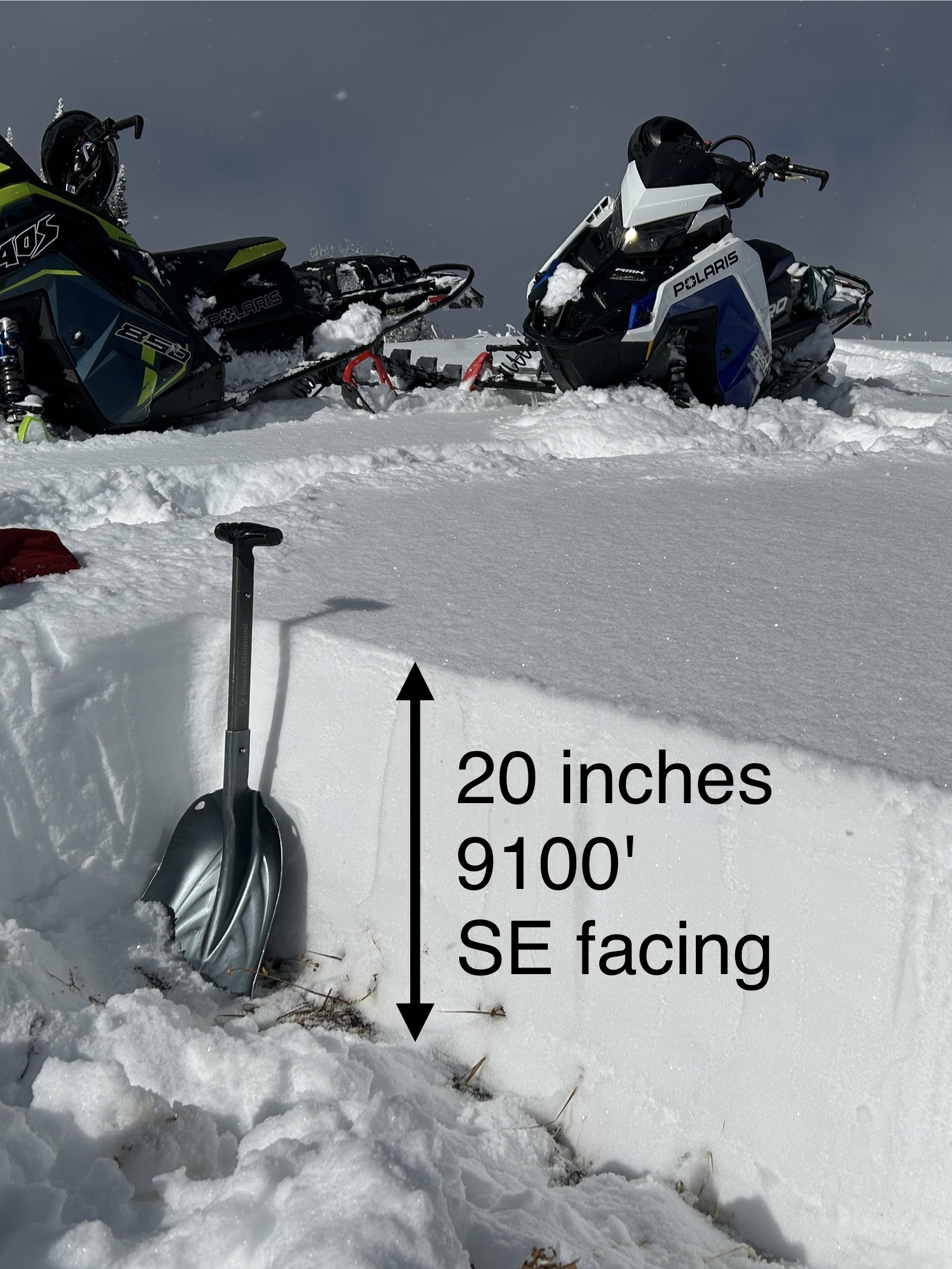
SE facing snow Cabin Creek
-

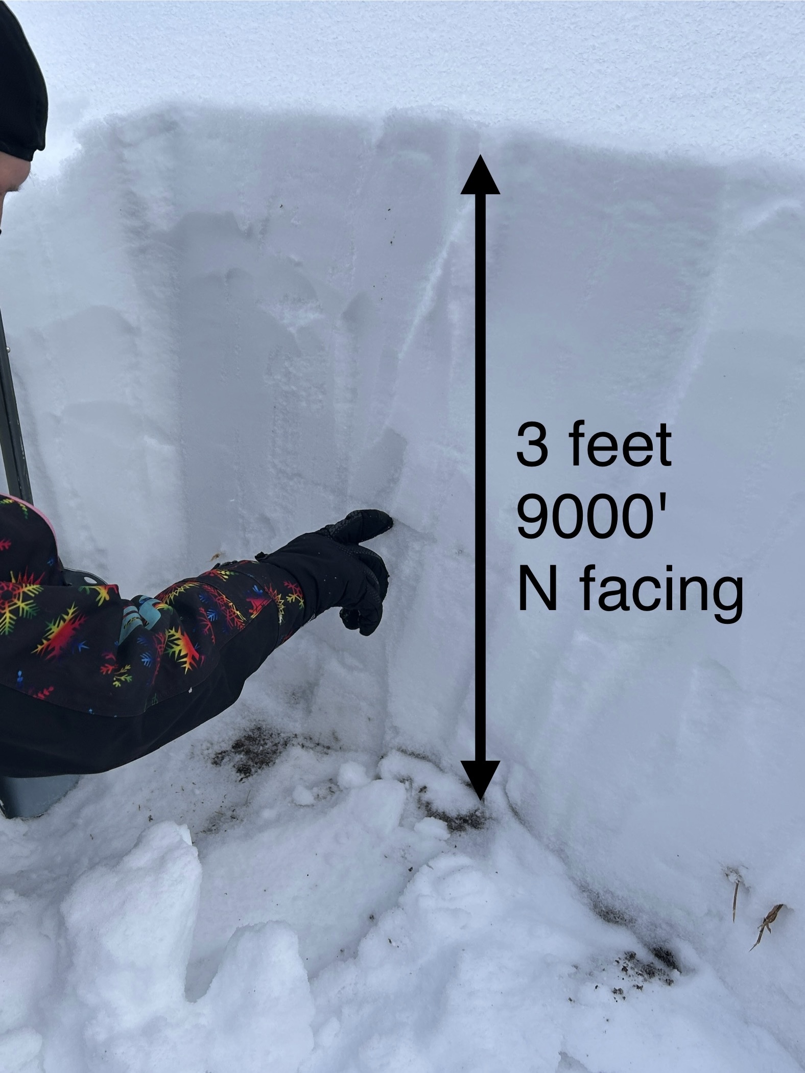
N facing snow Cabin Creek, 9000 ft
-

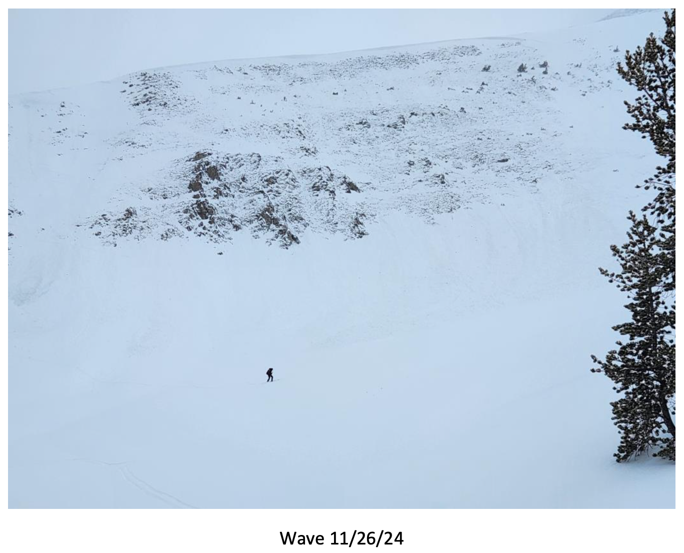
Big Sky Ski Patrol triggered this avalanche during mitigation work in The Wave on 11/26/24... "2-3' deep on an ice crust just above the ground with a 2# shot in the Upper rodeo. Volume was limited as most of the snow was loaded just underneath the cornice, but still produced a sizeable size 2... Other paths in the Lenin region ran meaty wind slabs, full track with no significant step downs." Photo: BSSP
-

Cracking on old, faceted, October snow hundreds of feet long. North facing near treeline. Photo: BSSP
-

Intentional, human-triggered avalanche by a ski patrol breaking at the ground on a north facing slope near treeline. Photo: BSSP
-

Snowpit at Bridger Bowl on 11/5. Photo: B. VandenBos
-

From e-mail: "Photo attached from near top of hyalite peak, 11/2. Cracking in recent hard wind slab, I had to really jump hard to make this. Walked on many other hard slabs that were well bonded. Highly variable snowpack. I think you'd be most likely to get into trouble by popping out a small hard slab pocket like this and getting magic carpeted into some thinly covered terrain." Photo: B. VandenBos
-

From obs: "1-3 mm faceting in front of the Montage. Clear skys and mid 20 temps"
-

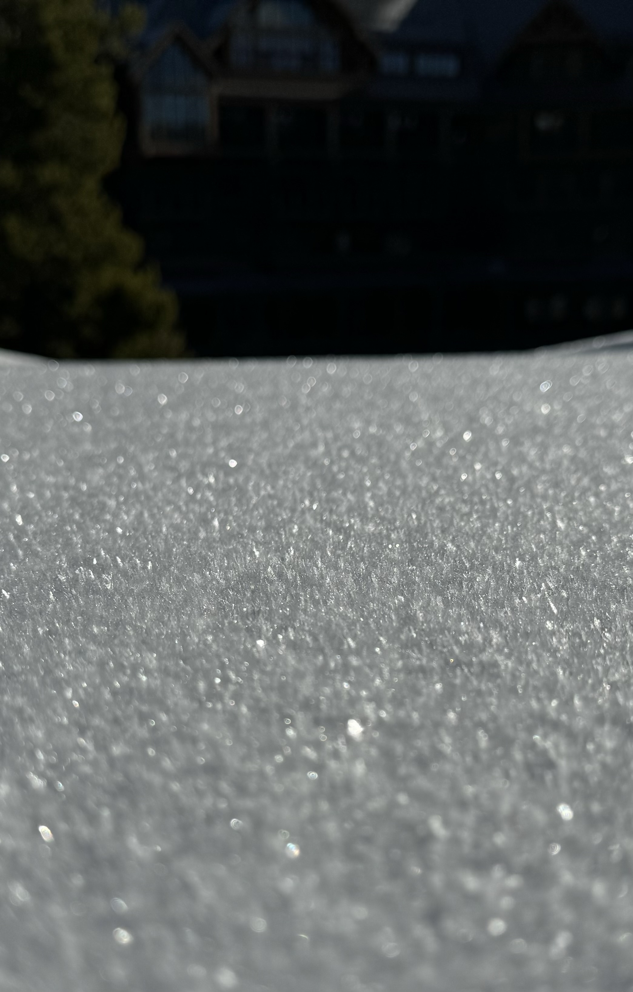
On October 17, rain turned to snow and blanketed the mountains of southwest Montana with a fresh coat of snow. Photo: Yellowstone Club Webcam
-

On October 17, rain turned to snow and blanketed the mountains of southwest Montana with a fresh coat of snow. Photo: Bridger Bowl Webcams
-

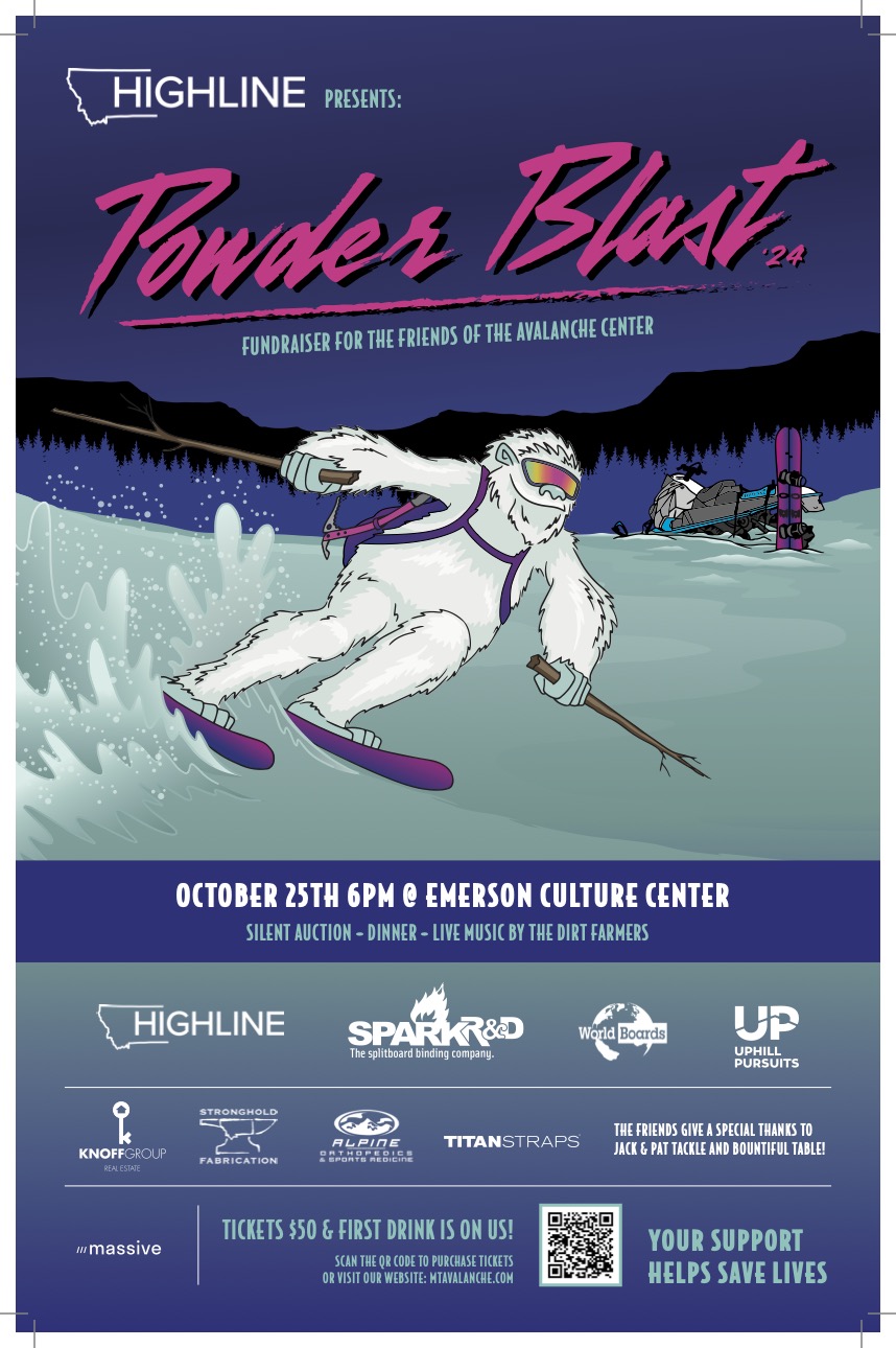
The 26th annual fundraiser for the Friends of the GNFAC is October 25 at the Emerson Cultural Center. More info and tickets at: https://events.eventgroove.com/event/Powder-Blast-2024-101627


Videos- Southern Gallatin
WebCams
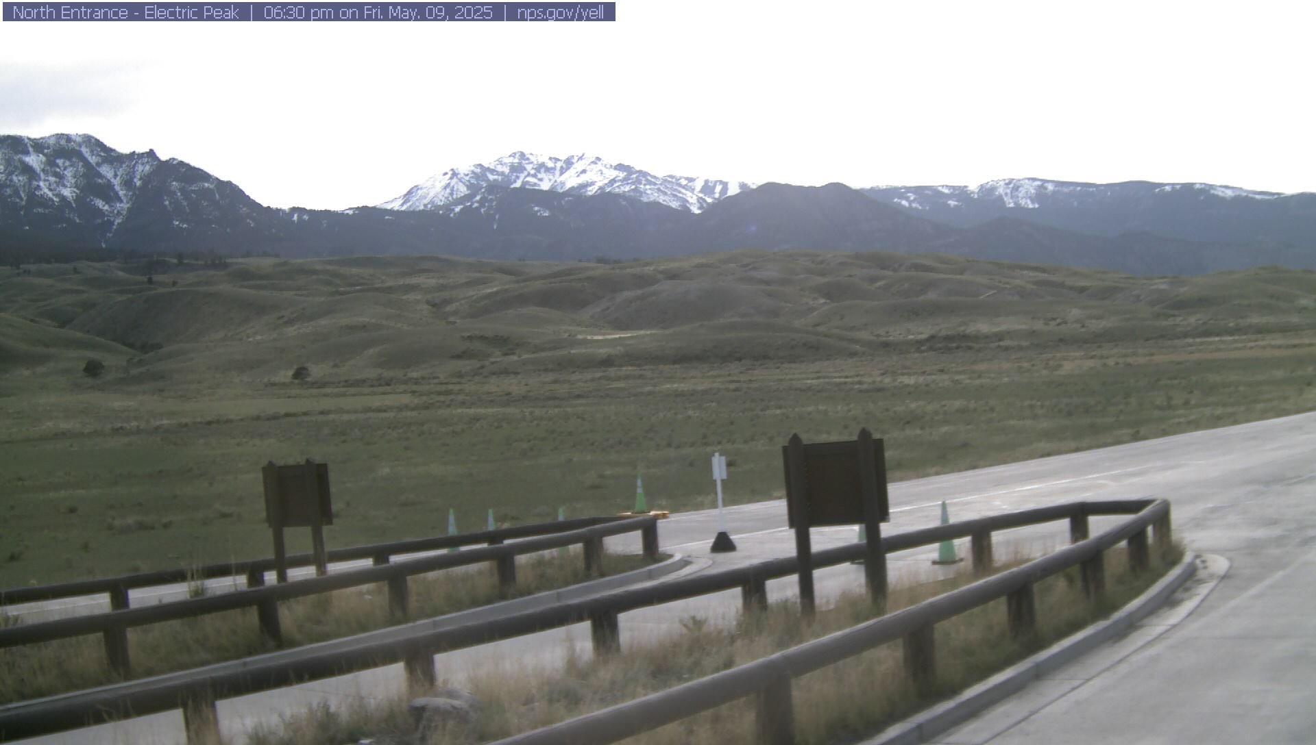
Electric Peak
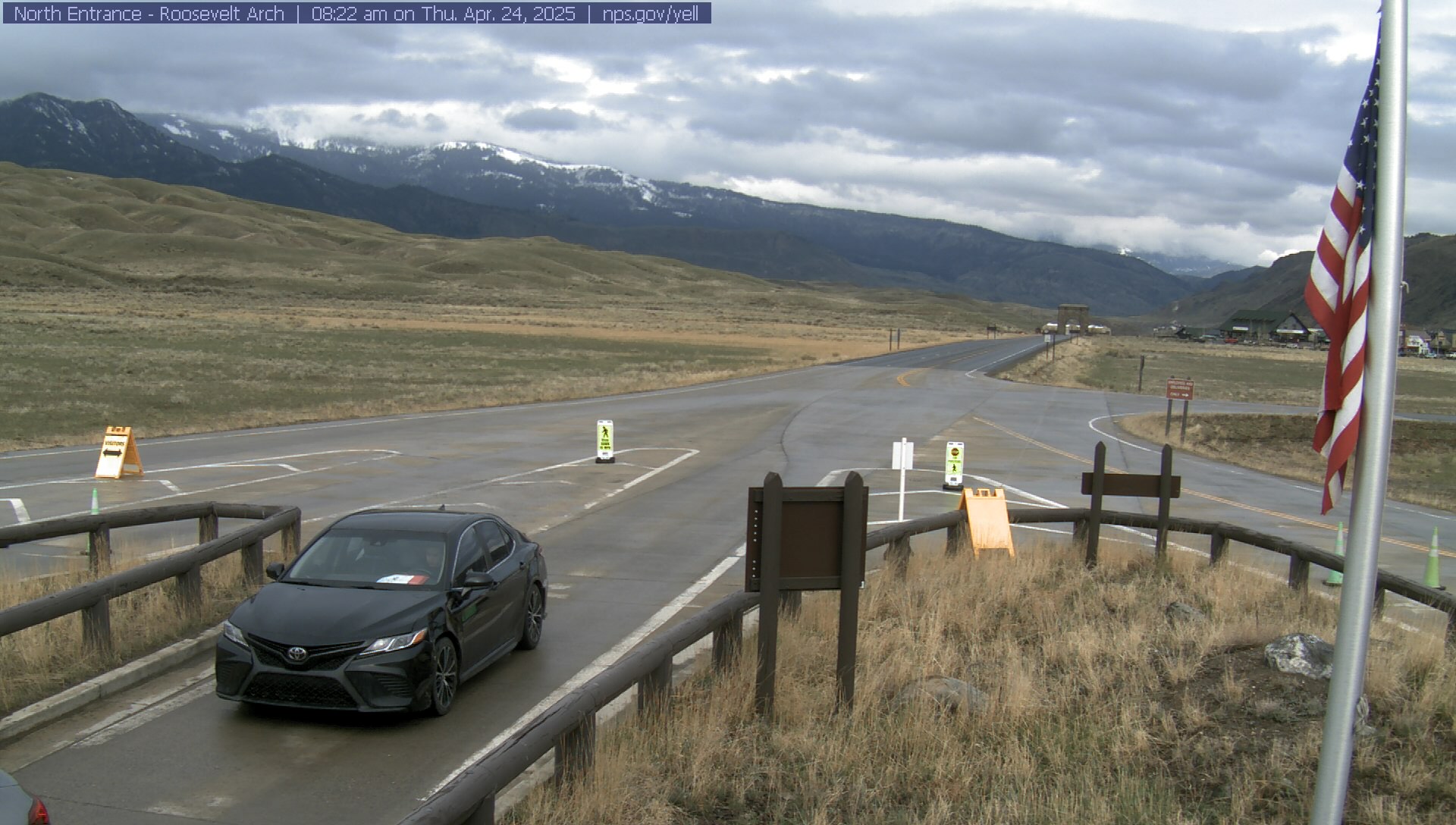
Roosevelt Arch

Weather Stations- Southern Gallatin
Weather Forecast Southern Gallatin
Extended Forecast for17 Miles SE Big Sky MT
This Afternoon

High: 45 °F
Scattered
Snow ShowersTonight
Low: 27 °F
Scattered
Snow Showers
then Patchy
FogThursday
High: 52 °F
Patchy Fog
then Mostly
SunnyThursday Night

Low: 28 °F
Mostly Clear
Friday

High: 61 °F
Sunny
Friday Night
Low: 35 °F
Mostly Clear
Saturday
High: 62 °F
Sunny
Saturday Night
Low: 39 °F
Mostly Clear
Sunday
High: 61 °F
Mostly Sunny
then Showers
Likely
The Last Word
Thank you for another successful season. Our success is directly related to support from our community and the Forest Service. Thanks to the readers of the forecast, everyone that sent in observations, took an avalanche class, or donated money, time or gear. We will issue conditions updates on Mondays and Fridays through April.
GENERAL SPRING SNOWPACK AND TRAVEL ADVICE
Spring weather can be highly variable and create a mix of avalanche problems. Snow conditions and stability can change drastically from day to day or hour to hour. Anticipate rapid change and plan accordingly. Abundant snowfall over the winter with more spring snow to come makes avalanches possible into summer.
NEW SNOW AND WIND LOADED SLOPES
Spring storms are notorious for depositing heavy amounts of snow in the mountains. Even with a deep and generally stable snowpack throughout the advisory area, heavy and rapid loads of new snow will decrease stability. The main problems to look out for are avalanches breaking within the new snow, wind slabs, and loose snow avalanches. The likelihood of triggering an avalanche spikes during and immediately after snowstorms. New snow instabilities tend to stabilize quickly, but it’s a good idea to give fresh snow a day to adjust before hitting big terrain. New snow instabilities can be challenging to assess, and spring storms bond to old snow differently across aspects and elevations. Conservative terrain selection is essential during and immediately following storms. Avoid wind-loaded slopes and slopes steeper than 35 degrees for 24-48 hours after new snow and wind.
New snow can quickly change from dry to wet on a spring day, and stability can decrease rapidly with above freezing temperatures or brief sunshine. New snow may bond well early in the morning and then easily slide later. Wet loose slides are likely during the first above freezing temperatures or sunshine immediately after a storm. Anticipate changes in snow stability as you change aspect or elevation and over the course of the day. An early start is always an advantage. Be ready to change plans or move to safer terrain at the first signs of decreasing stability.
WET SNOW AVALANCHES
Spring and wet snow avalanches go hand-in-hand. Above freezing temperatures, rain, and/or intense sunshine cause the snow to become wet and weak and make wet avalanches easy to trigger or release naturally. Conditions tend to become most unstable when temperatures stay above freezing for multiple days and nights in a row. Avoid steep terrain, and be aware of the potential for natural wet avalanches in steep terrain above you, if you see:
- Heavy rain,
- Above freezing temperatures for more than 24 hours,
- Natural wet avalanches,
- Rollerballs or pinwheels indicating a moist or wet snow surface,
- Or if you sink to your boot top in wet snow.
In general, if the snow surface freezes solid overnight, the snowpack will be stable in the morning and stability will decrease through the day as snow warms up. The snow surface hardness, rate of warming, duration of sunshine, aspect and elevation determine how fast stability will decrease through the day. Be aware that sunny aspects may have a wet snow avalanche danger while shadier slopes still have a dry snow avalanche danger. Getting off of steep slopes should be considered when, or before, the above signs of instability are present. Wet snow avalanches, whether loose snow or slabs, can be powerful, destructive and very dangerous. Conservative terrain choices, starting early in the day, and careful observations can keep you safe. See Alex’s recent video, and this article for more spring travel advice.
CORNICES
Cornices along ridgelines are massive and can break under the weight of a person (photo). Prolonged above freezing temperatures and rain make them weaker and possible to break naturally. They can break off suddenly and farther back than one might expect. Cornice falls can also entrain large amounts of loose snow or trigger slab avalanches. Stay far back from the edge of ridgelines and minimize exposure to slopes directly below cornices. Regardless of whether a cornice triggers a slide or not, a falling cornice is dangerous to anyone in its path.
DISCLAIMER
It does not matter if new snow falls or not, avalanches will continue to occur until the existing snowpack is mostly gone. Always assess the slope you plan to ride with diligence and safety in mind. Do not let your guard down. Travel with a partner, carry rescue gear and only expose one person at a time in avalanche terrain.
Have a safe and enjoyable spring and summer!
Mark, Alex, Ian and Dave
For more spring travel advice see this article from our GNFAC forecaster blog.