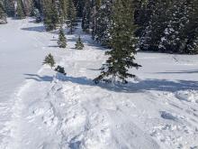


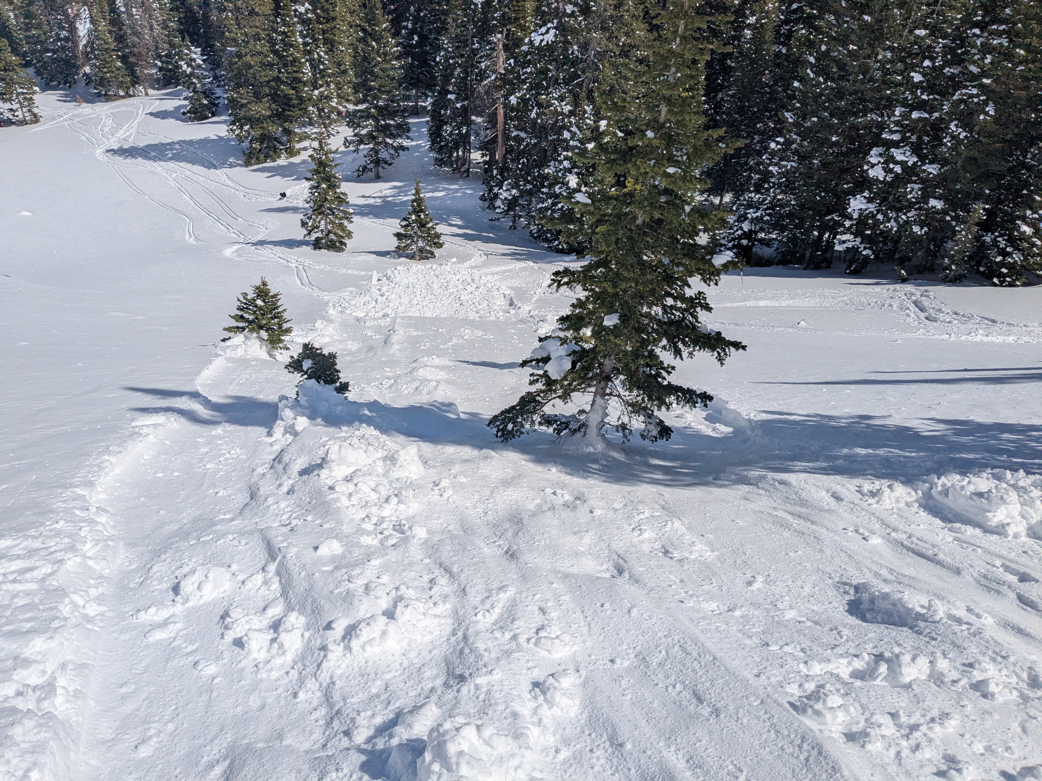
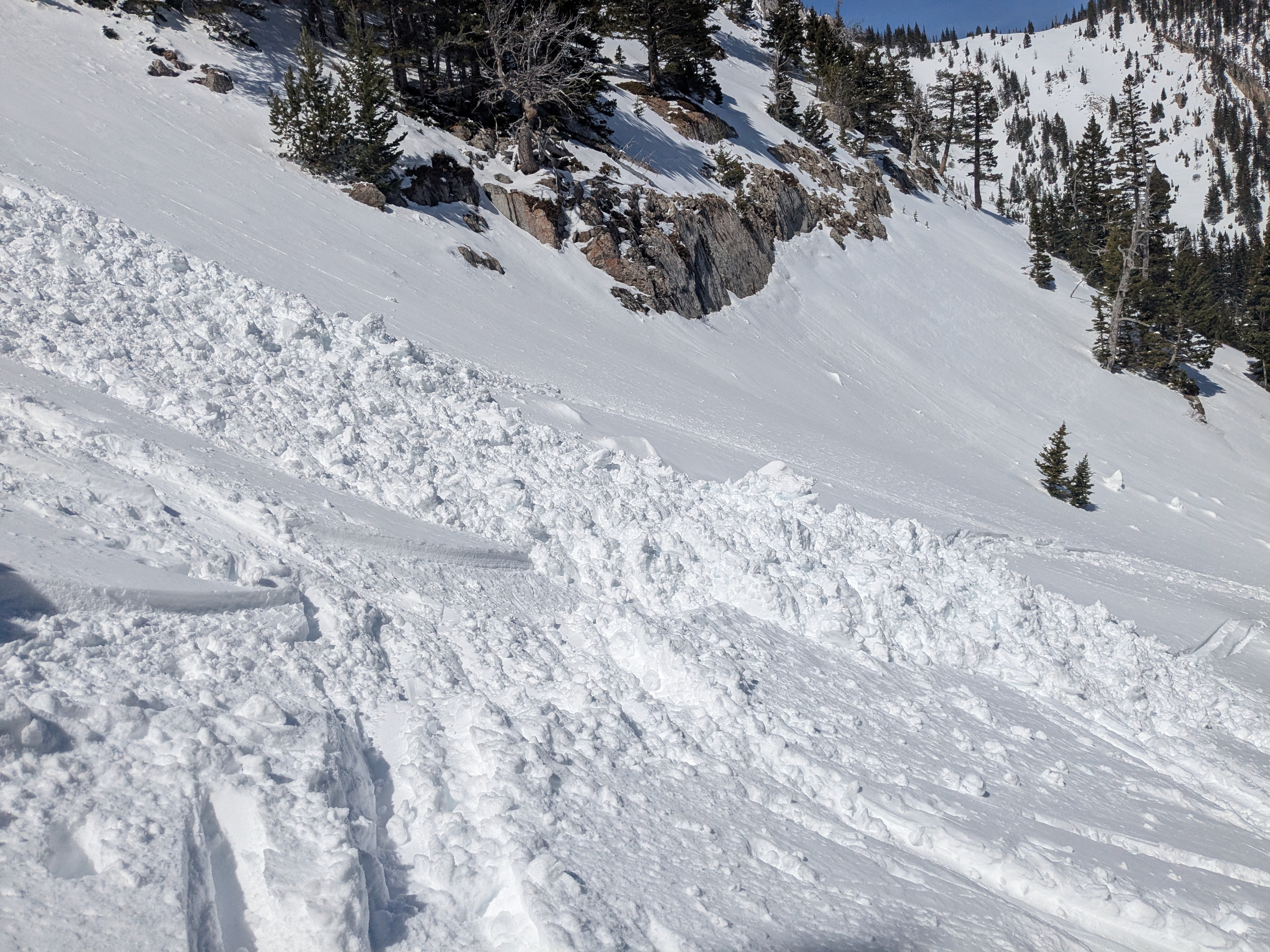
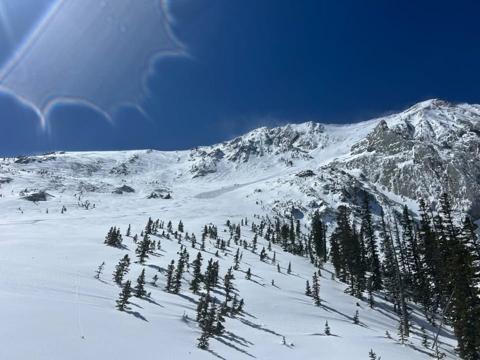
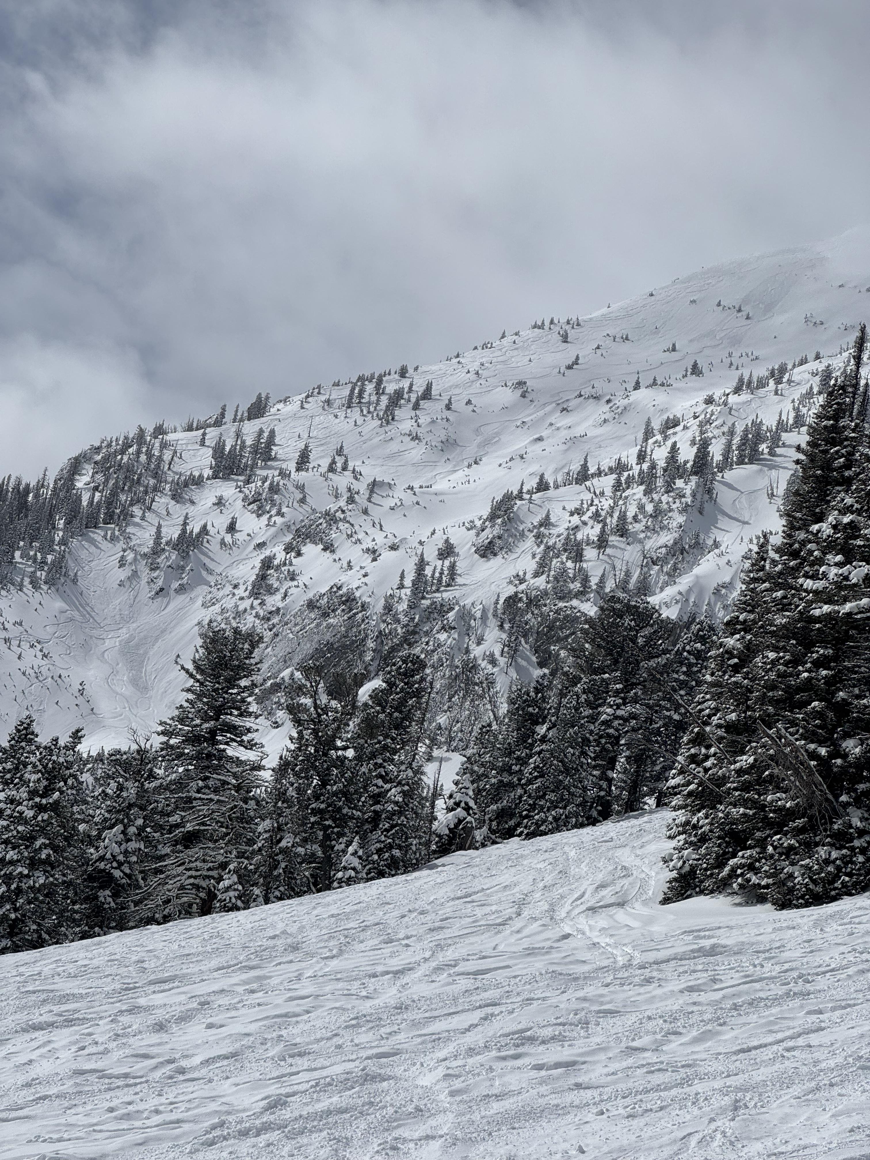
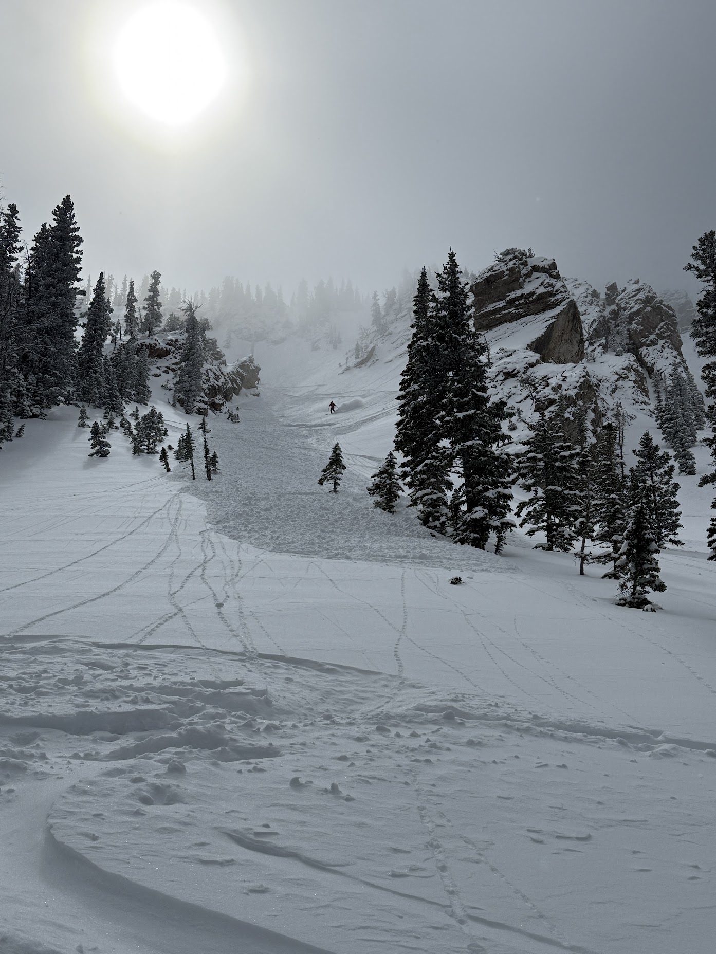
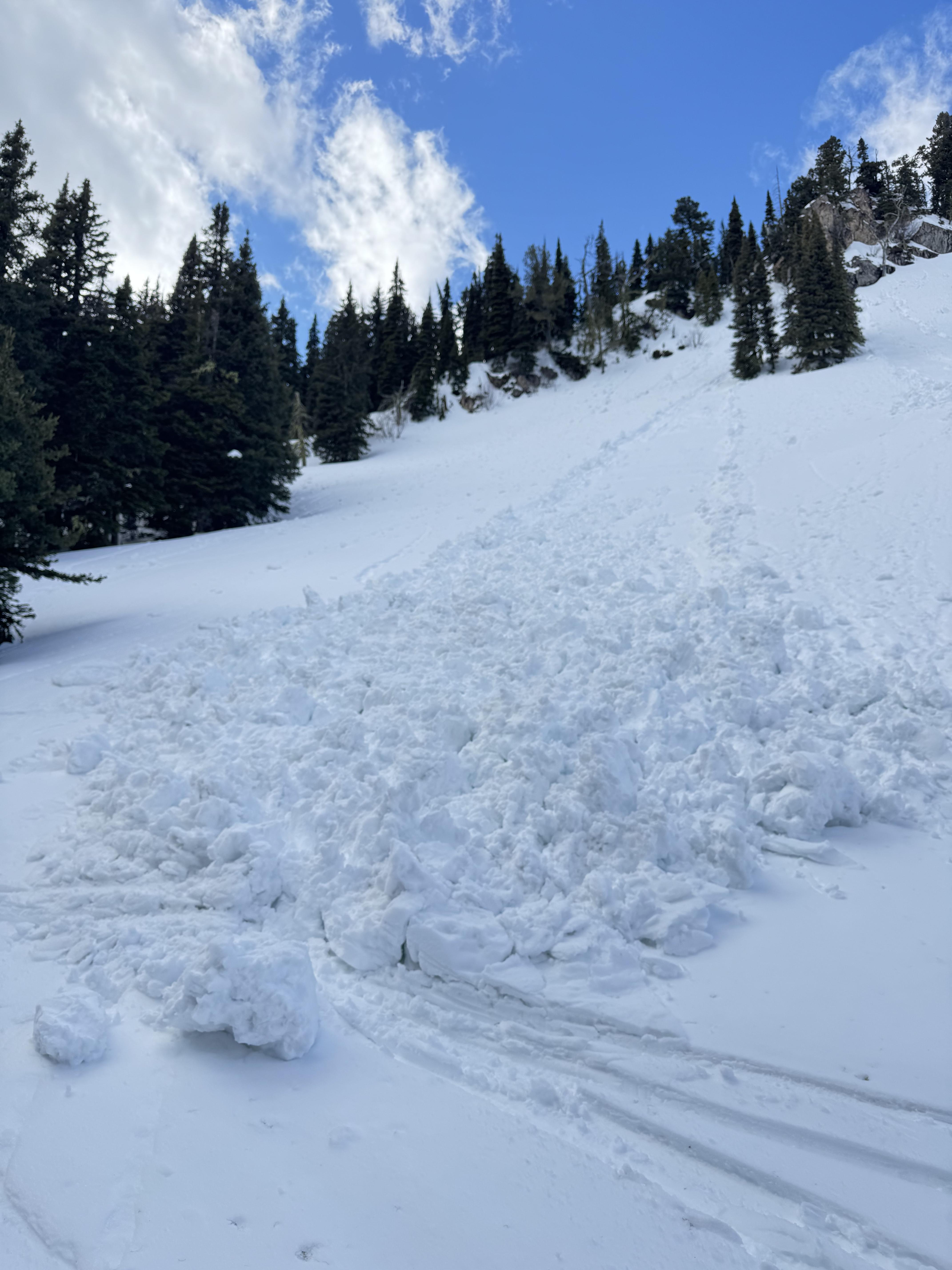
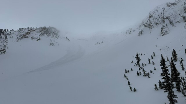
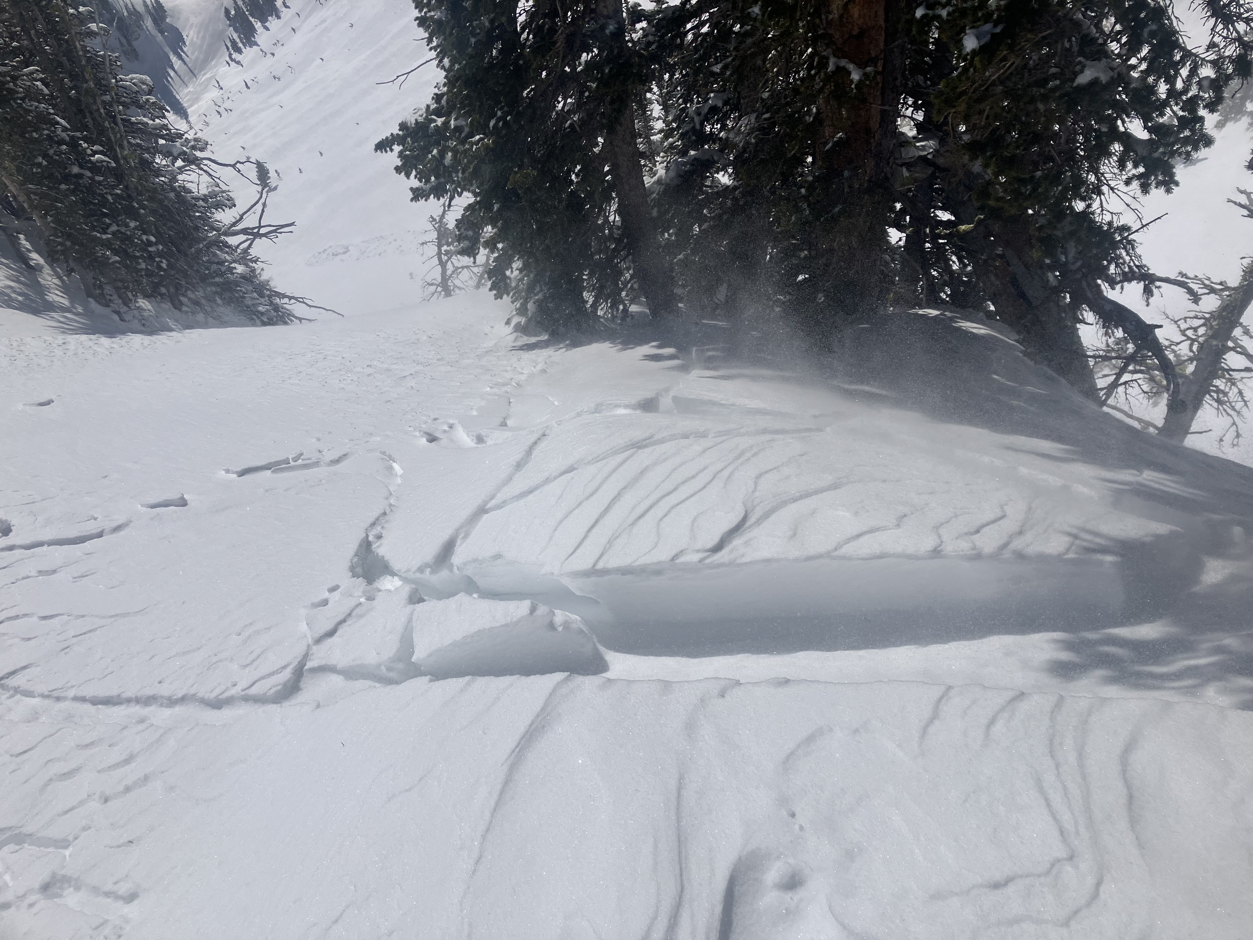
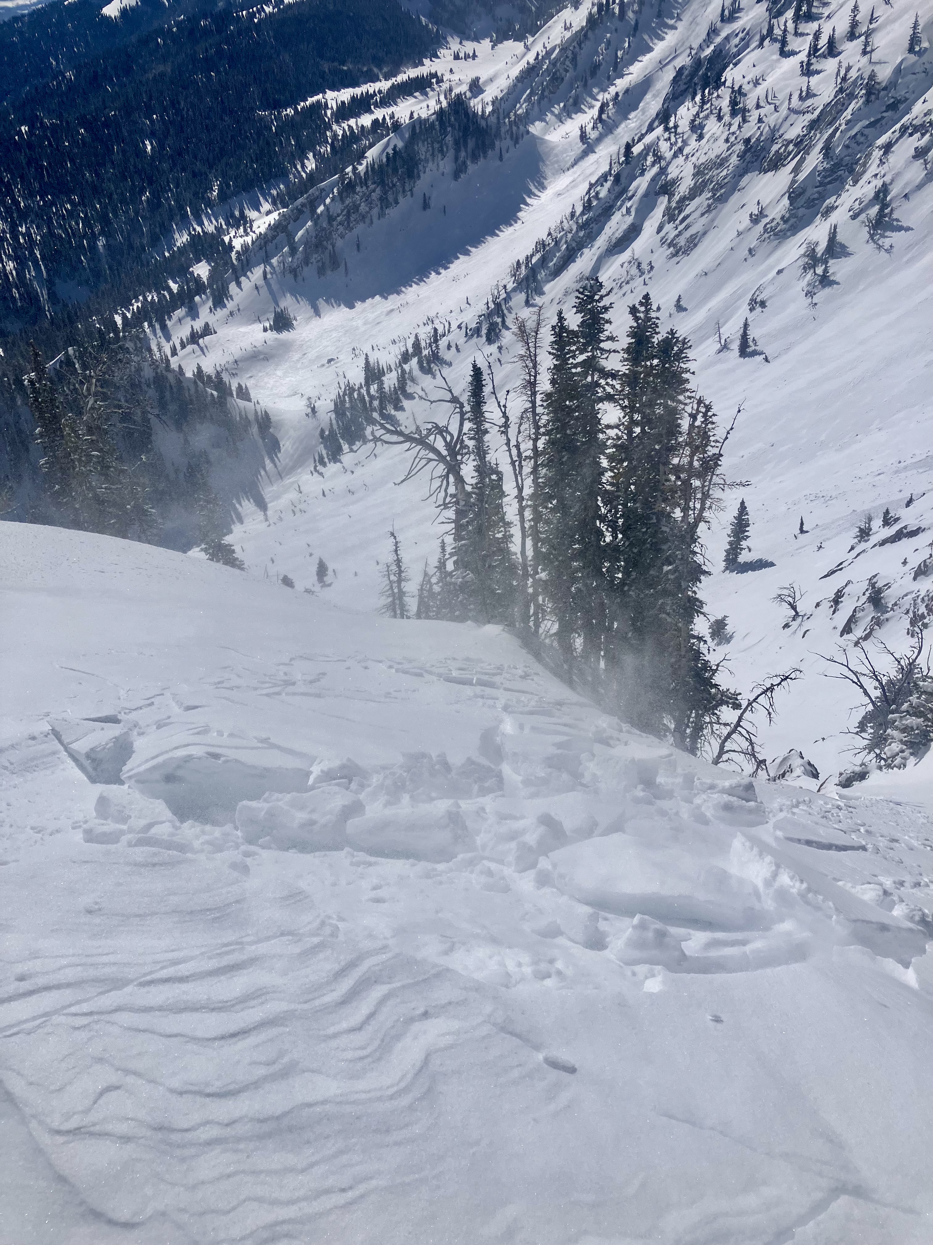
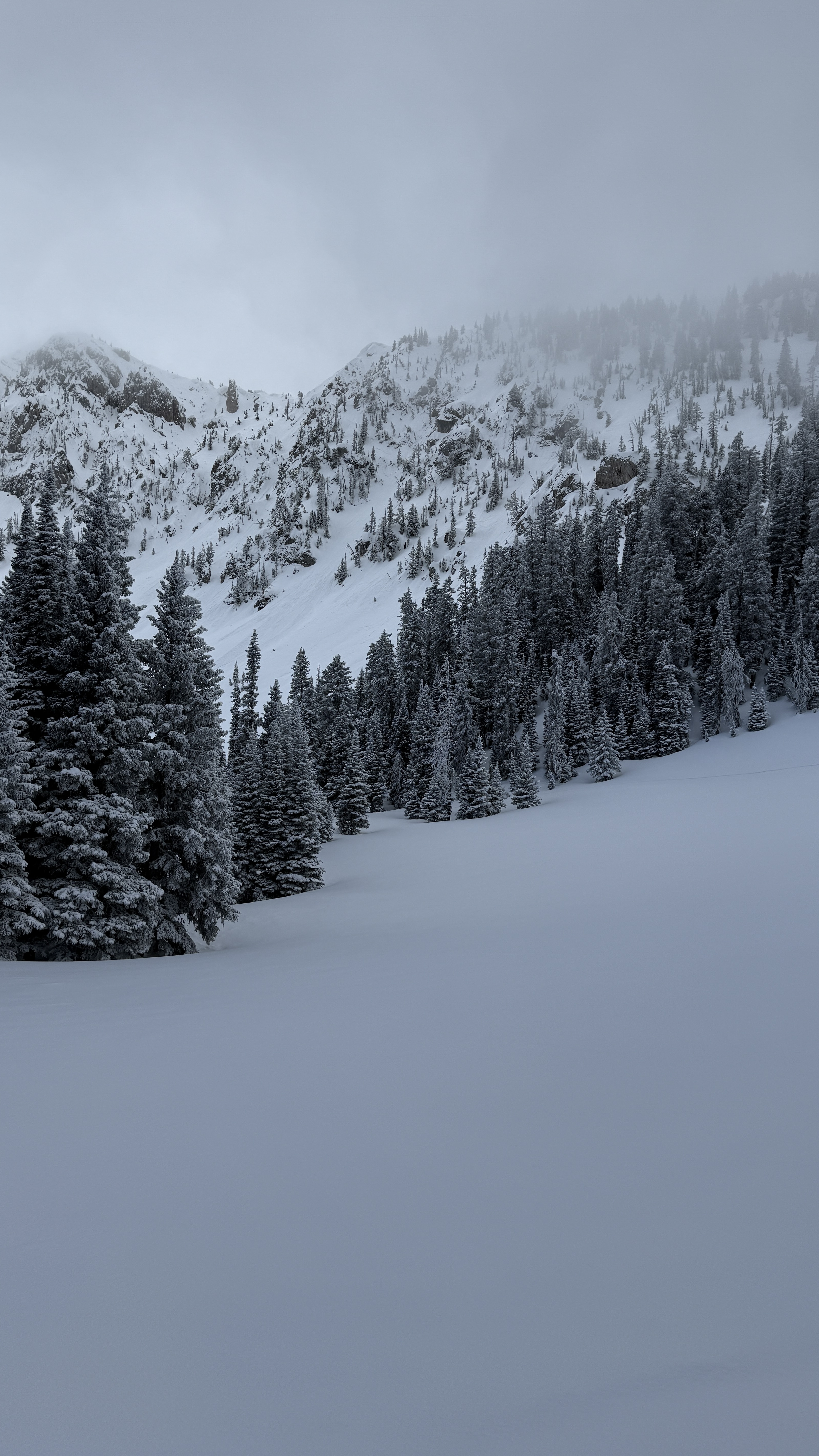
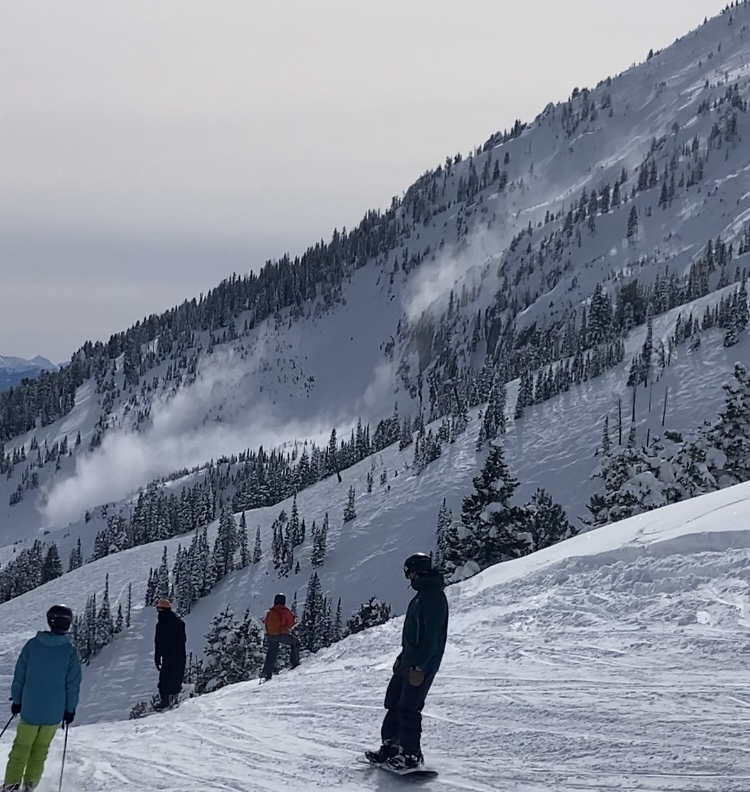
"Today (Saturday, 4/19), I triggered a small soft-slab avalanche at about 7,700' on a E-NE aspect on the headwall between Frazier Lake and Angier Lake in the northern Bridgers. The slide was maybe 6" deep, 20' wide and ran 100-200 feet and involved only the new storm snow over the icy, thick crust underneath. No one was caught or injured, though I had a bit of a scare because my dog was right in the path (luckily she outran it)."
Trip Planning for Bridgers

Primary Problem: Wind Slab
Bottom Line: Avalanche conditions are complicated by a mix of winter and spring weather this week. Rain and snow fell on mountain snowpacks, with the most significant precipitation in the Bridger Range for the start of the week. The more new snow there is, the more likely you are to encounter avalanches and the larger their potential size. If your travel plans take you to slopes steeper than 30 degrees, assess how the new and wind-drifted snow is bonding to the old snow surface by watching for clear signs of instability, such as avalanches and shooting cracks. If rain fell on the snowpack and as temperatures warm, breaking through an unsupportable and slushy snowpack, seeing pinwheels of wet snow and small wet slides are indicators of wet snow instability.Past 5 Days
Sat Apr 19

Moderate
Moderate
Sun Apr 20

Low
Low
Mon Apr 21

None
None
Fri Apr 25
None
None
Mon Apr 28
None
None
Relevant Avalanche Activity
Bridger Range
Northern Bridgers
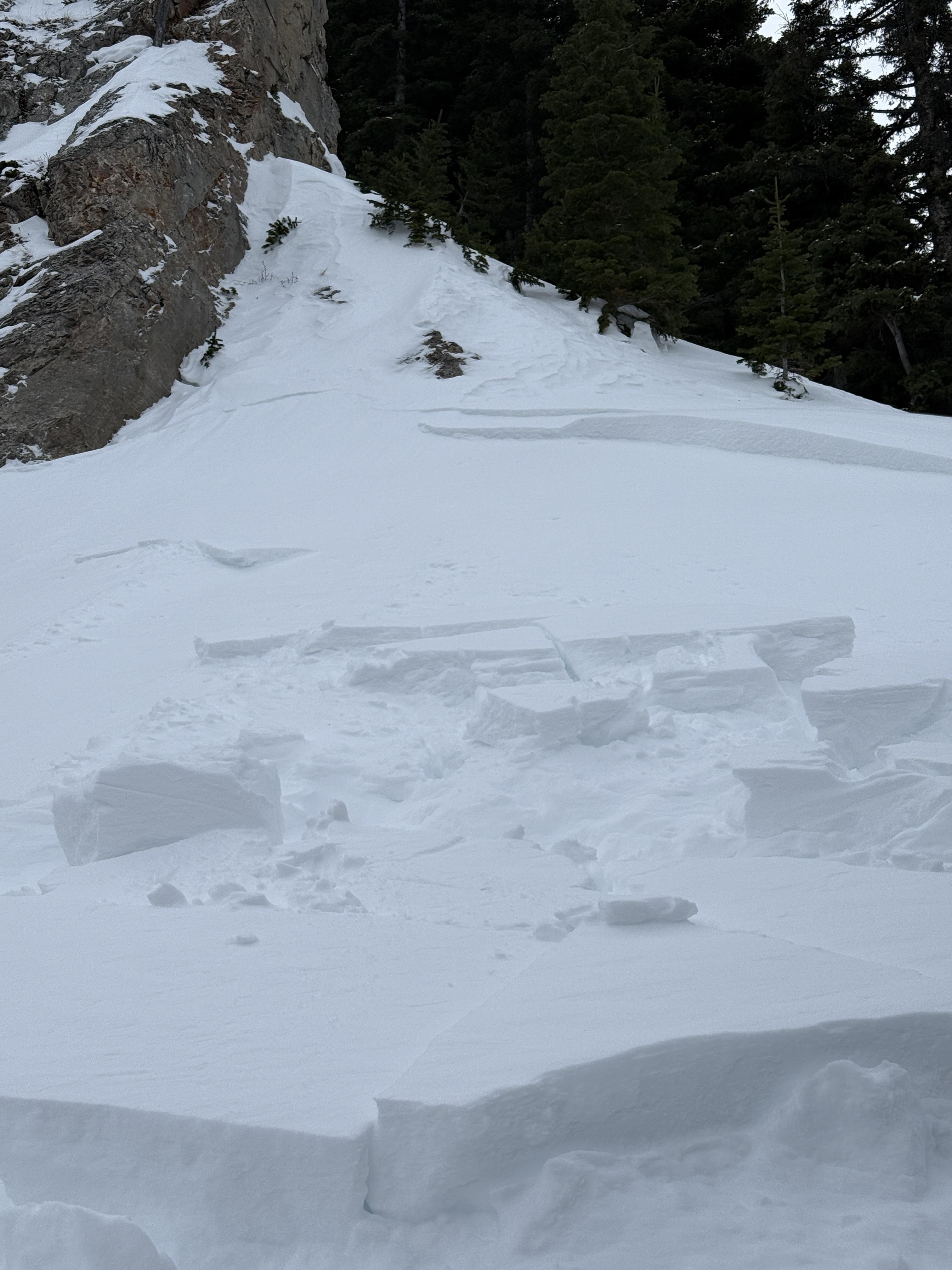
Skier-triggered small soft slab, northern Bridger Range
Northern Bridgers
SS-AS-R1-D1-I
Elevation: 7,700
Aspect: NE
Coordinates: 45.9196, -110.9760
Caught: 0 ; Buried: 0
More Avalanche Details
SS-AS-R1-D1-I
Elevation: 7,700
Aspect: NE
Coordinates: 45.9196, -110.9760
Caught: 0 ; Buried: 0
Today (Saturday, 4/19), I triggered a small soft-slab avalanche at about 7,700' on a E-NE aspect on the headwall between Frazier Lake and Angier Lake in the northern Bridgers. The slide was maybe 6" deep, 20' wide and ran 100-200 feet and involved only the new storm snow over the icy, thick crust underneath. No one was caught or injured, though I had a bit of a scare because my dog was right in the path (luckily she outran it). We had gone up with the intention of skiing the Ainger "Love Chutes", but bailed partway up when that whole aspect turned out to be breakable crust. However, we had beta from another party that conditions on the Frazier-Angier headwall were good, so decided to check that out. We skinned up without incident, following a well-set skin track that followed the line of least resistance; snow surface was variable but seemed stable. Coming down, we mostly followed the ascent route, but towards the end I was tempted onto a fun-looking, untracked stash a bit to skier's left, that seemed only a tad steeper than the ascent line. A few turns into this line is when I triggered the slide, right at the steepest part (mid-high 30s). It definitely took me by surprise given that we'd been skiing great, stable powder in the Bridgers the past couple days. No harm done but definitely a good wake-up call!
More Avalanche Details
Bridger Range
Fairy Lake
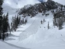
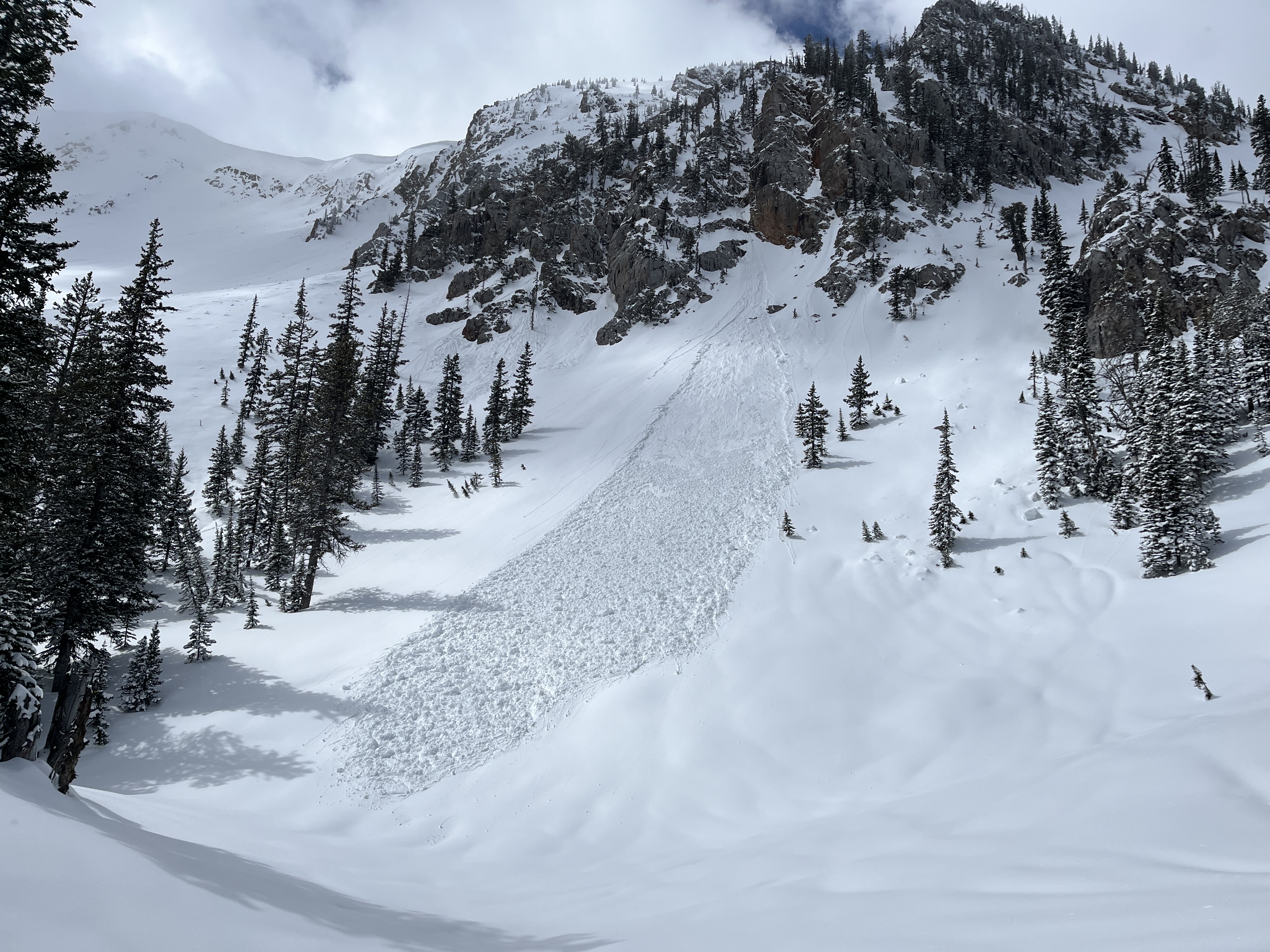
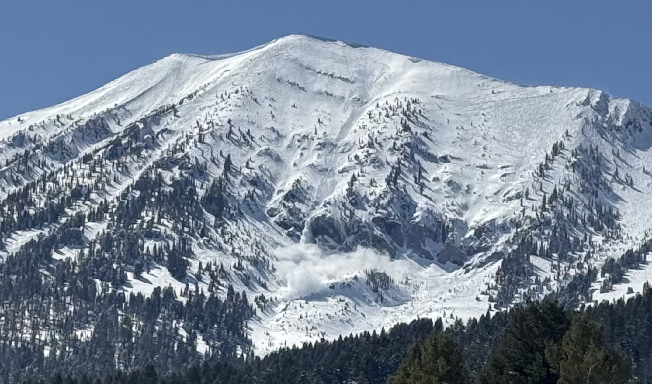
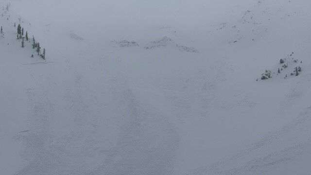
Wet loose in northern bridgers
Fairy Lake
WL-N-R1-D1
Coordinates: 45.9043, -110.9580
Caught: 0 ; Buried: 0
More Avalanche Details
WL-N-R1-D1
Coordinates: 45.9043, -110.9580
Caught: 0 ; Buried: 0
Meant to submit this yesterday (4/18), saw this one wet loose slide that naturally started off some rocks. Decent size by the bottom. Other than that, just some spiff. Surprisingly didn’t see any big wind slabs trigger, despite the widespread wind effect in the northern Bridger’s. Lots of wind scour on southerly aspects. Northern aspects had wind loading.
More Avalanche Details
Bridger Range
Fairy Lake
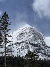
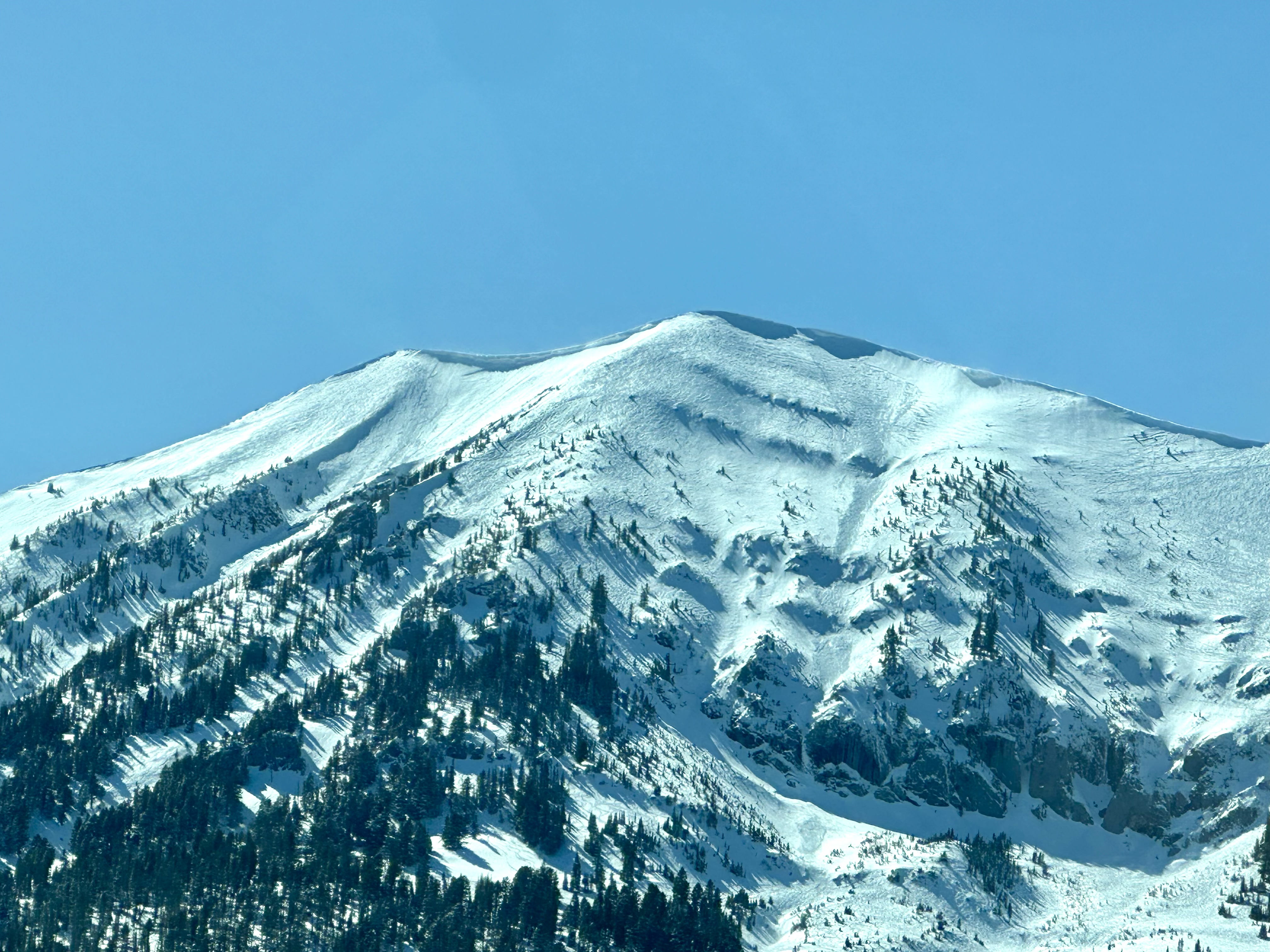
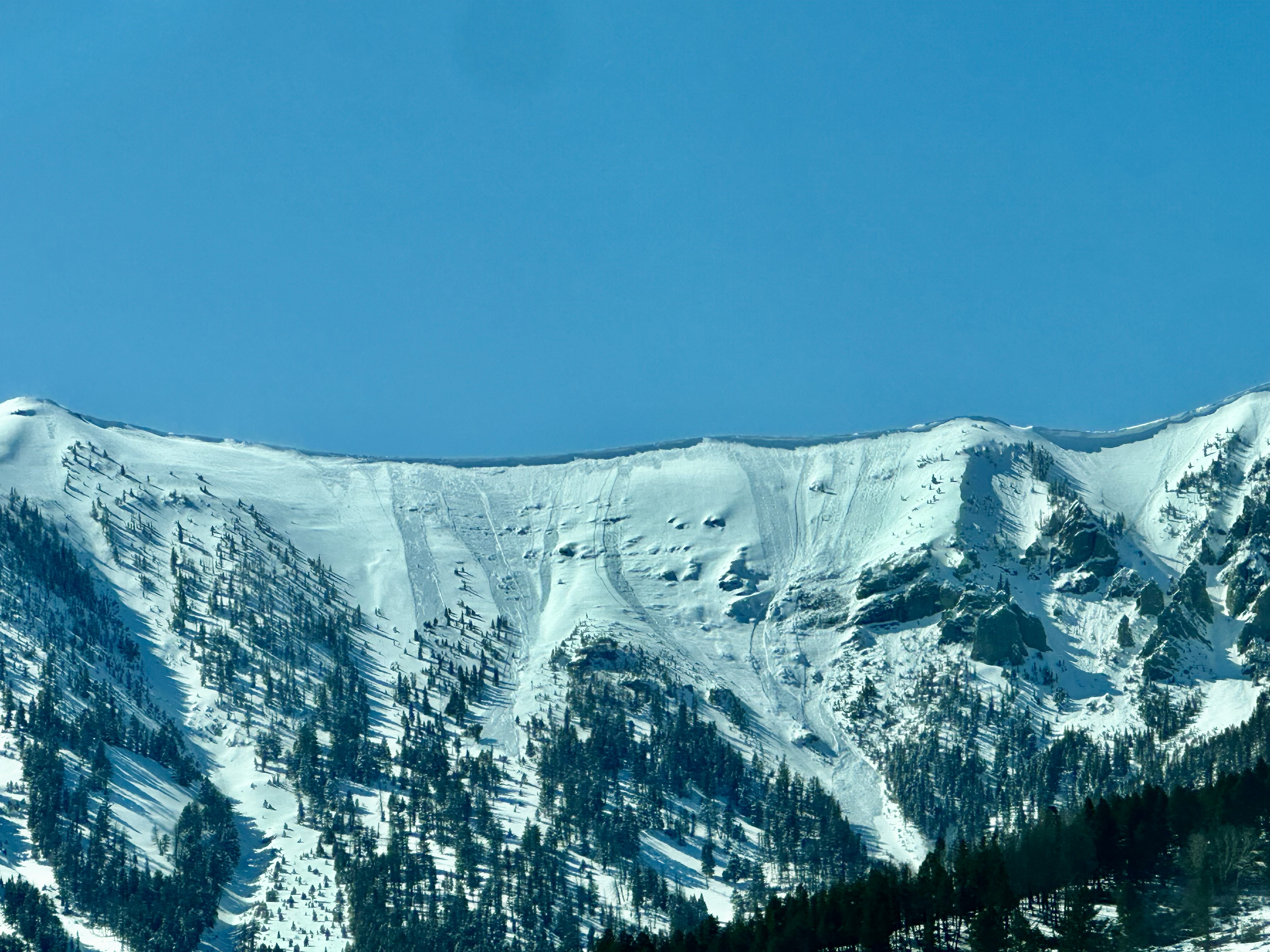
Thin Wind Slab Avalanche near Hardscrabble
Fairy Lake
SS-N-R1-D1-I
Elevation: 9,000
Aspect: SE
Coordinates: 45.9043, -110.9580
Caught: 0 ; Buried: 0
More Avalanche Details
SS-N-R1-D1-I
Elevation: 9,000
Aspect: SE
Coordinates: 45.9043, -110.9580
Caught: 0 ; Buried: 0
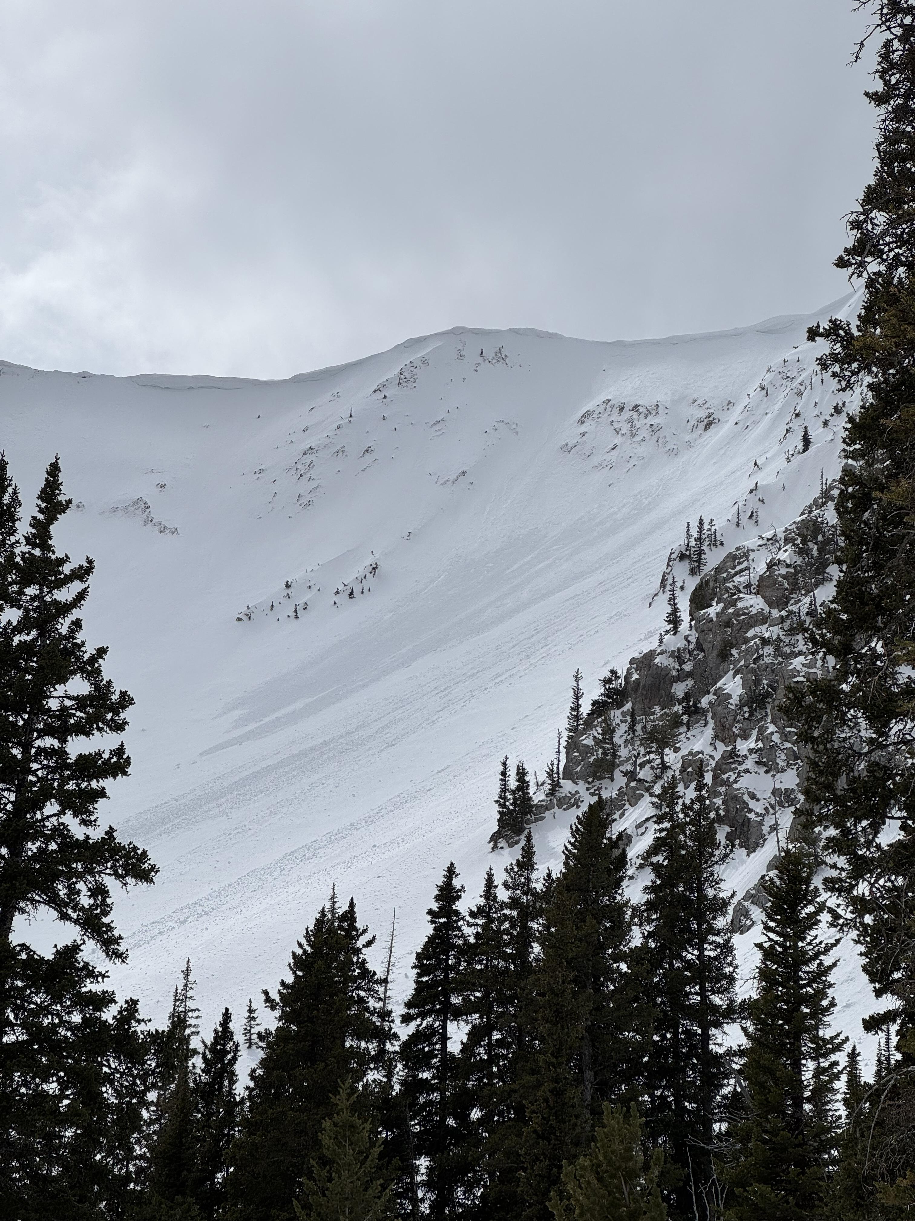
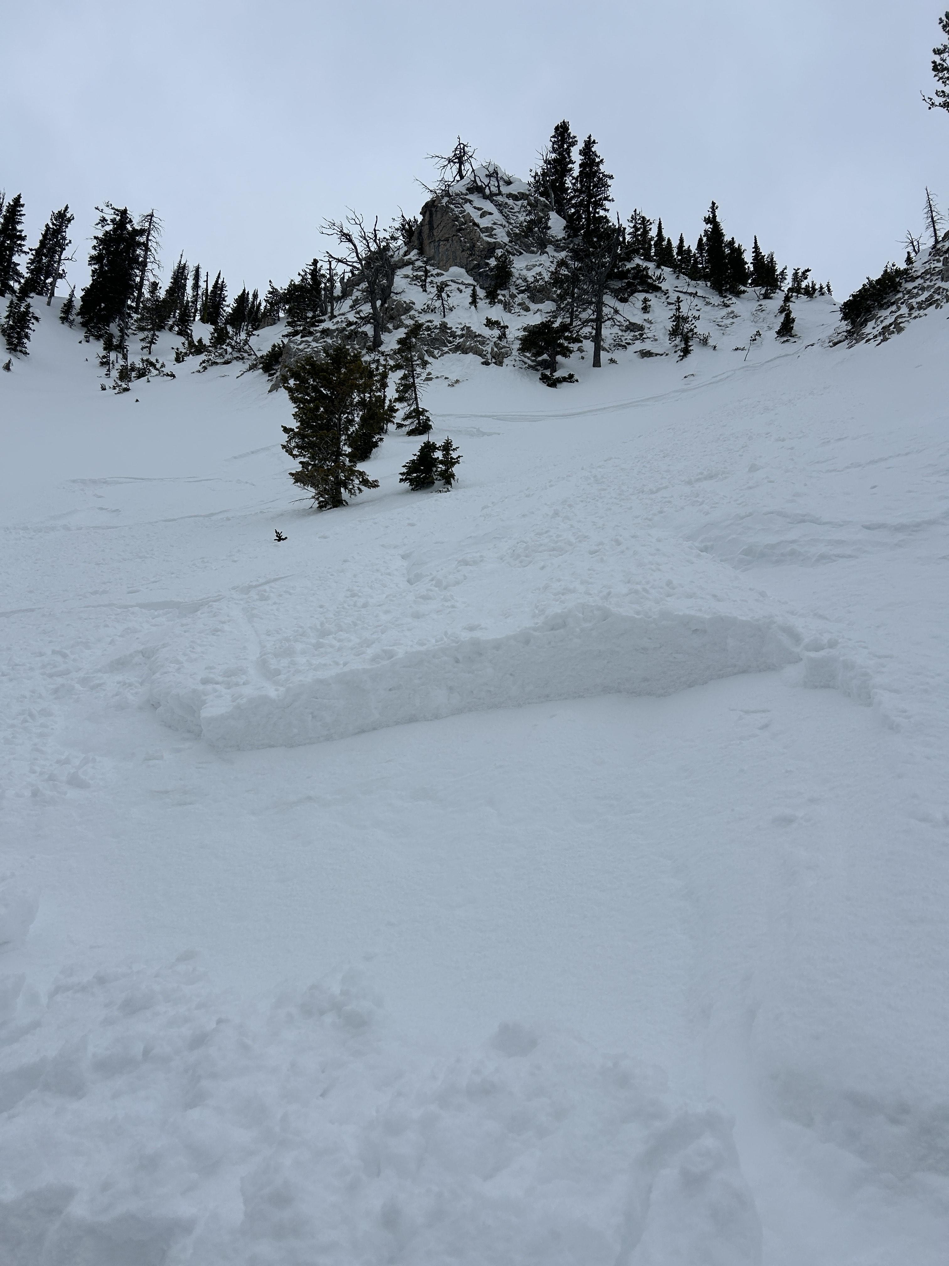
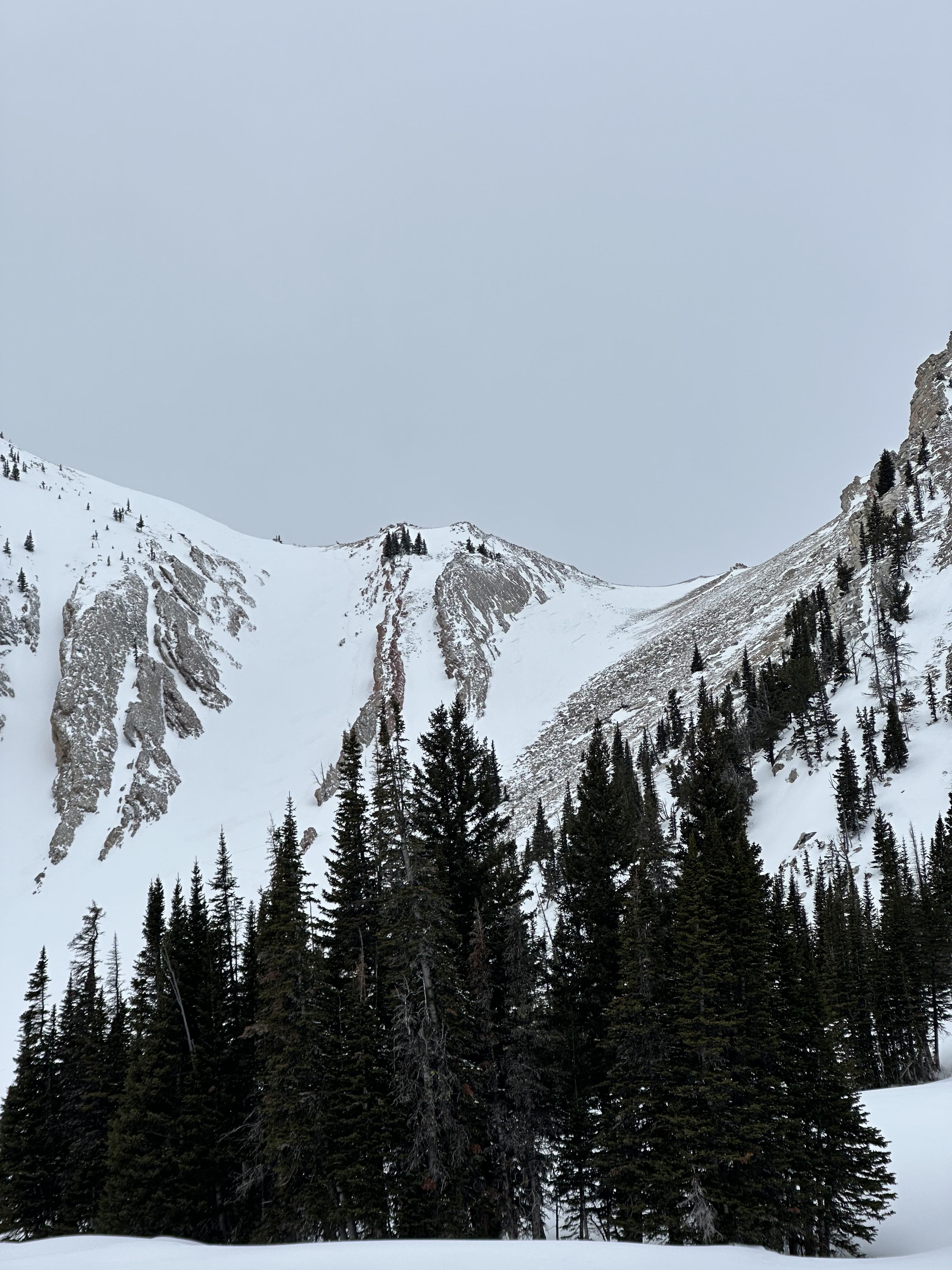
I rode into Fairy Lake. There was 2-3” of new snow above the elevation of Fairy Lake, a trace below. Winds were cranking at ridge top elevation, transporting what soft snow there was. Minimal hazard formation. I spotted one fresh wind slab avalanche near Hardscrabble. The slide ran several hundred feet in steep terrain but was very thin (R1,D1).
There was a mostly supportable crust below the new snow about 1” thick. The snow below the crust was moist.
More Avalanche Details
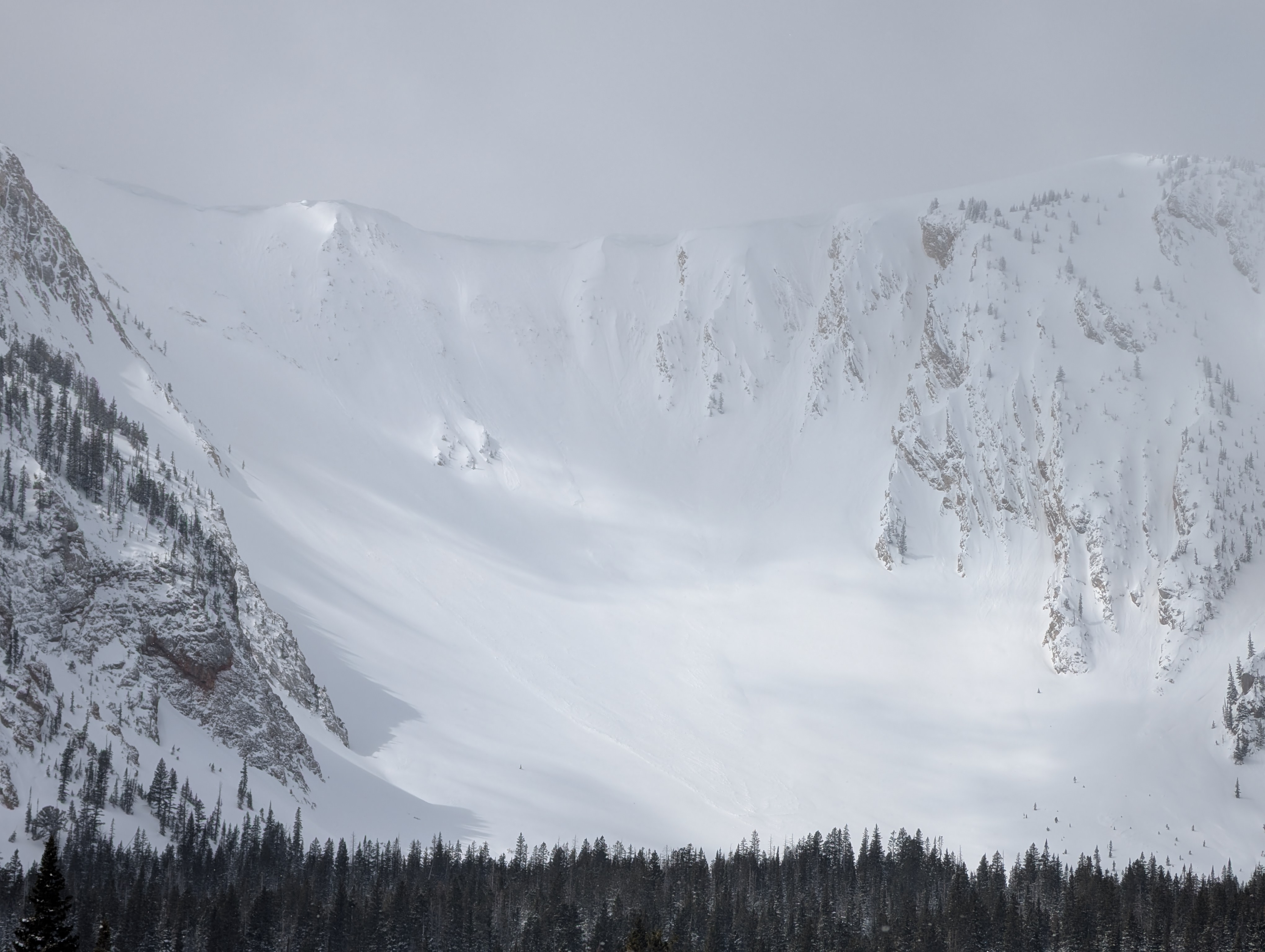
Relevant Photos
Displaying 1 - 40
-

-

"Today (Saturday, 4/19), I triggered a small soft-slab avalanche at about 7,700' on a E-NE aspect on the headwall between Frazier Lake and Angier Lake in the northern Bridgers. The slide was maybe 6" deep, 20' wide and ran 100-200 feet and involved only the new storm snow over the icy, thick crust underneath. No one was caught or injured, though I had a bit of a scare because my dog was right in the path (luckily she outran it)."
-

"yesterday (4/18), saw this one wet loose slide that naturally started off some rocks. Decent size by the bottom. Other than that, just some spiff. Surprisingly didn’t see any big wind slabs trigger, despite the widespread wind effect in the northern Bridger’s. Lots of wind scour on southerly aspects. Northern aspects had wind loading." Photo: W. Landry
-

-

Winds were cranking at ridge top elevation, transporting what soft snow there was. Minimal hazard formation. I spotted one fresh wind slab avalanche near Hardscrabble. The slide ran several hundred feet in steep terrain but was very thin (R1,D1). Photo: GNFAC
-

Winds were cranking at ridge top elevation, transporting what soft snow there was. Minimal hazard formation. I spotted one fresh wind slab avalanche near Hardscrabble. Photo: GNFAC
-

"We went on a tour in the Bridgers today [Apr 5], we ascended the east ridge of Naya Nuki to the entrance of the Great One. Wind was blowing and we were being careful about potential wind slabs up high.
Skier 1 ski cut the top of the chute and produced a small wind slab that ran to the break in the chute and continued another 100 vert down the east apron. After all meeting up halfway down, skier 2 proceeded to ski the E facing apron. A wind slab propagated and carried skier 2 roughly 300 vert down the apron where skier 2 was able to swim out of the fall line and came to a rest on top of the debris. Everyone was okay aside two missing ski poles."
-

From BBSP: " At 2.45?pm [Apr 5] a... solo skier triggered a wind loaded pocket on the main face of Saddle Peak that ran down over the cliff and produced an impressive powder cloud.... I met him... and confirm he was alone and no one was in front of him. The avalanche looked to be 2' deep on the southern flank and 5" deep on the northern flank... It entrained more snow on the way down, one 2' deep downhill wind loaded pocket and some loose wet snow. It ran into the bottom of the going home chute, gouging a large hole and then 100ft downhill left a 200ft by 30ft wide shallow debris pile."
-

(Apr 5) "...Also observed one small wind slab occurring between Saddle & the Football Field, possibly skier-triggered." Photo: G. Antonioli
-

(Apr 5 ) "Observed multiple D1-1.5 natural dry loose avalanches (and some tiny wind slab pockets under the ridge cornice) that likely occurred during peak warming around 2-3 PM. North/sheltered aspects from ~9- 8.5k held an average of 8+ inches of dry, drifted snow...." Photo: G. Antonioli
-

There was a pair of R1, D1 avalanches on Saddle Peak. One appears to be a loose snow avalanche triggered by a skier coming off of north Saddle Peak That ran a couple hundred feet. The second was a small slab coming out of Spencer’s with debris running into Going Home Chute. Photo: GNFAC
-

In one steeper roll over, I got shooting cracks and a small storm slab to break at my ski tips. Photo: GNFAC
-

Heavy, wet slide of recent snow released while skiing off South Saddle. The photo is from South Central. Photo: E. Volk
-

Heavy, wet slide of recent snow released while skiing off South Saddle. The photo is from South Central. Photo: E. Volk
-

"Skied the north chutes above fairy lake around 8,400 ft. Found 8-12" of new snow, with the bottom 2" consisting of large graupel. In steep terrain our sluff entrained lots of snow making for some large debris piles. Overall the snow was generally well bonded." Photo: S. Lipsteuer
-

There were a number of wet loose avalanches in Airplane Bowl. All on E/S aspects near rocks or cliffs. Most were relatively small and had not entrained much snow from the surface or gouged deeper than a few inches. Photo: GNFAC
-

There were a number of wet loose avalanches in Airplane Bowl. All on E/S aspects near rocks or cliffs. Most were relatively small and had not entrained much snow from the surface or gouged deeper than a few inches. Photo: GNFAC
-

Noticed crown and debris on drive up Bridger Canyon this morning. Looks like a wind slab. Photo: Peter H
-

Understanding Avalanche Safety Preparedness – 5-Minute Survey for Motorized Users
We need your input! Eastern Oregon University is conducting a survey to better understand avalanche safety preparedness among motorized backcountry users like you. Your feedback will help us learn more about who is purchasing and practicing with avalanche rescue gear (beacon, probe, shovel) and participating in avalanche education—and why some riders aren’t. The survey is confidential and anonymous.
Your feedback is invaluable in improving avalanche education and awareness. Please take a moment to share your experience and help us make a difference.
https://eoustmhs.qualtrics.com/jfe/form/SV_3L8QKAuZzcxJBLo
Thank you for your time and for being a part of this important effort!
-

We skied past a wet loose avalanche that came off of the south face of Bradley‘s Meadow. It was slightly bigger than the rest of the wet snow activity that I observed during the day. Photo: GNFAC
-

The snow ranger crew was riding around the Bridgers today and we spotted this slide in the bowl to the south of Hardscrabble peak. It looked fairly recent (last 2 days) but a little hard to tell due to the new snow since yesterday and blowing snow today. Photo: USFS Snow Rangers
-

As we neared the ridgeline and shifted to a more southerly aspect, we noted scalloped and scoured snow surfaces and the development of thin wind skins and a few 1-2" wind slabs. Photo: GNFAC
-

Nature or cornice triggered slides in Arrowhead and Hardscrabble Bowls. Photo: I Freeland
-

Nature or cornice triggered slides in Arrowhead and Hardscrabble Bowls. Photo: I Freeland
-

Nature or cornice triggered slides in Arrowhead and Hardscrabble Bowls. Photo: I Freeland
-

Isolated wind slabs today in the southern Bridgers. Photo: E. Selinger
-

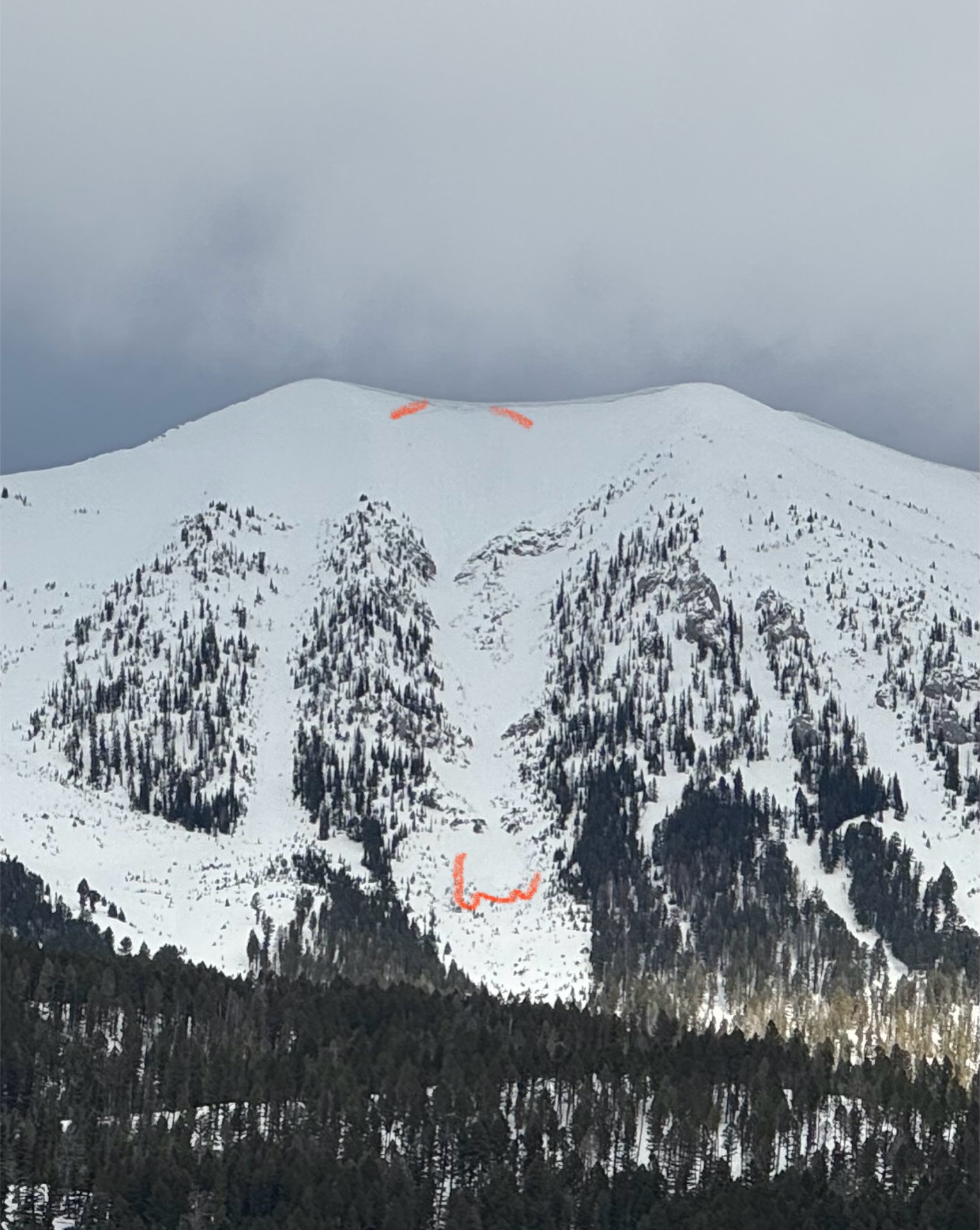
Mar 15 Winds in the Frazier Basin zone were stronger than expected with moderate to strong gusts at the ridge, increasing through the day. We noticed two large windslab pockets that had released since yesterday’s snow. One at the base of Hardscrabble Peak on a N aspect, the other in one of the SE facing gullies that access the Peak 9299/Hollywood Headwall ridge (see photo).
-

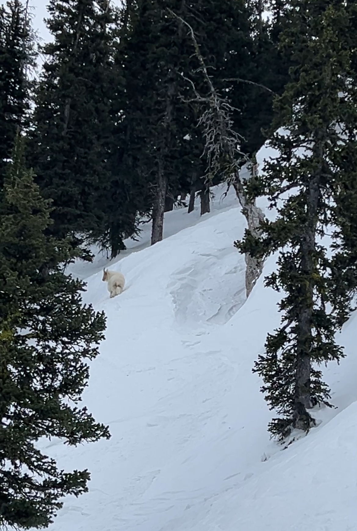
Mountain goat hanging out in Wolverine Bowl
-

Skier triggered wind slab on Northeast slope at 7,450 feet elevation. One skier was caught and carried roughly 10 feet before the slide came to a stop.
-

Skier triggered wind slab on Northeast slope at 7,450 feet elevation. One skier was caught and carried roughly 10 feet before the slide came to a stop.
-

Skier triggered wind slab on Northeast slope at 7,450 feet elevation. One skier was caught and carried roughly 10 feet before the slide came to a stop.
-

Mar 7 obs: "...There was 6" of low density snow from yesterday. Winds were stronger than expected, from the north at the top of the Throne, and increased through the morning.... We found fresh drifts that were reactive, cracking easily and 5-10' wide out from our skis, on south and east facing slopes around 8000-8300'." Photo: GNFAC
-

Mar 7 obs: "There was 6" of low density snow from yesterday.... The new snow was low density and sluffed easily on steep shady northerlies. On steep slopes facing the sun (south and east, and probably west) the new snow sat on a crust and became moist as the sun warmed it up and started to slide under skis. We saw a couple very small natural loose snow slides below rock outcrops on south facing slopes. Air temperatures were well below freezing, especially with wind chill, but the sun quickly warmed the recent new snow." Photo: GNFAC
-

From obs on 3/4/25:
"Saw a few sluffs in the new snow triggered by skiers in the very steep terrain just north of the Bridger Bowl ski area boundary (see photo). These sluffs were small, definitely not large enough to bury someone."
-

Observed multiple wet loose slides naturally triggering and running on south facing slopes beyond bradleys and on the south facing aspects of hourglass chute.
-

Observed multiple wet loose slides naturally triggering and running on south facing slopes beyond bradleys and on the south facing aspects of hourglass chute. Photo: T McGarry
-

From obs.: "Saw a recent cornice triggered wind slab off of Hardscrabble Peak, crown looked fairly fresh. There was a second crown line below the rock band. Conditions were very windy, with snow still being transported. Most snow surfaces were wind affected, but saw no cracking or collapsing." Photo: F. Miller
-

Skiers triggered a medium sized cornice fall that triggered a dry loose (sluff) avalanche that created large powder cloud.


Videos- Bridgers
WebCams
Bridger Base Area
Ridge, Looking North
Alpine Apron

Weather Forecast Bridgers
Extended Forecast for10 Miles NNE Bozeman MT
This Afternoon

High: 44 °F
Chance Snow
ShowersTonight

Low: 32 °F
Partly Cloudy
Thursday

High: 49 °F
Mostly Sunny
Thursday Night

Low: 34 °F
Mostly Clear
Friday

High: 61 °F
Sunny
Friday Night

Low: 41 °F
Clear
Saturday

High: 65 °F
Sunny
Saturday Night
Low: 44 °F
Partly Cloudy
Sunday
High: 63 °F
Mostly Sunny
then Showers
Likely
The Last Word
Thank you for another successful season. Our success is directly related to support from our community and the Forest Service. Thanks to the readers of the forecast, everyone that sent in observations, took an avalanche class, or donated money, time or gear. We will issue conditions updates on Mondays and Fridays through April.
GENERAL SPRING SNOWPACK AND TRAVEL ADVICE
Spring weather can be highly variable and create a mix of avalanche problems. Snow conditions and stability can change drastically from day to day or hour to hour. Anticipate rapid change and plan accordingly. Abundant snowfall over the winter with more spring snow to come makes avalanches possible into summer.
NEW SNOW AND WIND LOADED SLOPES
Spring storms are notorious for depositing heavy amounts of snow in the mountains. Even with a deep and generally stable snowpack throughout the advisory area, heavy and rapid loads of new snow will decrease stability. The main problems to look out for are avalanches breaking within the new snow, wind slabs, and loose snow avalanches. The likelihood of triggering an avalanche spikes during and immediately after snowstorms. New snow instabilities tend to stabilize quickly, but it’s a good idea to give fresh snow a day to adjust before hitting big terrain. New snow instabilities can be challenging to assess, and spring storms bond to old snow differently across aspects and elevations. Conservative terrain selection is essential during and immediately following storms. Avoid wind-loaded slopes and slopes steeper than 35 degrees for 24-48 hours after new snow and wind.
New snow can quickly change from dry to wet on a spring day, and stability can decrease rapidly with above freezing temperatures or brief sunshine. New snow may bond well early in the morning and then easily slide later. Wet loose slides are likely during the first above freezing temperatures or sunshine immediately after a storm. Anticipate changes in snow stability as you change aspect or elevation and over the course of the day. An early start is always an advantage. Be ready to change plans or move to safer terrain at the first signs of decreasing stability.
WET SNOW AVALANCHES
Spring and wet snow avalanches go hand-in-hand. Above freezing temperatures, rain, and/or intense sunshine cause the snow to become wet and weak and make wet avalanches easy to trigger or release naturally. Conditions tend to become most unstable when temperatures stay above freezing for multiple days and nights in a row. Avoid steep terrain, and be aware of the potential for natural wet avalanches in steep terrain above you, if you see:
- Heavy rain,
- Above freezing temperatures for more than 24 hours,
- Natural wet avalanches,
- Rollerballs or pinwheels indicating a moist or wet snow surface,
- Or if you sink to your boot top in wet snow.
In general, if the snow surface freezes solid overnight, the snowpack will be stable in the morning and stability will decrease through the day as snow warms up. The snow surface hardness, rate of warming, duration of sunshine, aspect and elevation determine how fast stability will decrease through the day. Be aware that sunny aspects may have a wet snow avalanche danger while shadier slopes still have a dry snow avalanche danger. Getting off of steep slopes should be considered when, or before, the above signs of instability are present. Wet snow avalanches, whether loose snow or slabs, can be powerful, destructive and very dangerous. Conservative terrain choices, starting early in the day, and careful observations can keep you safe. See Alex’s recent video, and this article for more spring travel advice.
CORNICES
Cornices along ridgelines are massive and can break under the weight of a person (photo). Prolonged above freezing temperatures and rain make them weaker and possible to break naturally. They can break off suddenly and farther back than one might expect. Cornice falls can also entrain large amounts of loose snow or trigger slab avalanches. Stay far back from the edge of ridgelines and minimize exposure to slopes directly below cornices. Regardless of whether a cornice triggers a slide or not, a falling cornice is dangerous to anyone in its path.
DISCLAIMER
It does not matter if new snow falls or not, avalanches will continue to occur until the existing snowpack is mostly gone. Always assess the slope you plan to ride with diligence and safety in mind. Do not let your guard down. Travel with a partner, carry rescue gear and only expose one person at a time in avalanche terrain.
Have a safe and enjoyable spring and summer!
Mark, Alex, Ian and Dave
For more spring travel advice see this article from our GNFAC forecaster blog.