Trip Planning for Northern Gallatin

Past 5 Days

Moderate

Low

None
None
None
Relevant Photos
-

-

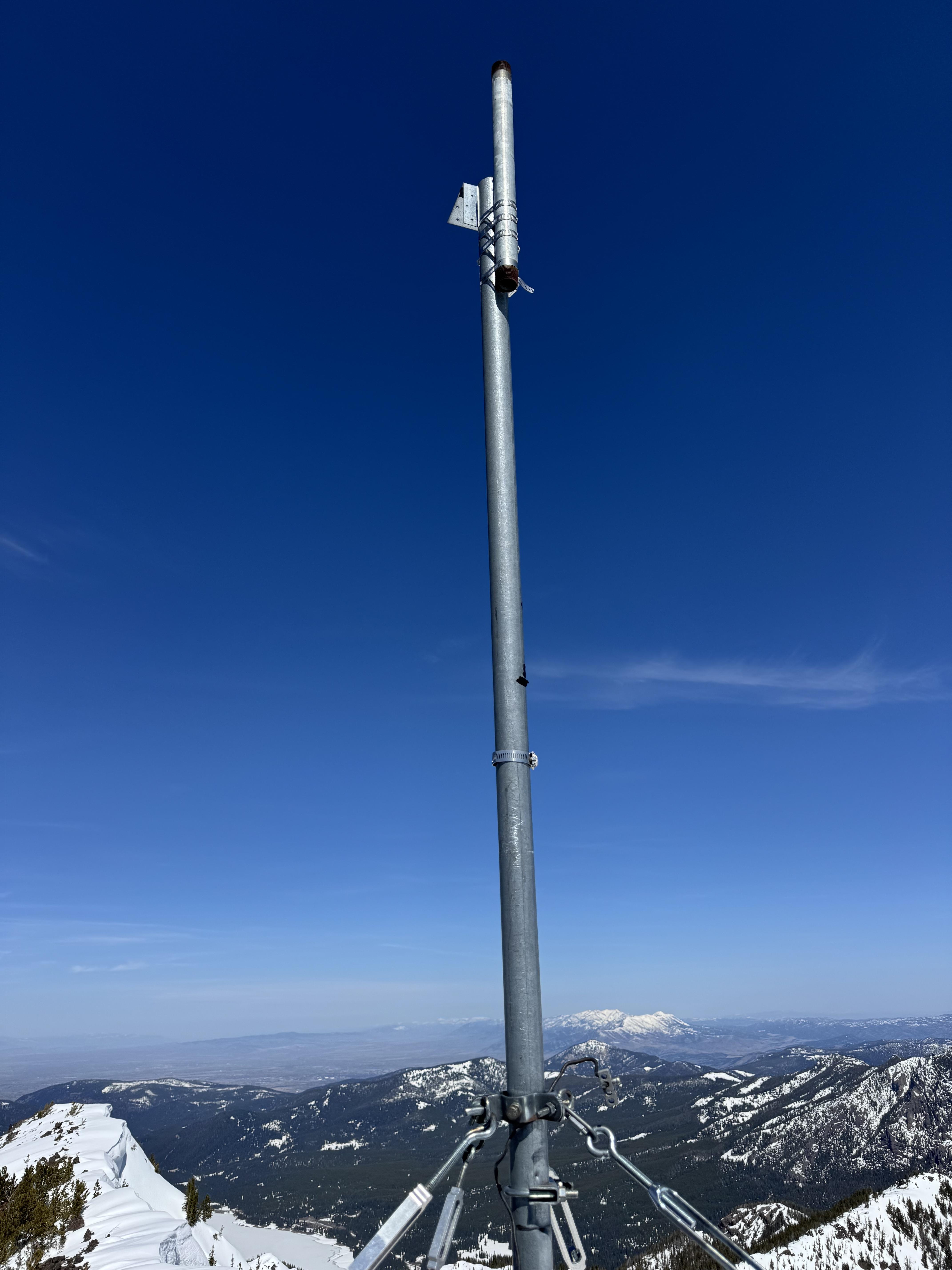
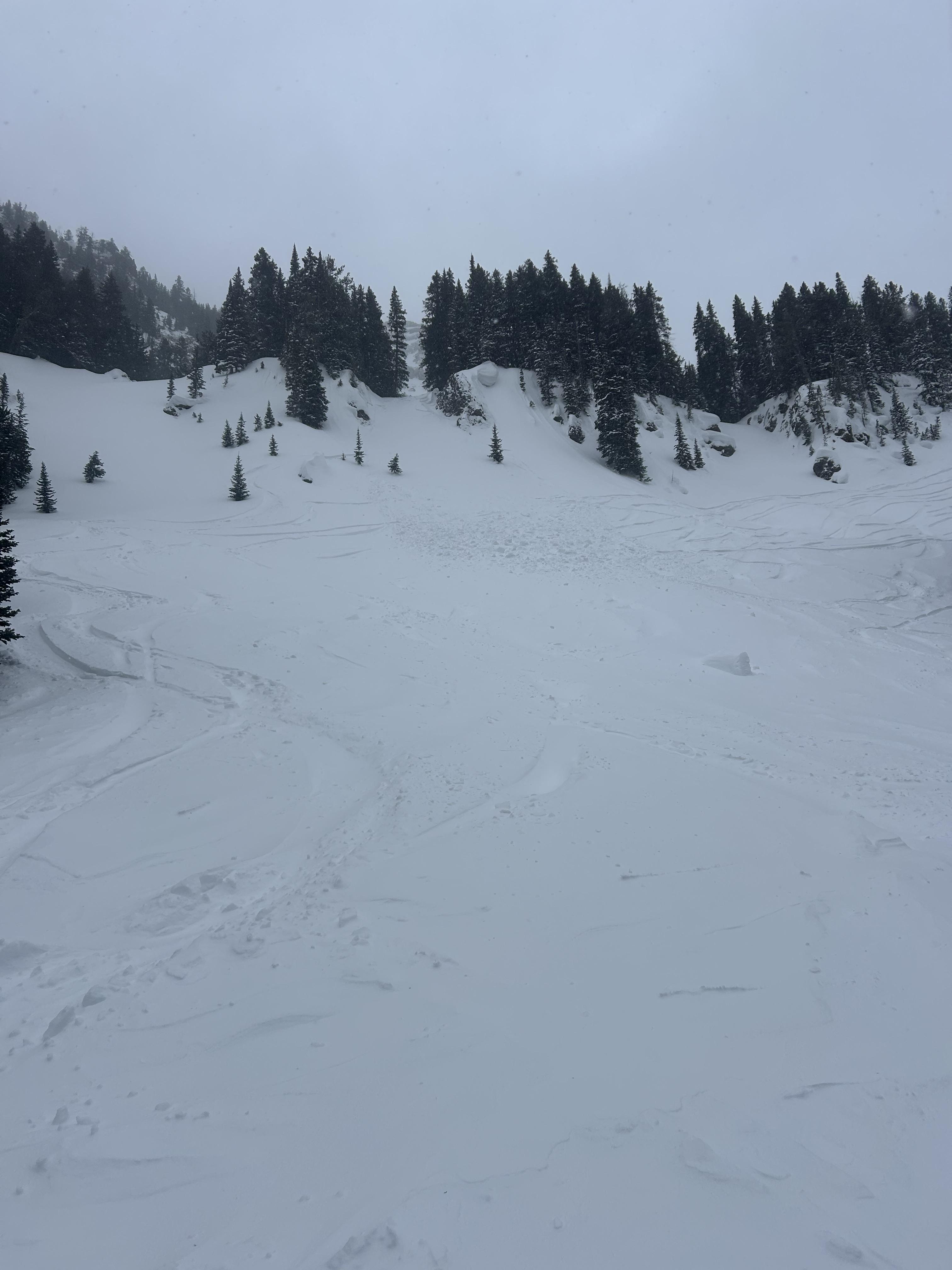
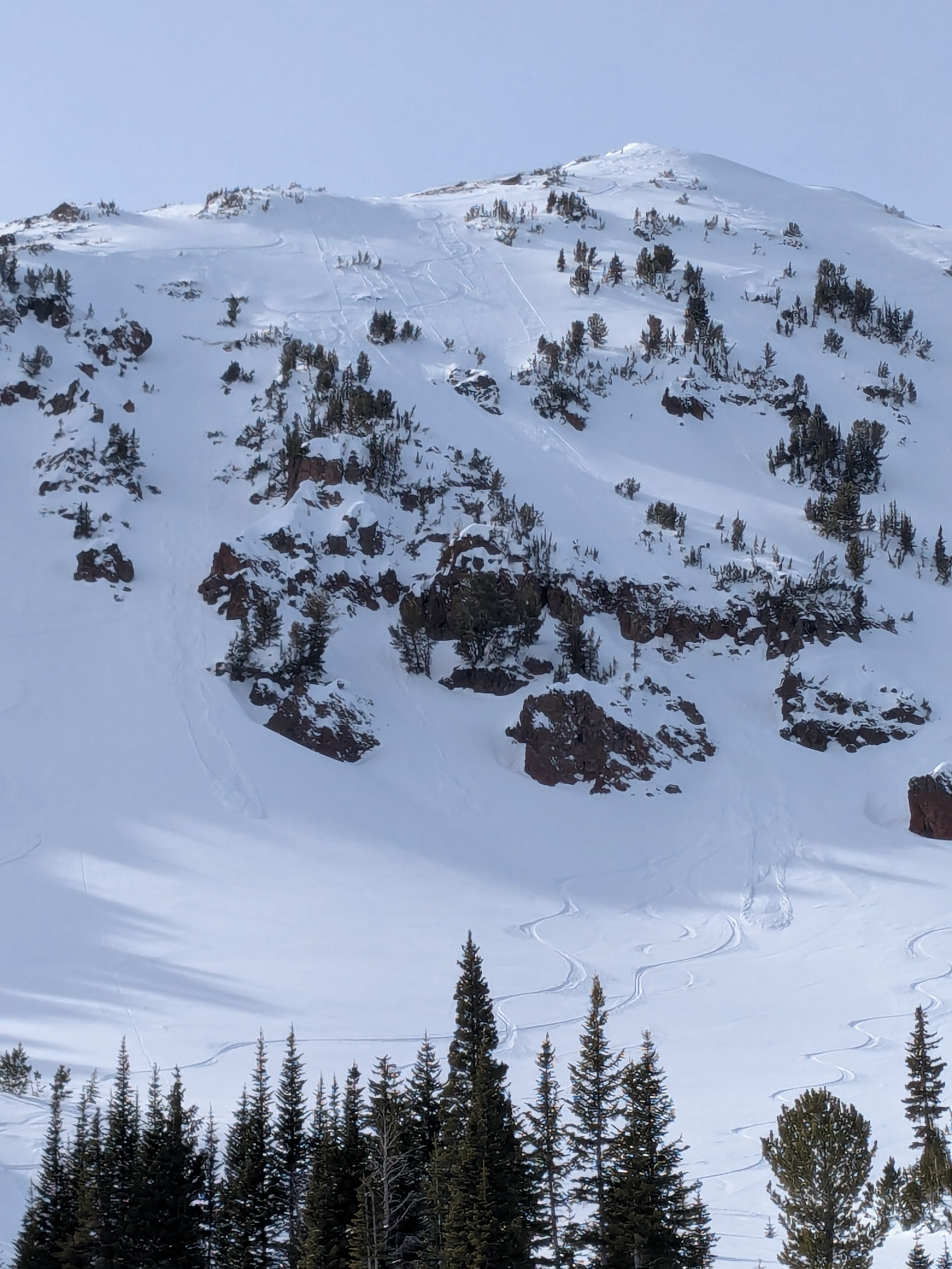
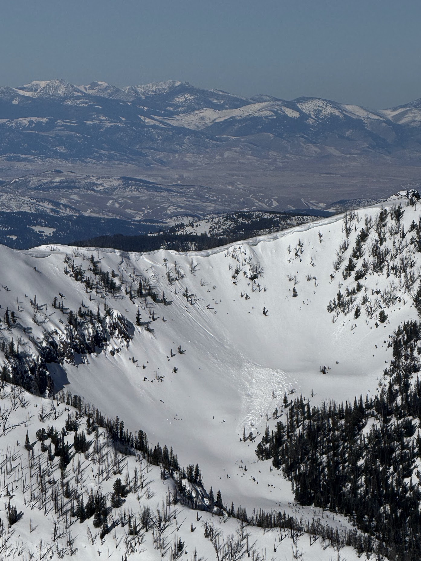
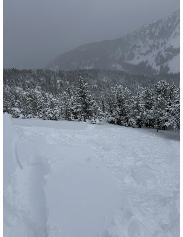
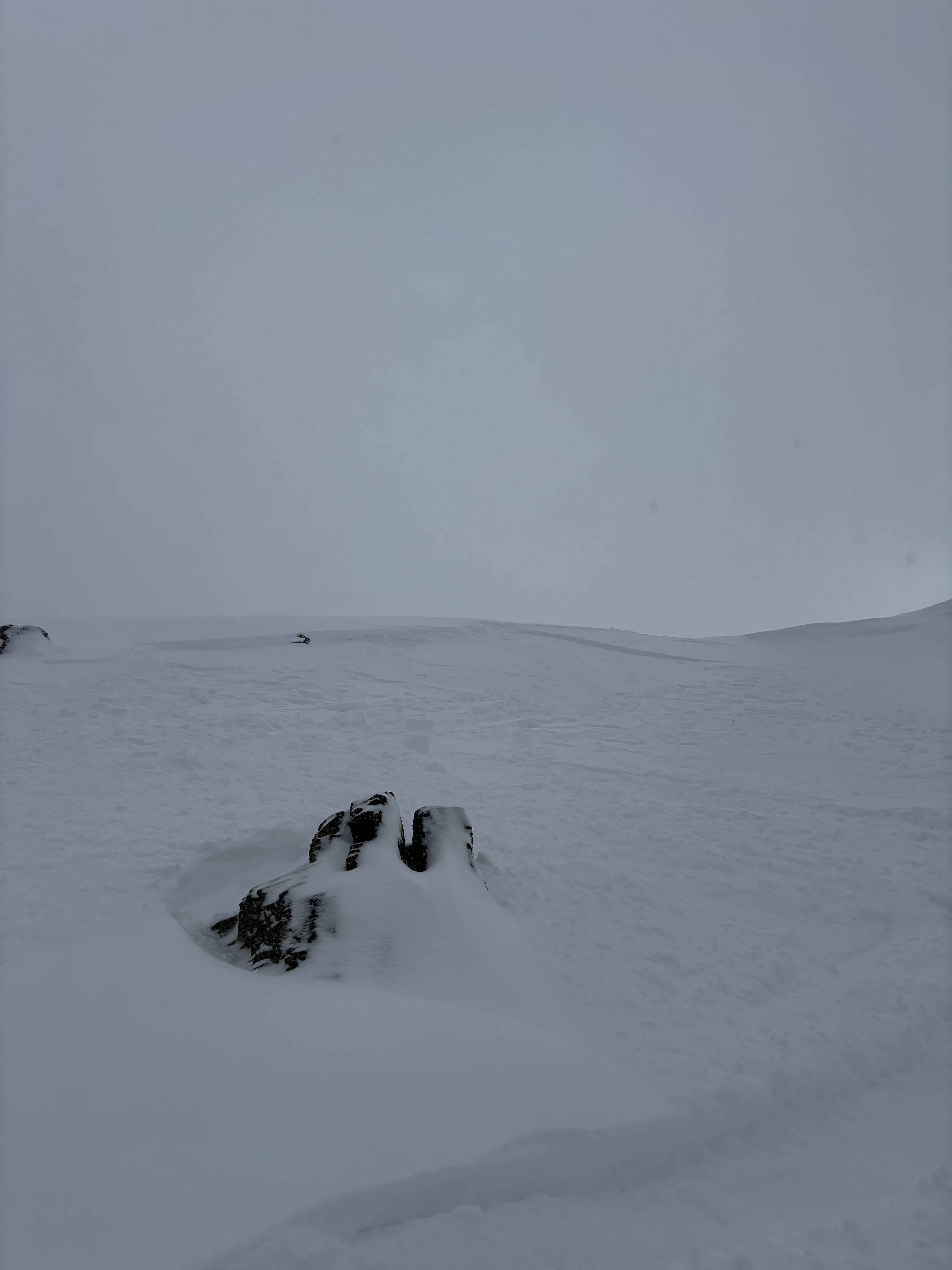
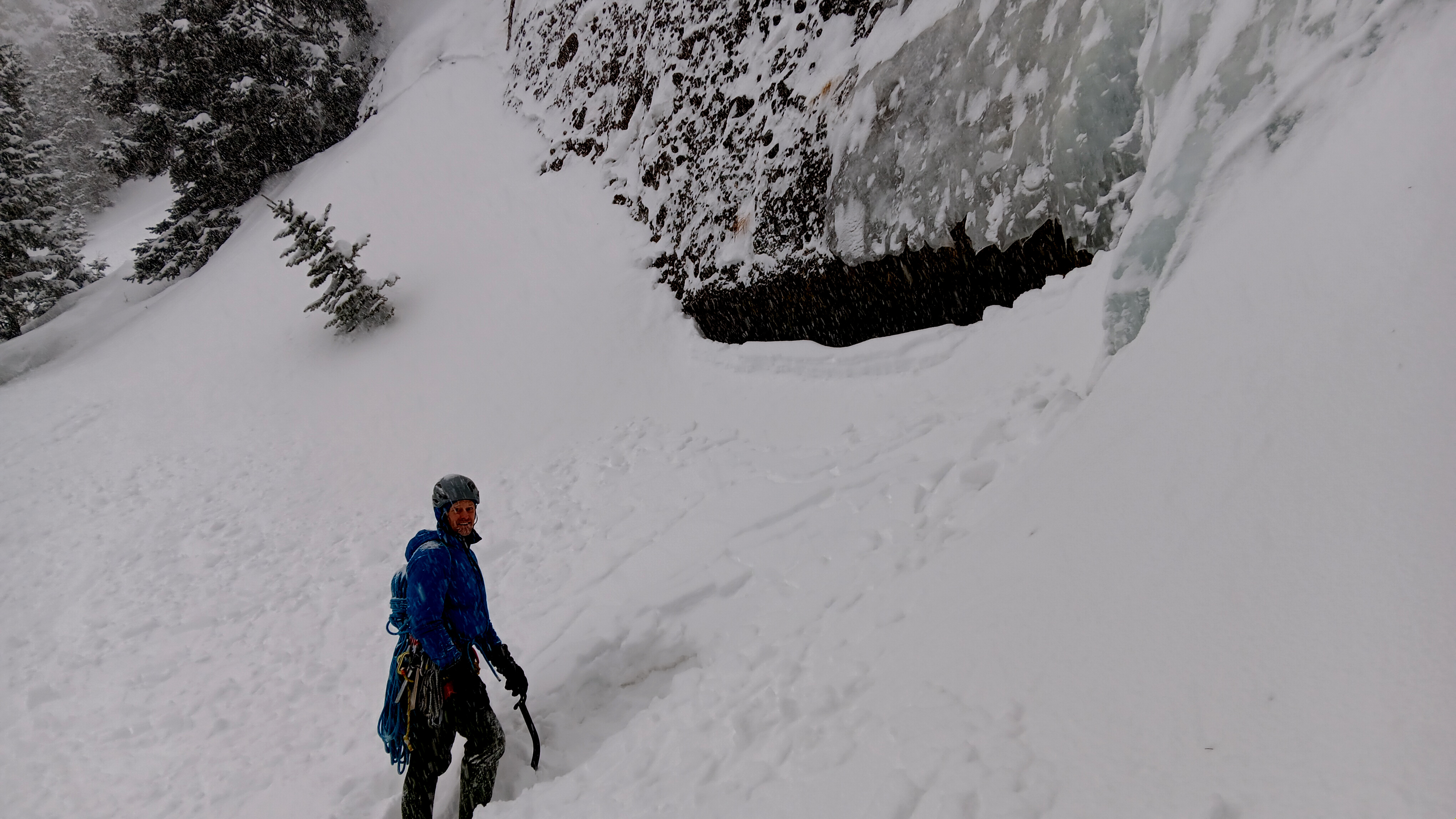
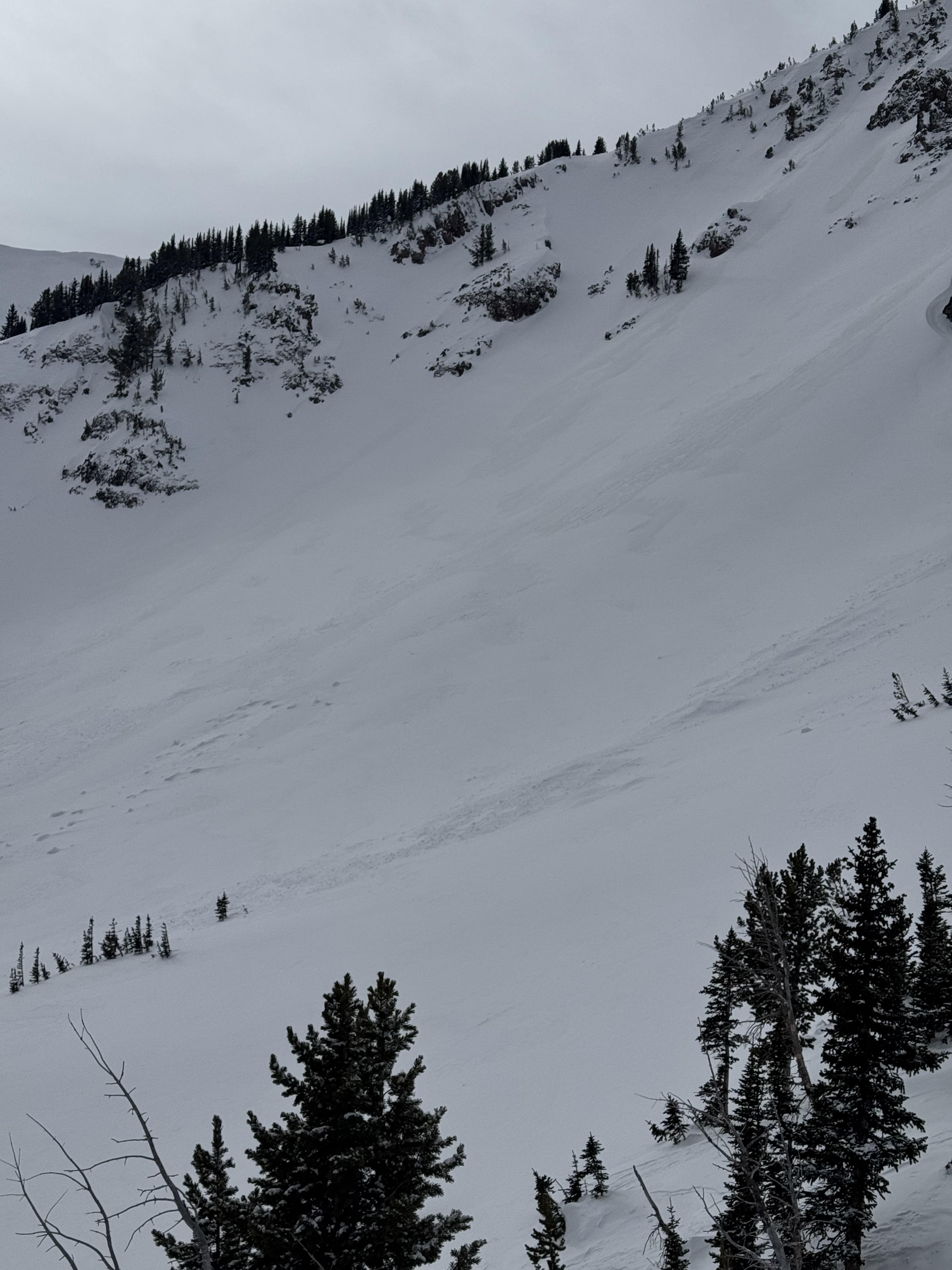
We went through Flanders' Creek to the Flanders Weather Station to pull it for the season. We descended to the Grotto Falls TH via the Winter Dance Route. The surface snow got wet as the day progressed, but we saw no wet snow avalanche activity. I wouldn't be surprised if there was limited activity as the day progressed.
Recent warm temperatures have almost universally affected snow surfaces. North-facing slopes above 9500' elevation remain dry, and pockets of dry snow exist at lower elevations on shaded slopes. South-facing slopes have cycled a few times, and the corn snow is coming in reasonably well.
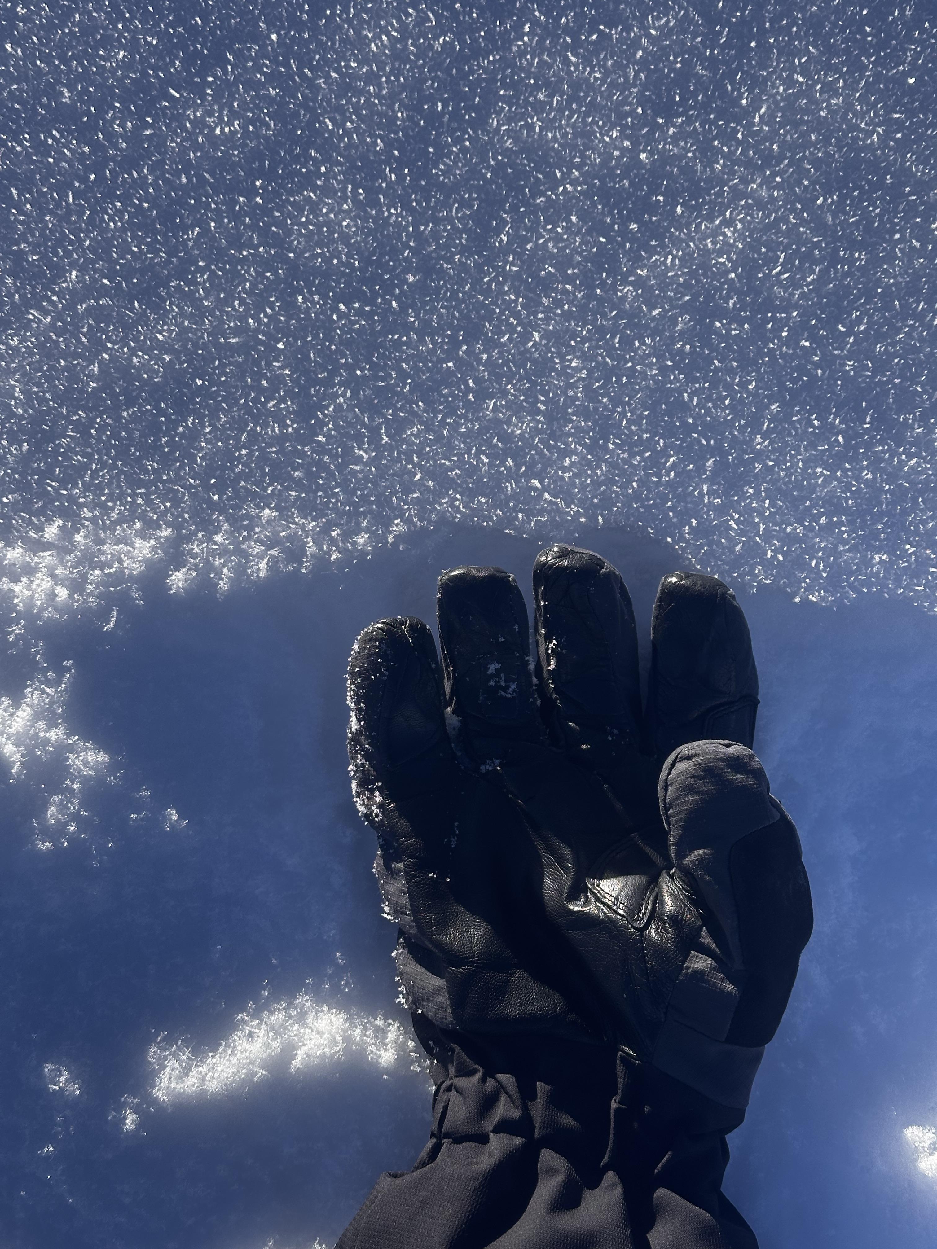
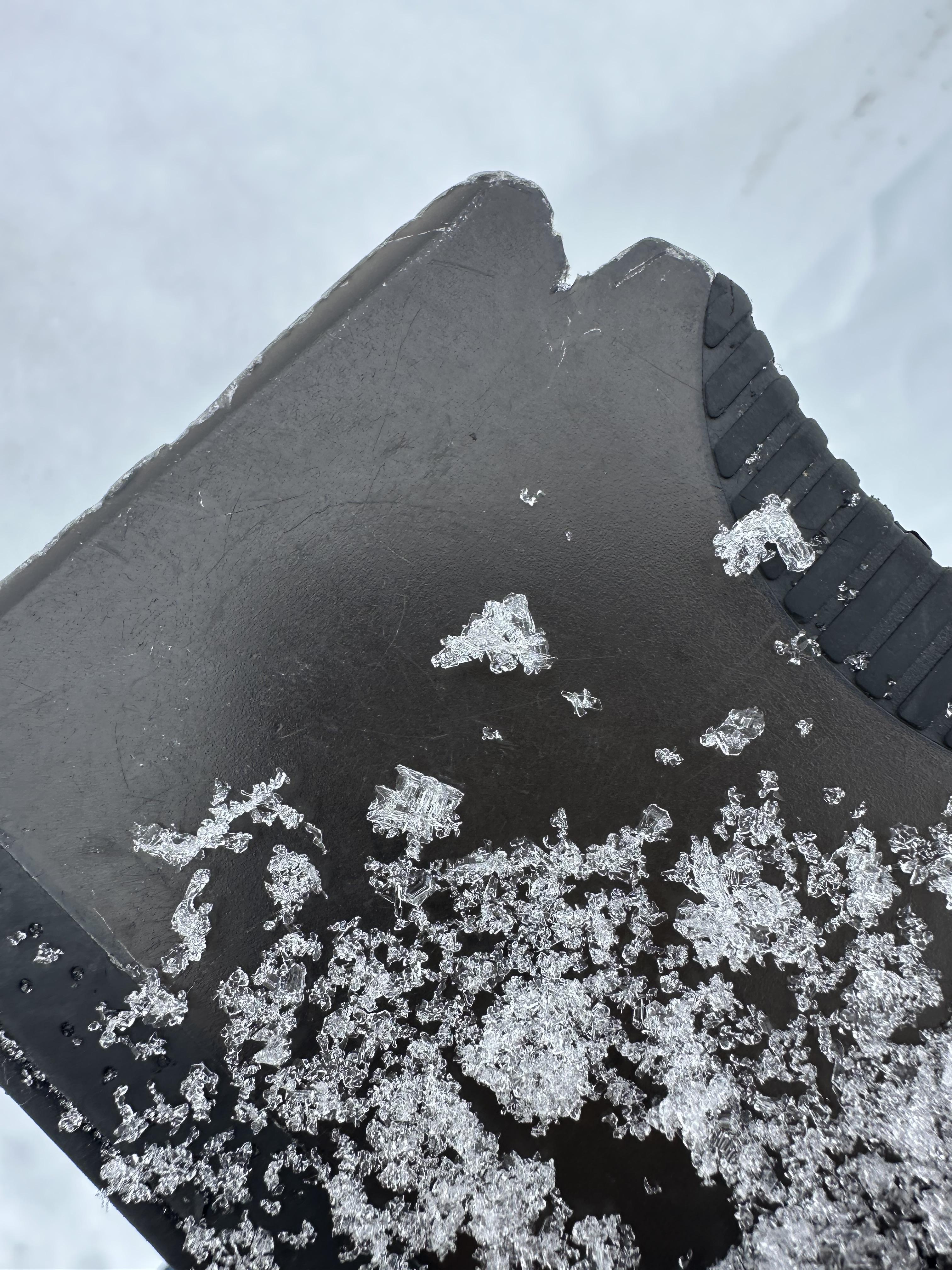
There were no signs of dry snow instability. Photo: GNFAC
-

-

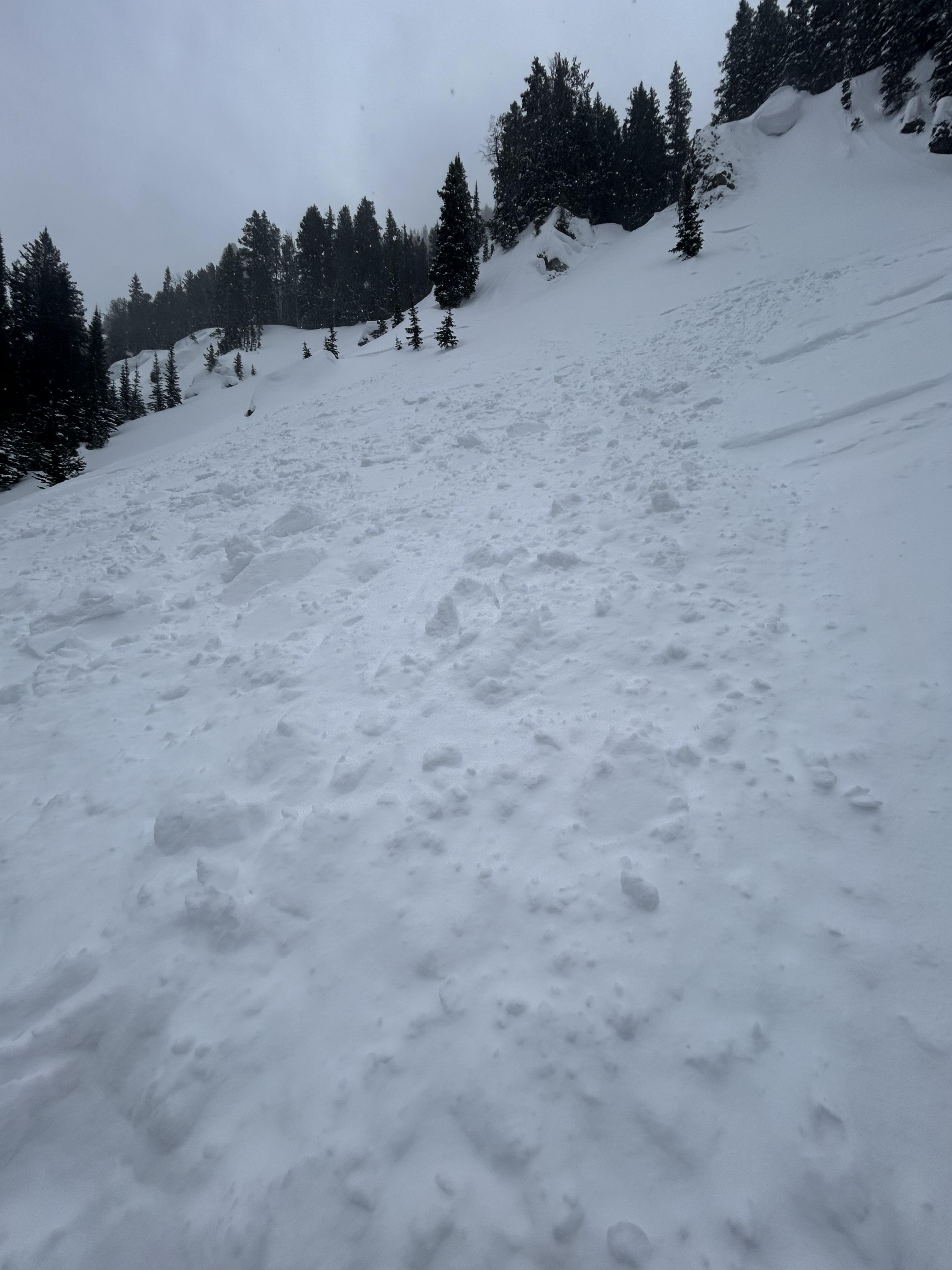
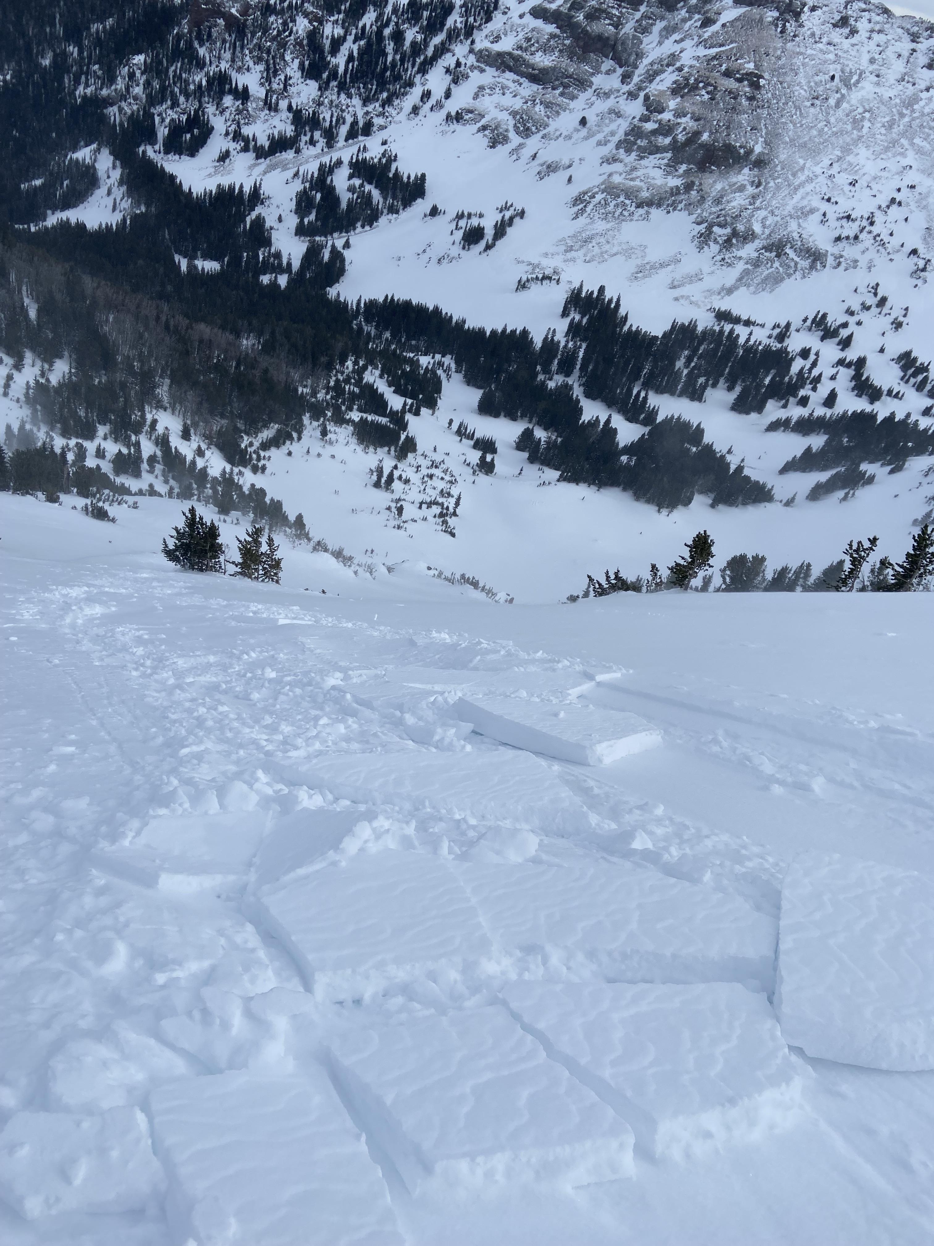
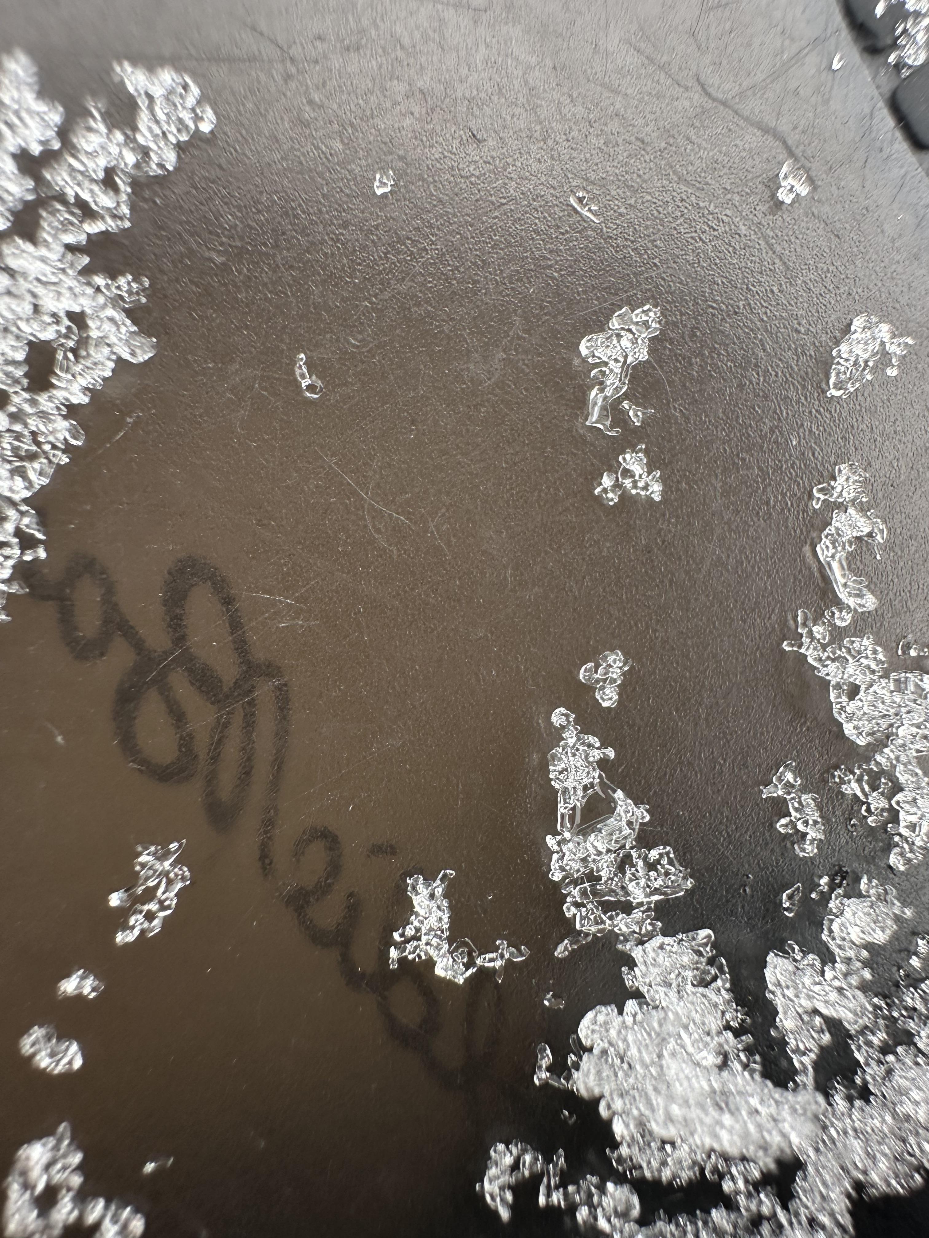
The 12" of snow since yesterday fell right-side-up and had little to no slab properties. This new snow rests on a stout melt-freeze crust from the high temperatures last week. Photo: GNFAC
-

Understanding Avalanche Safety Preparedness – 5-Minute Survey for Motorized Users
We need your input! Eastern Oregon University is conducting a survey to better understand avalanche safety preparedness among motorized backcountry users like you. Your feedback will help us learn more about who is purchasing and practicing with avalanche rescue gear (beacon, probe, shovel) and participating in avalanche education—and why some riders aren’t. The survey is confidential and anonymous.
Your feedback is invaluable in improving avalanche education and awareness. Please take a moment to share your experience and help us make a difference.
https://eoustmhs.qualtrics.com/jfe/form/SV_3L8QKAuZzcxJBLo
Thank you for your time and for being a part of this important effort!
-

This small wind slab avalanche failed on Mt Blackmore on Sunday. Photo: C Rendeiro
-

Debris pile from a small wind slab avalanche on Mt Blackmore. Photo: C Rendeiro
-

From obs: "Multiple natural loose avalanches in the steep terrain of mt Blackmore. All originated at the base of cliffs or trees. Counted 4 prominent ones."
Photo: M. Stern
-

Saw lots of small loose avalanches on Mt Blackmore and nearby slopes, some appeared to be natural and others skier triggered. We saw multiple dry loose on N and E aspects and a wet loose on a southeast aspect. Photo: H Meyers
-

Saw lots of small loose avalanches on Mt Blackmore and nearby slopes, some appeared to be natural and others skier triggered. We saw multiple dry loose on N and E aspects and a wet loose on a southeast aspect. Photo: H Meyers
-

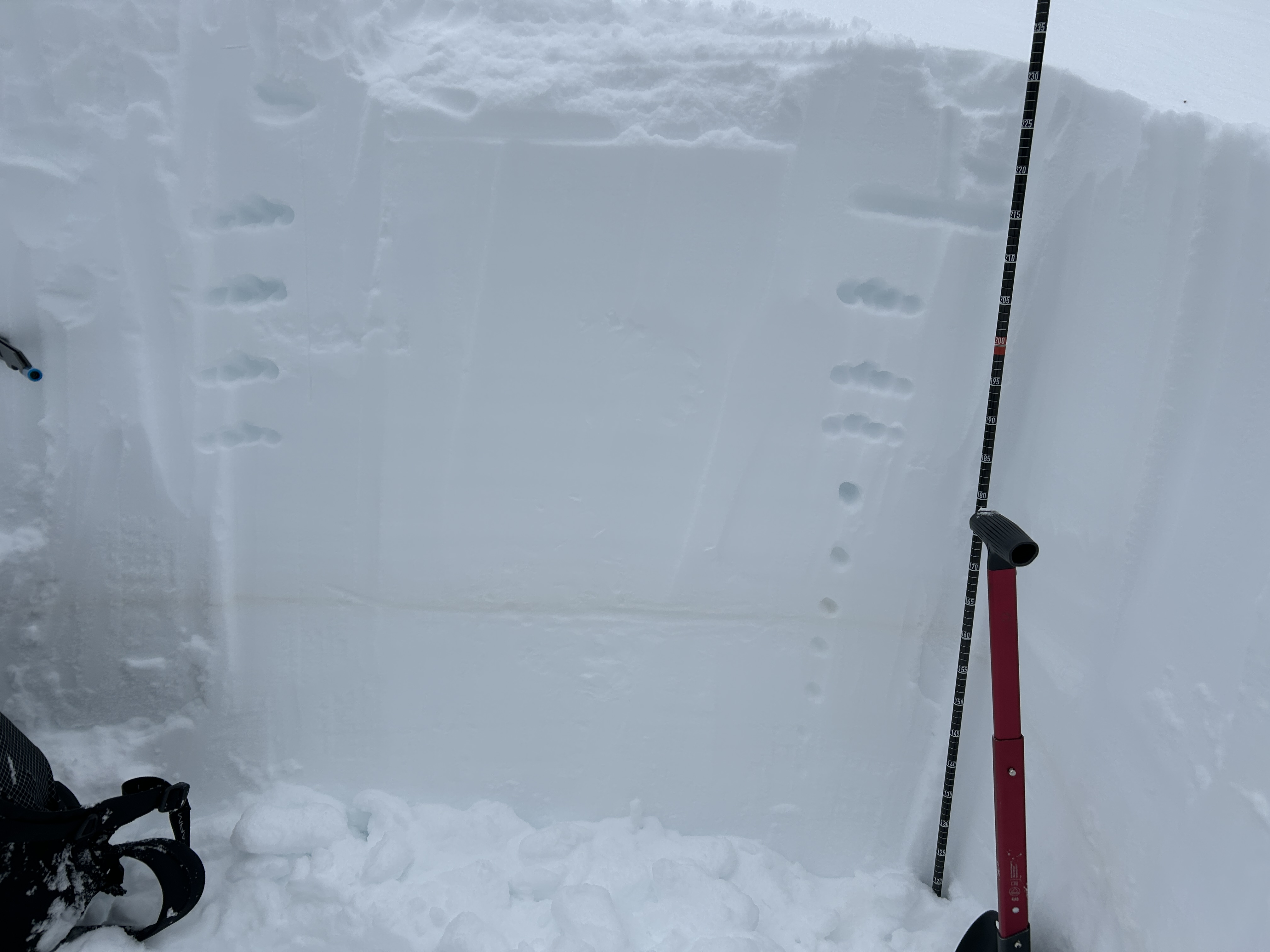
"Toured up Flanders Creek to the main cirque. I was wondering what the snow surface was doing with the high pressure. I dug a pit on a NNW aspect at 8900'. HS 205cm, light SW wind, clear skies and air temp was 2.1 C at 4pm. Dust layer was down 60cm from the surface.
I didn't get any propagating results in my pit and the snowpack was right side up. I did notice a strong temperature gradient in the top few centimeters of snow. I only found this on sheltered, shaded slopes with dry powdery snow. I did not find a strong temp gradient or facets in dense wind affected snow. Something to keep in mind if we get a big dump of snow in the near future." Photo: B. Oackes
-

Ridge line just west of divide peak in Hyalite canyon. Photo: O Silitch
-

Saw a fairly fresh avalanche up Hyalite from the top of the Fat and Skinny Maids, I think that would put the avalanche in the Storm Castle Creek basin. Photo: F Miller
-

Pictures of two cornice triggered avalanches way up the South Cottonwood drainage that was viewed from Alex Lowe. Looks to be in the recent days, around 9,000 feet North facing. Photo: S Lipsteuer
-

A massive cornice had cracked and was slowly making its way towards falling down. Cornice was around 50 feet long, and largely overhanging. Photo: S Lipsteuer
-

A massive cornice that has cracked and is slowly making its way towards falling down. Cornice was around 50 feet long, and largely overhanging. On the standard ascent of the East Ridge of Alex Lowe, the skin track usually travels below this cornice while ascending to the ridge. Photo S Lipsteuer
-

This older wet slide is a good example of what to look out for especially at low elevations.
-

This older wet slide is a good example of what to look out for especially at low elevations.
-

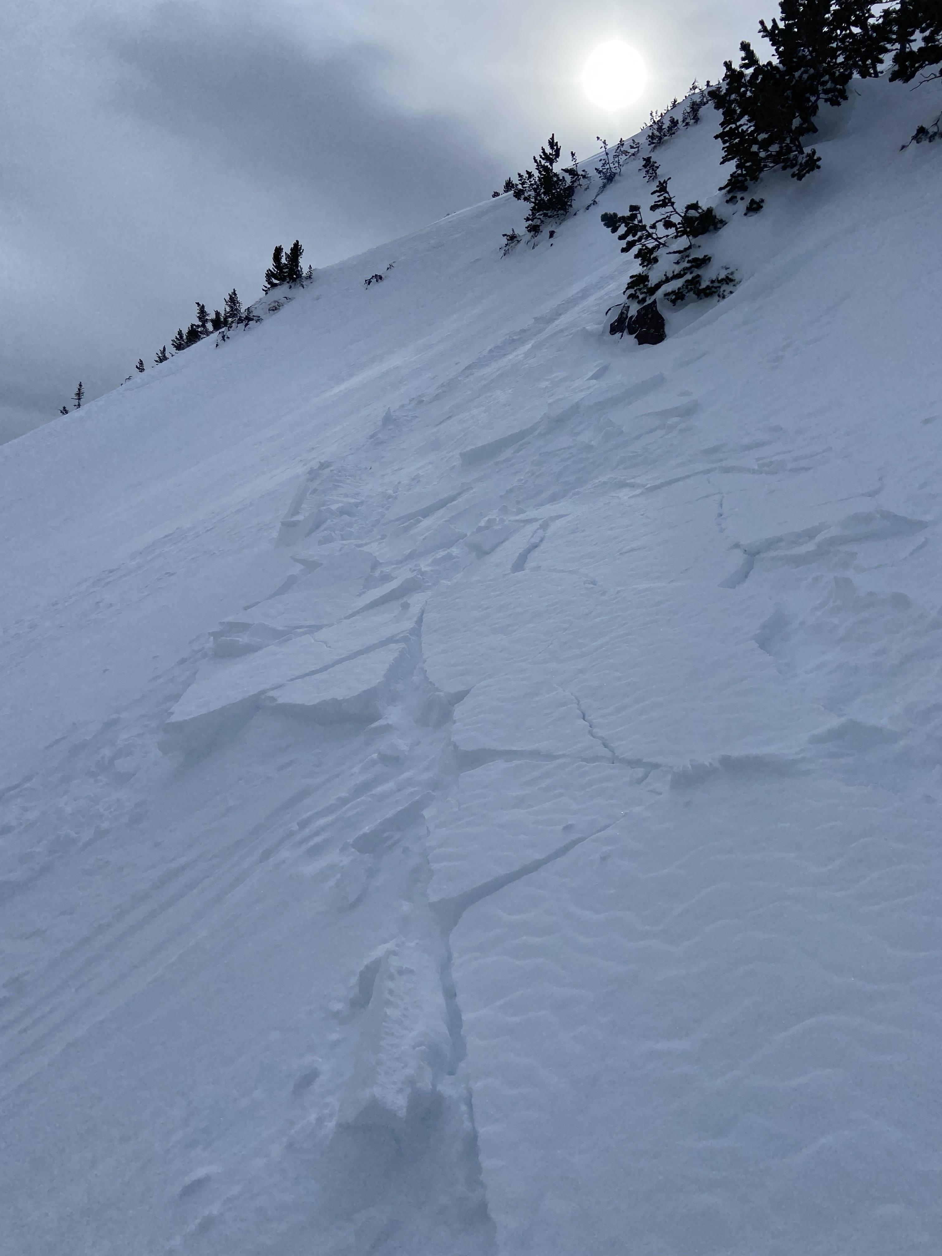
Cornice release above the headwaters of storm castle creek which triggered a slab, east facing aspect. Looked to be several feet deep and ran a long way.
-
Cornice triggered slab avalanche, maybe wind slab. Hard to say.
-

Total snow depth on a NE aspect was 230 cm (7.5 ft). Right side up and strong. Dust layer from Feb 4th was 70 cm deep (28 inches) with no facets under it.
-

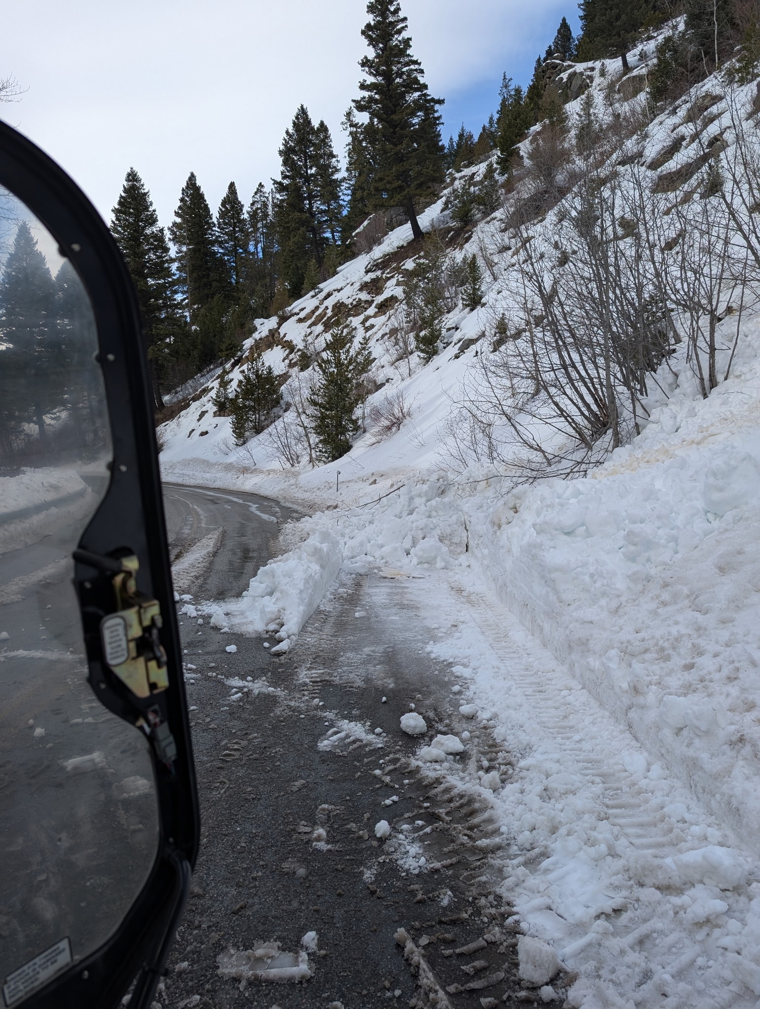
Clean up on aisle hyalite! Couple small wet slides between the retaining wall and practice rock, big enough to reduce the road to one lane. Photo: K. Marvinney
-

From obs.: "Saw a recent cornice triggered wind slab off of Hardscrabble Peak, crown looked fairly fresh. There was a second crown line below the rock band. Conditions were very windy, with snow still being transported. Most snow surfaces were wind affected, but saw no cracking or collapsing." Photo: F. Miller
-

From obs: "2/17 Immediately noticed signs of wind loading and wind slabs on NE-E aspects once in the basin. New cornices have formed in the last couple days along the North ridge to the summit. Cornice collapse on the summit triggered a small wind slab on an isolated slope." Photo: R. Rintala
-

From obs: "2/17 Immediately noticed signs of wind loading and wind slabs on NE-E aspects once in the basin. New cornices have formed in the last couple days along the North ridge to the summit. Cornice collapse on the summit triggered a small wind slab on an isolated slope." Photo: R. Rintala
-

SS-ASc-R1-D.5-I
310 Degrees NW
8129ft
Photo: Tagg Cole
-

Storm slab avalanche between Blackmore and Elephant. Photo: Anonymous
-

-

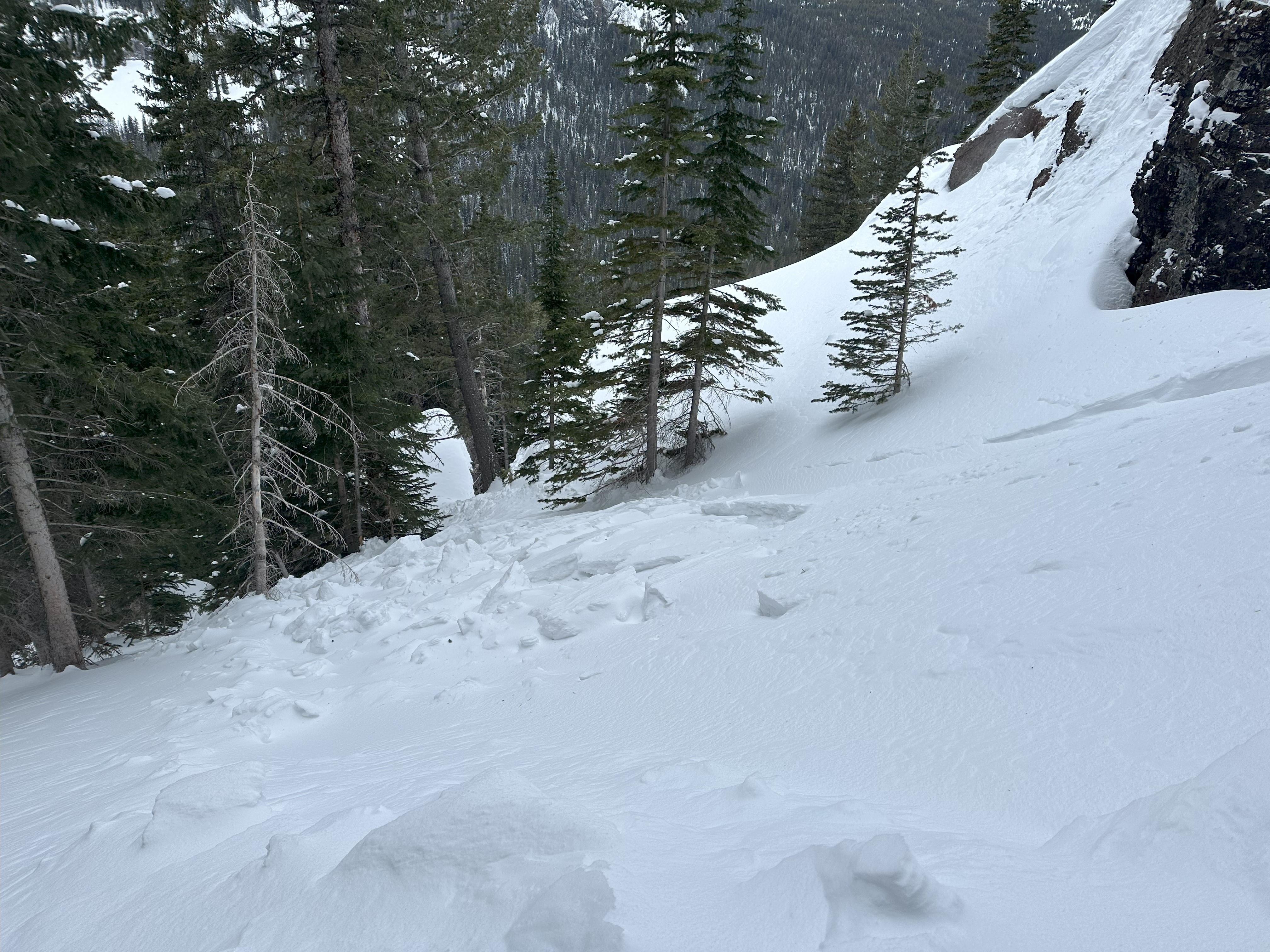
Saw a small natural slide that started at the bottom of Cyptorchid. Crown was 10' wide and 8-18" deep, it ran 150' down a very shallow slope and covered the climbers trail. Photo: R Beck
-

Saw a small natural slide that started at the bottom of Cyptorchid. Crown was 10' wide and 8-18" deep, it ran 150' down a very shallow slope and covered the climbers trail. Photo: R Beck
-

Triggered a small wind slab avalanche on the east face of mt Blackmore today at 9850 ft elevation. Around 5 inches thick, ~ 20 ft wide, and ran for 100 ft. Photo: I Masi
-

Triggered a small wind slab avalanche on the east face of mt Blackmore today at 9850 ft elevation. Around 5 inches thick, ~ 20 ft wide, and ran for 100 ft. Photo: I Masi
-

Cold temps and sunny days starting to create some surface hoar forming seen on the primary ridge of big Ellis. Surface hoar was less widely distributed on the primary ski zone but was present all along the top of the ridge. Photo: K Gordon
-

I went skate skiing up Sourdough Canyon today. The trail intersects many south and southwest-facing avalanche terrains that generally do not have much snow coverage due to their exposure to the sun.
However, the snowpack is much deeper than normal in the Gallatin Valley and in the low-elevation mountains around the Valley, and these slopes make me nervous, especially because they would impact a trail that sees heavy use by people who do not intend to expose themselves to avalanches and who are not prepared for avalanche rescue.
Currently, 2.5 to 4 feet of snow is in the terrain near the trail.
Photo: GNFAC
-

I went skate skiing up Sourdough Canyon today. The trail intersects many south and southwest-facing avalanche terrains that generally do not have much snow coverage due to their exposure to the sun.
However, the snowpack is much deeper than normal in the Gallatin Valley and in the low-elevation mountains around the Valley, and these slopes make me nervous, especially because they would impact a trail that sees heavy use by people who do not intend to expose themselves to avalanches and who are not prepared for avalanche rescue.
Photo: GNFAC
-

At the base of G2 I triggered a 3 inch x 100 foot soft slab. Photo: D Chabot
-

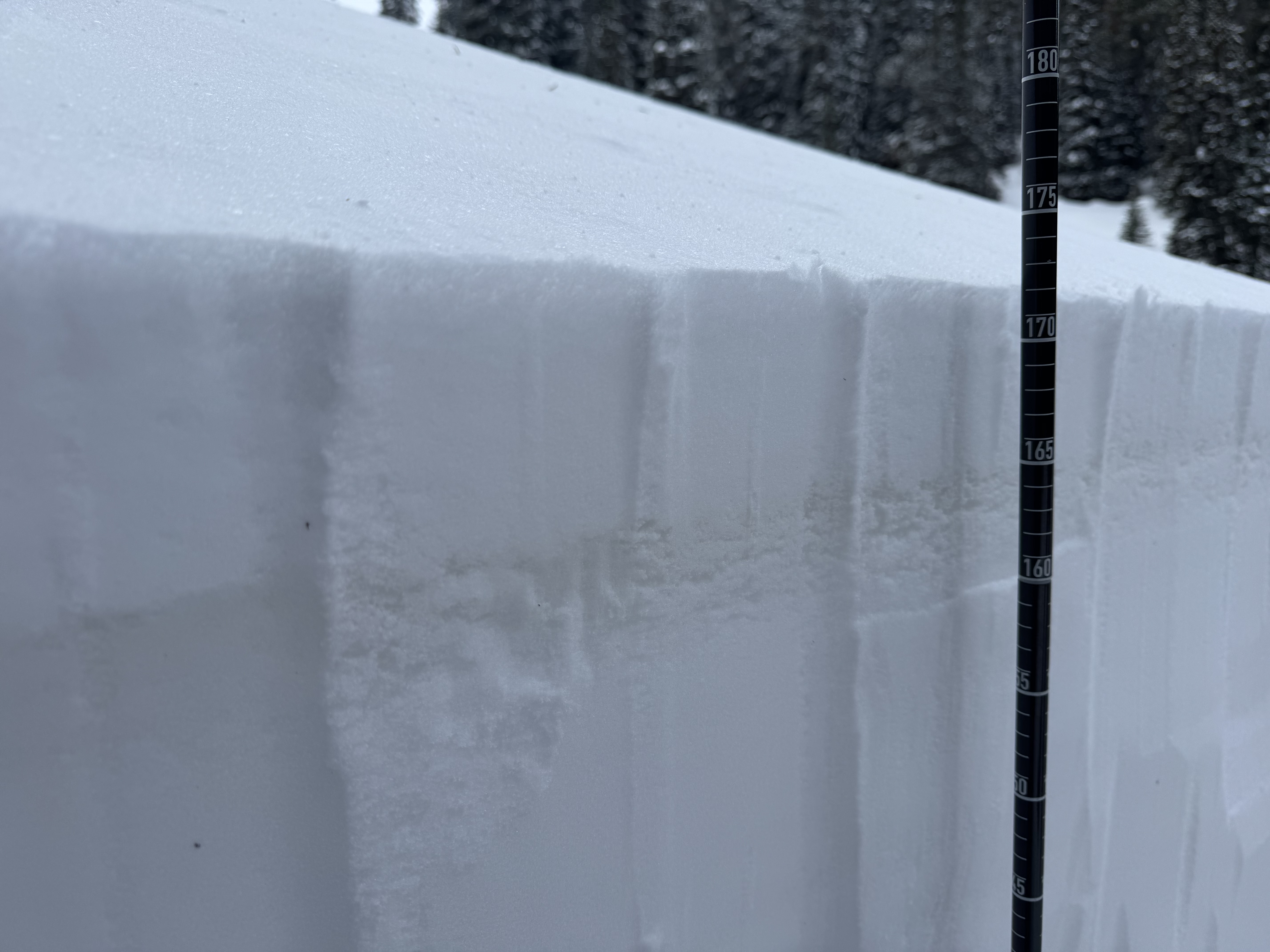
Most notable test result was ECTP16 down 35 cm on a layer of surface hoar. Photo: E Heiman
-

Most notable test result was ECTP16 down 35 cm on a layer of surface hoar. Photo: E Heiman
-

Three to four inches of new snow from yesterday sat on top of the dust layer that got deposited across most of the forecast area on Monday and Tuesday. Photo: GNFAC
-

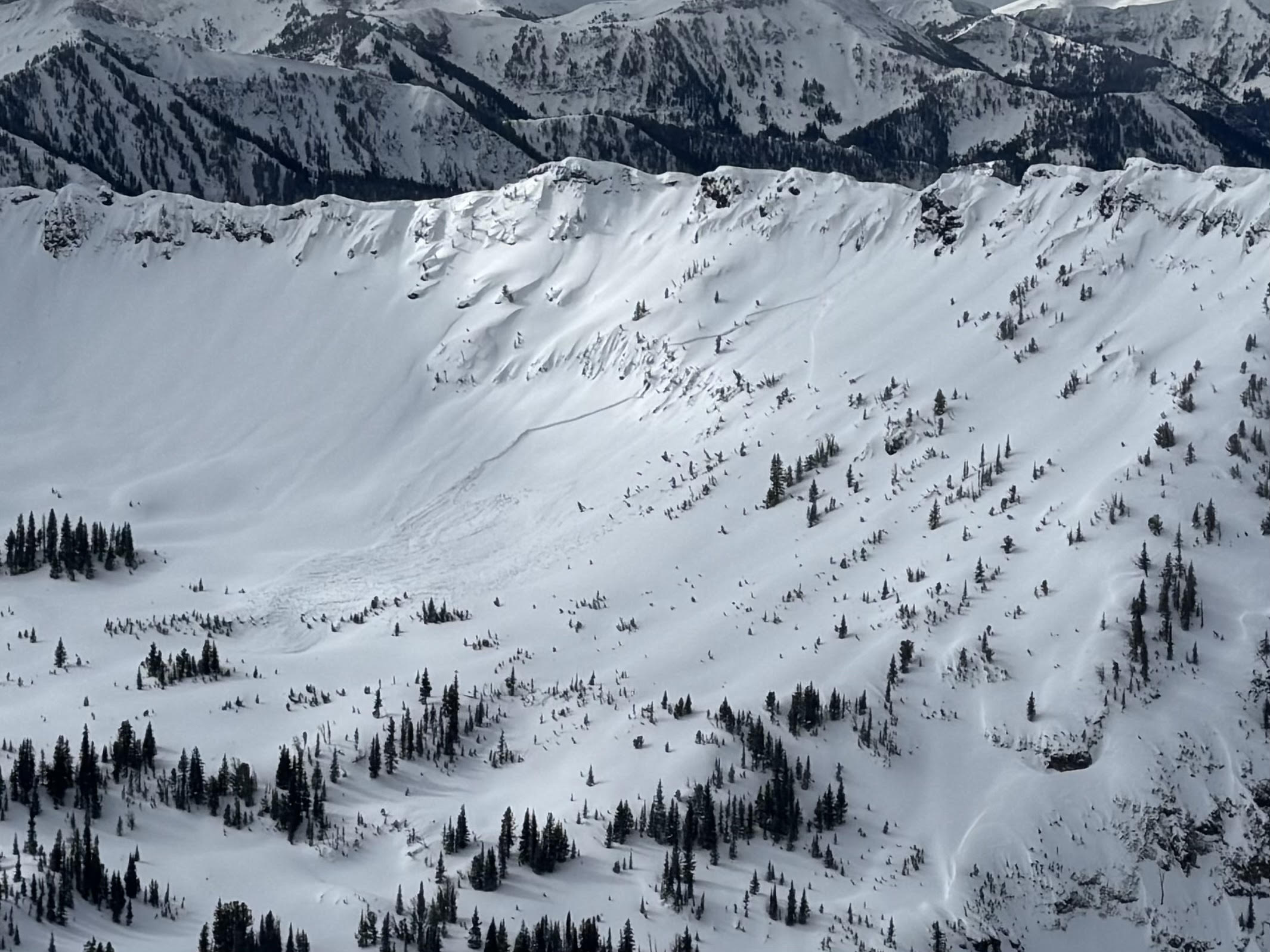
There was evidence of several R1-2/ D1-2 wind slab avalanches that likely ran this weekend on the east face of Blackmore. Photo: GNFAC


Videos- Northern Gallatin
WebCams
Bozeman Pass, Looking SE

Weather Stations- Northern Gallatin
Weather Forecast Northern Gallatin
Extended Forecast for14 Miles SE Gallatin Gateway MT
This Afternoon

High: 39 °F
Snow Showers
LikelyTonight

Low: 28 °F
Mostly Cloudy
Thursday

High: 45 °F
Mostly Sunny
Thursday Night

Low: 30 °F
Mostly Clear
Friday

High: 56 °F
Sunny
Friday Night
Low: 37 °F
Mostly Clear
Saturday
High: 60 °F
Sunny
Saturday Night

Low: 40 °F
Partly Cloudy
Sunday

High: 57 °F
Showers
Likely
The Last Word
Thank you for another successful season. Our success is directly related to support from our community and the Forest Service. Thanks to the readers of the forecast, everyone that sent in observations, took an avalanche class, or donated money, time or gear. We will issue conditions updates on Mondays and Fridays through April.
GENERAL SPRING SNOWPACK AND TRAVEL ADVICE
Spring weather can be highly variable and create a mix of avalanche problems. Snow conditions and stability can change drastically from day to day or hour to hour. Anticipate rapid change and plan accordingly. Abundant snowfall over the winter with more spring snow to come makes avalanches possible into summer.
NEW SNOW AND WIND LOADED SLOPES
Spring storms are notorious for depositing heavy amounts of snow in the mountains. Even with a deep and generally stable snowpack throughout the advisory area, heavy and rapid loads of new snow will decrease stability. The main problems to look out for are avalanches breaking within the new snow, wind slabs, and loose snow avalanches. The likelihood of triggering an avalanche spikes during and immediately after snowstorms. New snow instabilities tend to stabilize quickly, but it’s a good idea to give fresh snow a day to adjust before hitting big terrain. New snow instabilities can be challenging to assess, and spring storms bond to old snow differently across aspects and elevations. Conservative terrain selection is essential during and immediately following storms. Avoid wind-loaded slopes and slopes steeper than 35 degrees for 24-48 hours after new snow and wind.
New snow can quickly change from dry to wet on a spring day, and stability can decrease rapidly with above freezing temperatures or brief sunshine. New snow may bond well early in the morning and then easily slide later. Wet loose slides are likely during the first above freezing temperatures or sunshine immediately after a storm. Anticipate changes in snow stability as you change aspect or elevation and over the course of the day. An early start is always an advantage. Be ready to change plans or move to safer terrain at the first signs of decreasing stability.
WET SNOW AVALANCHES
Spring and wet snow avalanches go hand-in-hand. Above freezing temperatures, rain, and/or intense sunshine cause the snow to become wet and weak and make wet avalanches easy to trigger or release naturally. Conditions tend to become most unstable when temperatures stay above freezing for multiple days and nights in a row. Avoid steep terrain, and be aware of the potential for natural wet avalanches in steep terrain above you, if you see:
- Heavy rain,
- Above freezing temperatures for more than 24 hours,
- Natural wet avalanches,
- Rollerballs or pinwheels indicating a moist or wet snow surface,
- Or if you sink to your boot top in wet snow.
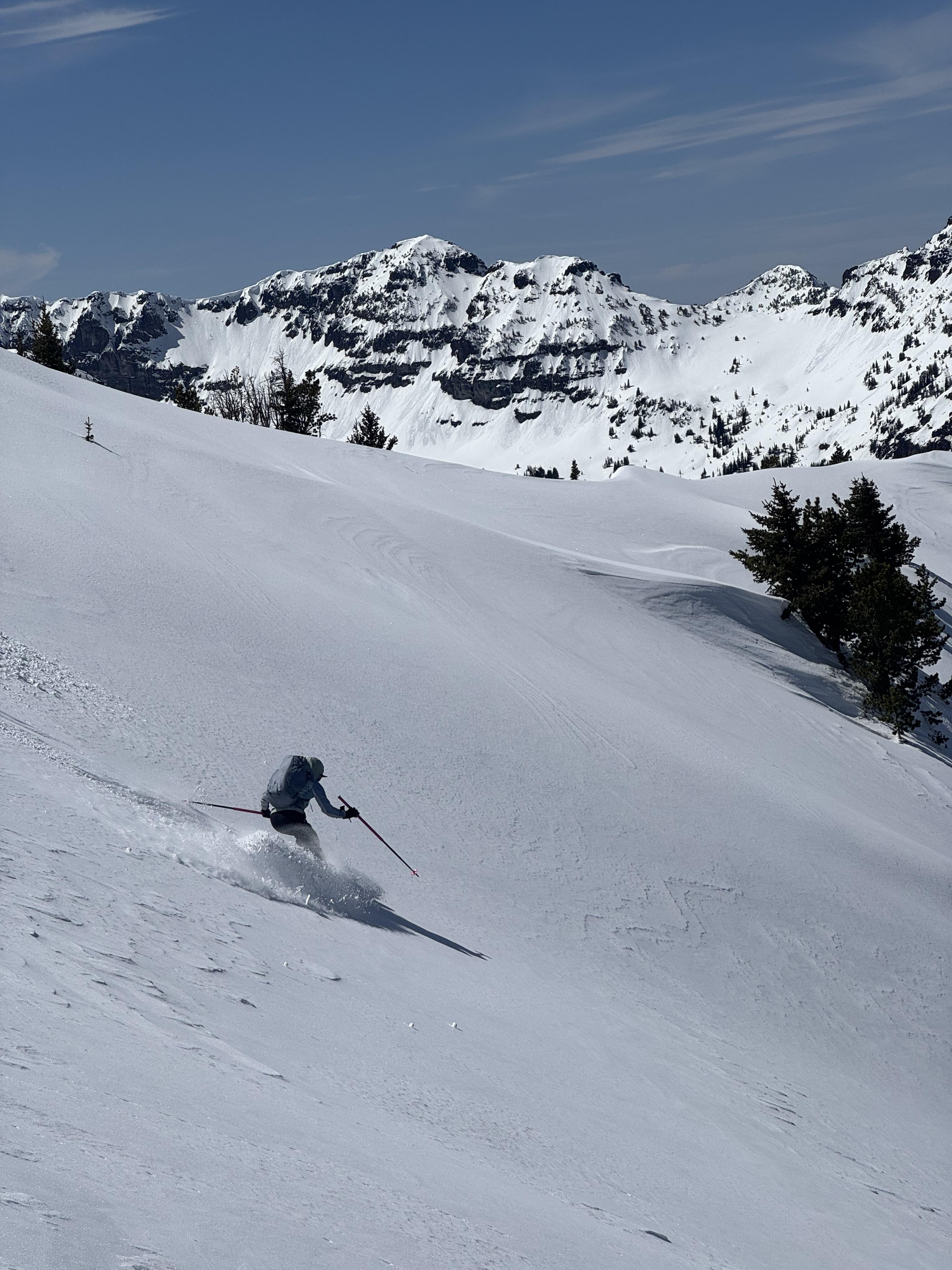
In general, if the snow surface freezes solid overnight, the snowpack will be stable in the morning and stability will decrease through the day as snow warms up. The snow surface hardness, rate of warming, duration of sunshine, aspect and elevation determine how fast stability will decrease through the day. Be aware that sunny aspects may have a wet snow avalanche danger while shadier slopes still have a dry snow avalanche danger. Getting off of steep slopes should be considered when, or before, the above signs of instability are present. Wet snow avalanches, whether loose snow or slabs, can be powerful, destructive and very dangerous. Conservative terrain choices, starting early in the day, and careful observations can keep you safe. See Alex’s recent video, and this article for more spring travel advice.
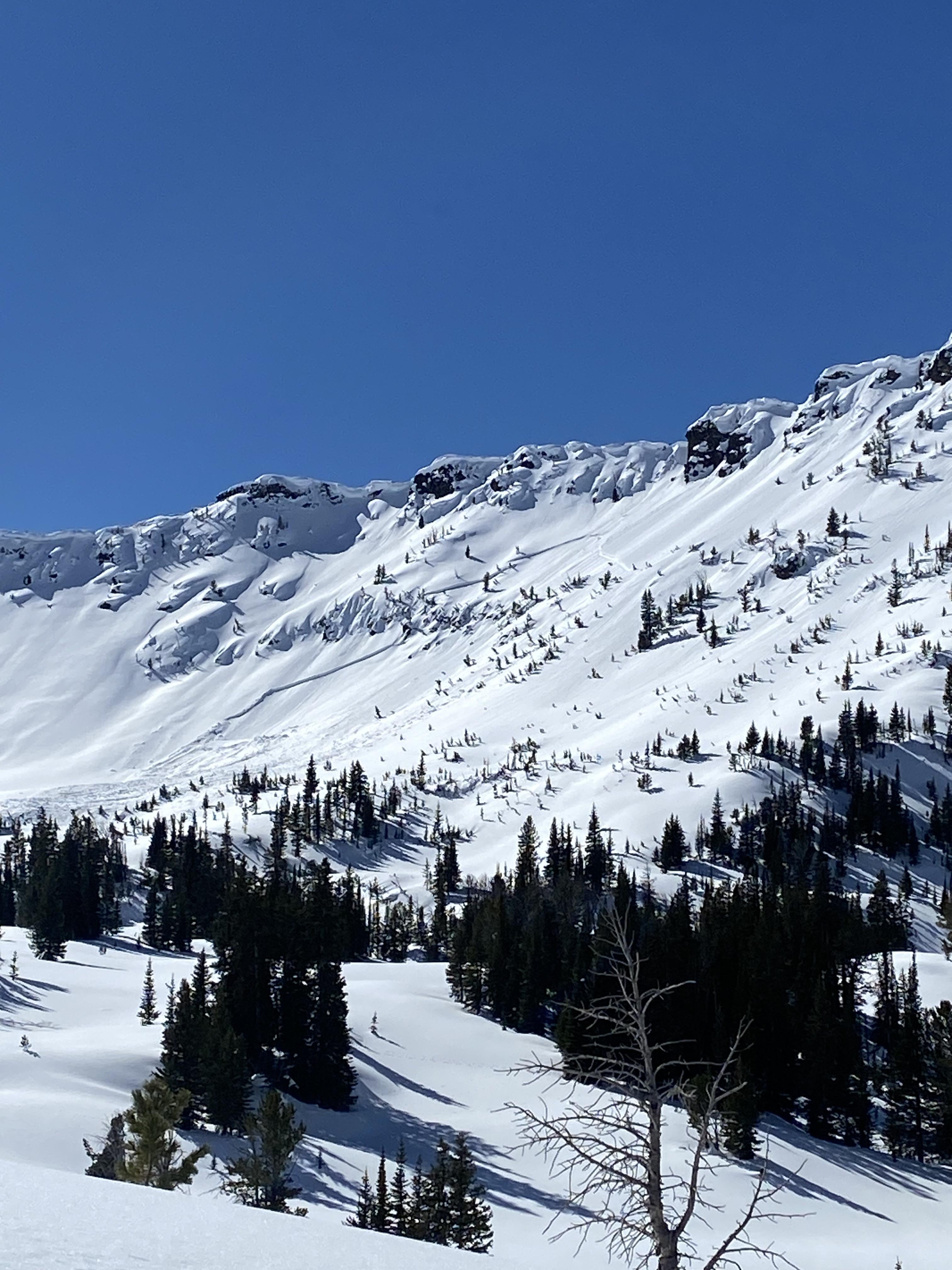
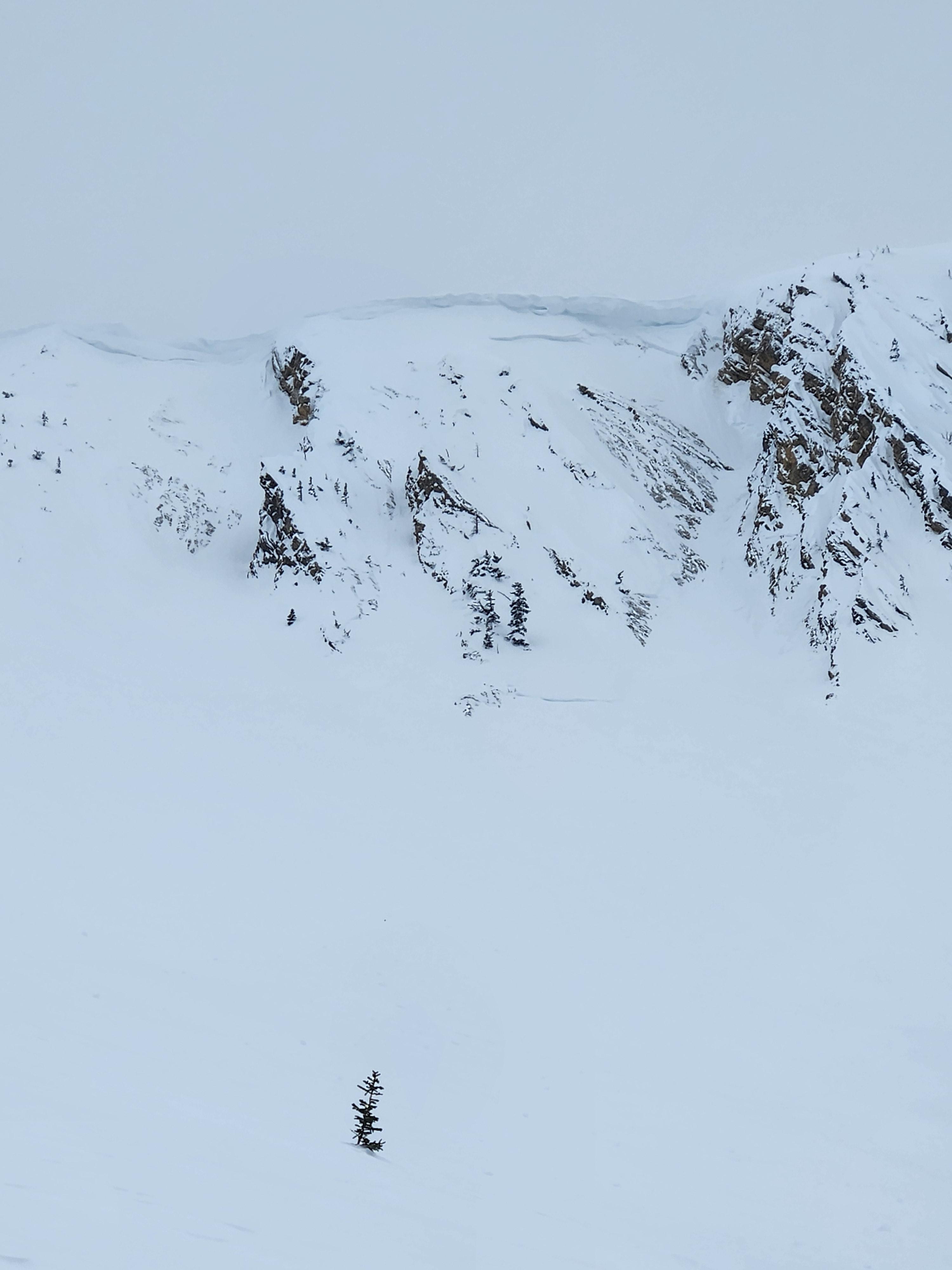
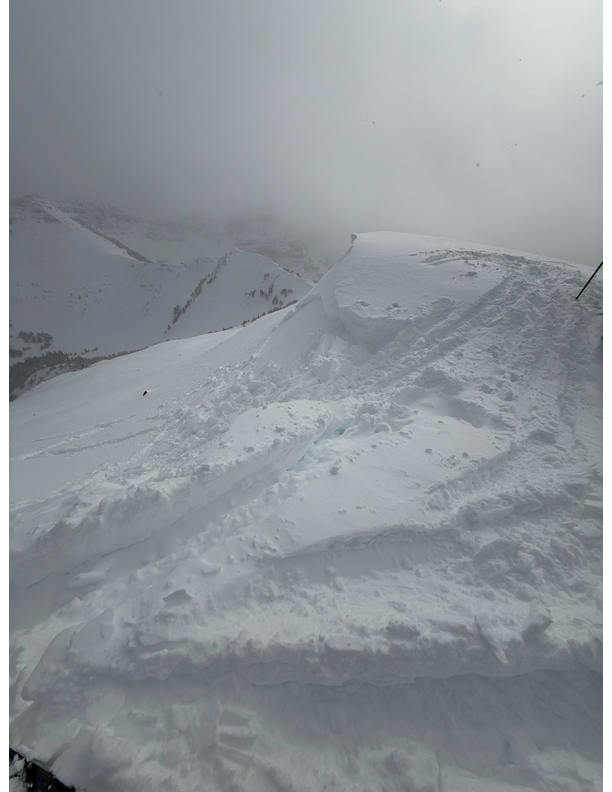
CORNICES
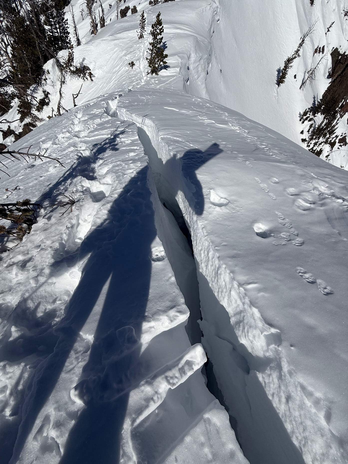
Cornices along ridgelines are massive and can break under the weight of a person (photo). Prolonged above freezing temperatures and rain make them weaker and possible to break naturally. They can break off suddenly and farther back than one might expect. Cornice falls can also entrain large amounts of loose snow or trigger slab avalanches. Stay far back from the edge of ridgelines and minimize exposure to slopes directly below cornices. Regardless of whether a cornice triggers a slide or not, a falling cornice is dangerous to anyone in its path.
DISCLAIMER
It does not matter if new snow falls or not, avalanches will continue to occur until the existing snowpack is mostly gone. Always assess the slope you plan to ride with diligence and safety in mind. Do not let your guard down. Travel with a partner, carry rescue gear and only expose one person at a time in avalanche terrain.
Have a safe and enjoyable spring and summer!
Mark, Alex, Ian and Dave
For more spring travel advice see this article from our GNFAC forecaster blog.