
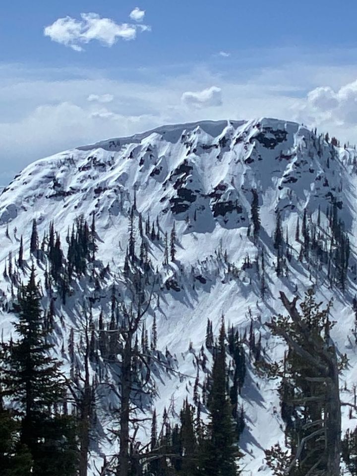
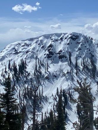
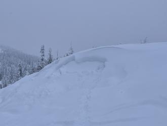
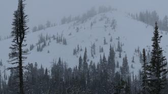
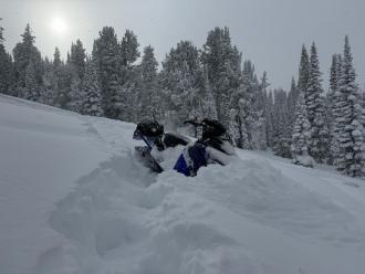
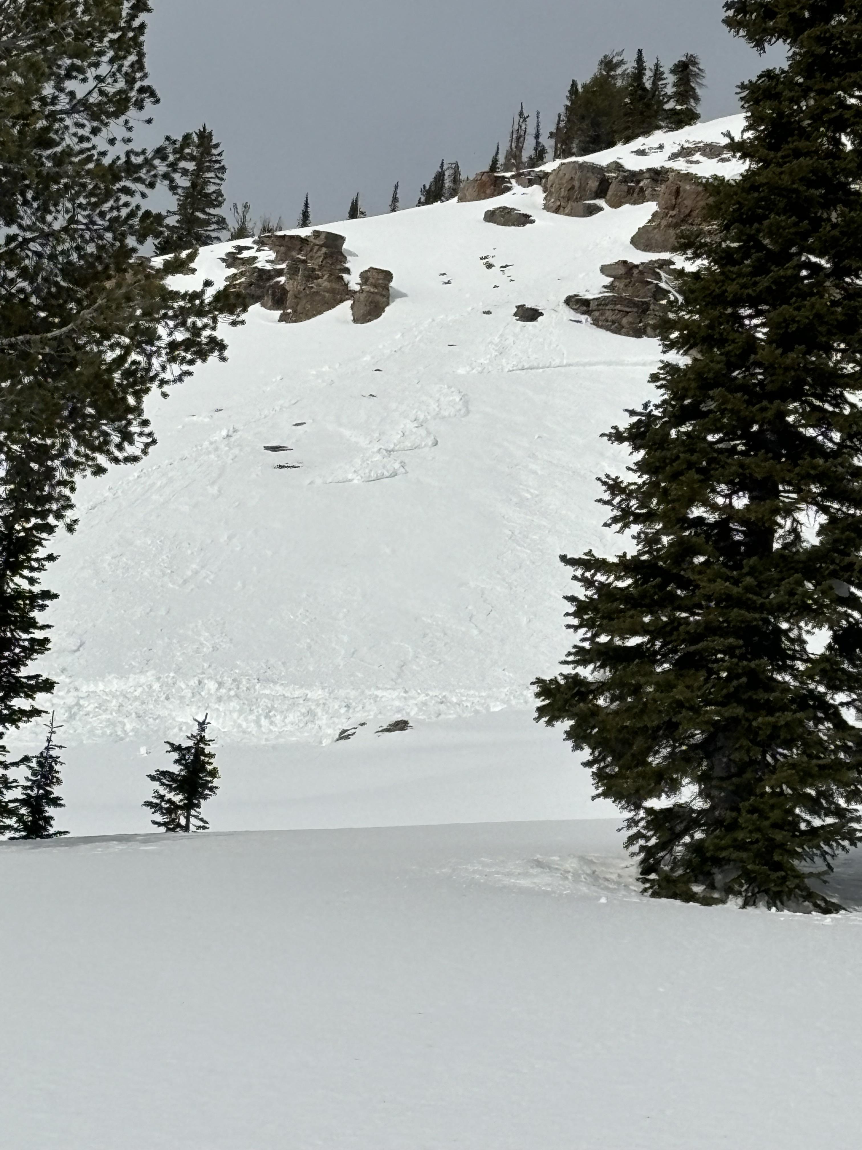
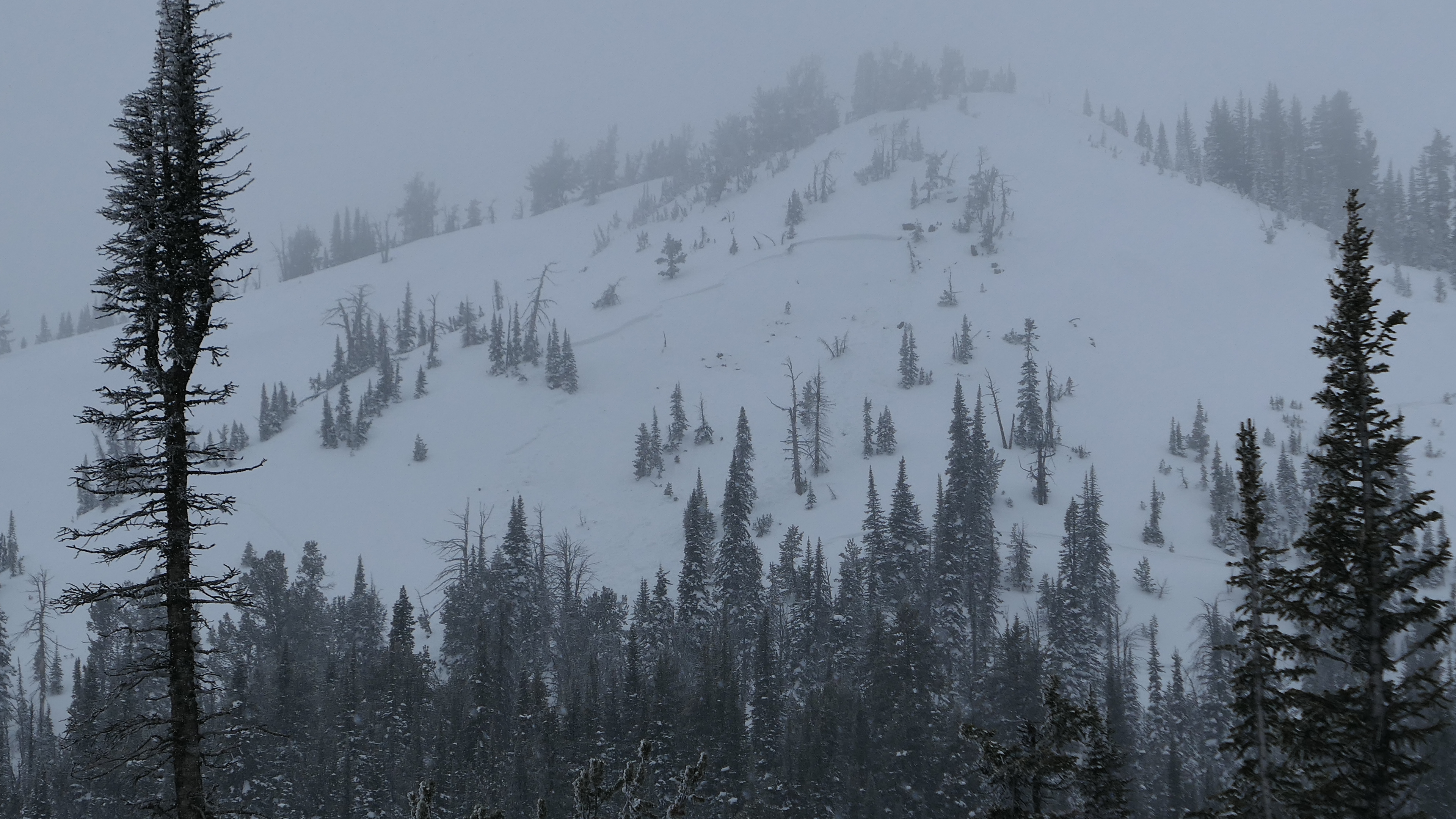
From IG mesasge (4/6): "Some wet action at arange peak near Sawtell yesterday. From slope Dave and I did our first pit on Monday. Lots of release in that new old interface but didn’t see anything releasing down deeper." Photo: Z. Bailey
Trip Planning for Island Park

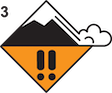
Primary Problem: New Snow
Bottom Line: New snow will create the main avalanche hazards this weekend. Avalanches could show a wide range of characteristics, from slabs of wind-drifted snow to wet-loose avalanches that run long distances. Where more snow falls, slab avalanches could break within or below the new snow, even where not drifted. Wet snow avalanches breaking deeper than the new snow are possible on slopes that have wet, unfrozen snow below the new snow, or where a lot of precipitation falls as rain on a wet and unsupportable snowpack. If you travel on or below steep slopes, carefully assess the new snow for signs of instability. Continuously reassess snow stability throughout the day, and as you move through different aspects and elevations.Past 5 Days
Sun Apr 14
Considerable
Considerable
Mon Apr 15

None
None
Fri Apr 19
None
None
Mon Apr 22
None
None
Fri Apr 26
None
None
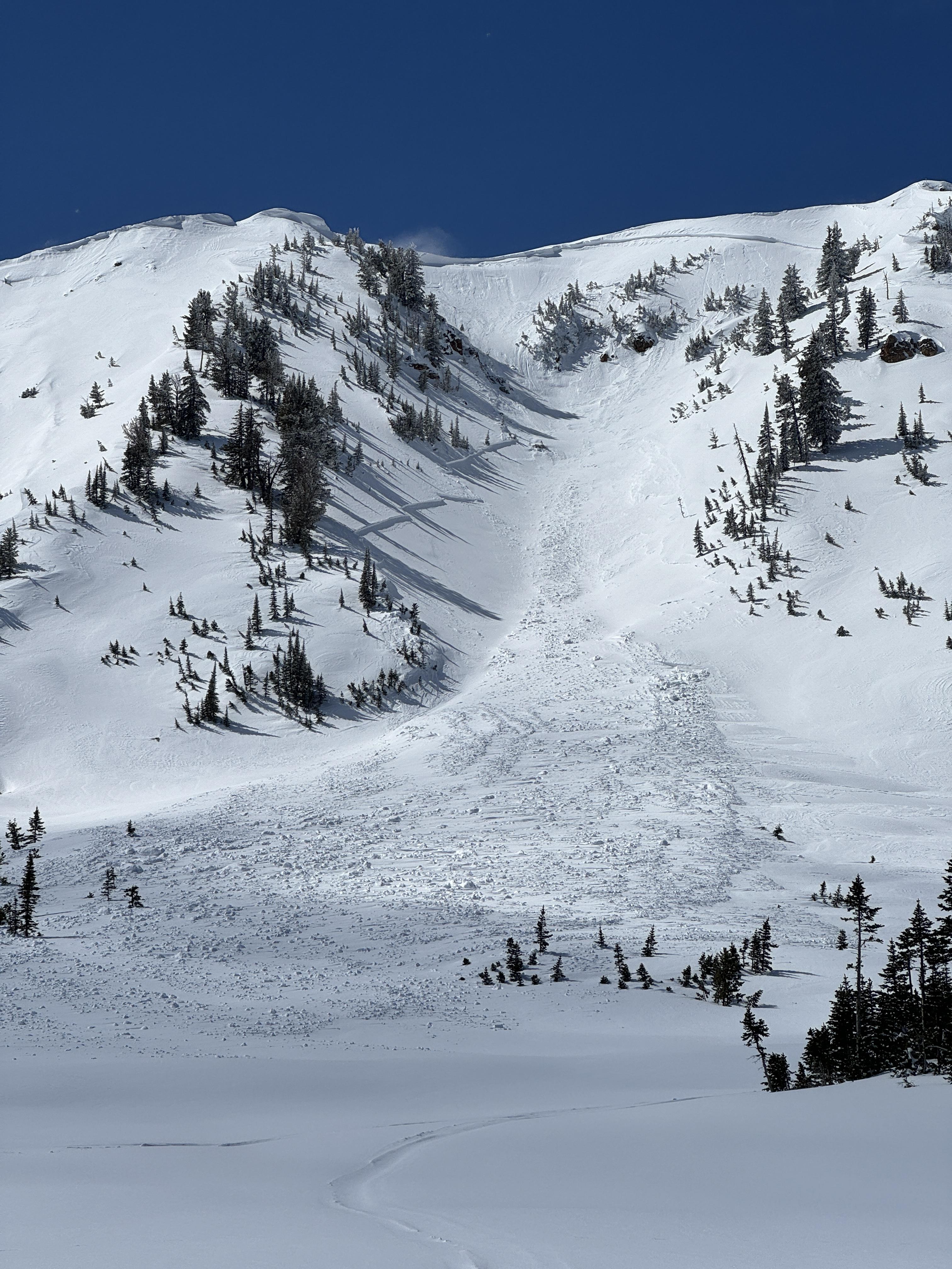
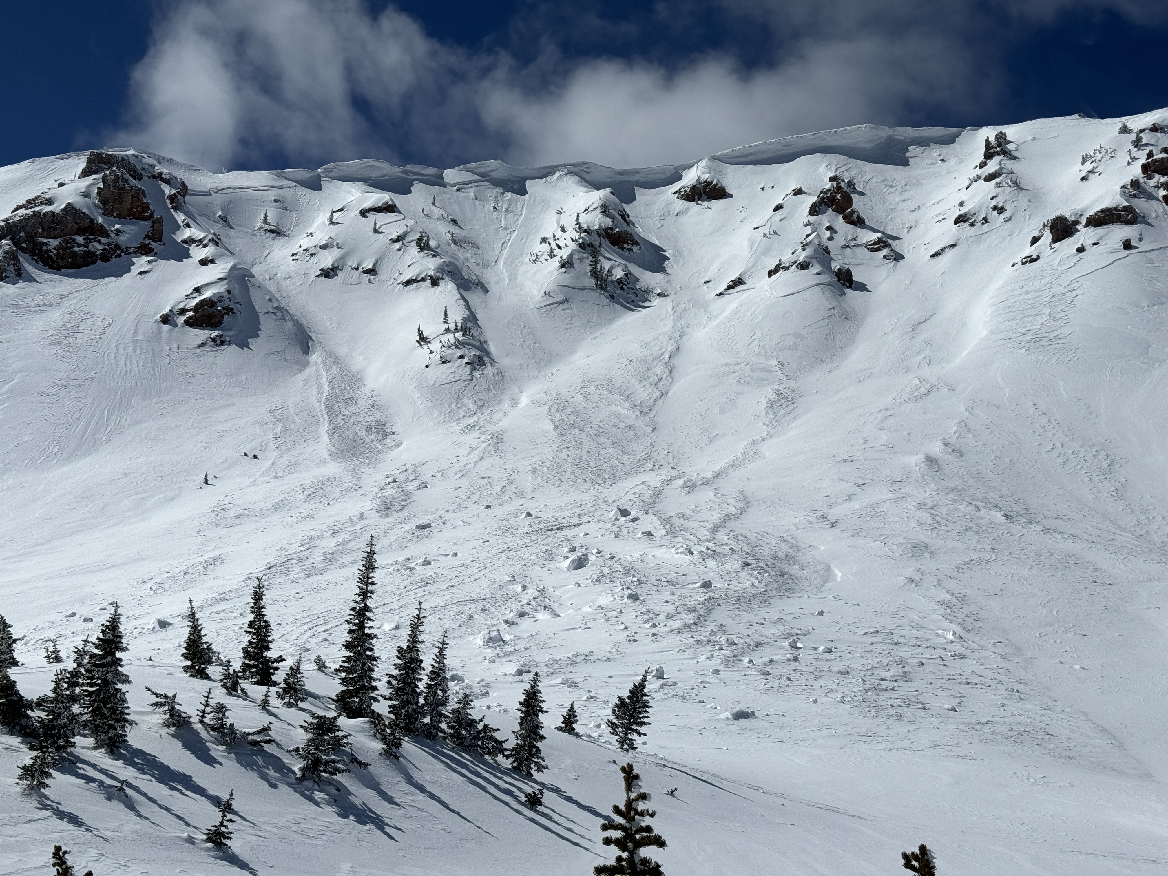
Relevant Avalanche Activity
Southern Madison
Quake Lake
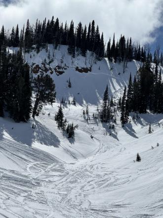
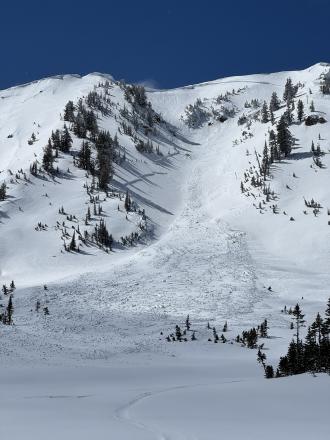
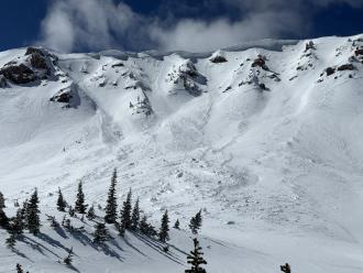
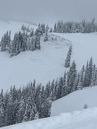
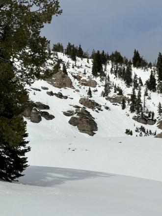
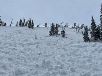
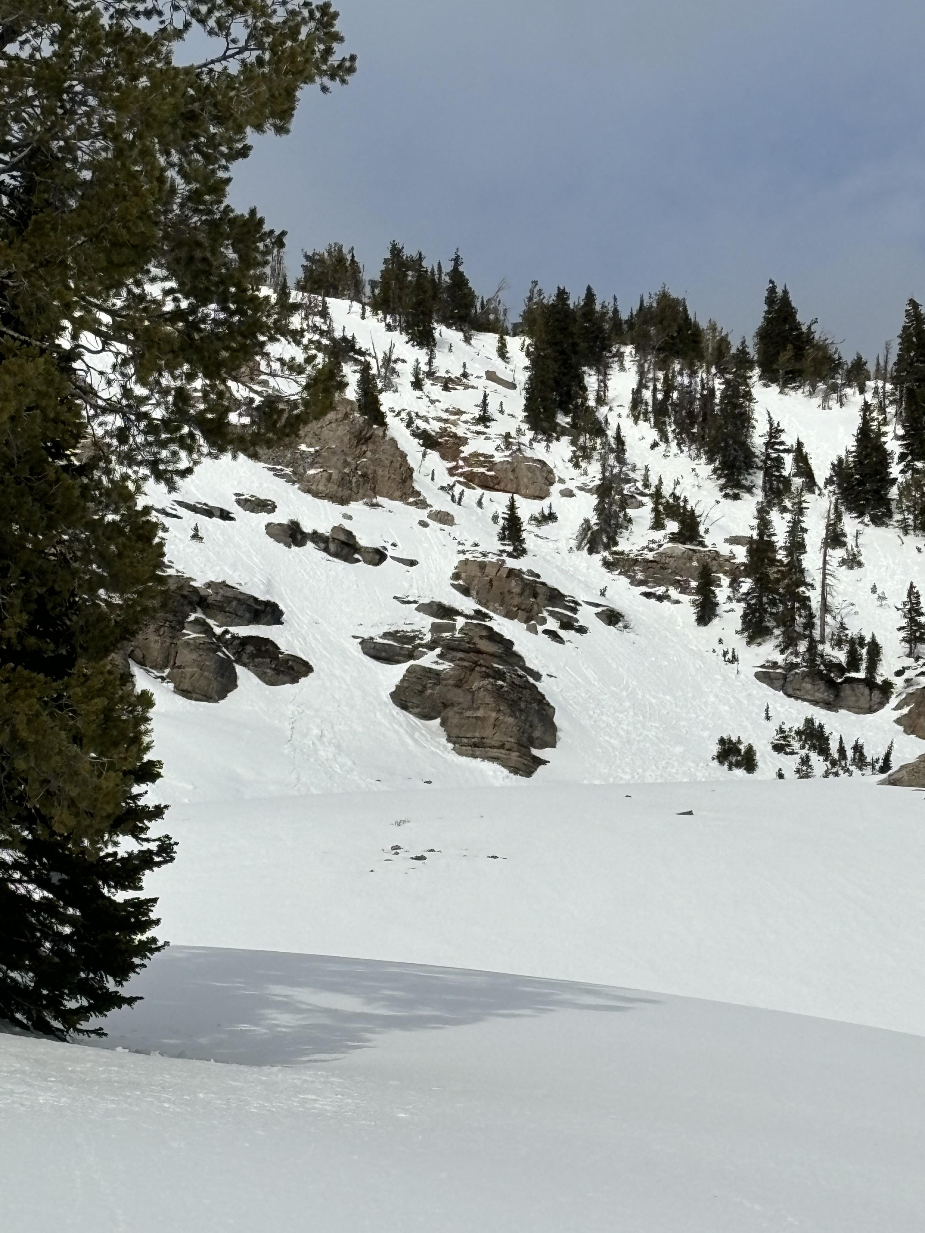
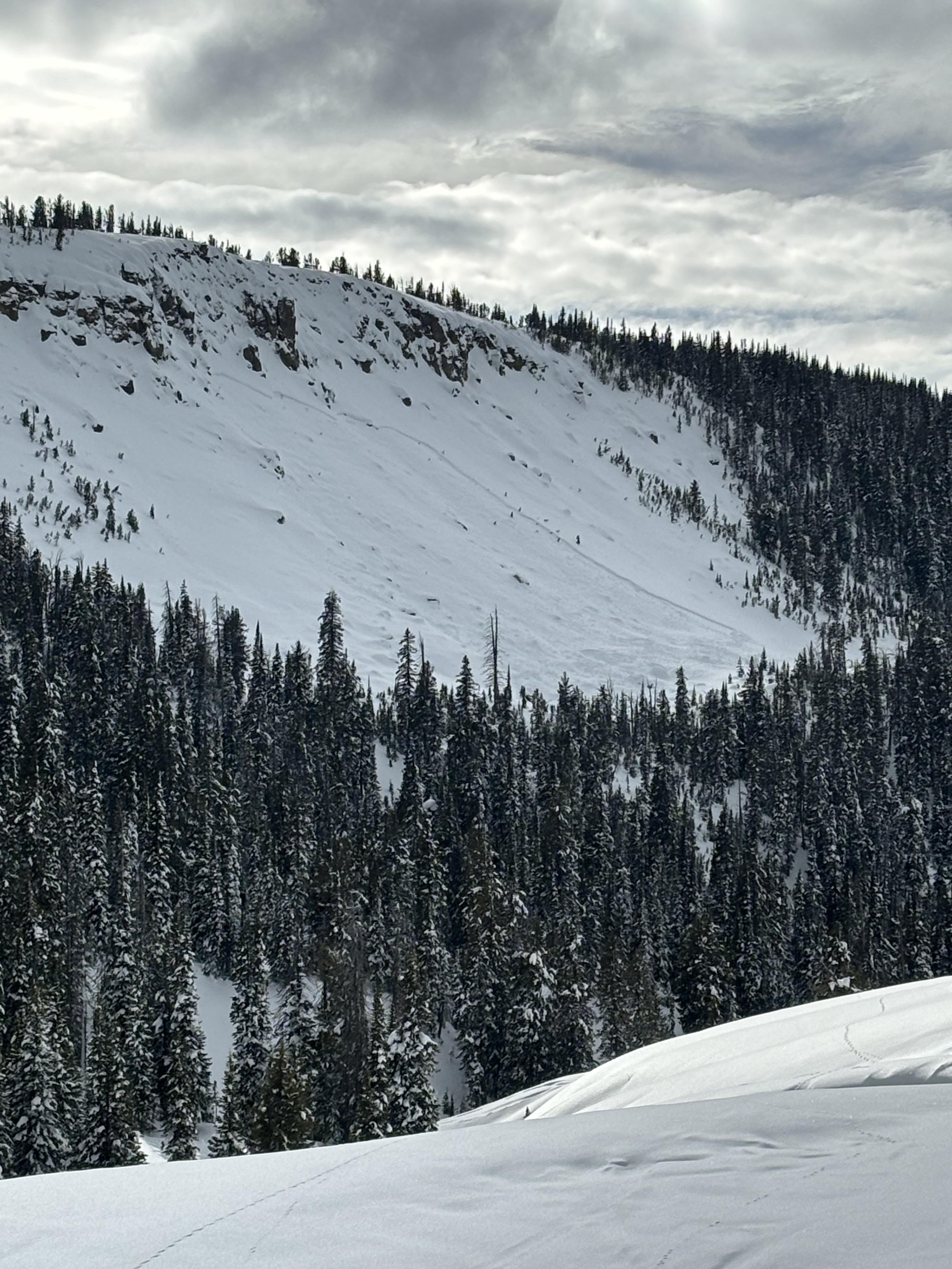
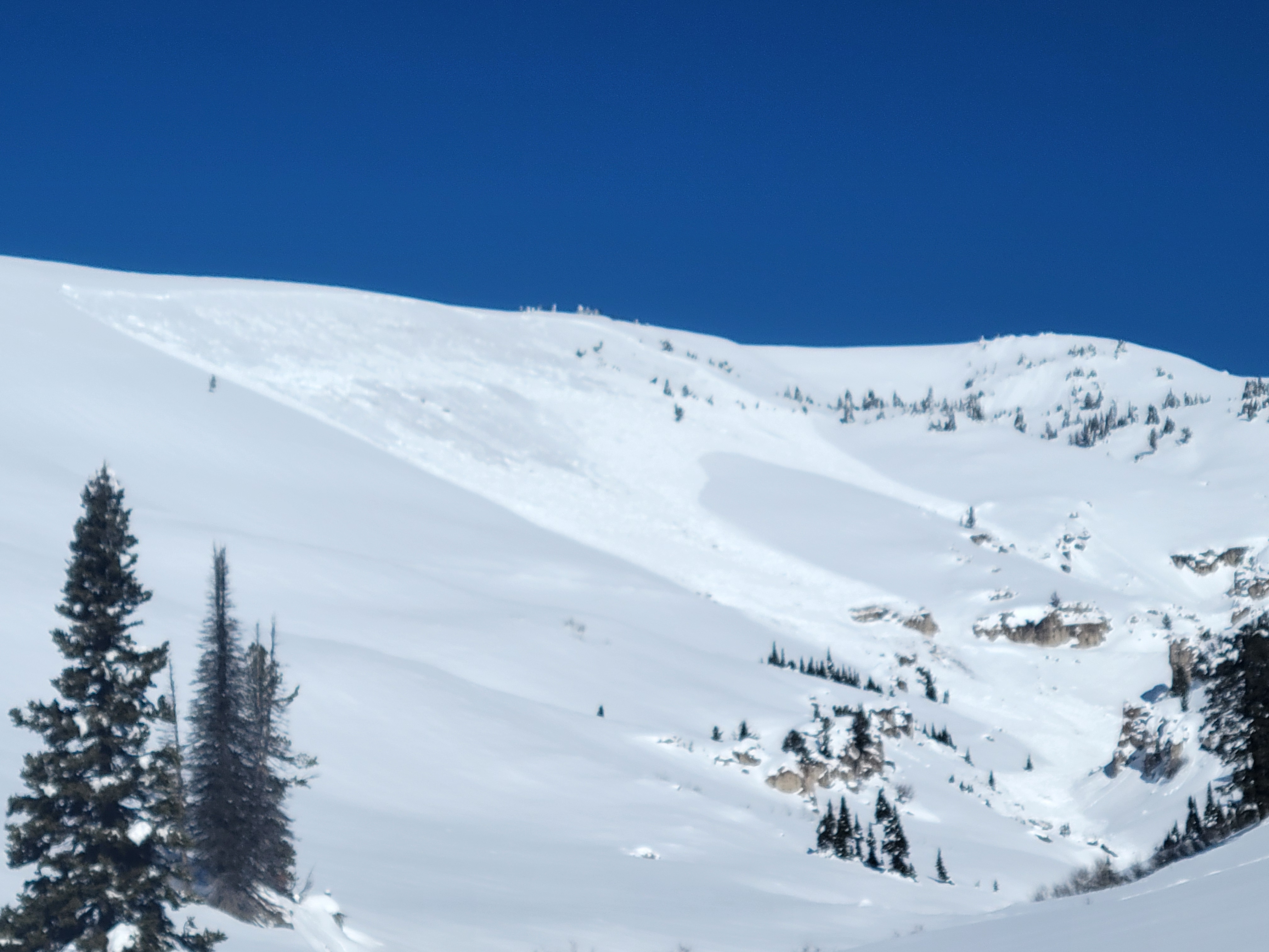
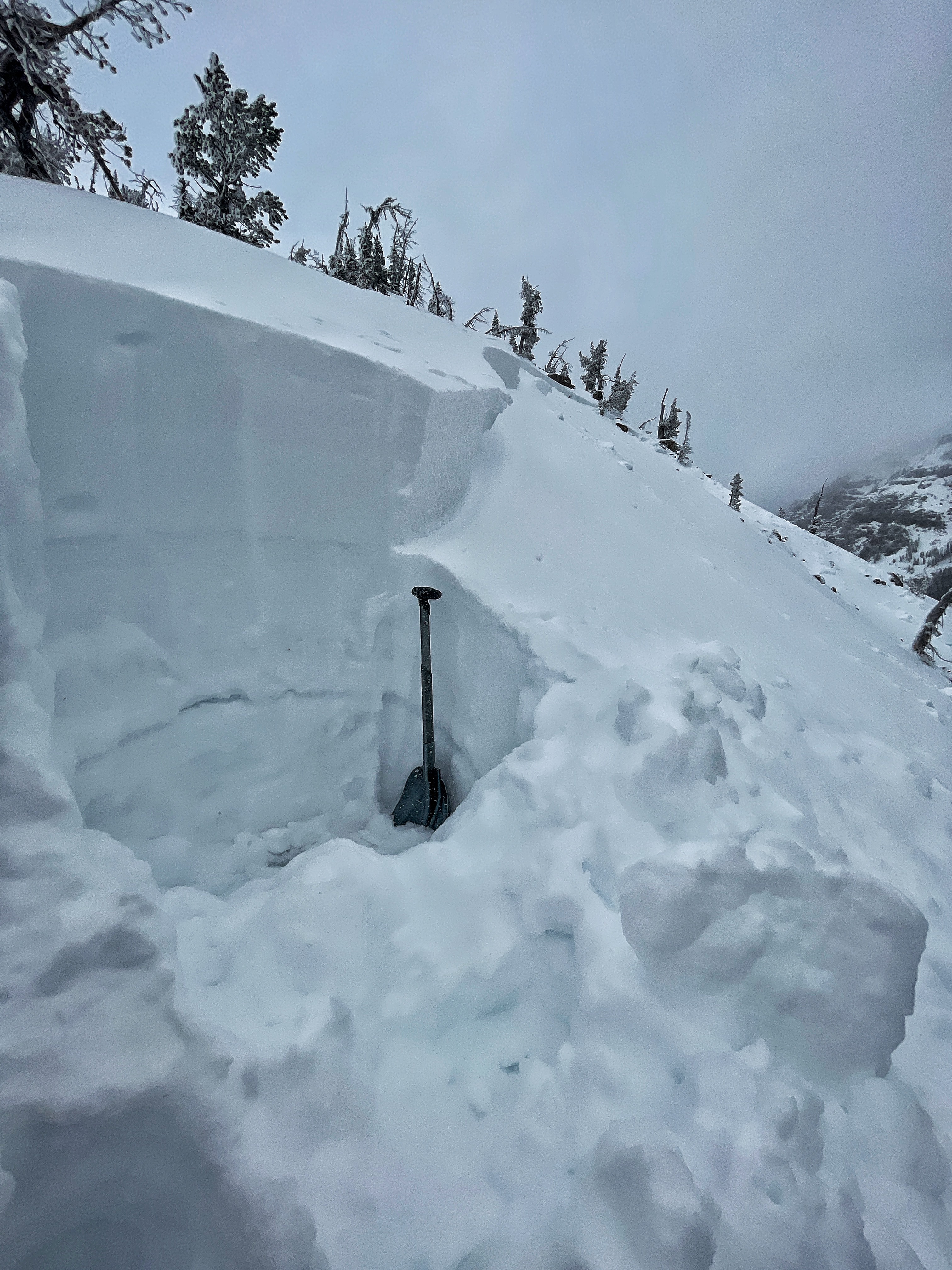
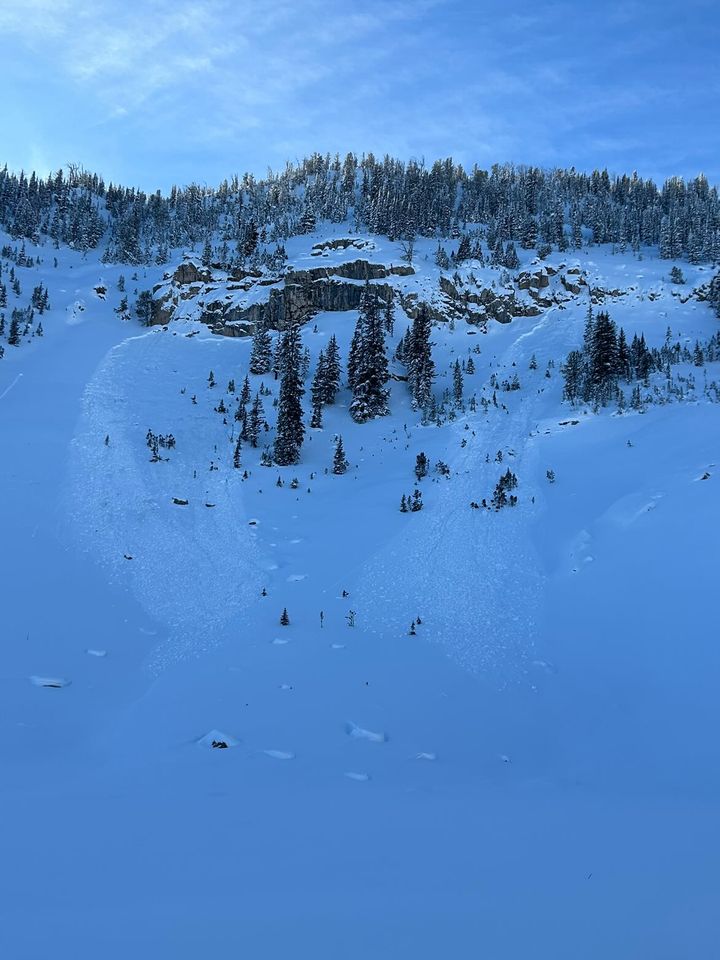
Wet Slab Avalanche Above Quake Lake
Quake Lake
WS-N-R2-D2-G
Coordinates: 44.8524, -111.3920
Caught: 0 ; Buried: 0
More Avalanche Details
WS-N-R2-D2-G
Coordinates: 44.8524, -111.3920
Caught: 0 ; Buried: 0
From IG: Wet slide to the ground above Quake Lake.
More Avalanche Details
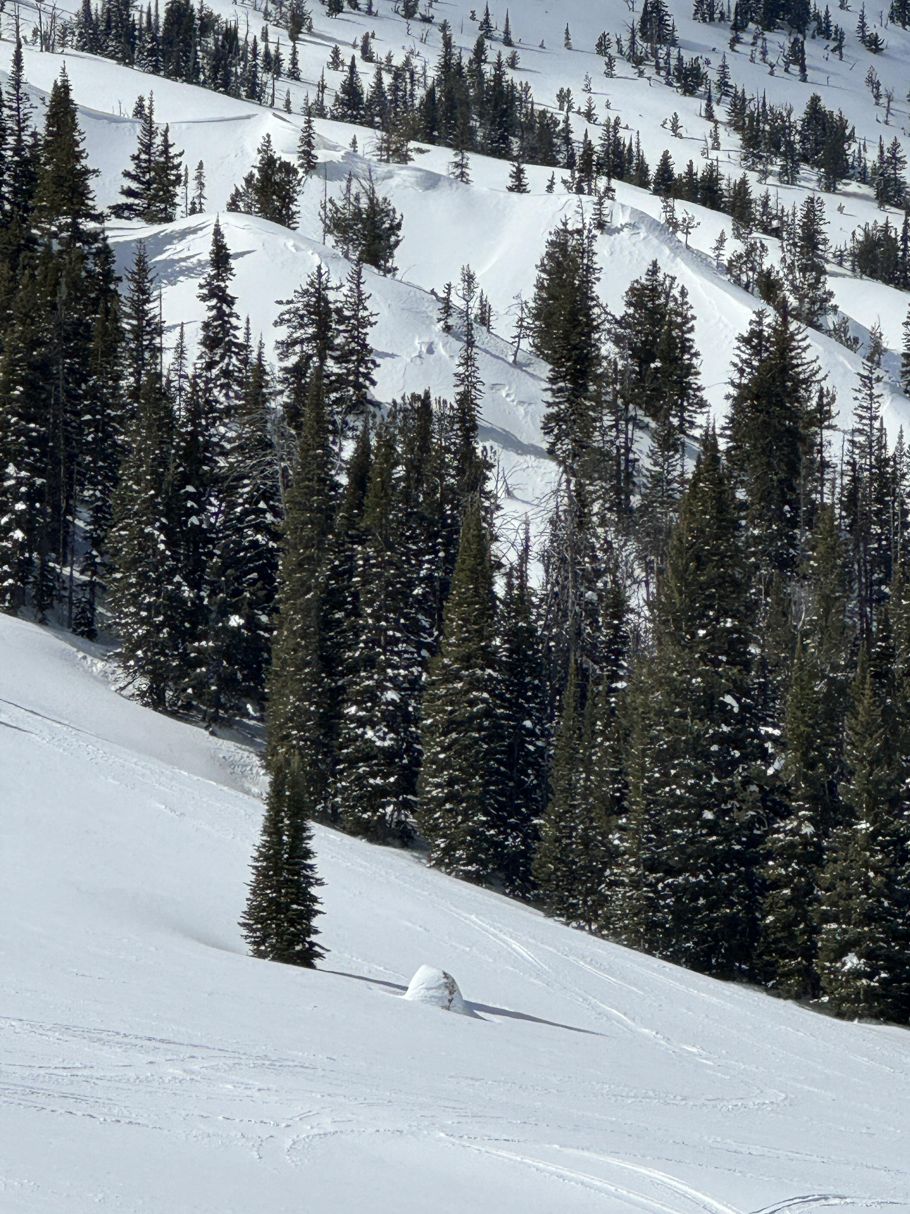
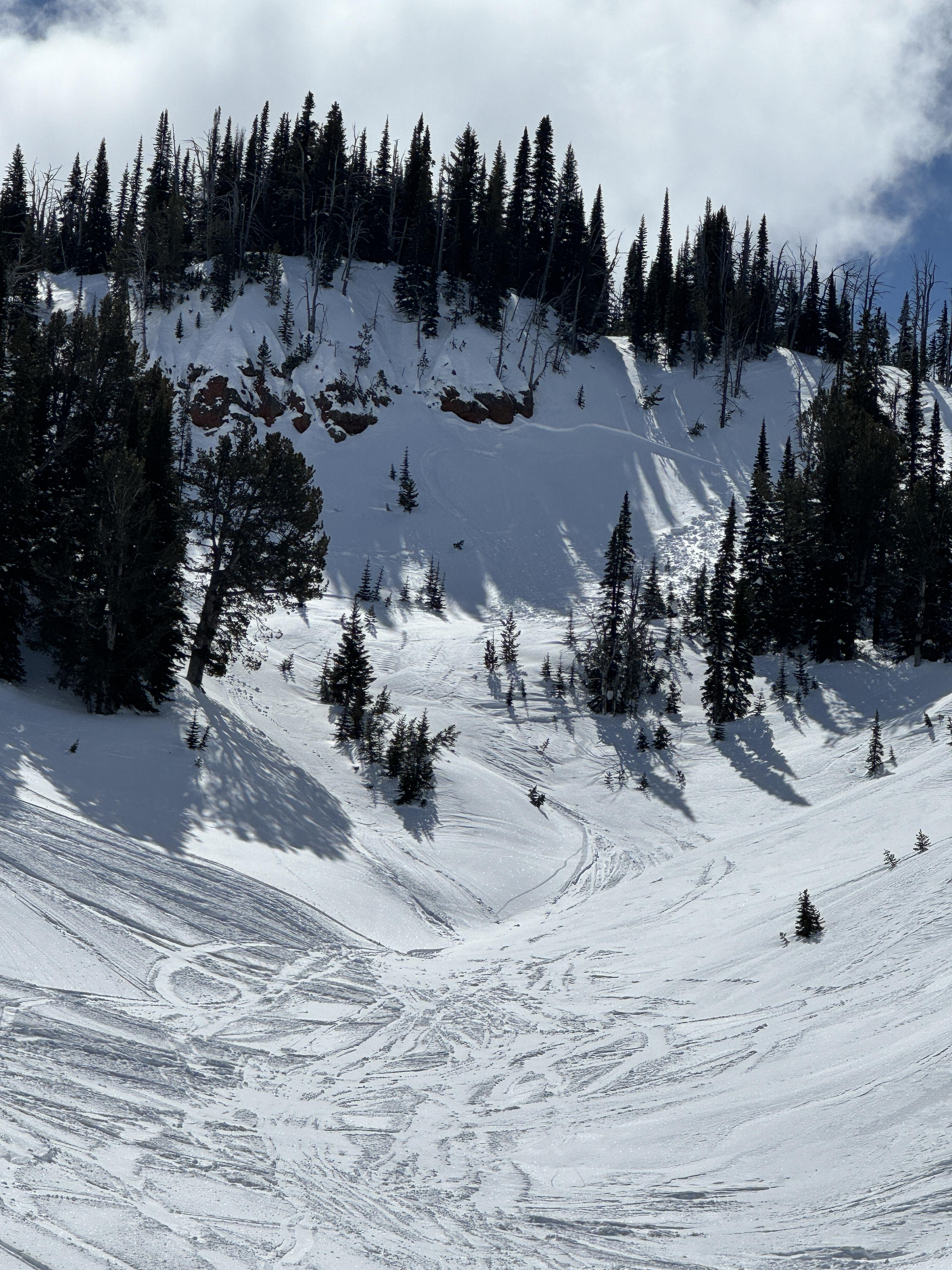
Relevant Photos
Displaying 1 - 40
-
-
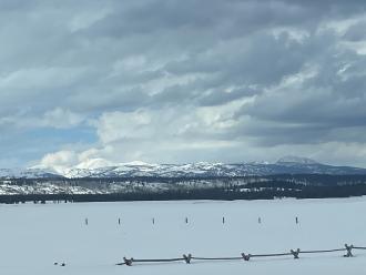
From email:" photo of mostly cloudy skies. 53 deg F while driving through IP at around 4pm" Photo: M. Staples
-
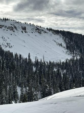
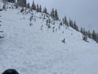
We saw a small natural avalanche below Reas Peak on a northerly aspect. Photo: GNFAC
-
We saw two avalanches below Reas Peak on North aspects that were likely triggered by snowmobilers. Photo: GNFAC
-
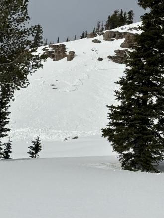
We saw two recent natural avalanches that broke below the wind-drifted snow in Jefferson Bowl. Photo: GNFAC
-
We saw two recent natural avalanches that broke below the wind-drifted snow in Jefferson Bowl. Photo: GNFAC
-

We saw a natural avalanche that broke near Yale Creek on a southern aspect that broke below the recent snow. Photo: GNFAC
-
From obs: "No details, came upon them while riding and making observations of the terrain. One was North-Northeast, the other was North-Northwest facing. Across the drainage from each other. Also, notice three other small avalanches on a west facing slope, about two miles east of the first two. All five were on slopes well over 30. In the centennial mountains, close to the continental on the Idaho/Montana border."
-
Riders snapped a photo of natural avalanche activity above Blue Creek in the Centennial Mountains. Photo: P Rockwell
-
A small avalanche that was triggered by riders on 02/08/2024. Photo: GNFAC
-
This avalanche was triggered by riders a few days ago. This was a small slope and broke 100' wide and 2-3' deep. Photo: GNFAC
-
Snowmobilers in Hell Roaring Creek saw a few natural avalanches that happened in the last week. The exact date is unknown. Photo: B. Schleicher
-
Snowmobilers in Hell Roaring Creek saw a few natural avalanches that happened in the last week. The exact date is unknown. Photo: B. Schleicher
-
Snowmobilers in Hell Roaring Creek saw a few natural avalanches that happened in the last week. The exact date is unknown. Photo: B. Schleicher
-
This on one of over 15 avalanches snowmobilers saw today, 01/30/2024. These avalanches likely happened on 01/29 or the morning of 01/30. Photo. N.
-
This on one of over 15 avalanches snowmobilers saw today, 01/30/2024. These avalanches likely happened on 01/29 or the morning of 01/30. Photo. N.
-

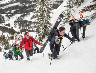
Do you like to hike? Do you like to ski? Then the King & Queen of the Ridge is for you. Hike, ski and raise money for the Friends of the Avalanche Center in their 2nd biggest fundraiser of the year. Join the effort to promote and support avalanche safety and awareness! Fundraising prizes for top 5 individuals who raise over $500. No racing is necessary to compete for the fundraising prizes. Info to fundraise is HERE or donate here. Race participants for the [insert dates] event must register separately with Bridger Bowl here.
-
A rider triggered this avalanche while side-hilling across the bottom of the slope. The rider was able to quickly turn downhill and avoid the slide. No one was caught. Photo: Anonymous
-
A rider triggered this avalanche while side-hilling across the bottom of the slope. The rider was able to quickly turn downhill and avoid the slide. No one was caught. Photo: Anonymous
-
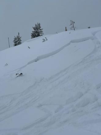
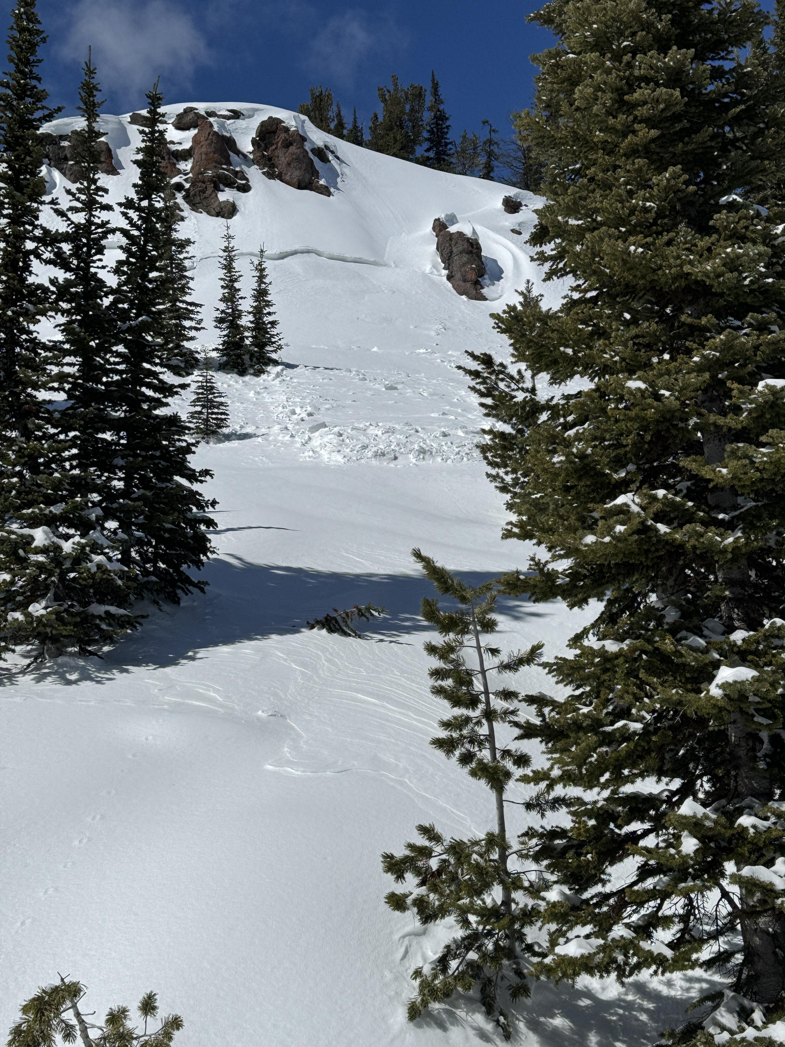
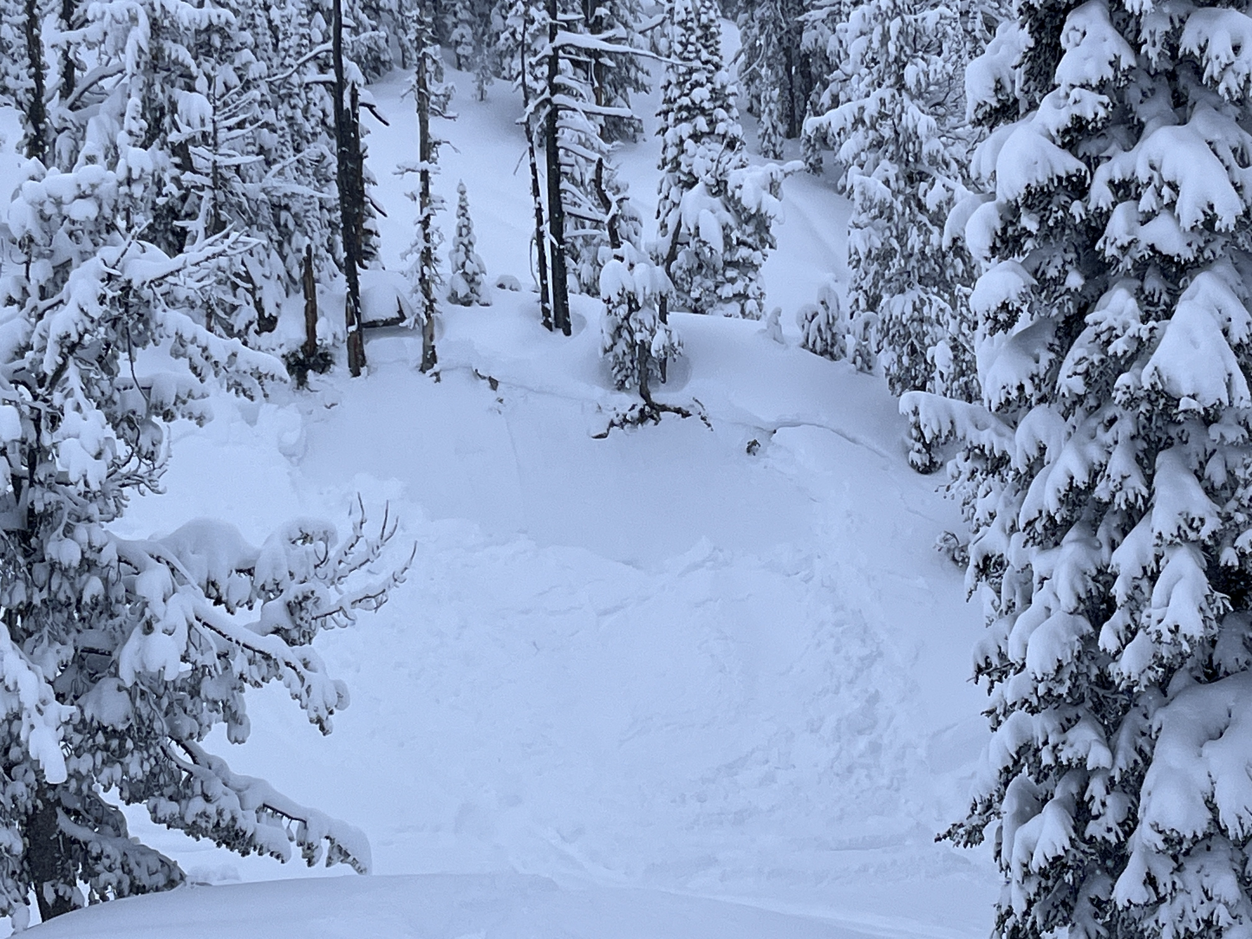
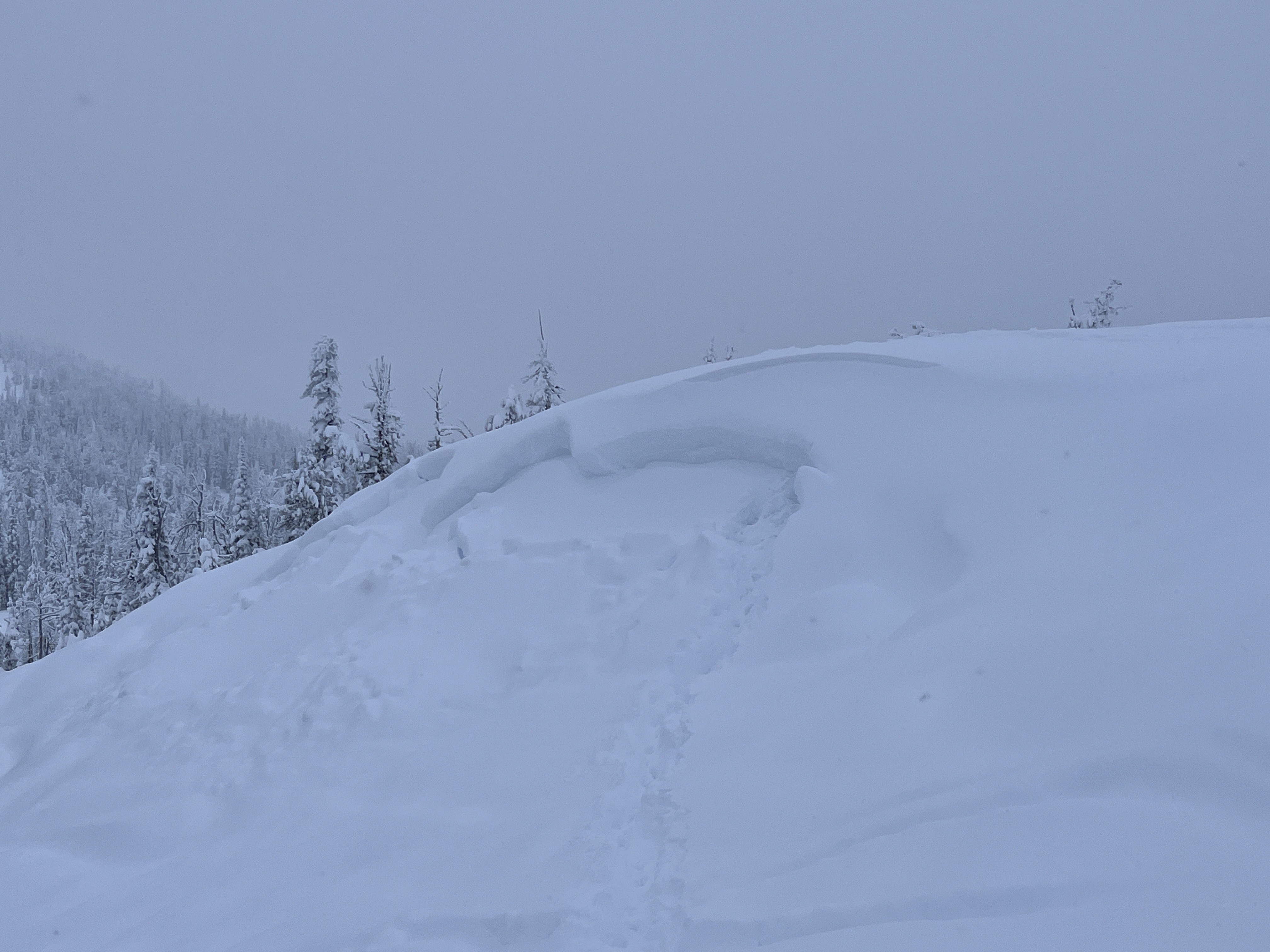
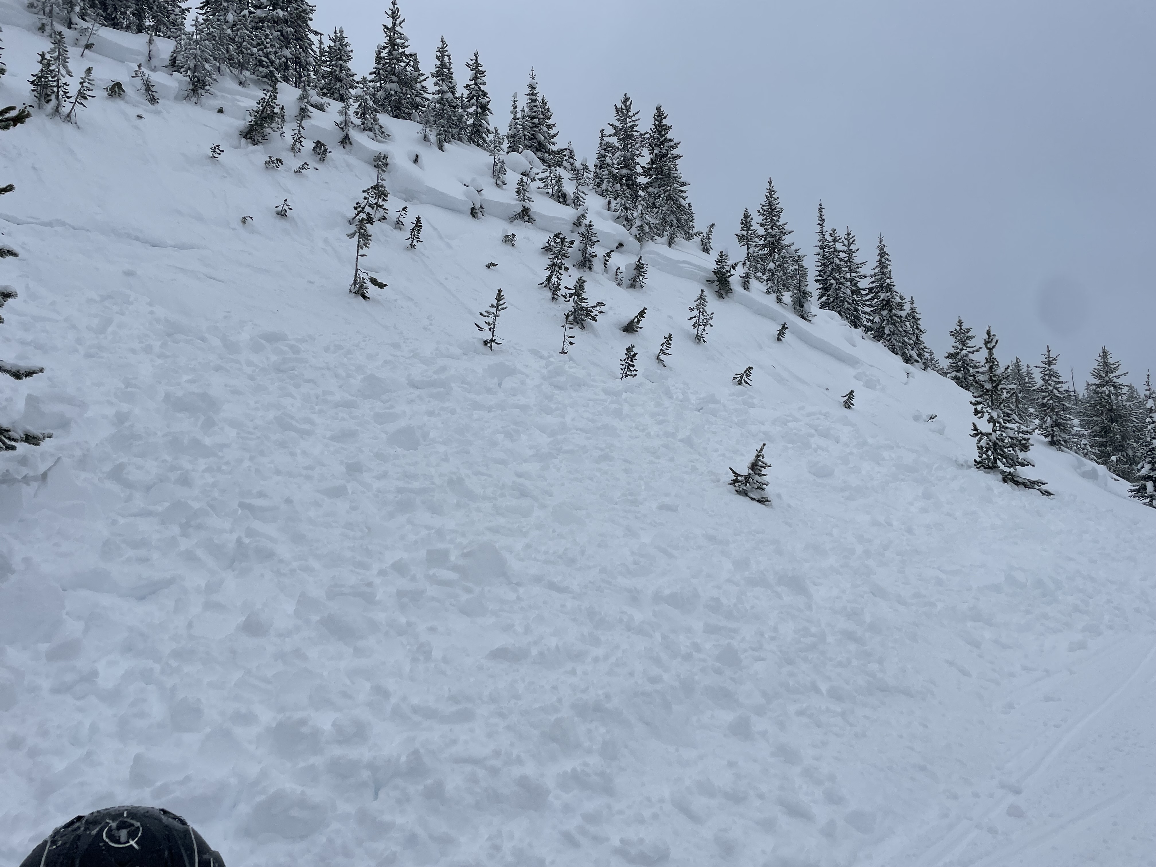
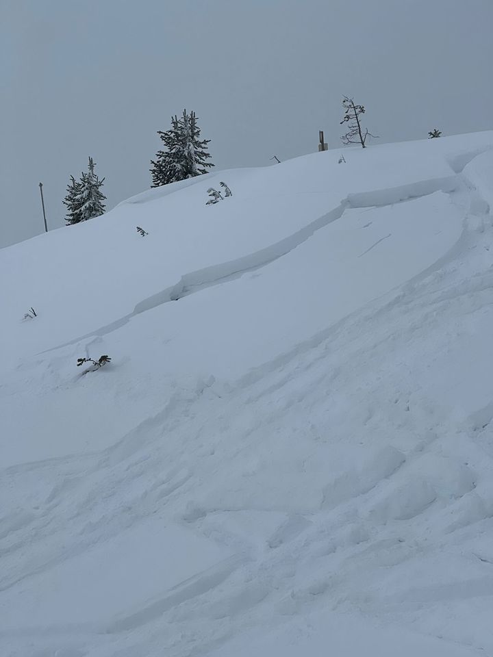
On Sawtelle Peak, Island Park, when the clouds lifted we could see a crown of a snowmobiler triggered slide that occurred yesterday. It broke on the buried surface hoar and facets about 1.5 feet under the surface. Recent snow and wind-loading has created dangerous avalanche conditions. Photo: GNFAC
-
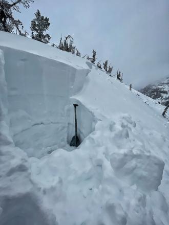
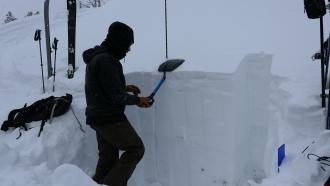
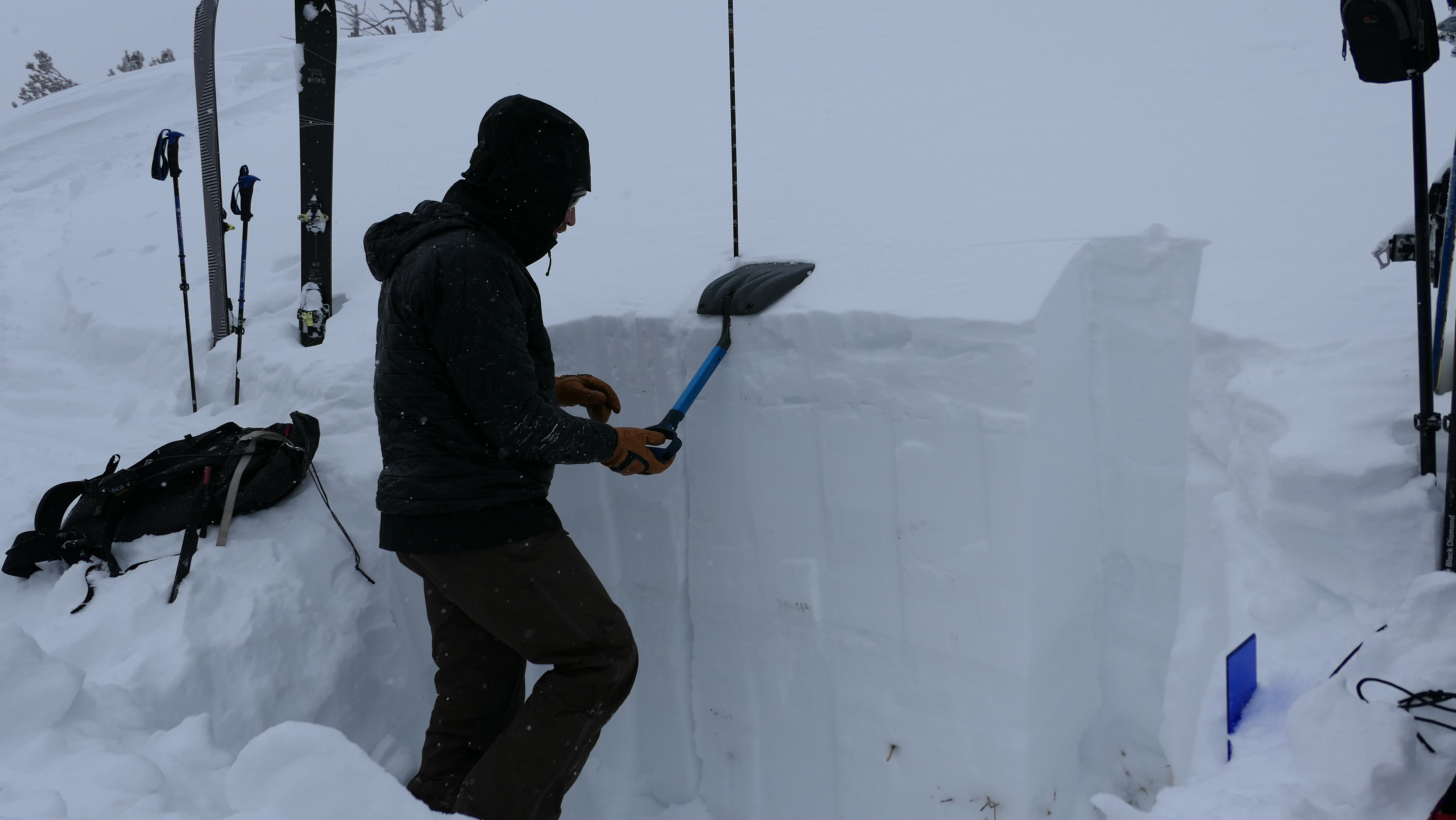
Snowpit at the Head of Hellroaring Creek on 1/7/24. Note the two stripes of surface hoar in the pit wall.
-
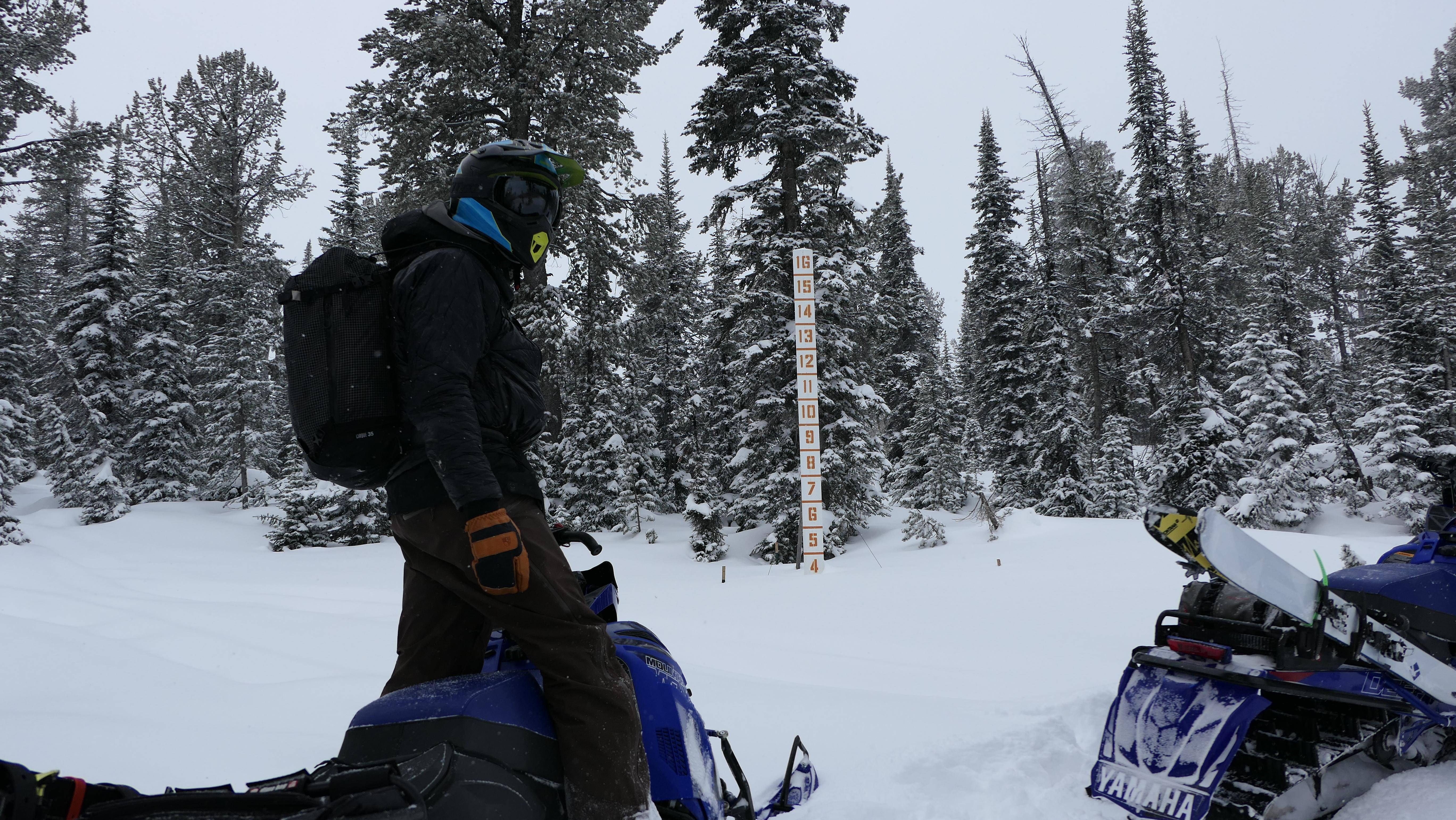
We measured 16" of low-density snow equaling 0.7" of snow water equivalent at higher elevations in the Centennial Mountains of Island Park, ID. The new snow is sitting on a couple of layers of feathery surface hoar and a weak snowpack. It will not take much wind, settlement, or new snow to push the snowpack to the breaking point. Photo: GNFAC
-
New snow in Island Park made for beautiful views and heightened avalanche danger as the new snow fell on a snowpack riddled with weak layers. Photo: GNFAC
-
Doug Chabot walking off Lionhead Ridge to a snowpit site.
-
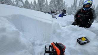
We snowmobiled up to 9,000' on Sawtelle peak, then skied to dig a couple pits. Our first pit was on an East aspect on a heavily wind loaded slope. The HS was 130cm (or 4.2 feet). There was 8" of new snow equal to 0.85" SWE, sitting over old consolidated snow that made up a slab over soft, weak facets about 50cm off the ground. We had ECTP24 x2 break on the old weak snow.... Photo: GNFAC
-
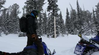
We snowmobiled up to 9,000' on Sawtelle peak on 12/23/23. The snow depth at 8,800' was 3-4 feet. Photo: GNFAC
-

Riders saw large surface hoar crystals while riding outside of Island Park. Photo. B.Schleicher
-

From IG on 12/10: "2 slides we triggered remotely in tepee yesterday"
-
From facebook message: "North facing slope 15 miles south of west Yellowstone probably 30ish degree slope. Probably 16-18 inch slab". Photo: T. Taubman
-

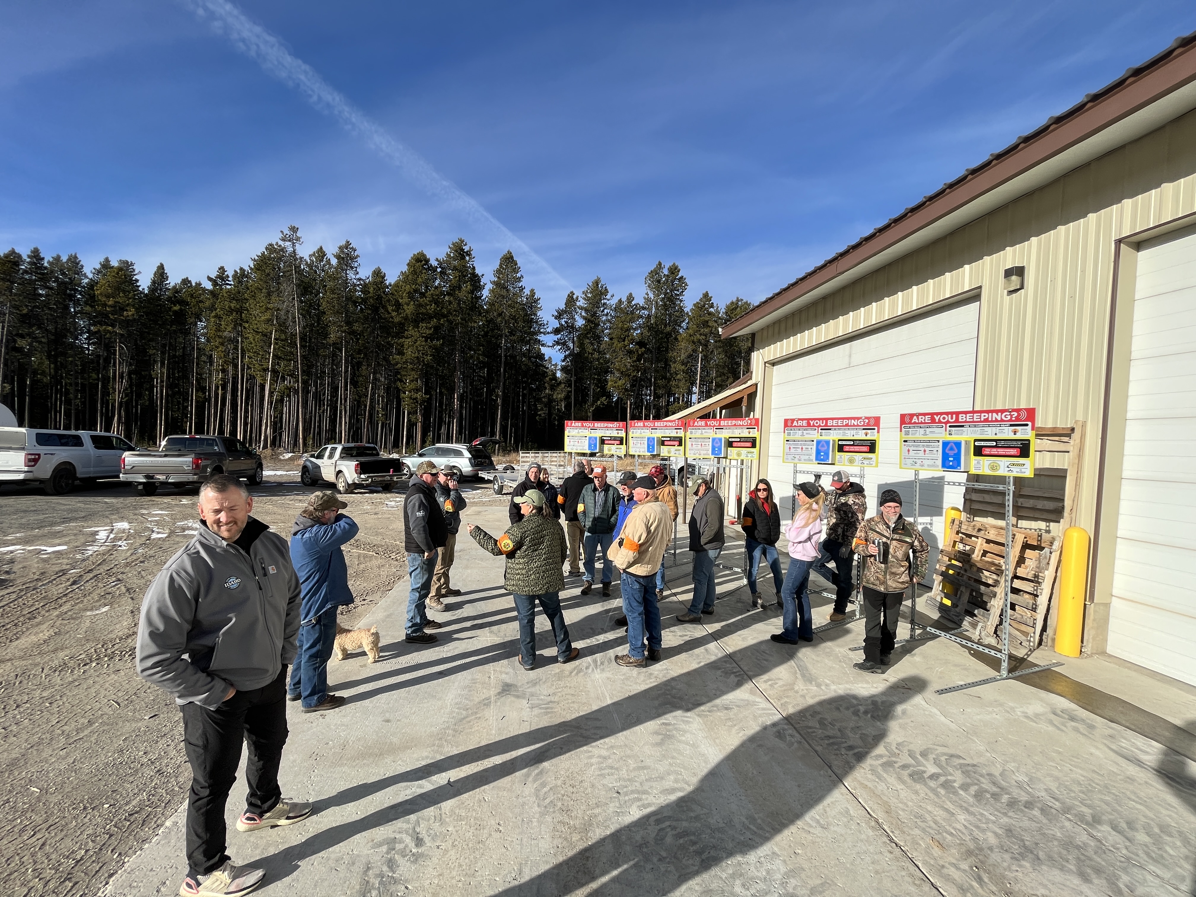
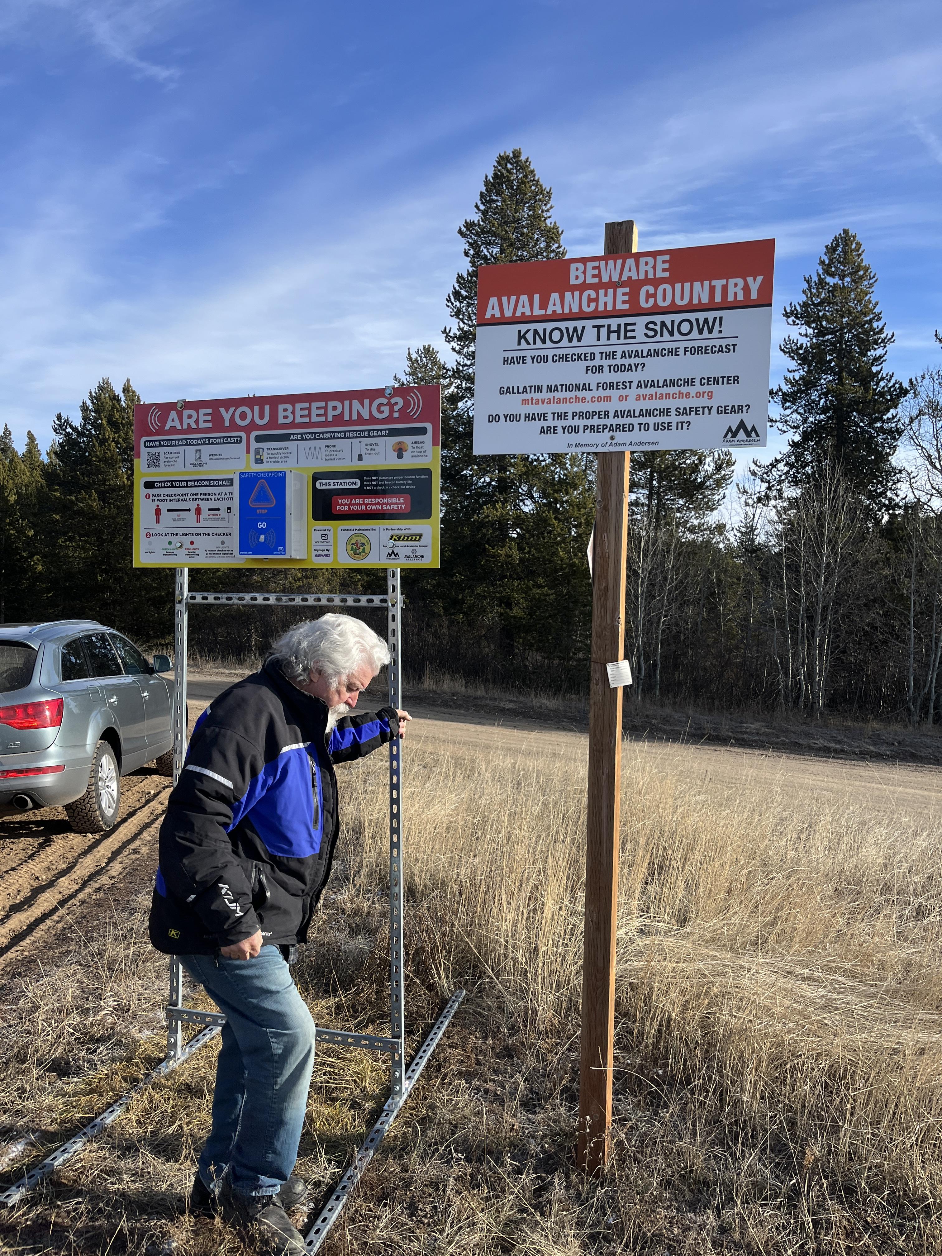
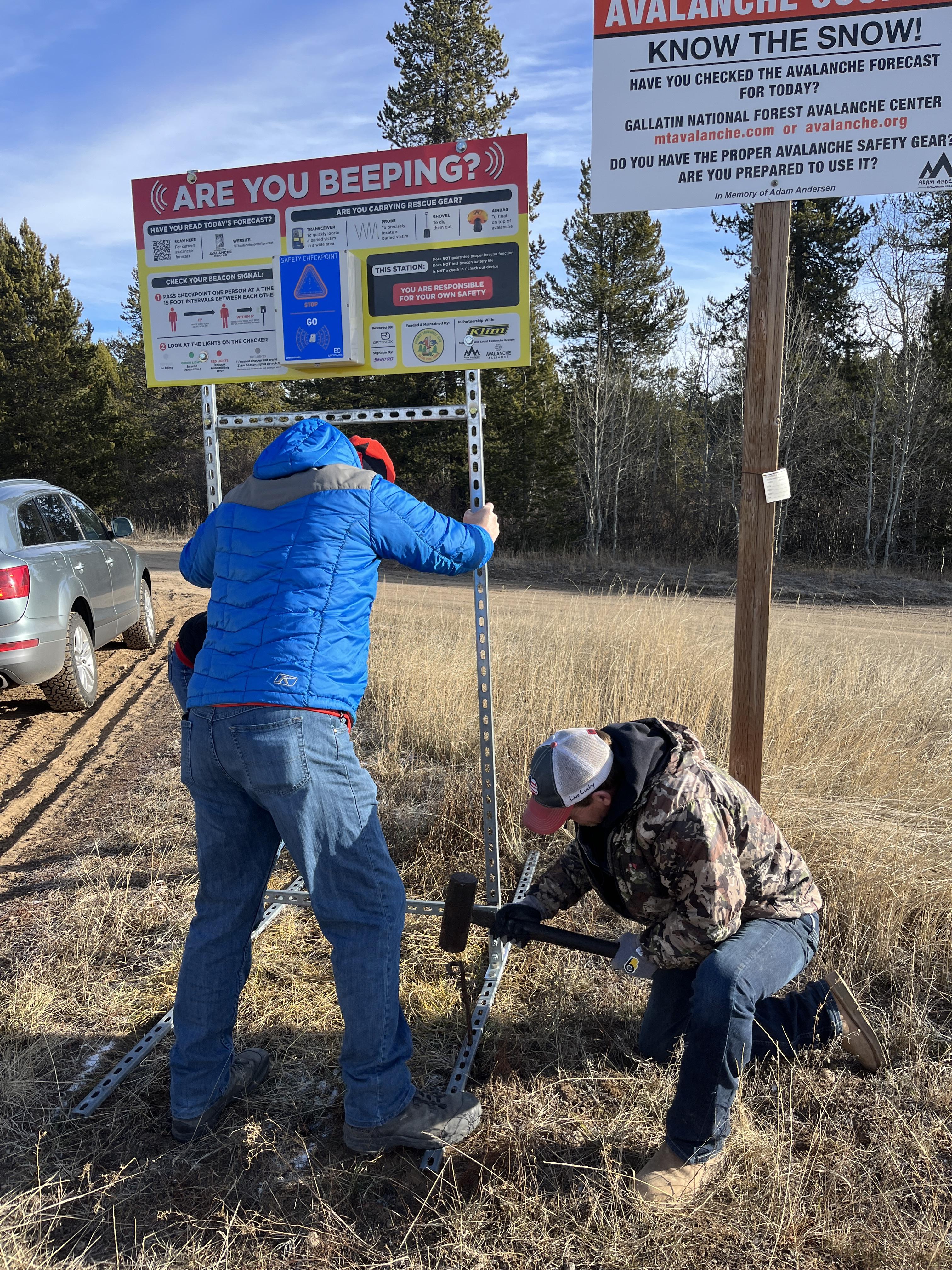
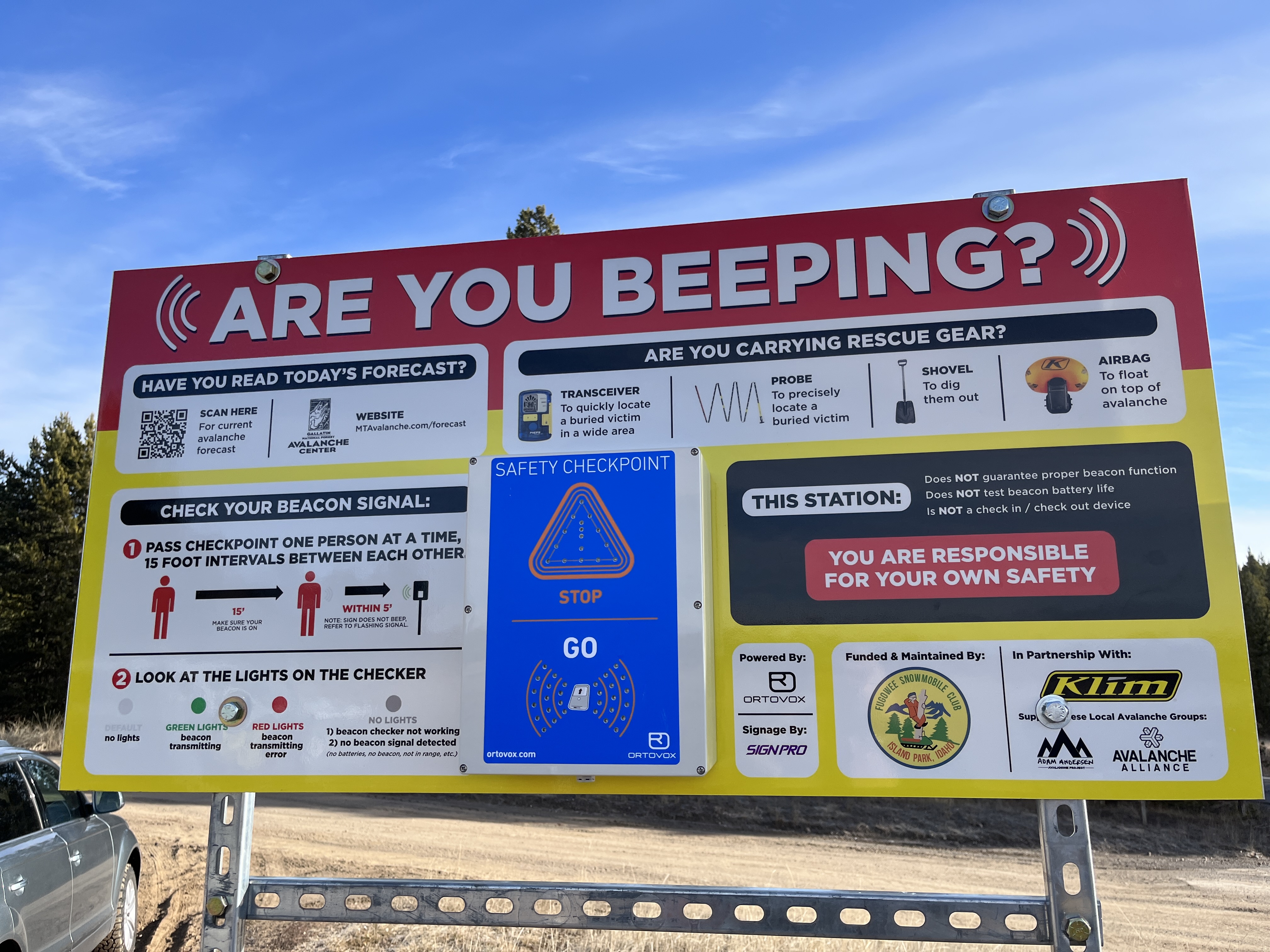
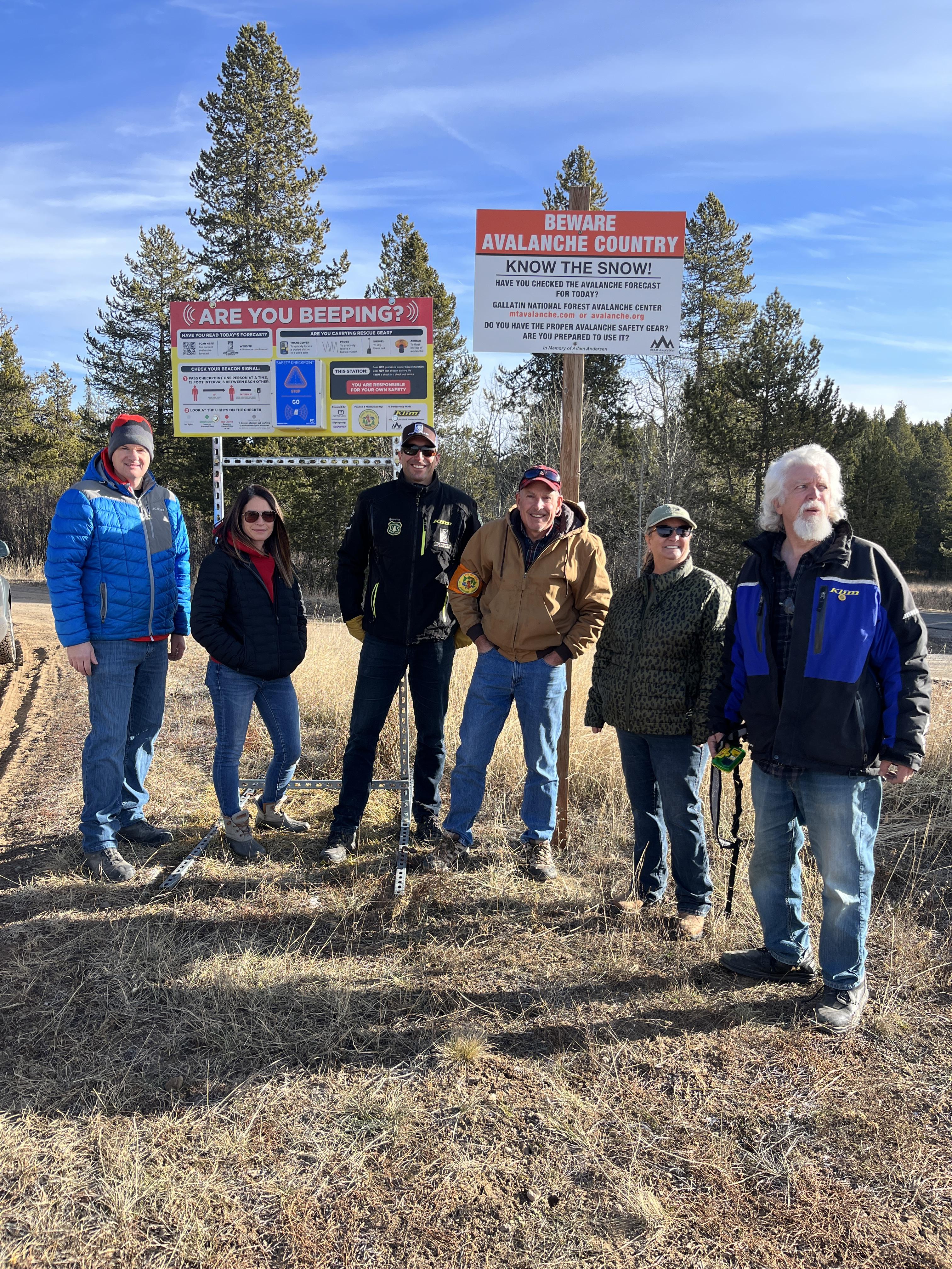
We met up with the Fugawee Snowmobile Club, Idaho Parks and Recreation, and Klim to install new beacon checkers at the trailhead in Island Park. Great work to the team! Photos: GNFAC
-
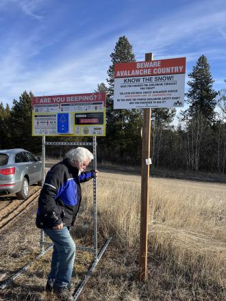
We met up with the Fugawee Snowmobile Club, Idaho Parks and Recreation, and Klim to install new beacon checkers at the trailhead in Island Park. Great work to the team! Photos: GNFAC
-
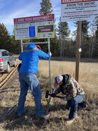
We met up with the Fugawee Snowmobile Club, Idaho Parks and Recreation, and Klim to install new beacon checkers at the trailhead in Island Park. Great work to the team! Photos: GNFAC
-

We met up with the Fugawee Snowmobile Club, Idaho Parks and Recreation, and Klim to install new beacon checkers at the trailhead in Island Park. Great work to the team! Photos: GNFAC
-
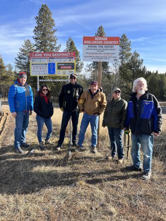
We met up with the Fugawee Snowmobile Club, Idaho Parks and Recreation, and Klim to install new beacon checkers at the trailhead in Island Park. Great work to the team! Photos: GNFAC
-
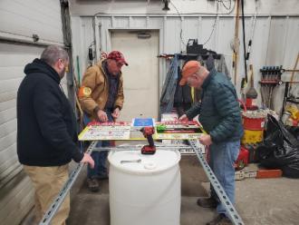
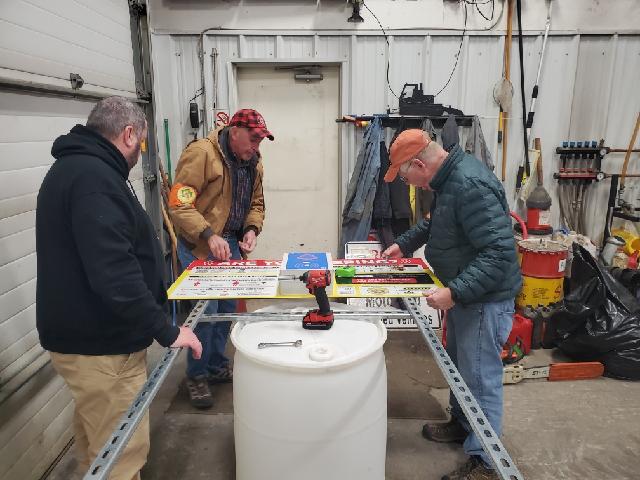
Fugawee Snowmobile Club Assembling New Beacon Checkers. Photo: Kent
-
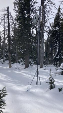
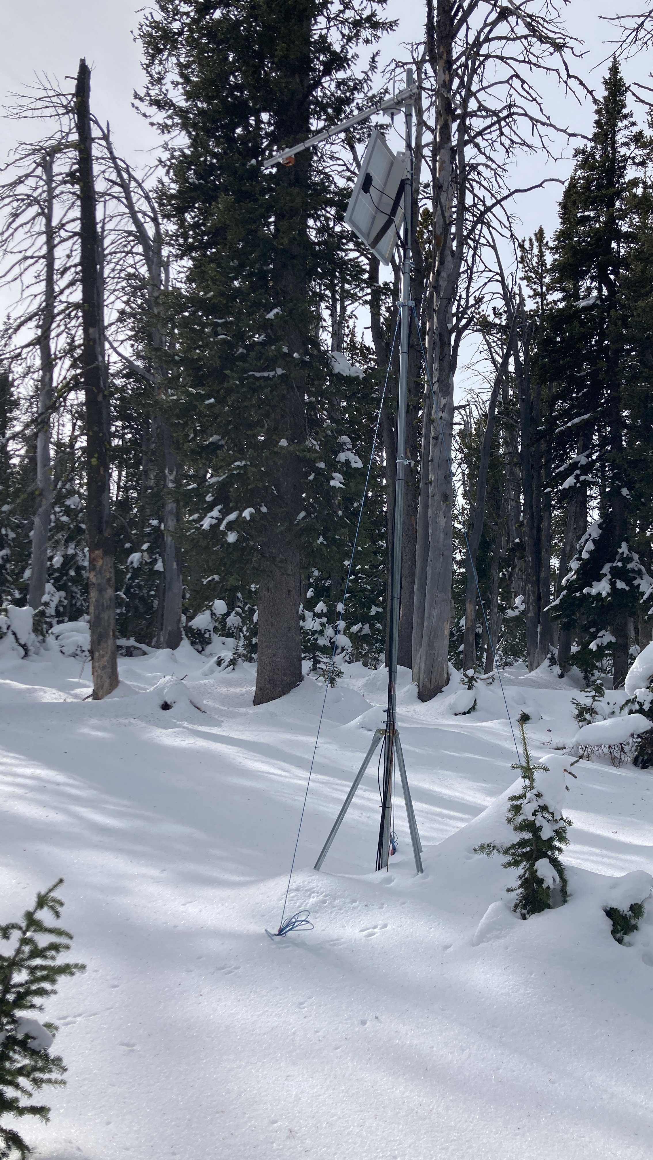
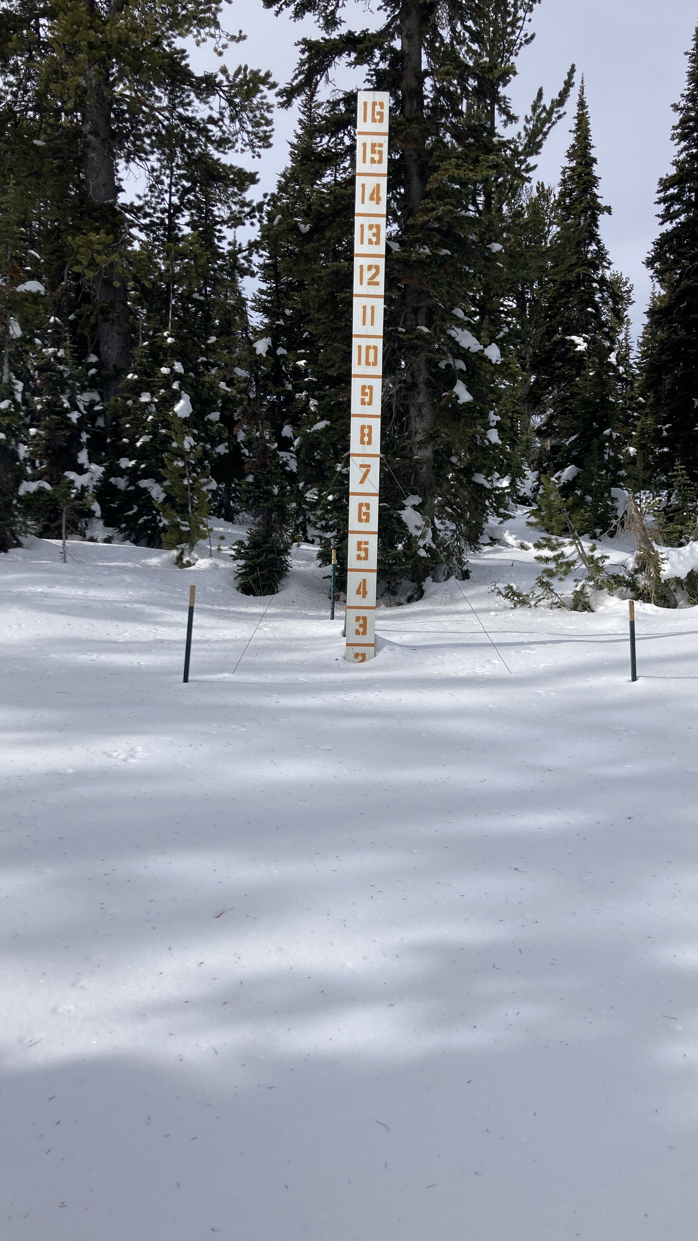
Went to do maintenance on the Sawtelle Snowfall weather station at 8800 ft just off the Sawtelle Mountain Road. Continuous snowcover starts around 8000 ft. At 8800 ft there is ~20" of snow with a mix of hard crusts and weak facets. These weak layers near the ground will be something to watch once snows again. Photo: GNFAC
-

Went to do maintenance on the Sawtelle Snowfall weather station at 8800 ft just off the Sawtelle Mountain Road. Continuous snowcover starts around 8000 ft. At 8800 ft there is ~20" of snow with a mix of hard crusts and weak facets. These weak layers near the ground will be something to watch once snows again. Photo: GNFAC


Videos- Island Park


Weather Stations- Island Park
Weather Forecast Island Park
Extended Forecast for10 Miles ESE Lakeview MT
-
Today
Snow Showers
then
Rain/Snow
LikelyHigh: 40 °F
-
Tonight
Chance
Rain/Snow
then Slight
Chance Snow
ShowersLow: 26 °F
-
Monday
Chance Snow
Showers and
Breezy then
Snow Showers
and WindyHigh: 39 °F
-
Monday
NightSnow Showers
Likely and
BreezyLow: 17 °F
-
Tuesday
Chance Snow
Showers then
Snow Showers
Likely and
BreezyHigh: 32 °F
-
Tuesday
Night
Chance Snow
Showers and
BreezyLow: 19 °F
-
Wednesday
Chance Snow
Showers then
Snow Showers
LikelyHigh: 32 °F
-
Wednesday
Night
Chance Snow
ShowersLow: 19 °F
-
Thursday

Chance Snow
ShowersHigh: 39 °F
The Last Word
We began our daily forecasts on December 7. 130 daily forecasts and 464 reported avalanches later, we wrapped up our daily forecasting season on April 14th. While avalanches remain a concern until the snow is in the rivers, read our SEASON SUMMARY to look back at the heart of the 2023-24 avalanche year.