
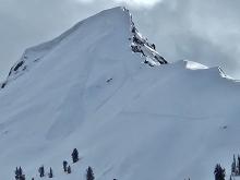

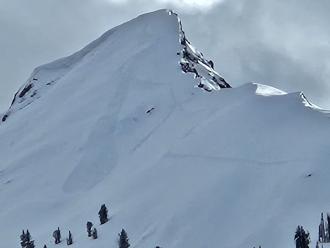
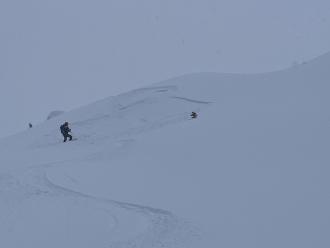
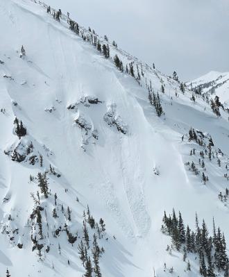
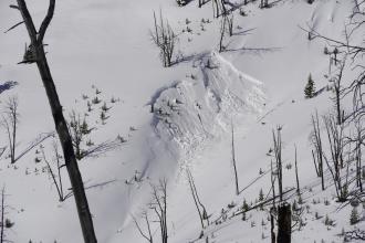
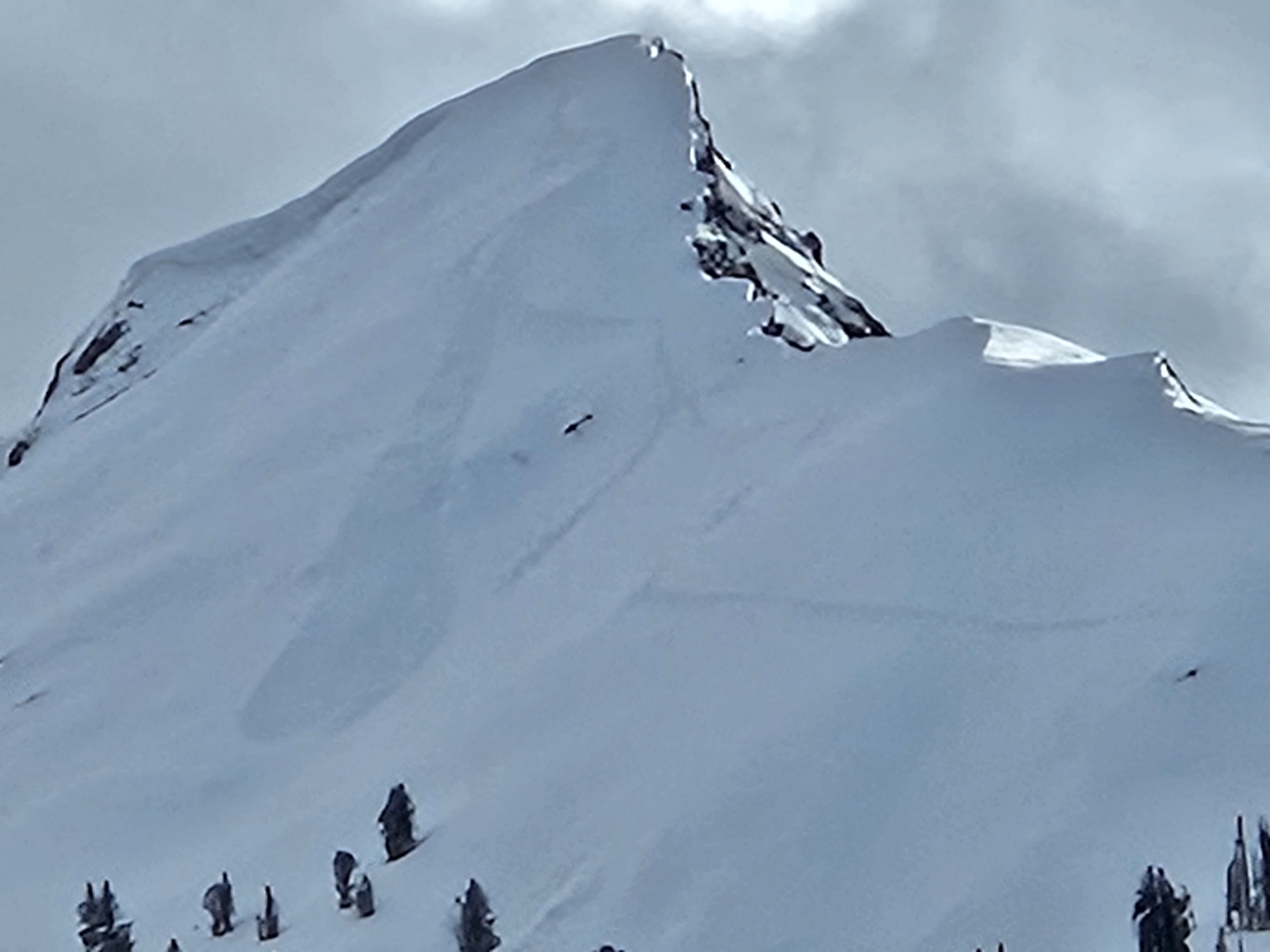
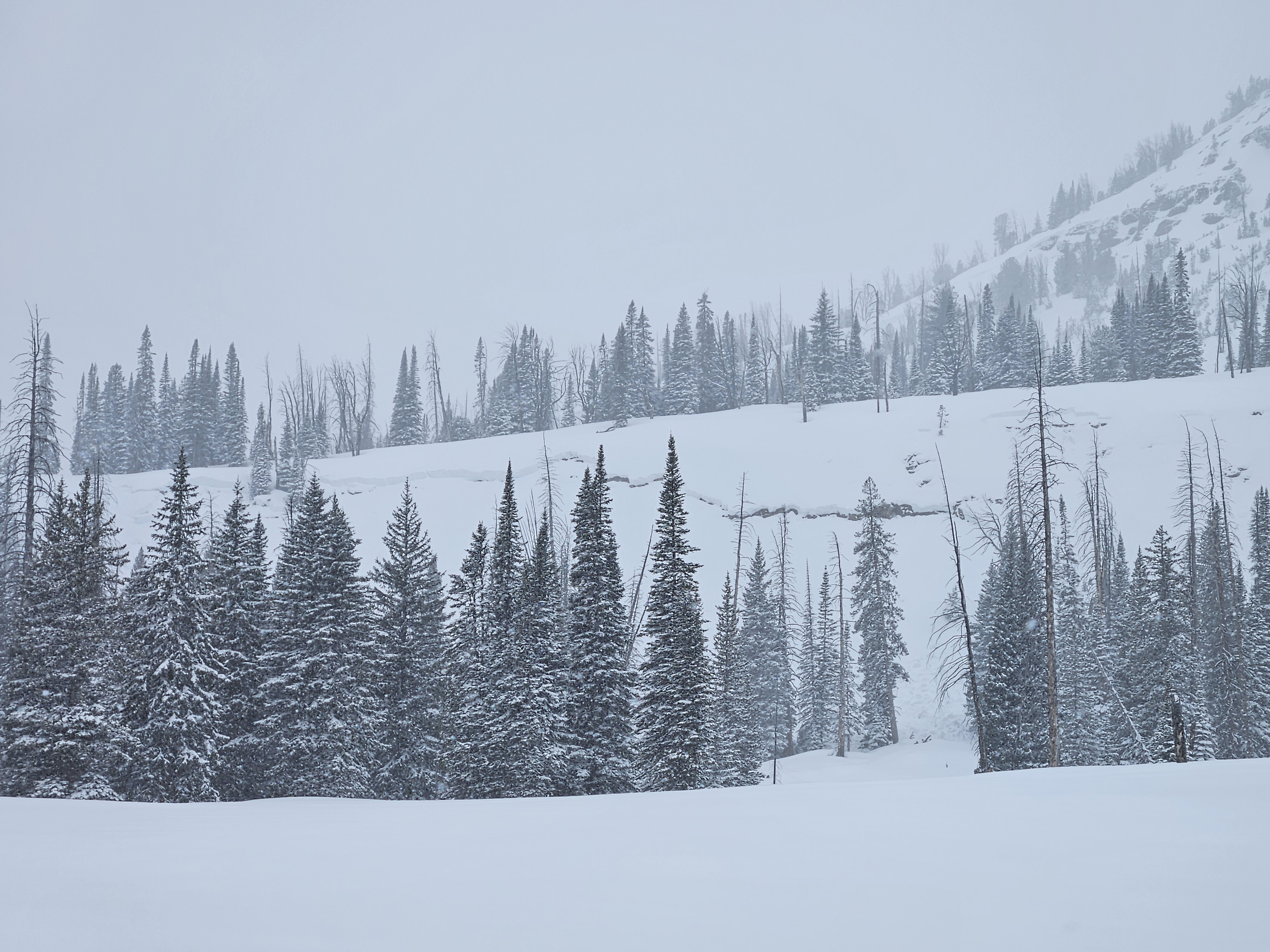
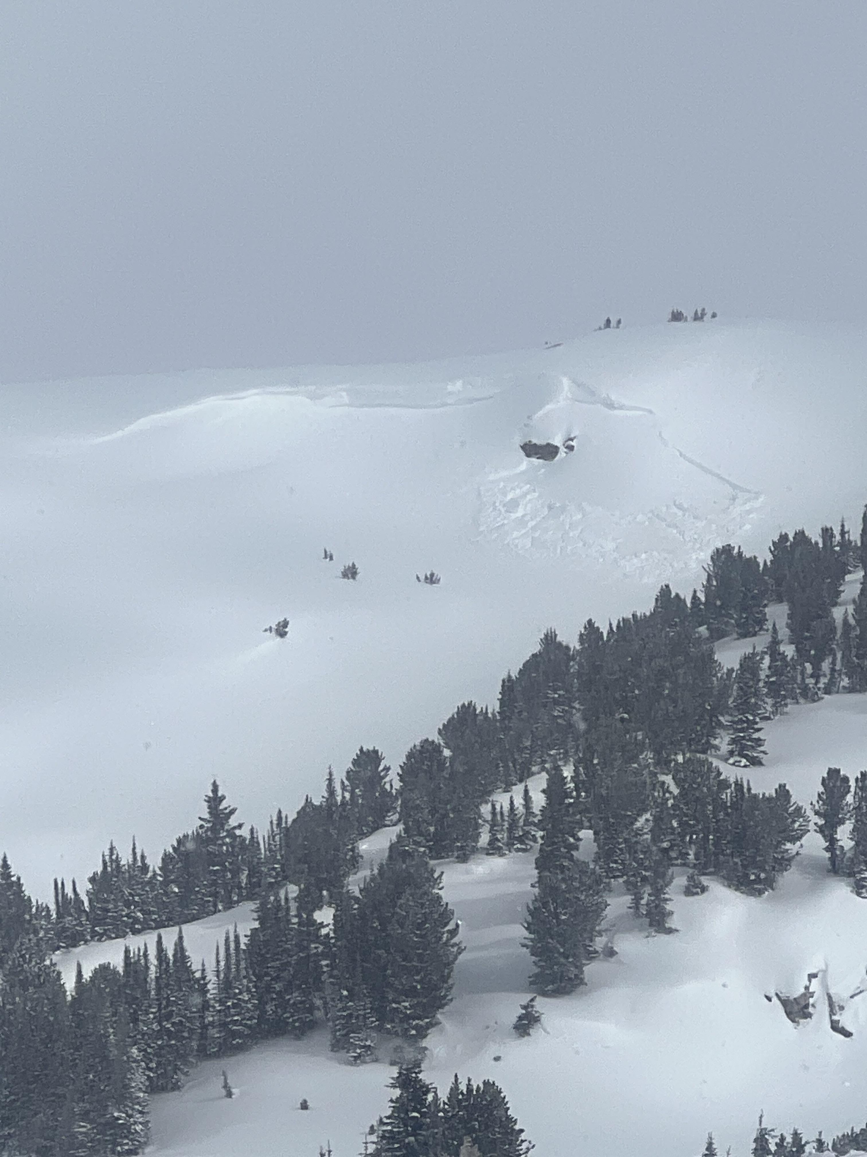
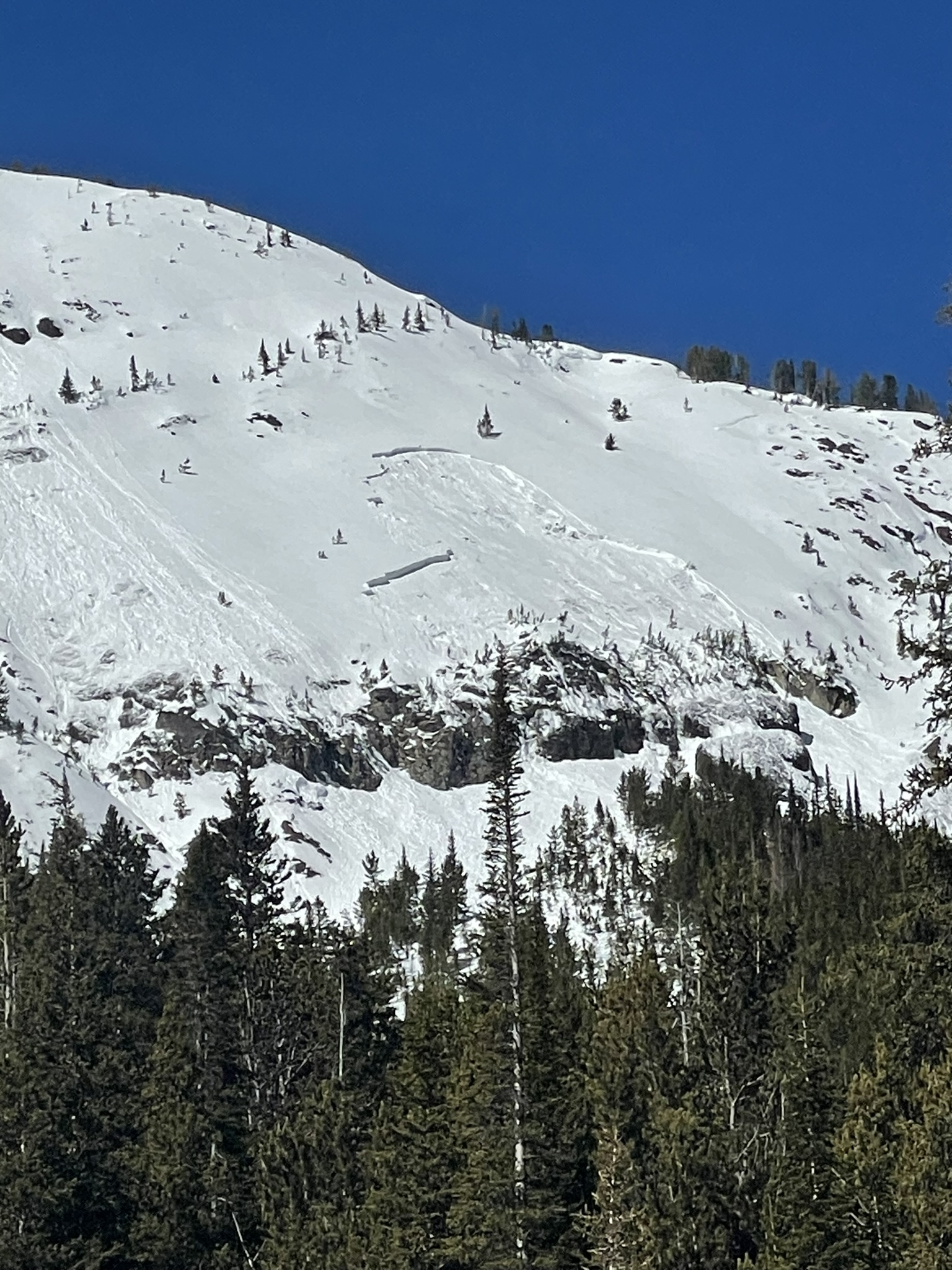
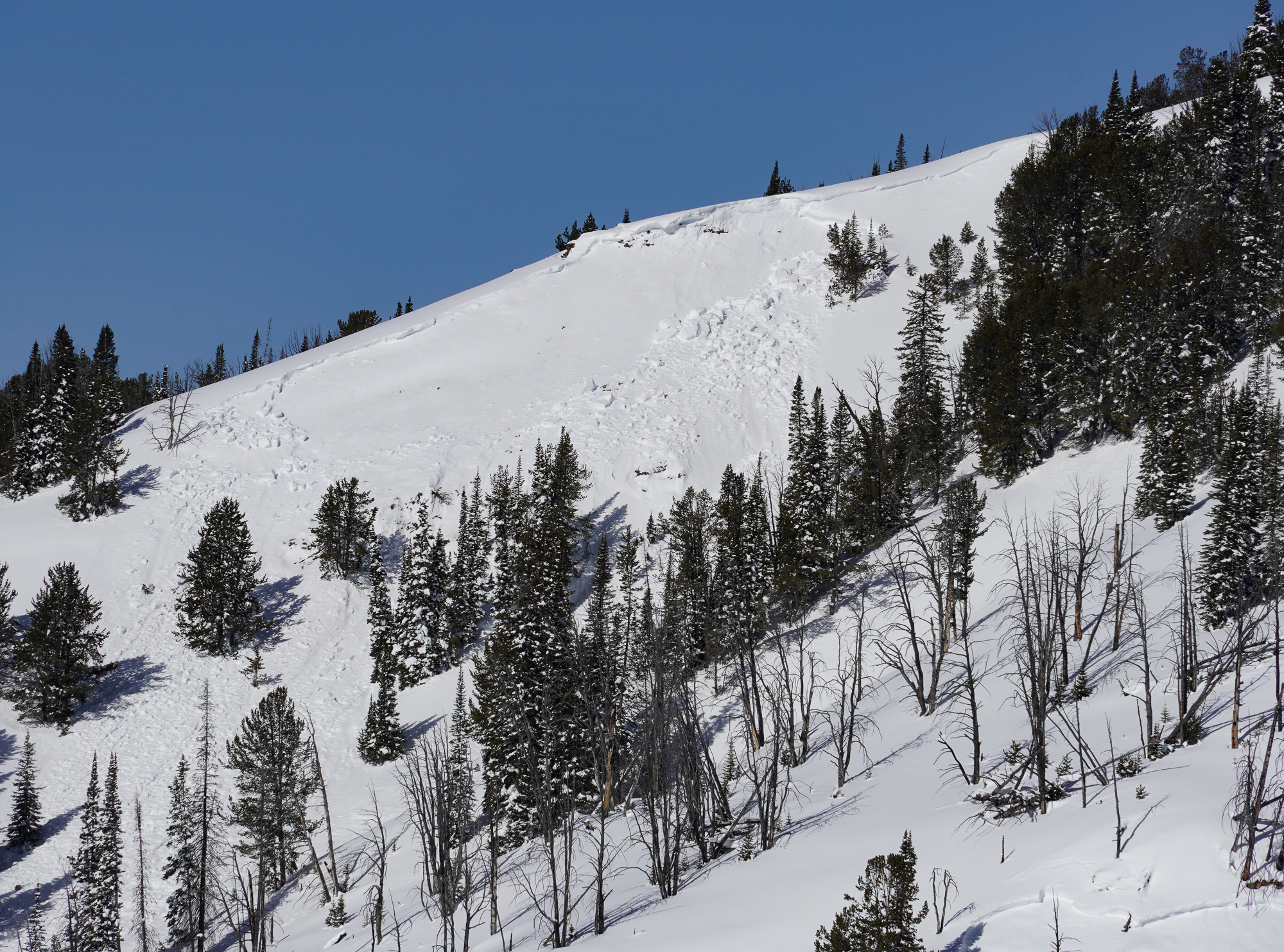
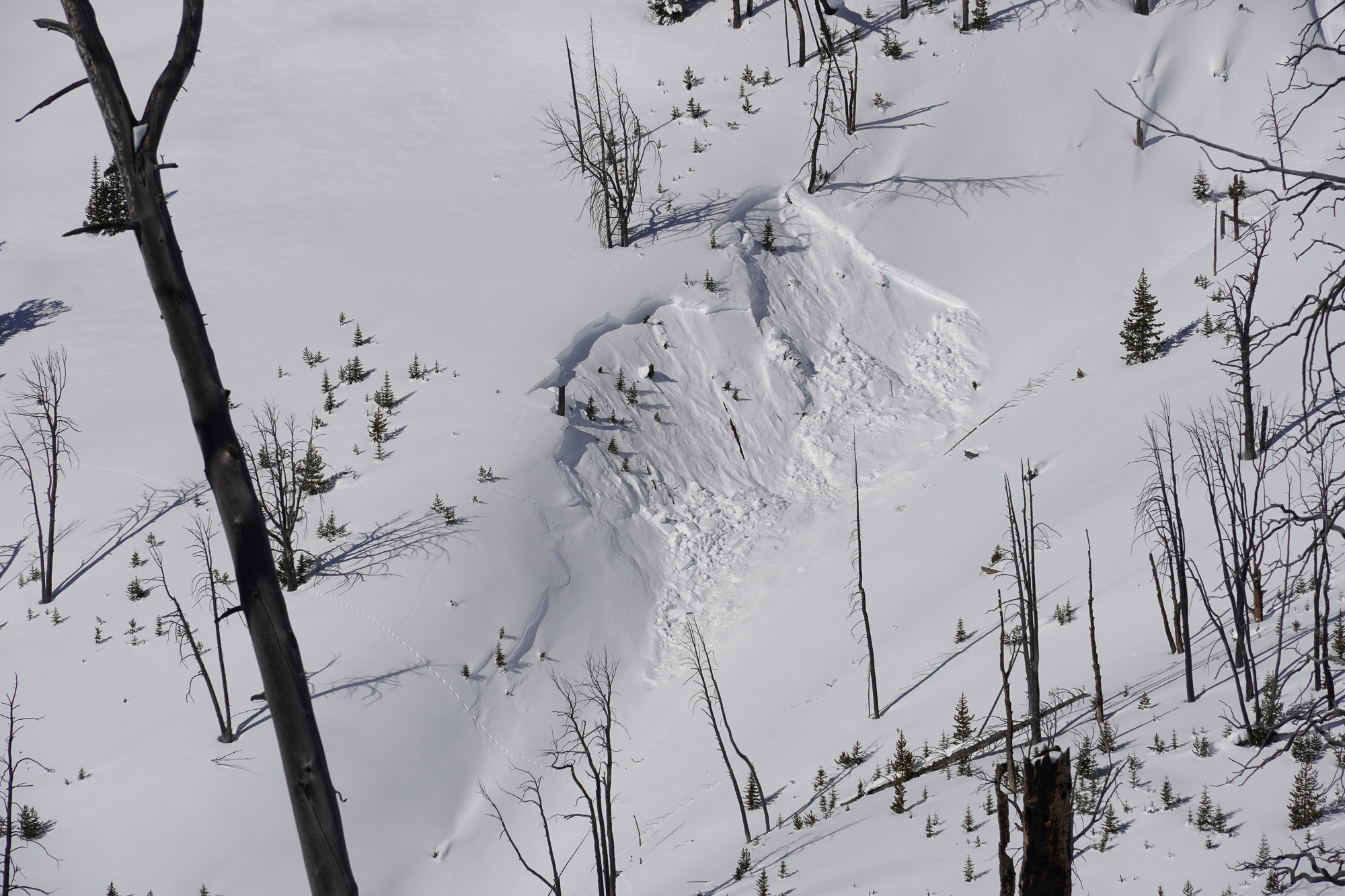
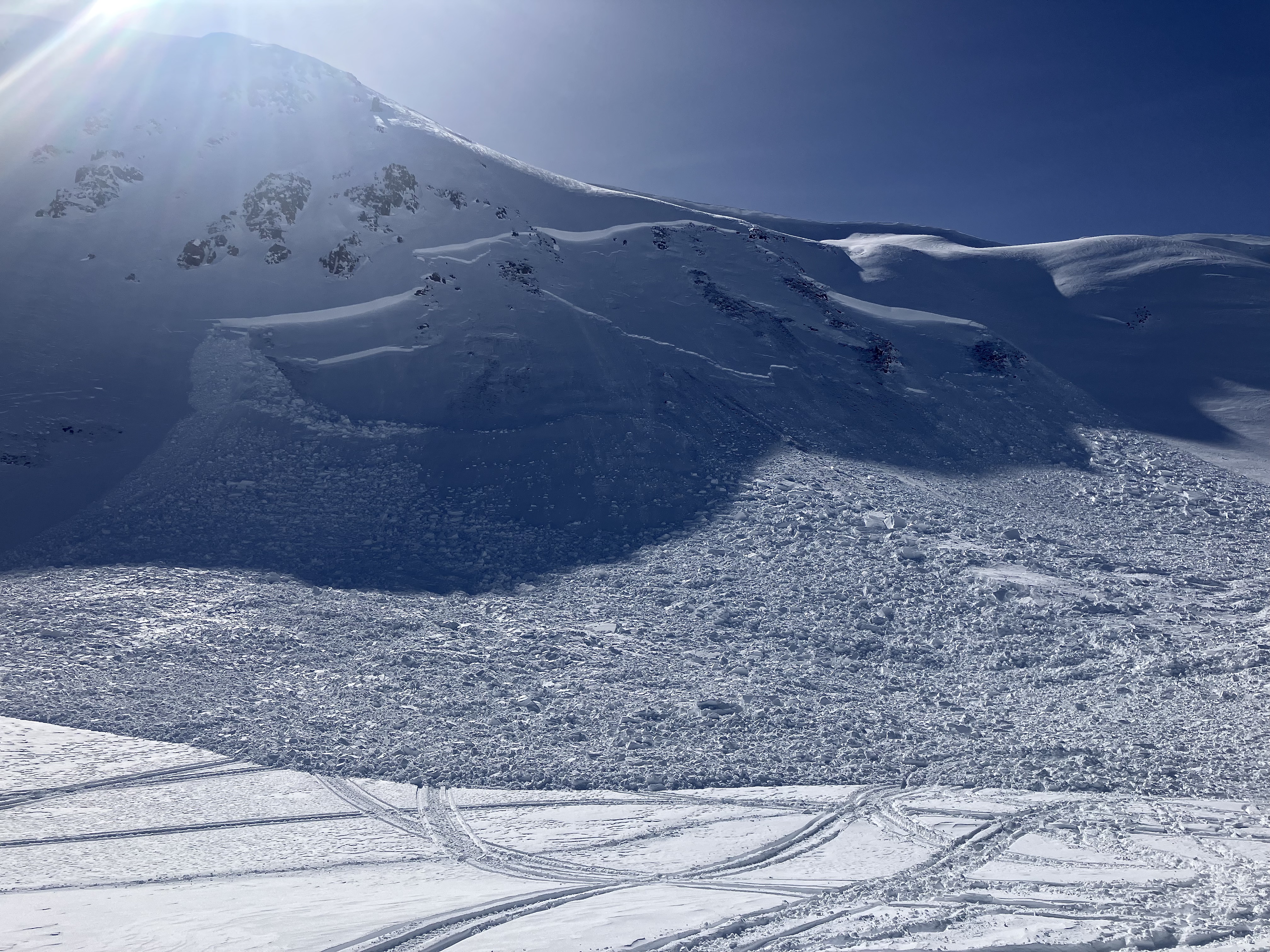
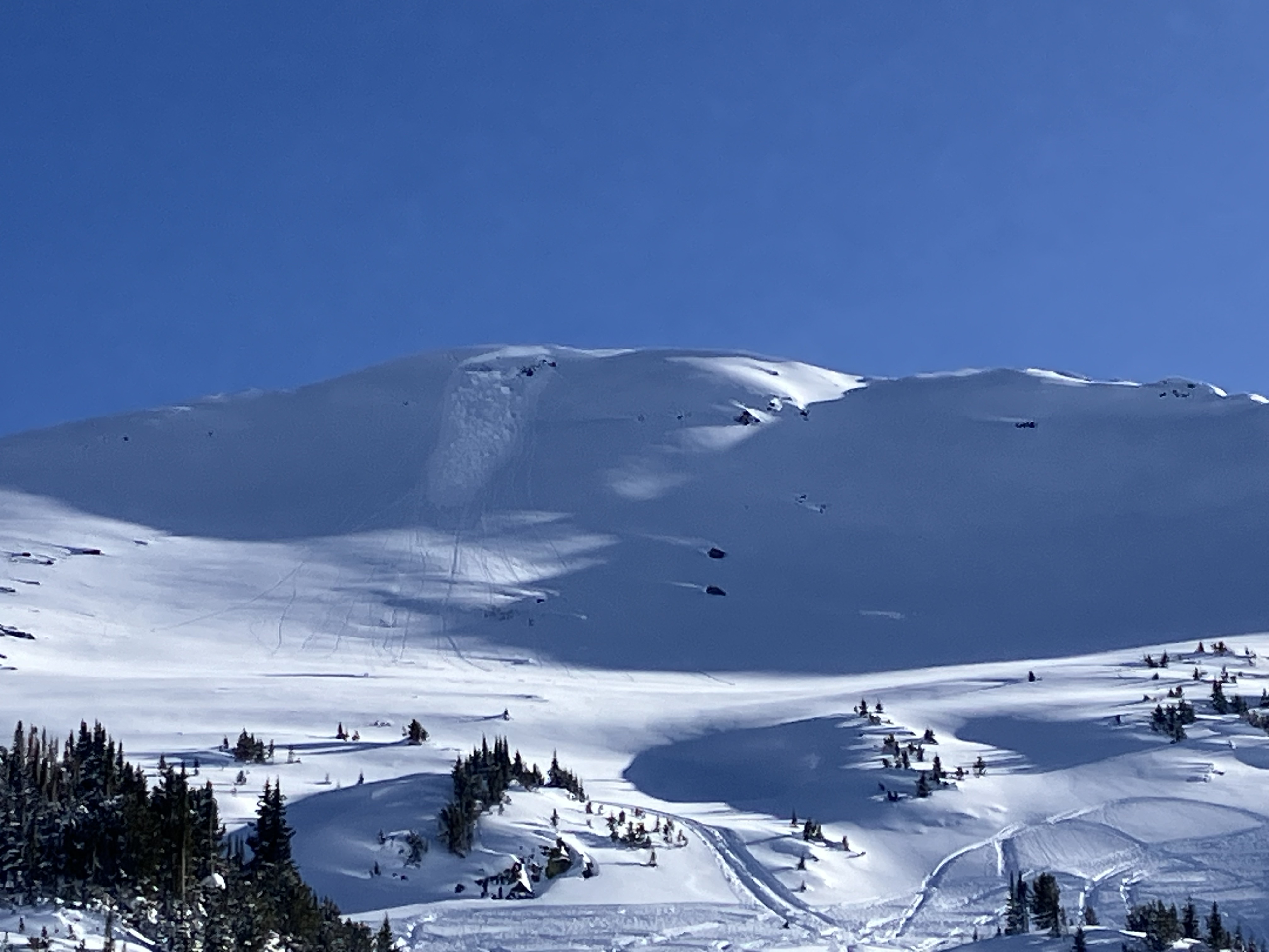
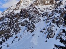
A skier triggered this sluff in a steep chute east of Republic Mountain. Photo: B
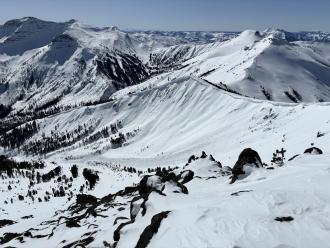
Trip Planning for Cooke City Area

Primary Problem: Wet Snow
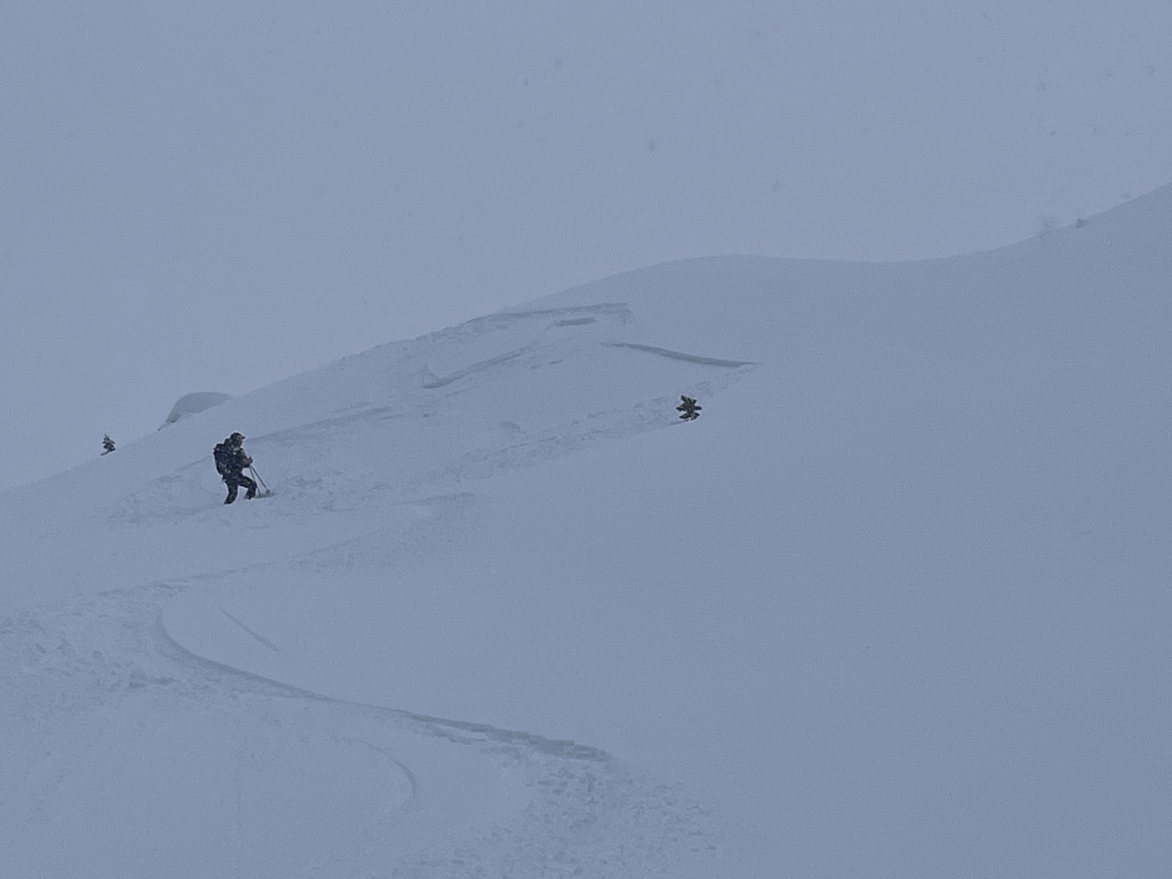
Bottom Line: Warm temperatures, wind-loading, and the possibility of rain and snow later in the week will drive avalanche problems. Wet snow avalanches will be the primary concern on most slopes. Get on to the snow early in the day when surface-level crusts are supportable and get off when the crust breaks down and more than the upper few inches of snow become slushy and wet. Relatively small wind-slab avalanches are possible on upper-elevation slopes that remain shady and cool. If the upper snowpack is dry, dig down and back off steep objectives if you find instability in your tests, observe shooting cracks or indications of fresh wind-loading. Reevaluate conditions when a mix of rain and snow moves into the area on Thursday and Friday. Past 5 Days
Sat Apr 13

Considerable
Considerable
Sun Apr 14
Considerable
Considerable
Mon Apr 15

None
None
Fri Apr 19
None
None
Mon Apr 22
None
None
Relevant Avalanche Activity
Cooke City
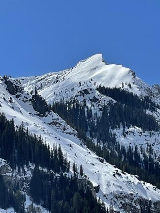
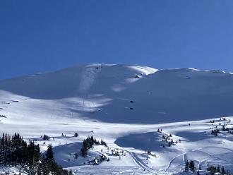
Republic Mountain
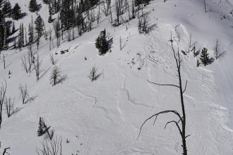
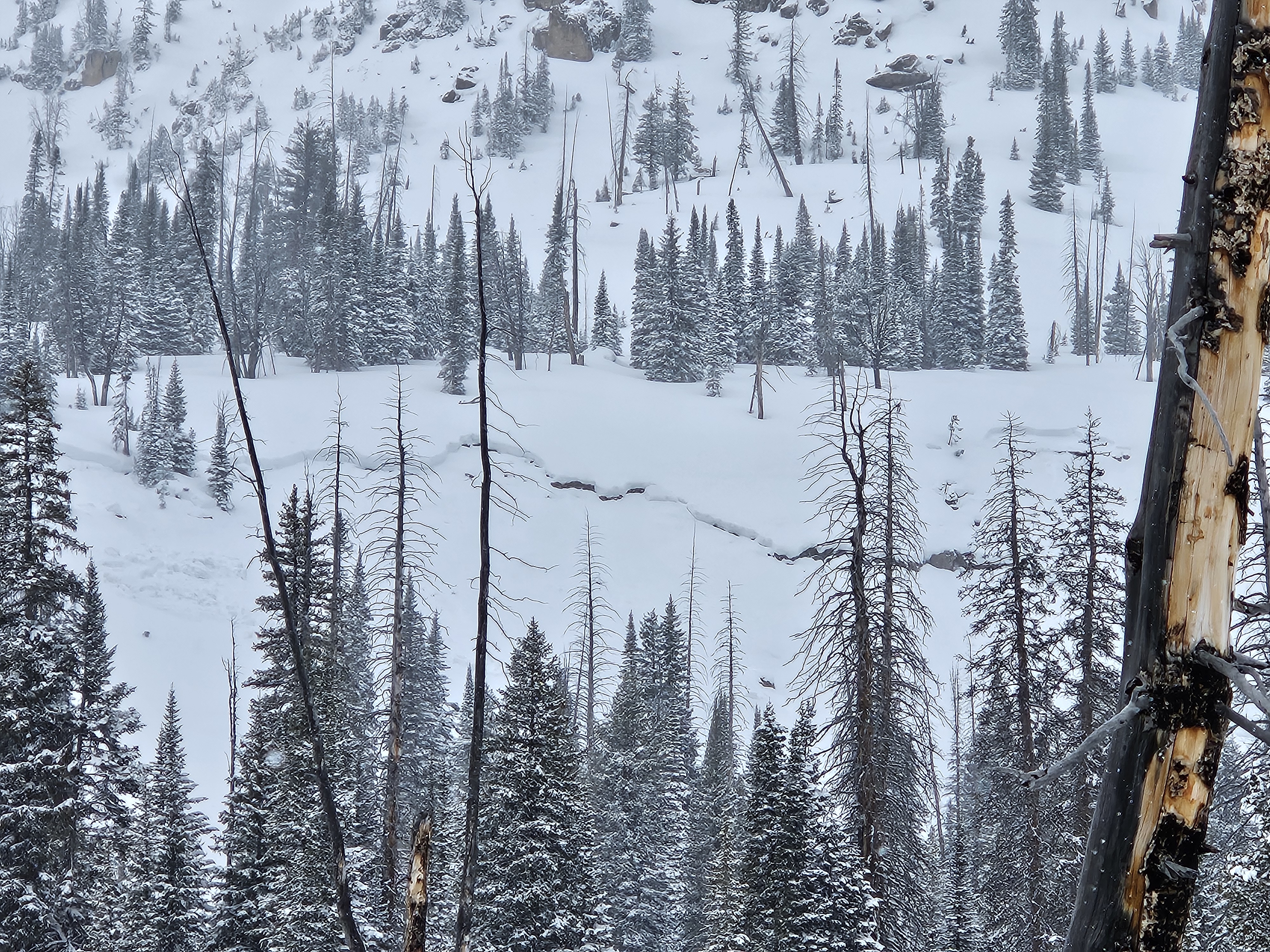
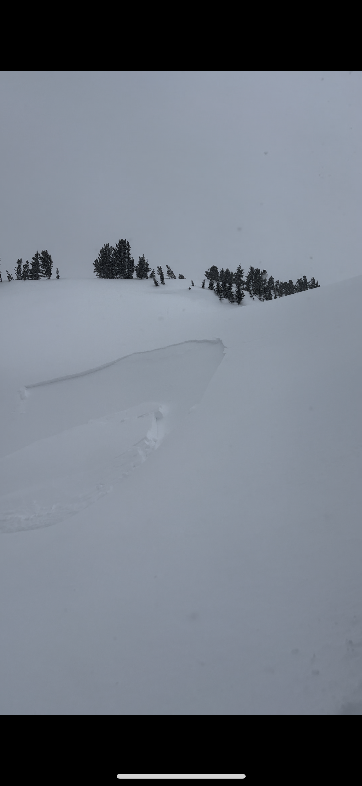
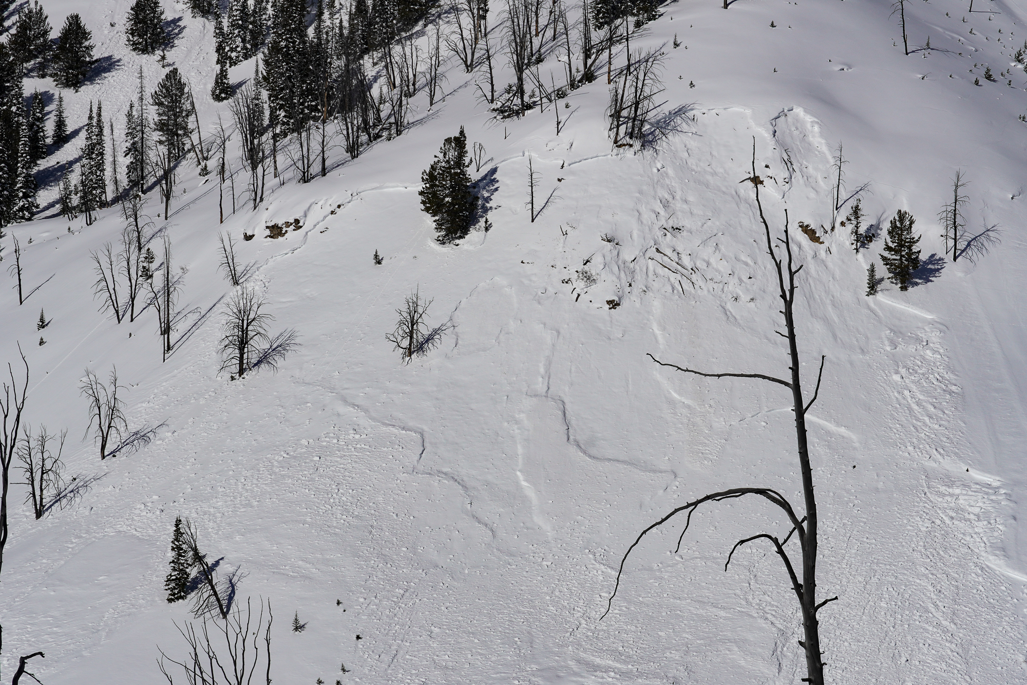
Loose Snow Avalanches Republic Mountain
Republic Mountain
L-AS-R1-D1
Aspect: NE
Coordinates: 45.0003, -109.9540
Caught: 0 ; Buried: 0
More Avalanche Details
L-AS-R1-D1
Aspect: NE
Coordinates: 45.0003, -109.9540
Caught: 0 ; Buried: 0
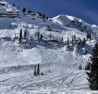
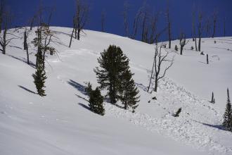
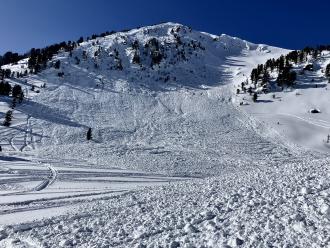
A skier triggered multiple loose snow avalanches while skiing near the Fin off of Republic Mountain in Cooke City.
More Avalanche Details
Cooke City
Mount Abundance
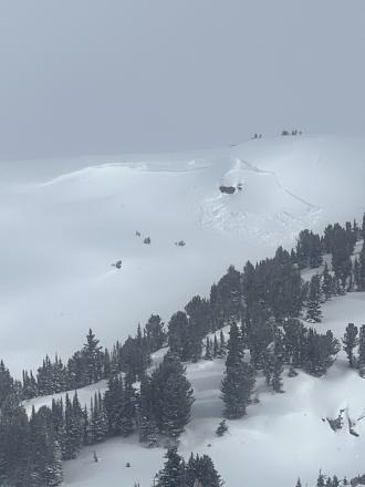
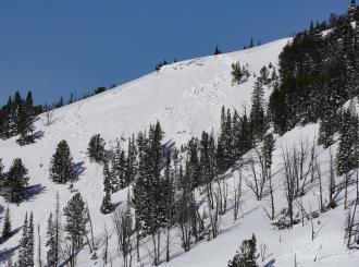
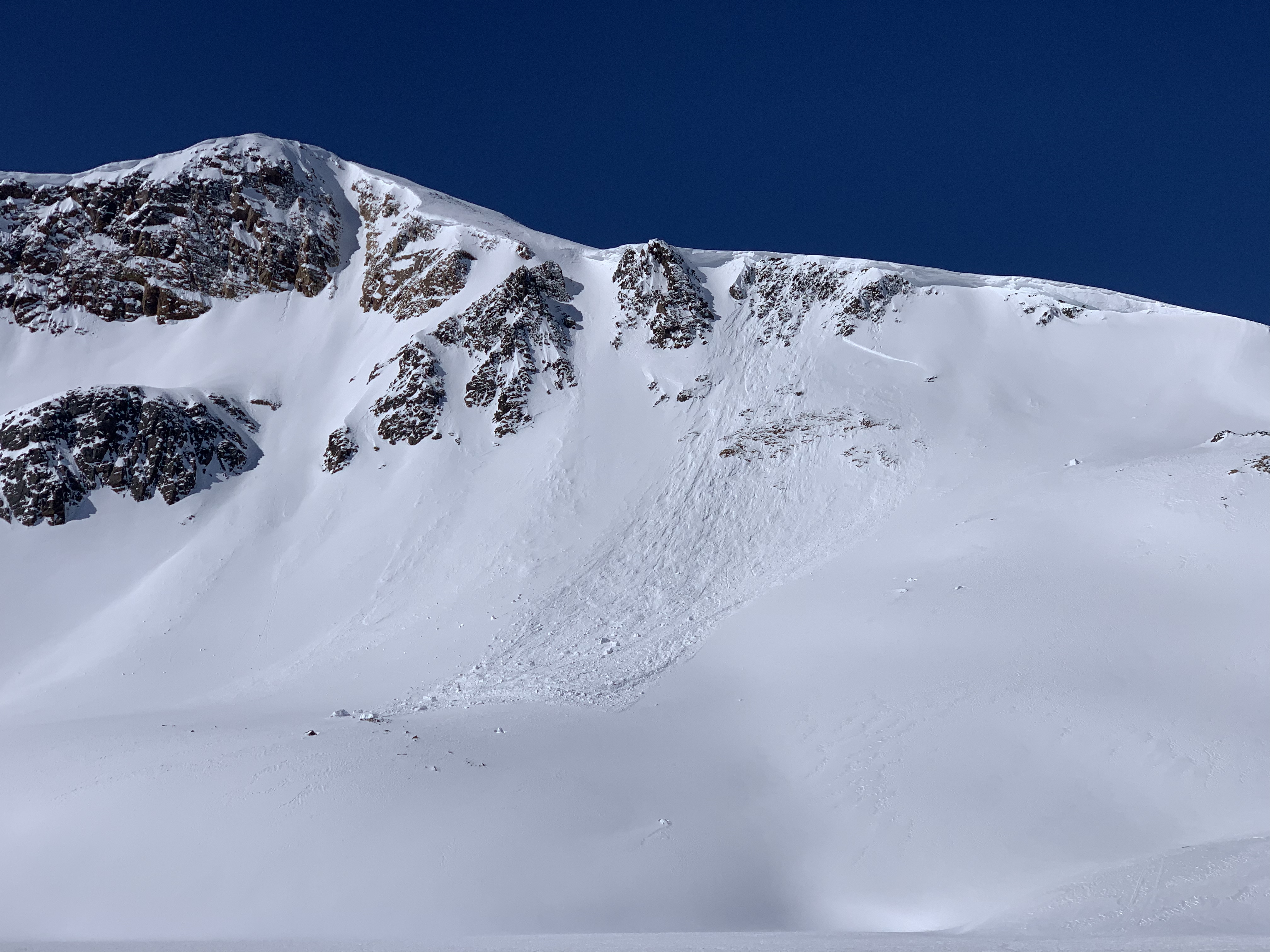
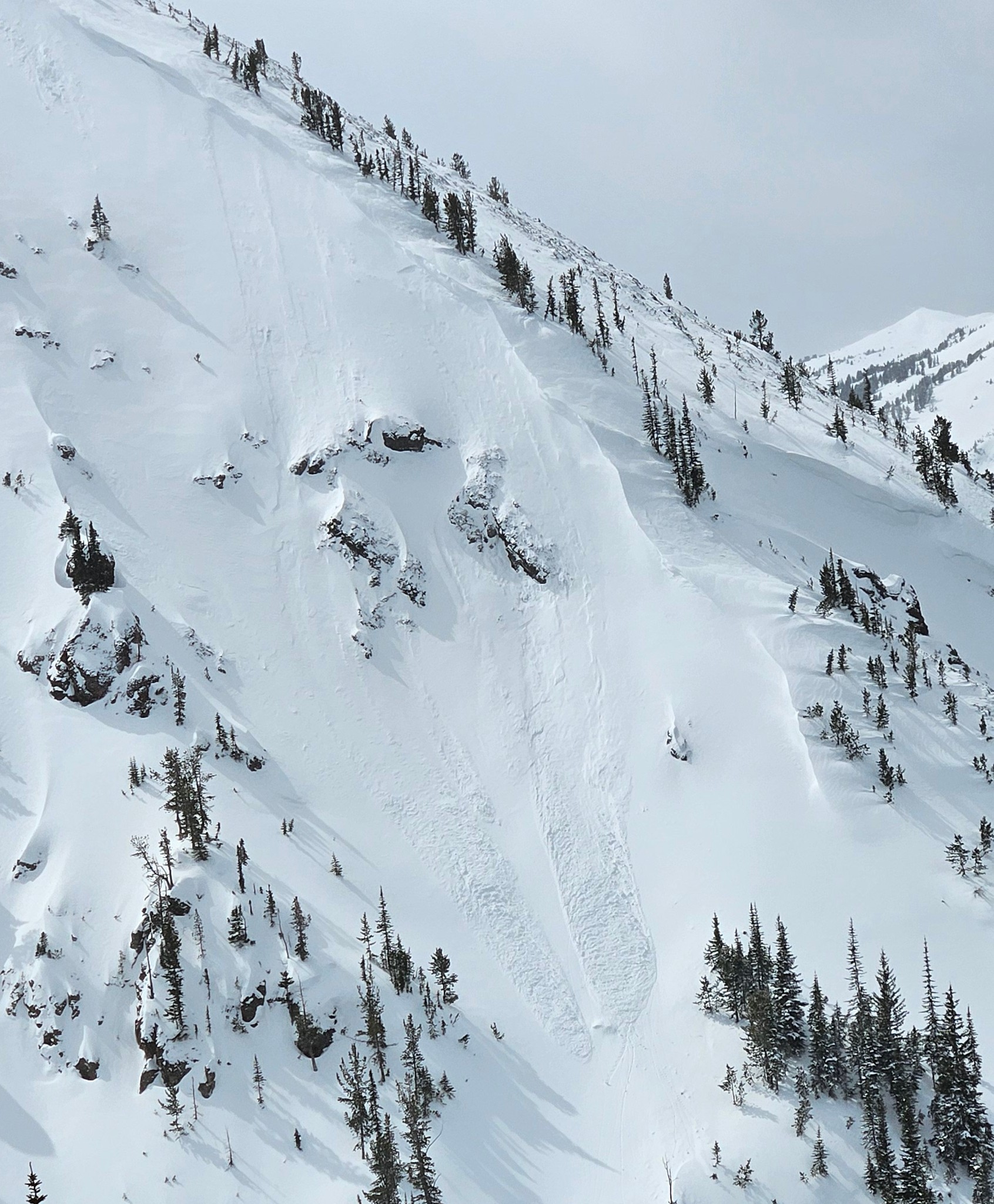
Wet Slab Avalanche SE Shoulder of Mount Abundance
Mount Abundance
WS-N-R3-D2-O
Aspect: SE
Coordinates: 45.0773, -110.0210
Caught: 0 ; Buried: 0
More Avalanche Details
WS-N-R3-D2-O
Aspect: SE
Coordinates: 45.0773, -110.0210
Caught: 0 ; Buried: 0
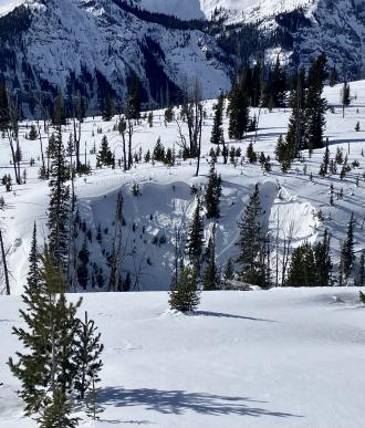
From obs on 04/17/2024: "Wet slab 150-200 ft across, SE shoulder of Abundance towards Wolverine. Looks to have maybe happened before new snow. New snow 6-8 was extra funky, 2-3 powder on a rain? crust on heavy wet. Bonded to unsupportive melt freeze on completely saturated glop. Lots of short running sluffs"
More Avalanche Details
Southern Madison
Quake Lake
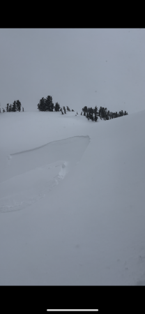
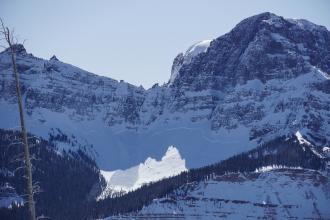
Wet Slab Avalanche Above Quake Lake
Quake Lake
WS-N-R2-D2-G
Coordinates: 44.8524, -111.3920
Caught: 0 ; Buried: 0
More Avalanche Details
WS-N-R2-D2-G
Coordinates: 44.8524, -111.3920
Caught: 0 ; Buried: 0
From IG: Wet slide to the ground above Quake Lake.
More Avalanche Details
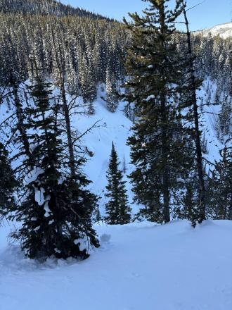
Relevant Photos
Displaying 1 - 40
-

-
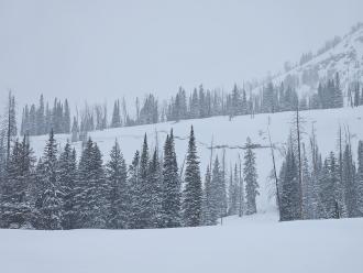
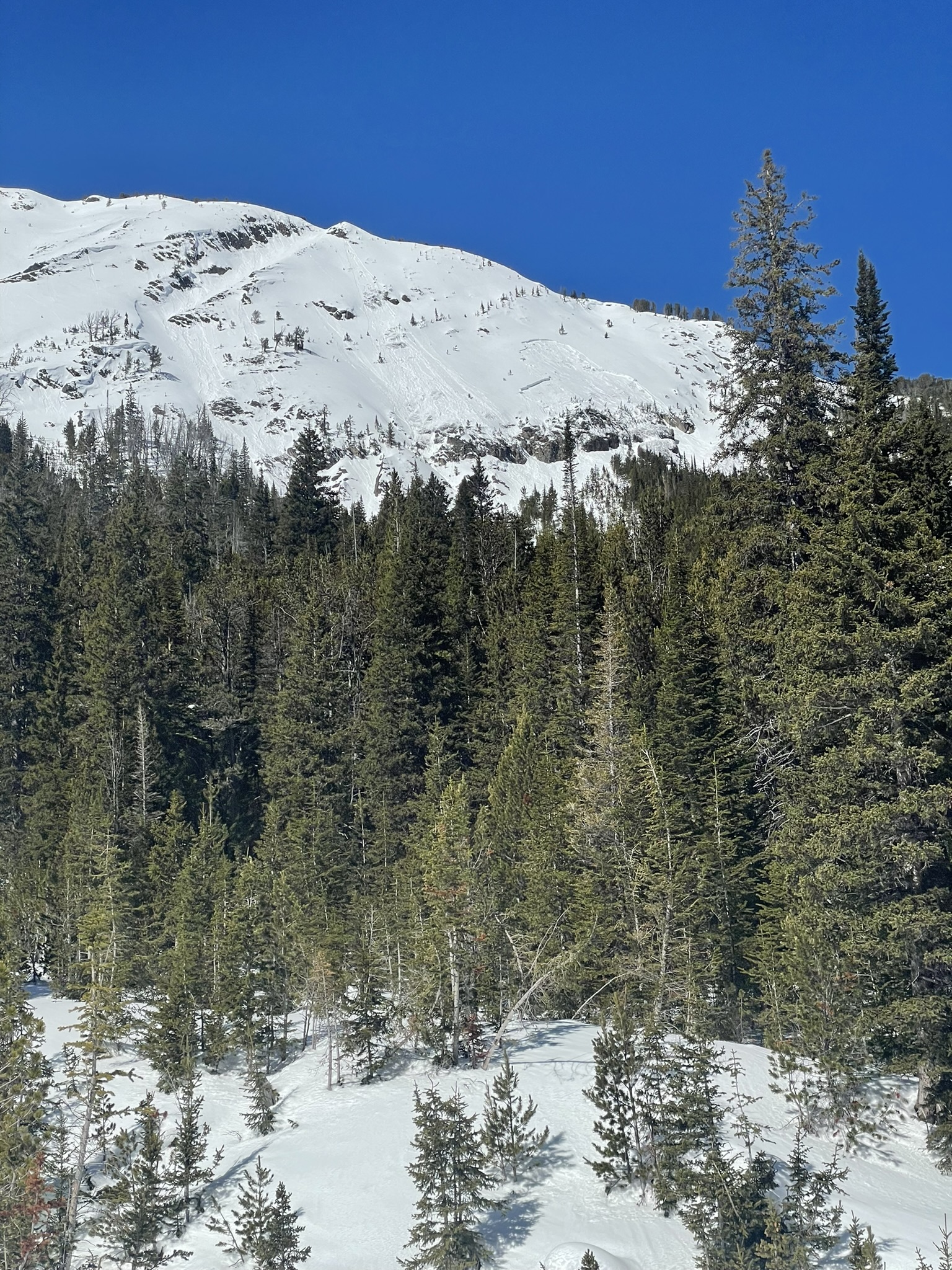
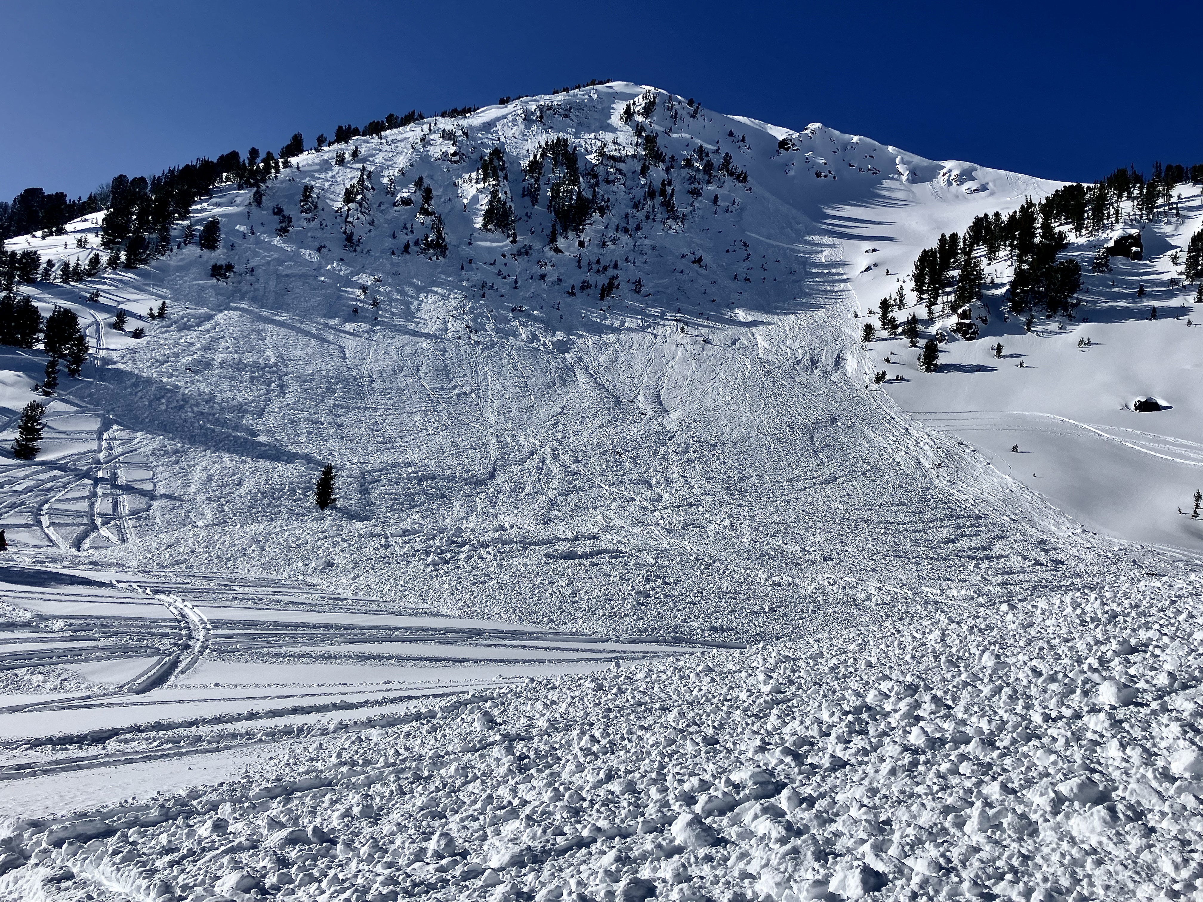
Skiers triggered a small sluff in steep terrain while skiing on the Fin near Republic Mountain. Photo: B.
-
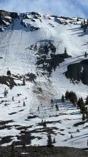
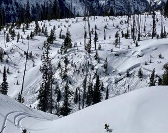
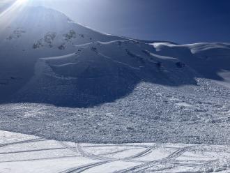
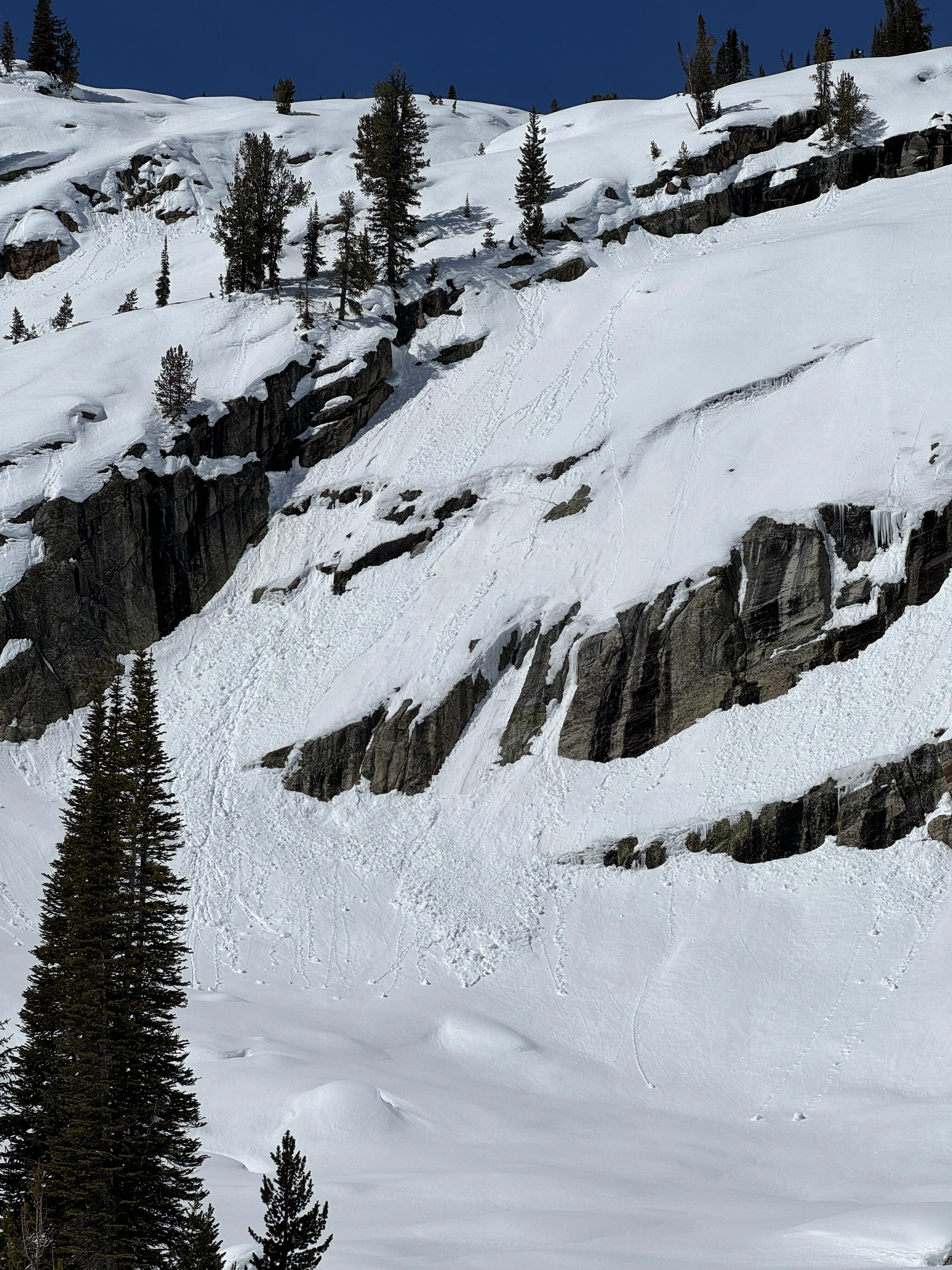
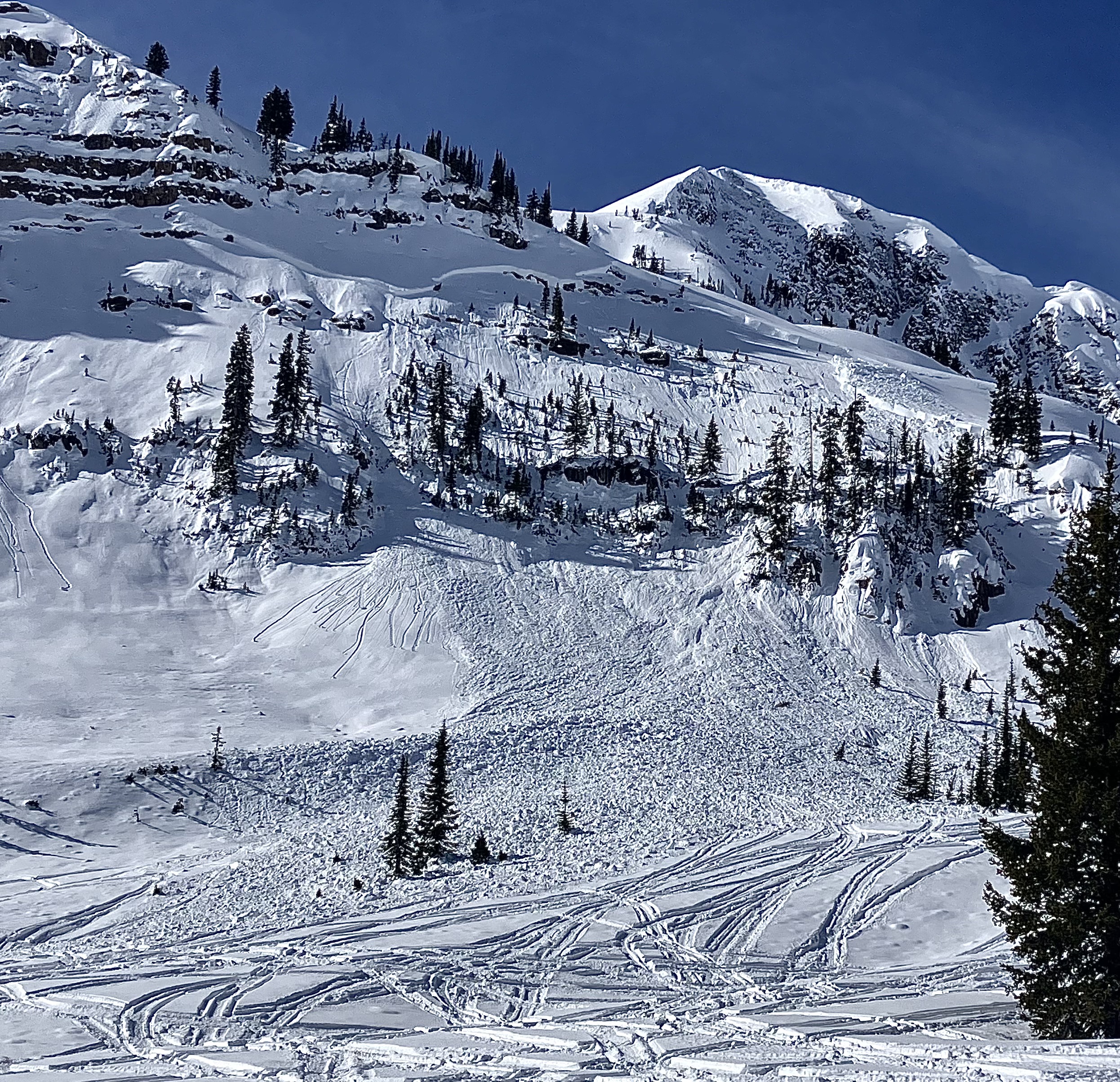
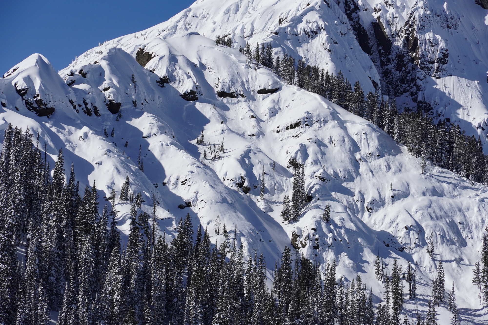
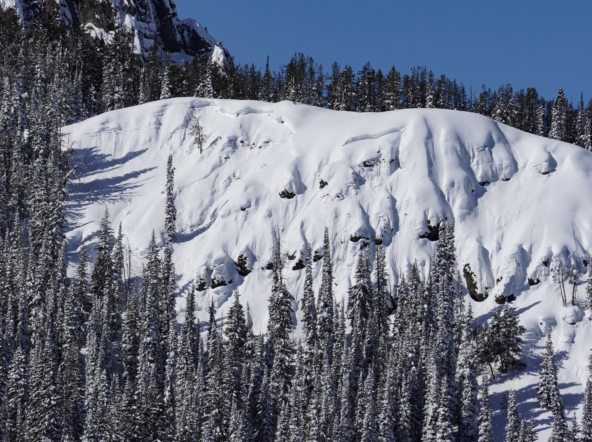
Riders saw this wet slab avalanche on the SE shoulder of Mount Abundance. The avalanche likely happened a few days ago during prolonged above-freezing temperatures. Photo: R.
-
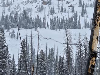
Riders saw this wet slab avalanche on the SE shoulder of Mount Abundance. The avalanche likely happened a few days ago during prolonged above-freezing temperatures. Photo: R.
-
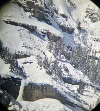
From obs: "Natural cornice failure and small slab on Iceberg Peak’s NE face. We skied by the day prior and judging by what the wind did to our tracks overnight, this looked like it happened in the morning." Photo A. Joy
-
A snowboarder saw this natural avalanche on the Fin from Cooke City. He estimated it happened between 10:30-1:30 and broke 2' deep. Photo: N. Mattes
-
We triggered this small avalanche on a steep windloaded rollover on an otherwise mellow slope. This avalanche was 15-20' wide, 8" deep, and ran for about 30-40 vertical feet. The skier easily skied away from the slide and was not caught. Photo: GNFAC
-
From obs: "skiing north of cooke city today observed this Small windslab on a South facing slope ~9800 ft." G. Roe
-
Skiers triggered this small windslab while skinning near a steeprollover at the top of an East facing slope above Zimmer Creek. Crown was ~20 ft wide and ran a similar distance. 2"-10" at the deepest. Photo: G. Roe
-
Skiers south of Cooke City saw a recent likely cornice-triggered avalanche on a northeast face. During their tour, they saw a small part of the same cornice fall off and trigger another small avalanche. Photo: B. Daley
-

A snowboarder intentionally triggered a wind-slab avalanche on Town Hill in Cooke City that broke 6-10” deep and approximately 30’ wide. It ran about 40 vertical feet. Photo: R. Youngbar
-

On the east side of Woody Ridge, skiers watched a wet, loose snow avalanche trigger a dry slab avalanche on March 17. photo: N Iltis
-
On the east side of Woody Ridge, skiers watched a wet, loose snow avalanche trigger a dry slab avalanche on March 17. photo: N Iltis
-
We saw no new deep slab avalanches in Cooke City since Alex was there last week. Unfortunately, if you triggered one, it would be no less deadly. This was a large deep slab avalanche on Sheep Mountain. Photo: GNFAC
-
Wet loose snow avalanche Astral Lake. Photo: GNFAC
-

A wet loose snow avalanche on Crown Butte. Photo: GNFAC
-
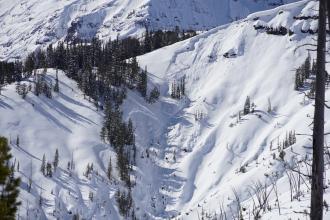
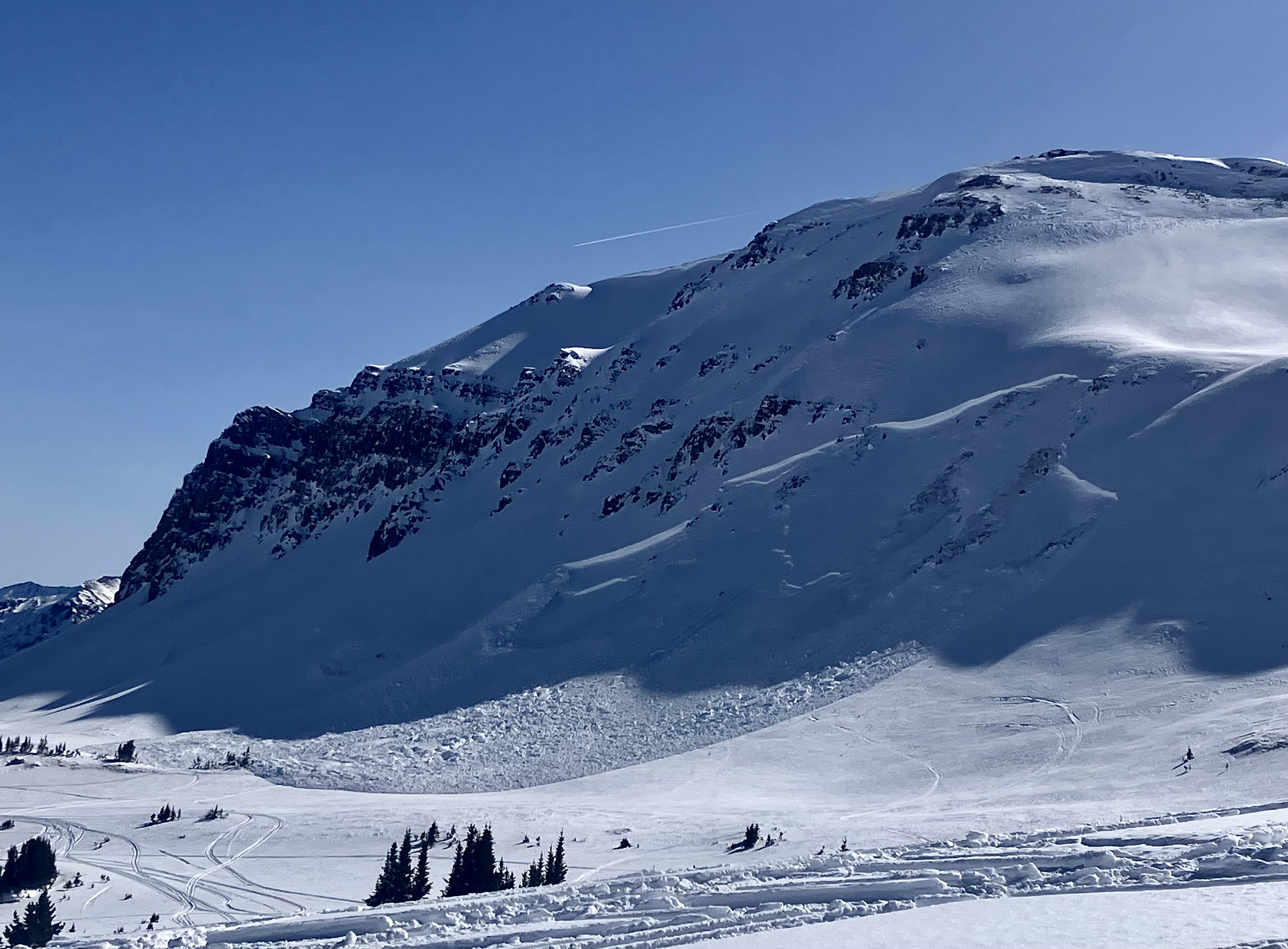
On 3/10/24 Between Miller and Wolverine there was a recent large avalanche that I would guess was triggered yesterday. 3-6' deep, 250-300' wide. Photo: GNFAC
-
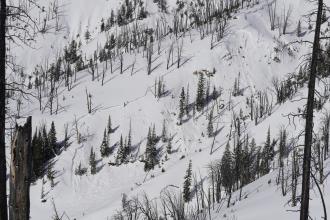
On 3/10/24 Low on Daisy Road along the steep creek walls we saw three recent 2' deep avalanches. each 70-100' wide. HS-R4-D2-O. This one looked within the last day or two and the other two were maybe 3-4 days old. Triggers unknown, there were various ages of sled/snowbike tracks nearby. Photo: GNFAC
-
On 3/10/24 Low on Daisy Road along the steep creek walls we saw three recent 2'+ deep avalanches. each 70-100' wide. HS-R4-D2-O. This one maybe 3-4 days old. Triggers unknown, there were various ages of sled/snowbike tracks nearby. Photo: GNFAC
-
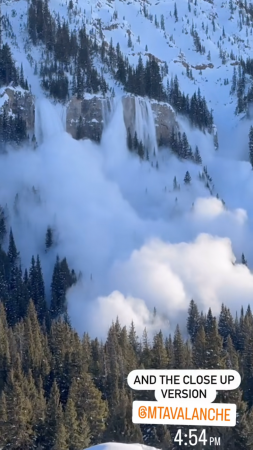
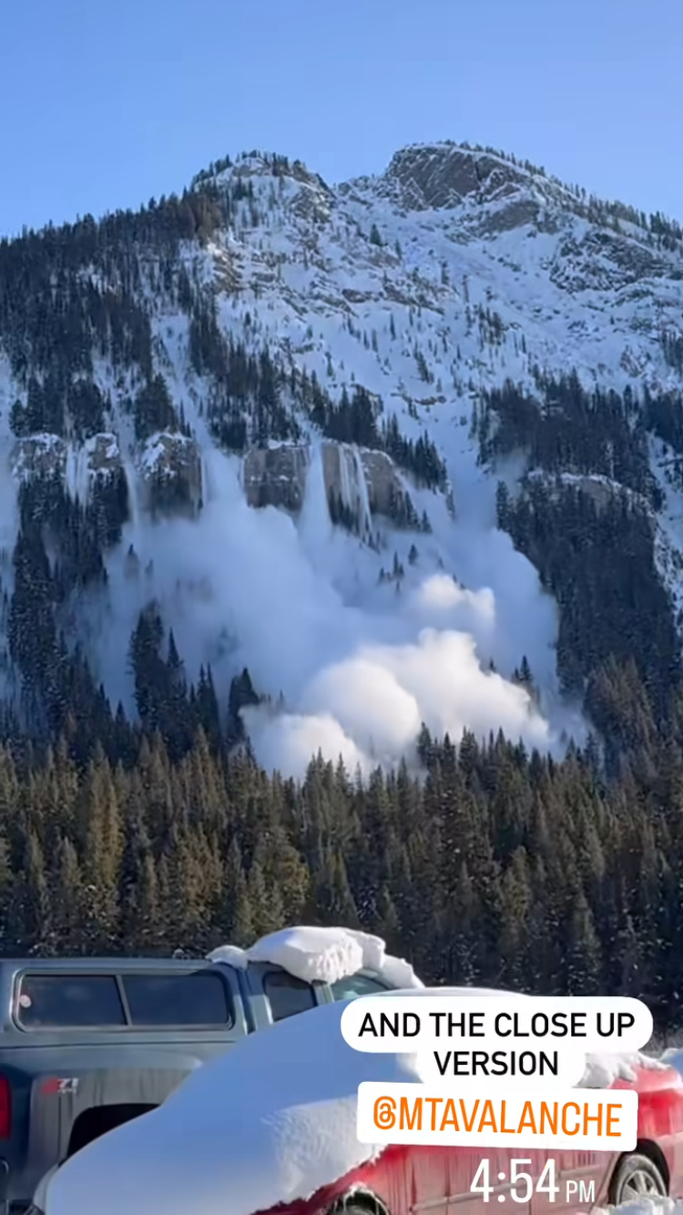
A natural avalanche was witnessed on the north side of Republic Mtn. on 3/9 at 4:54pm. It appeared to break around 3 feet deep. Photo: screenshot from IG, M. Simone
-
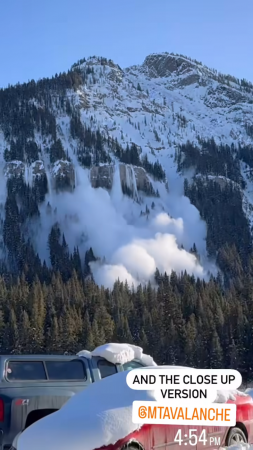
A natural avalanche was witnessed on the north side of Republic Mtn. on 3/9 at 4:54pm. It appeared to break around 3 feet deep. Photo: screenshot from IG, M. Simone
-
E aspect, 9100' Photo: B. Fredlund
-
N aspect, 9600' Photo: B. Fredlund
-
E aspect, 8800' Photo: B. Fredlund
-
SE aspect, 8800' Photo: B. Fredlund
-
Skiers saw a natural avalanche that likely happened late last week in Pilot Creek. The avalanche ran 1000 feet on a SE facing slope. Photo: J. Mundt
-
A natural avalanche in Woody Creek, right by the waterfall. D2, crown was up to 5 feet deep. NE facing. Photo: J. Mundt
-
E aspect, 9100'. Photo: B. Fredlund
-
E aspect, 8800'. Photo: B. Fredlund
-
SE aspect, 9000'. Photo: B. Fredlund
-

NE aspect, 9300' Photo: B. Fredlund
-

E aspect, 8900'. Photo: B. Fredlund
-

On 3/9/24 there was a big avalanche on the northeast side of Sheep that was previously not reported. It was there this morning so maybe happened yesterday. 6-8'+ deep, 500' wide R4-D3-O. Photo: GNFAC
-
On 3/9/24 there was a big avalanche on the northeast side of Sheep that was previously not reported. It was there this morning so maybe happened yesterday. 6-8'+ deep, 500' wide R4-D3-O. Photo: GNFAC
-

This morning (3/9/24) we saw previous avalanches on Henderson Mtn. in better light and got a photo of one on the lower Henderson Bench. Showing wide propagation through thick trees. Photo: GNFAC
-

On 03/08/2024 we observed widespread avalanches along Henderson Bench as well, below the steep break over in the trees, 3'+ deep breaking across multiple terrain features through thick trees, most of the bench slid, and appeared to have happened last weekend. Photo: GNFAC
-
On my drive to Cooke City I saw old slab avalanches in YNP near Mammoth and on Abiathar and Ampitheater among other places. These appeared to have happened earlier in the week. I also saw a more fresh looking persistent slab avalanche on Barronette, 2-3' deep and as wide as its terrain feature, 100-200' Photo: GNFAC
-
We saw one small but deep slab on the north side of Scotch Bonnet on 03/08/2024 that likely happened today or late yesterday. 6' deep x 30' wide, R1-D1.5. Photo: GNFAC
-
A recent avalanche on the south side of Scotch Bonnet happened today, 03/08, or yesterday. 4-6' deep and 300' wide. Photo: GNFAC
-
The crown of a recent avalanche on the south side of Scotch Bonnet that happened today, 03/08, or yesterday. 4-6' deep and 300' wide. Photo: GNFAC


Videos- Cooke City Area
WebCams
Soda Butte Lodge, looking West
Soda Butte Lodge, looking East


Weather Stations- Cooke City Area
Weather Forecast Cooke City Area
Extended Forecast for2 Miles NNE Cooke City MT
-
Tonight

Decreasing
CloudsLow: 26 °F
-
Wednesday

Mostly Sunny
High: 52 °F
-
Wednesday
NightPartly Cloudy
then Slight
Chance
Rain/SnowLow: 32 °F
-
Thursday
Chance
Rain/Snow
then ShowersHigh: 46 °F
-
Thursday
NightRain/Snow
then Snow
Showers
LikelyLow: 31 °F
-
Friday

Snow Showers
High: 39 °F
-
Friday
Night
Snow Showers
Low: 28 °F
-
Saturday

Snow Showers
High: 38 °F
-
Saturday
NightSnow Showers
Likely then
Chance Snow
ShowersLow: 26 °F
The Last Word
We began our daily forecasts on December 7. 130 daily forecasts and 464 reported avalanches later, we wrapped up our daily forecasting season on April 14th. While avalanches remain a concern until the snow is in the rivers, read our SEASON SUMMARY to look back at the heart of the 2023-24 avalanche year.