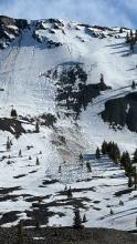
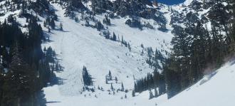
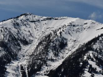
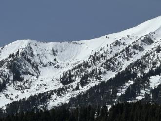
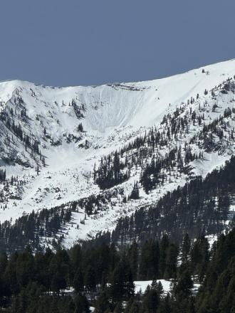
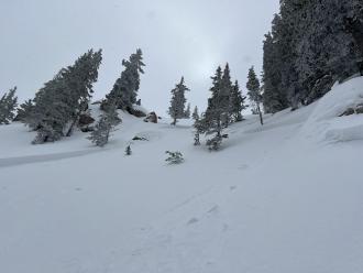
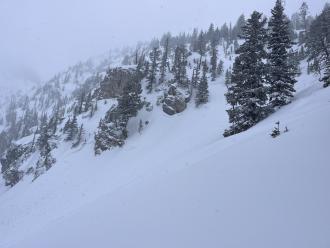
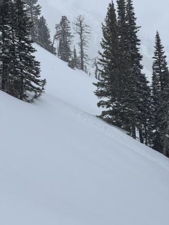
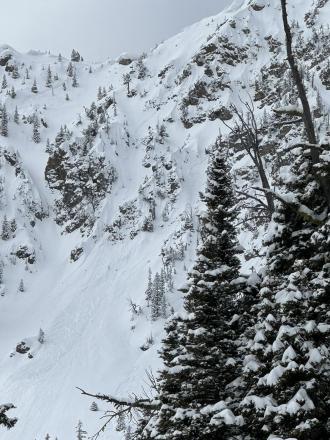
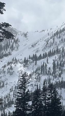
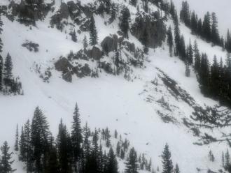
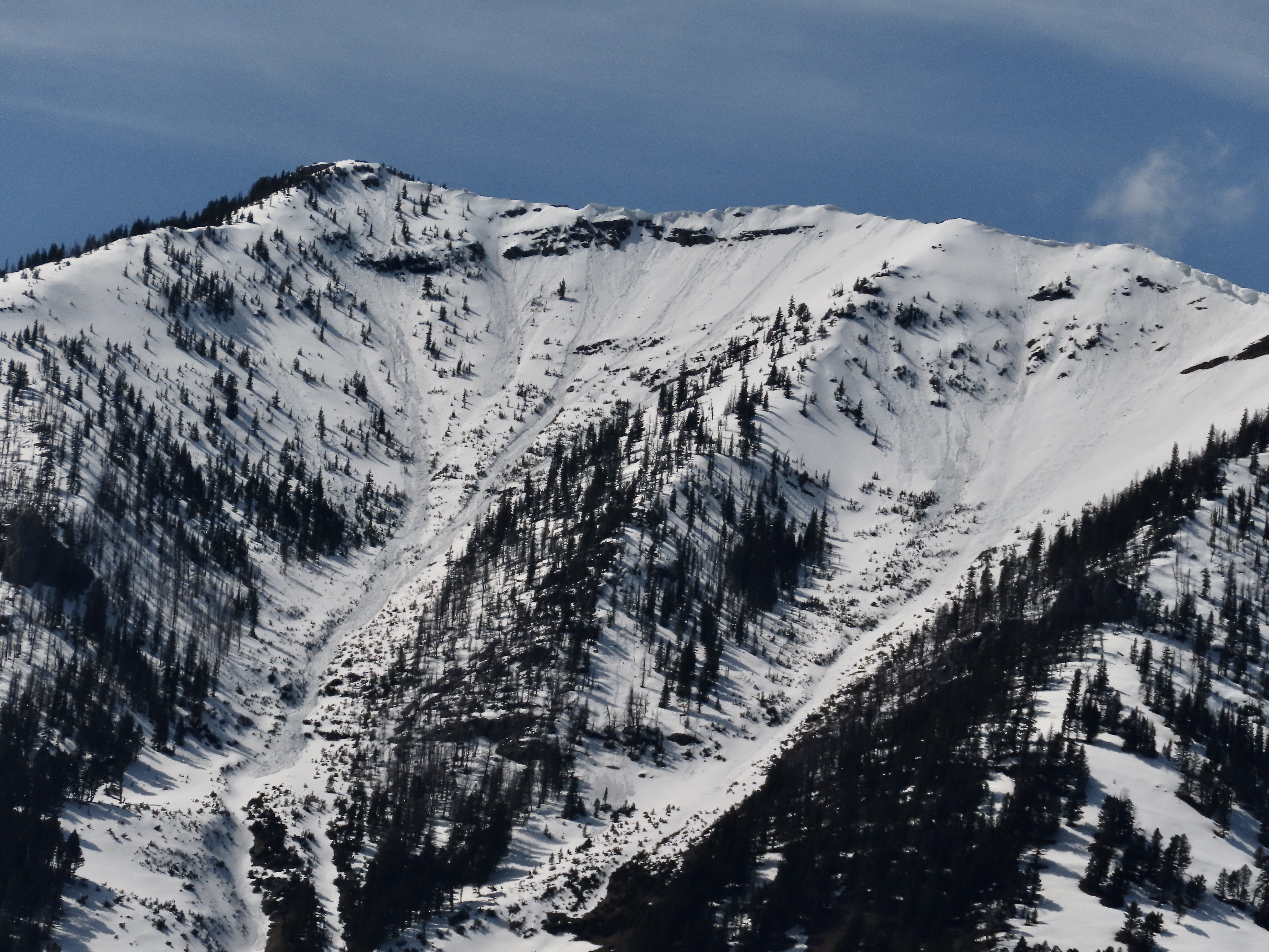
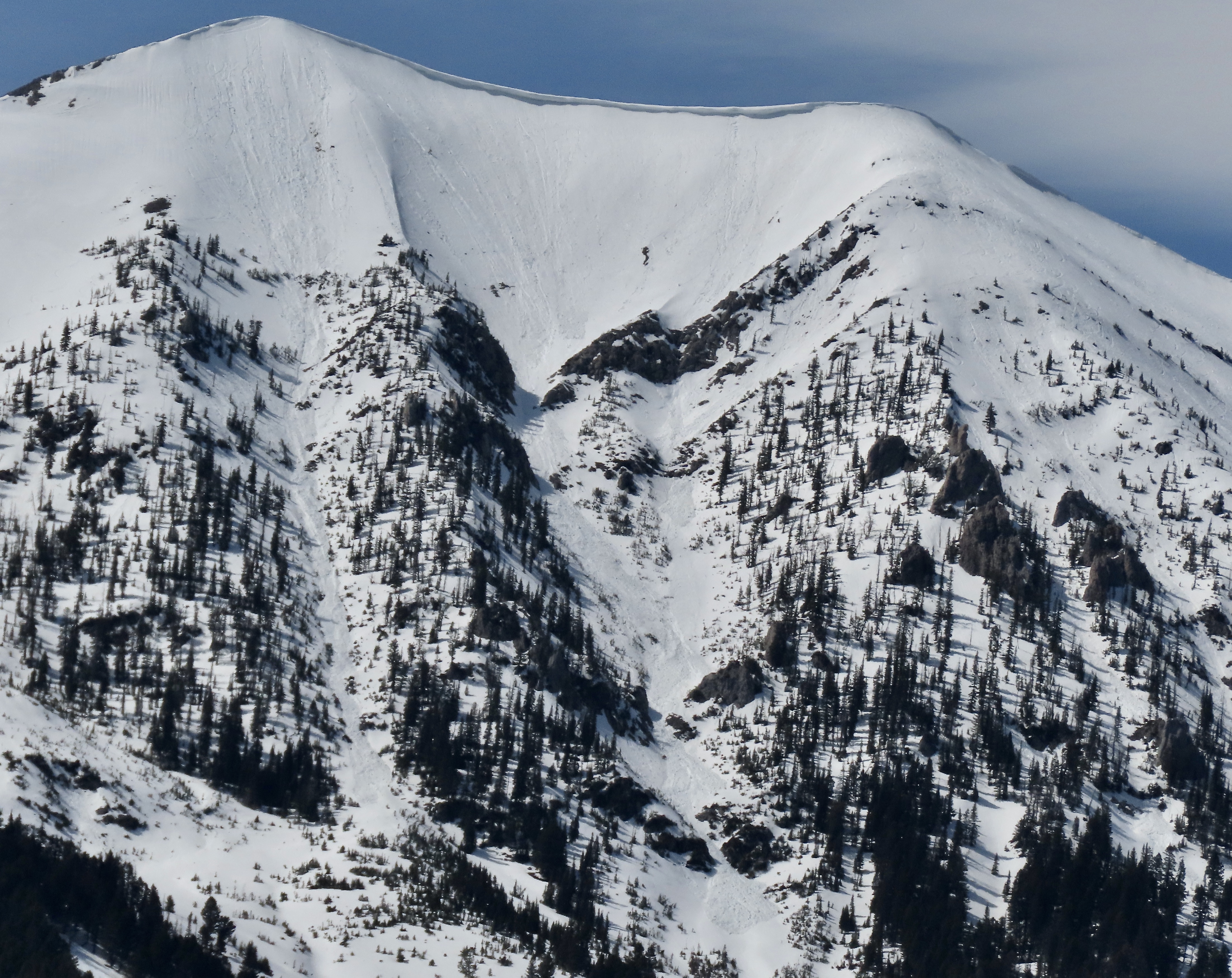
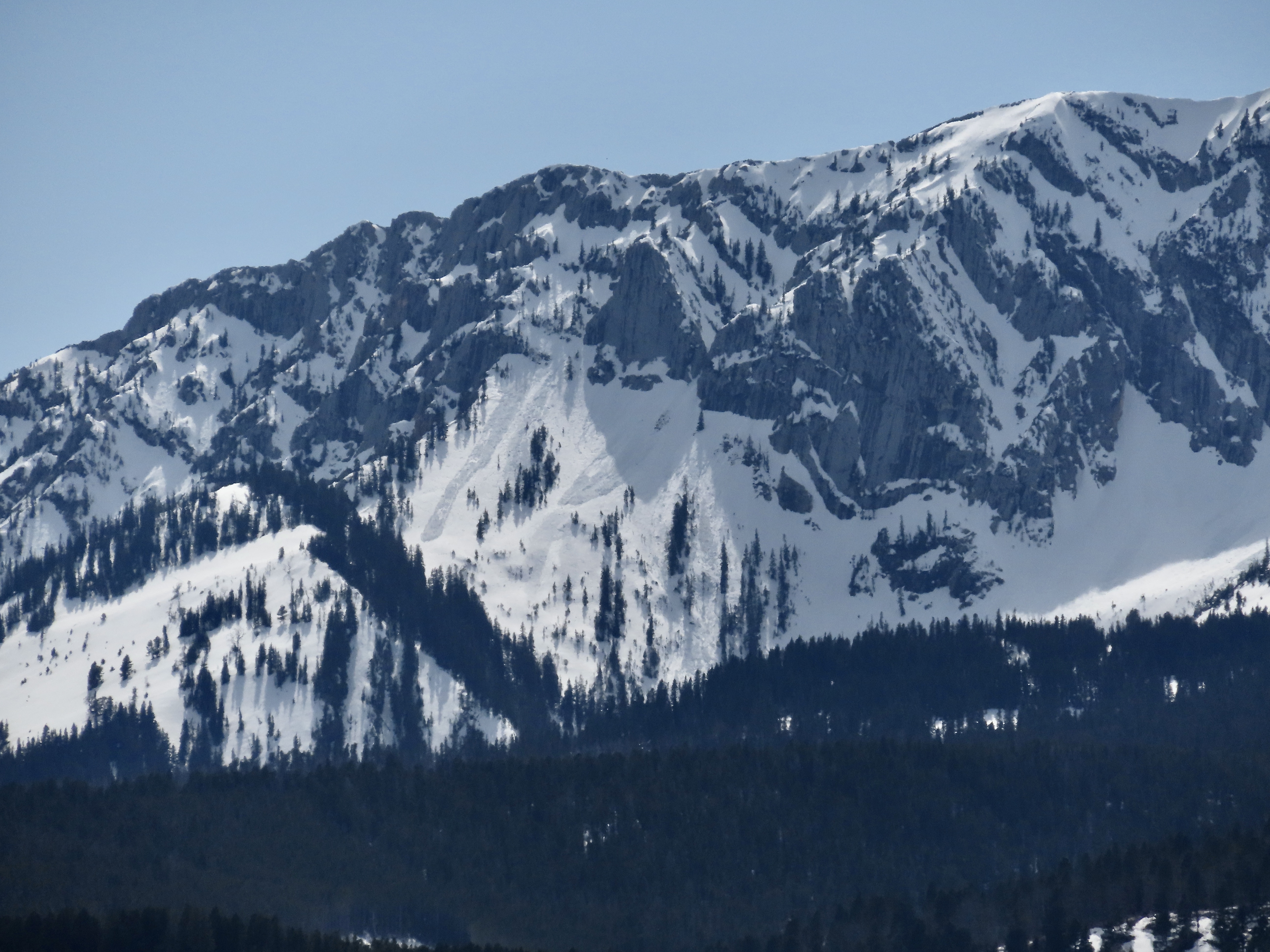
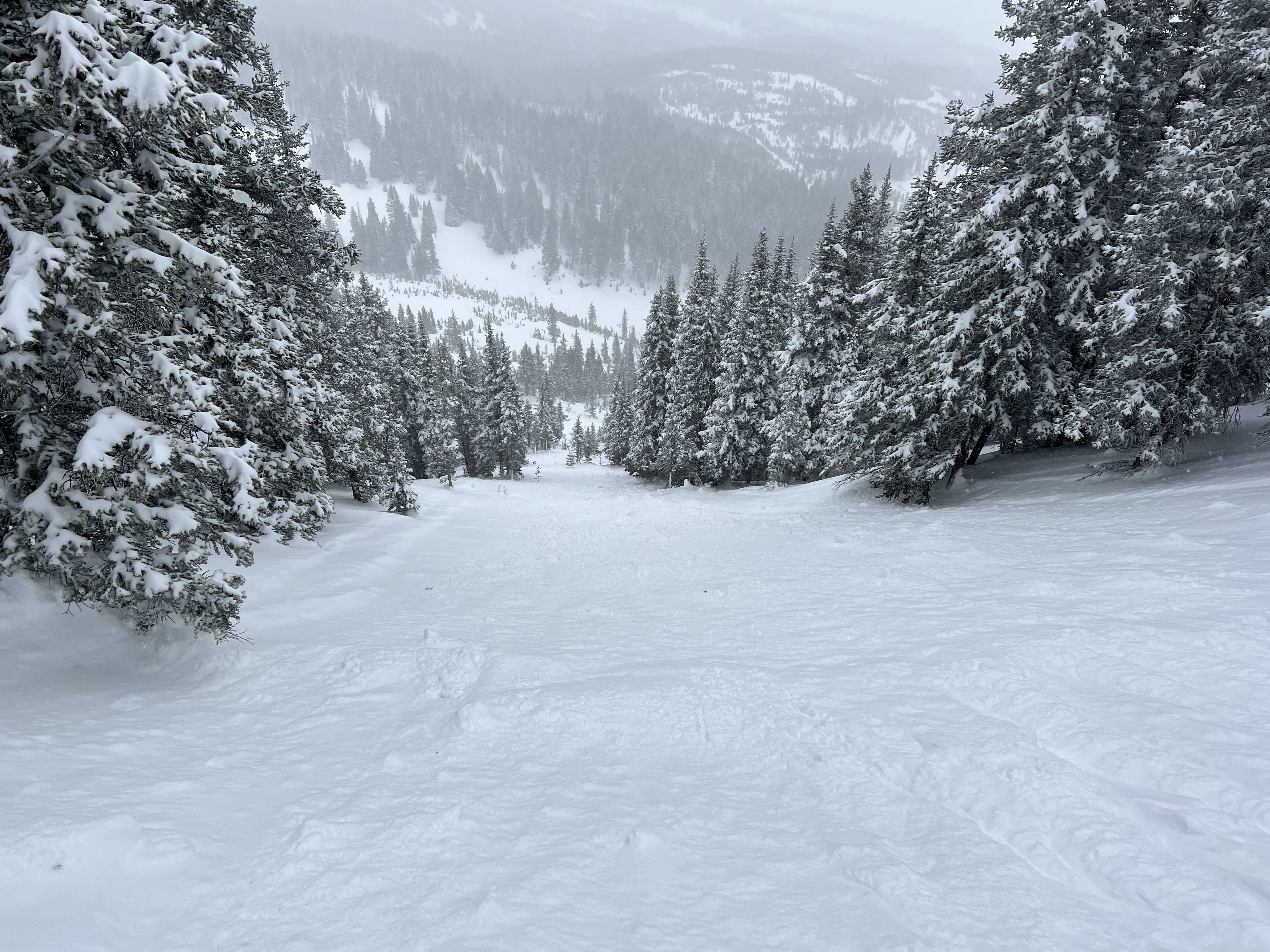
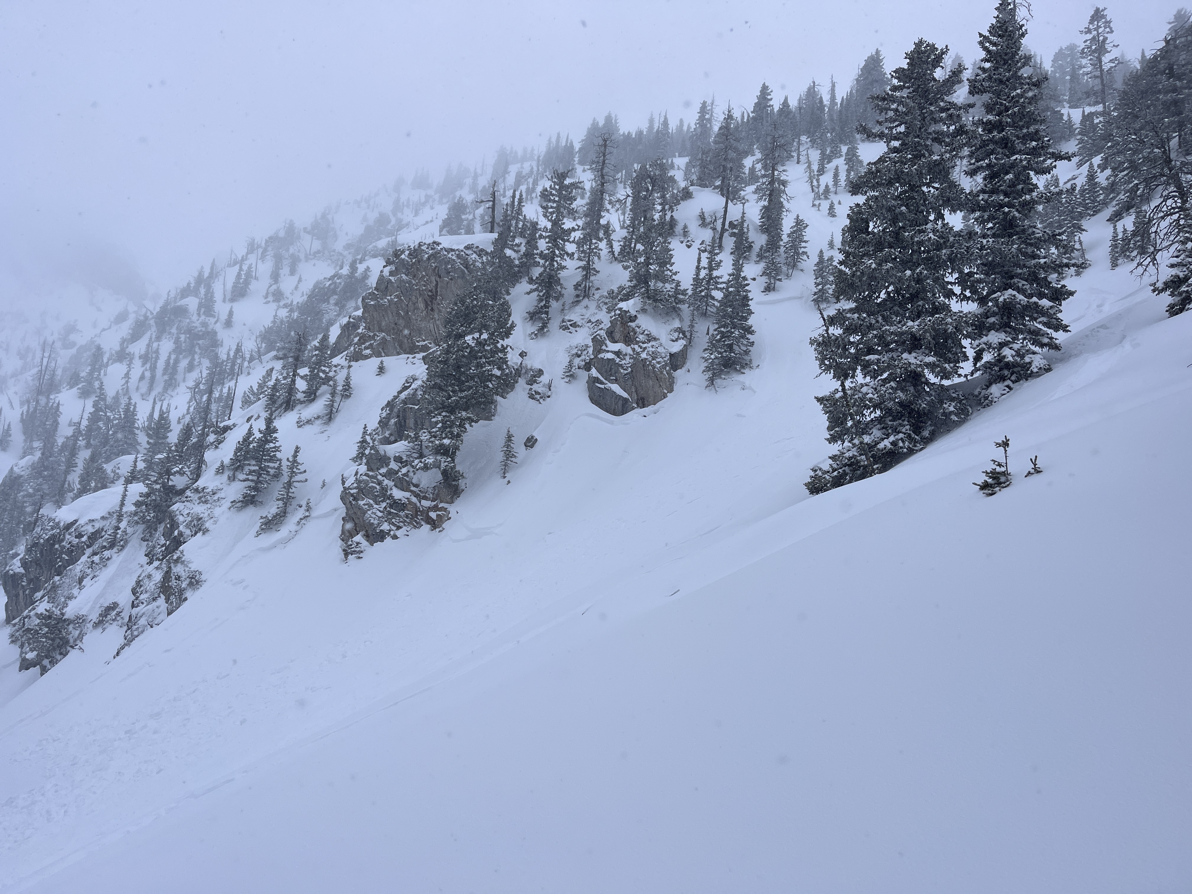
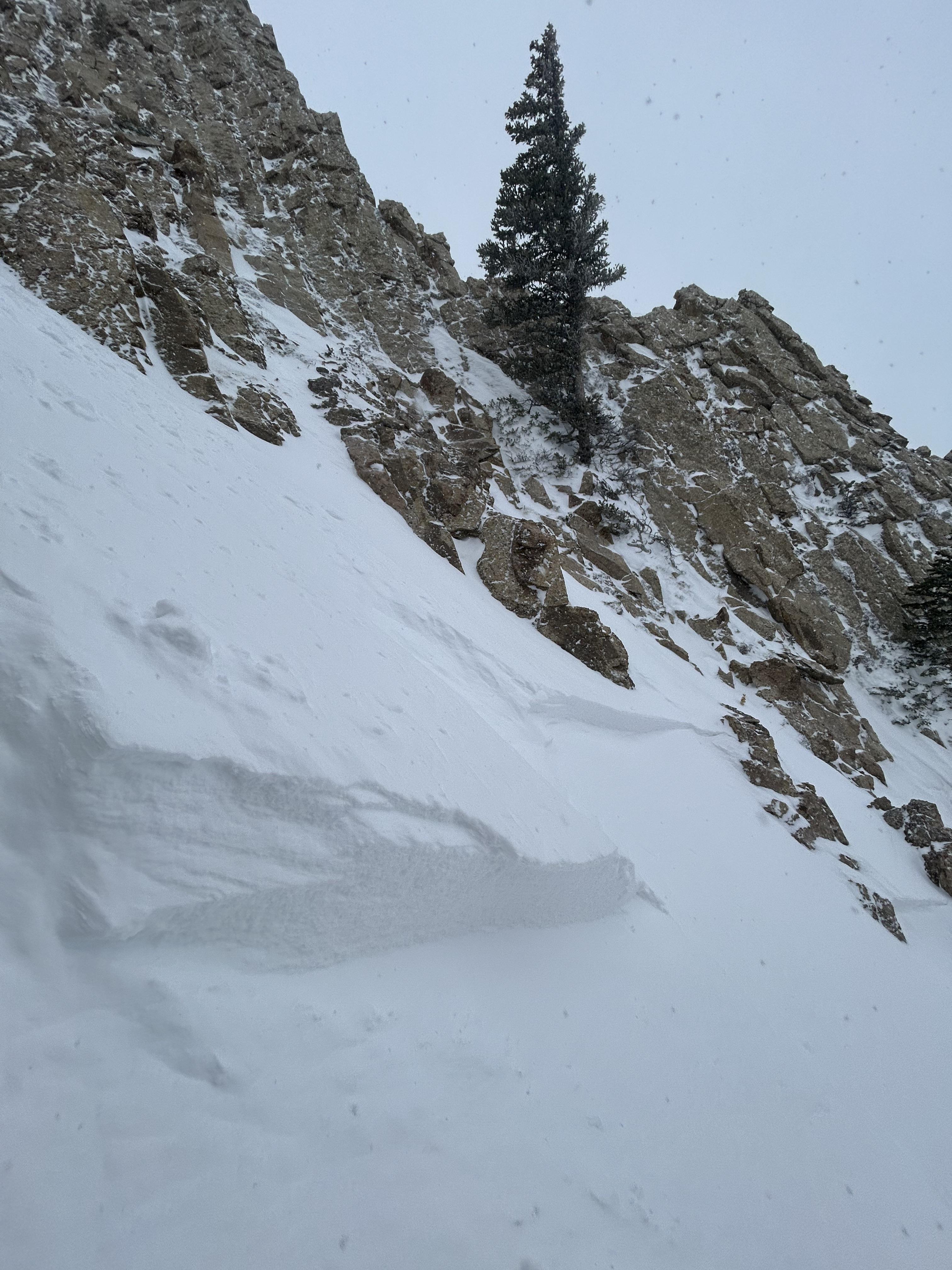
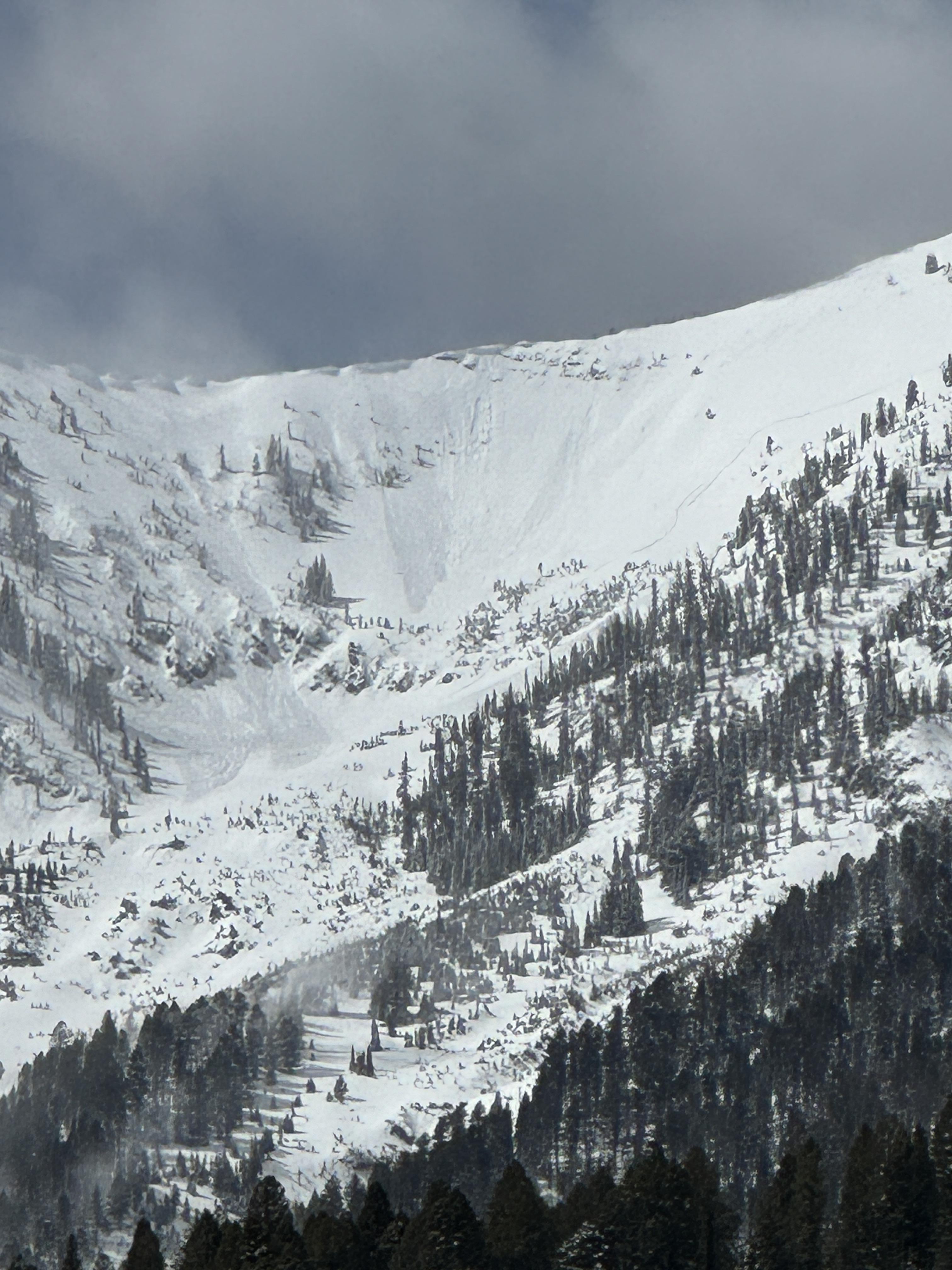
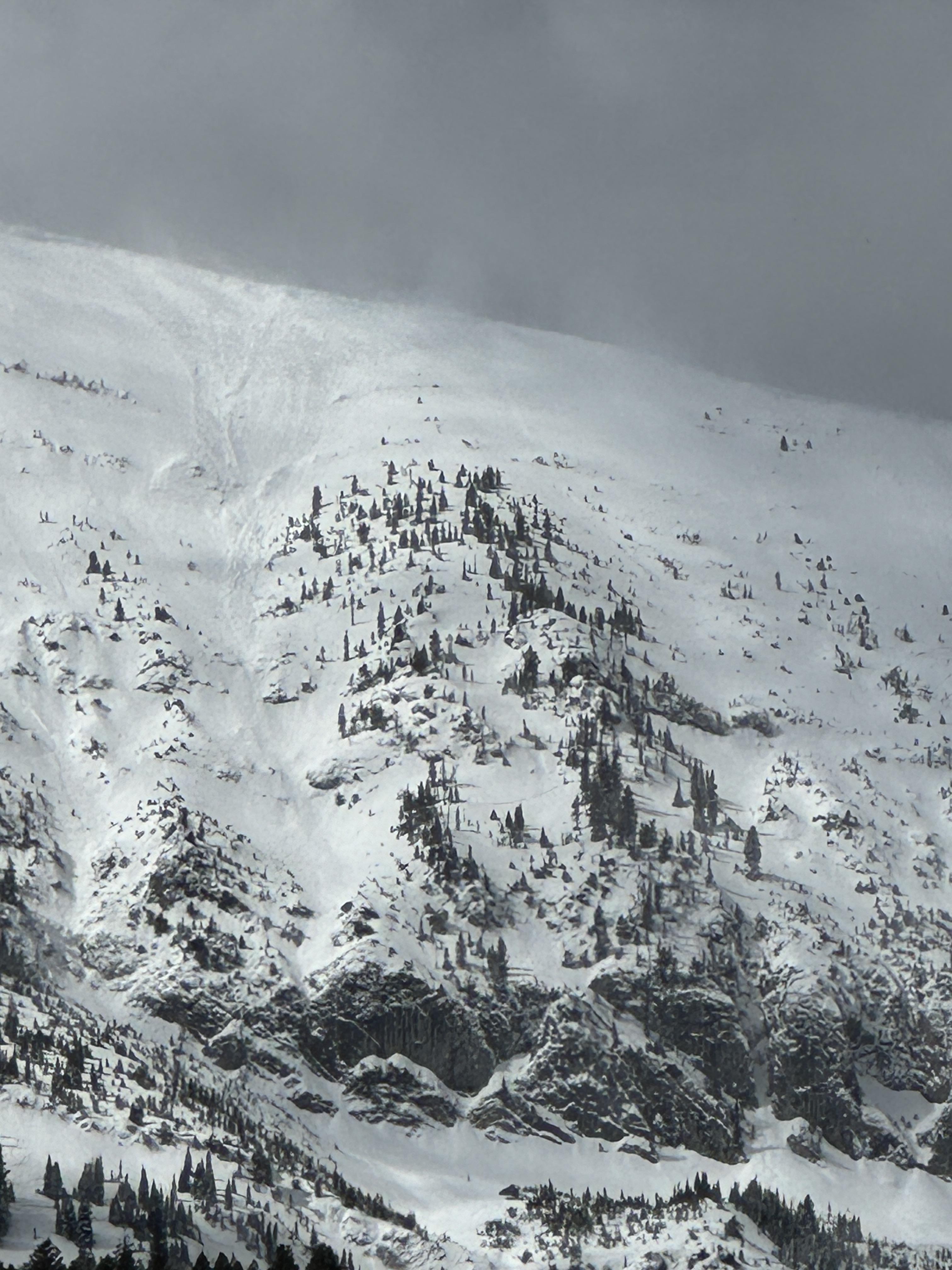
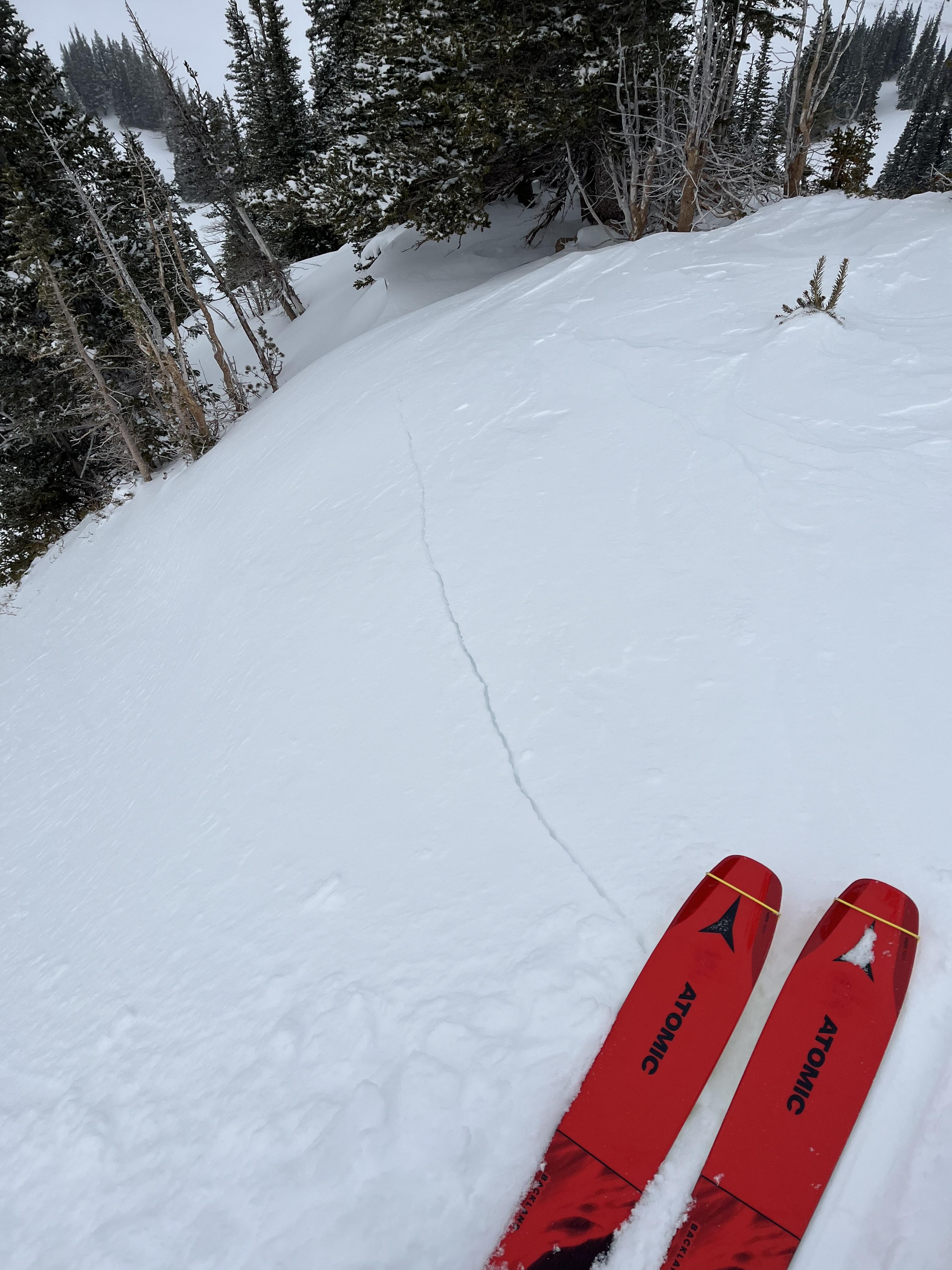
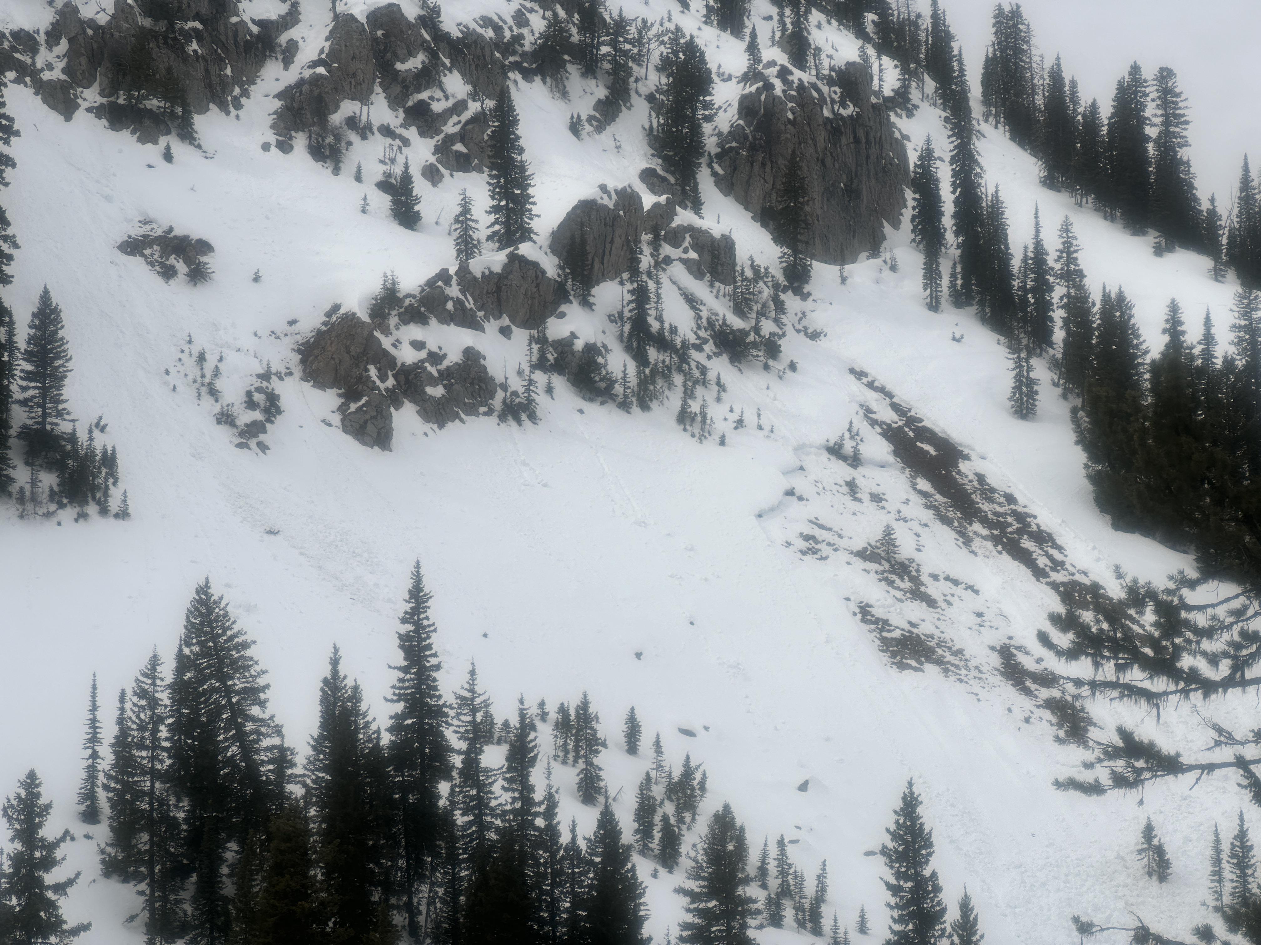
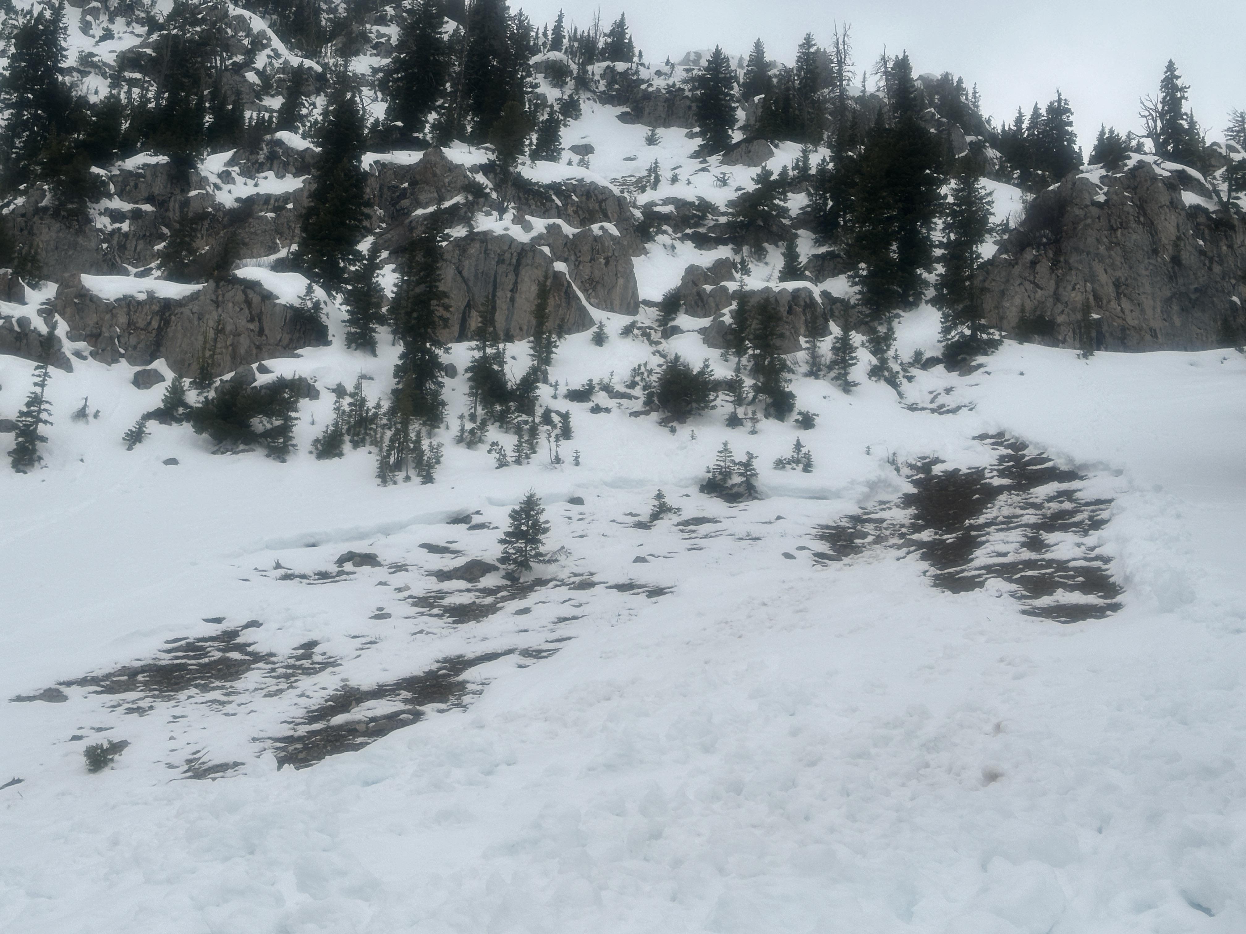
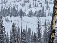
On sunday 4/14 a large wet loose avalanche ran naturally in closed terrain at Bridger. The larger of the two in the photo, on the right, is from 4/14 at 1230pm. The other slide, on the left, happened yesterday (4/13) or late in the day Friday. Photo: BBSP
Trip Planning for Bridgers

Primary Problem: Wet Snow
Bottom Line: Avalanche concerns through this weekend will chiefly be driven by the new snow that fell this week, in combination with warm temperatures and sunshine. Avalanches could break in the recent snow, particularly on shady, high elevation slopes. On sunny slopes, the new snow provides the needed ammunition for big wet loose sluffs. Recent slides also remind us that it’s still possible for avalanches to break deeper.Past 5 Days
Fri Apr 12

Considerable
Considerable
Sat Apr 13
Considerable
Considerable
Sun Apr 14

High
High
Mon Apr 15

None
None
Today
None
None
Relevant Avalanche Activity
Bridger Range
Ross Peak
Dry Loose on Ross Pk.
Ross Peak
L-AS
Coordinates: 45.8570, -110.9510
Caught: 0 ; Buried: 0
More Avalanche Details
L-AS
Coordinates: 45.8570, -110.9510
Caught: 0 ; Buried: 0
From obs: "Skied the Banana Coulior off Ross today (04/18). 6-8" of fresh, dry snow has fallen and lies above a bomber crust that was observed on all aspects we traveled on. The weak interface between new, dry snow and the pervasive crust allowed for a large sluff, or dry-loose slide, that began near the top of the Banana Coulior and ran for ~ 500'"
More Avalanche Details
Southern Madison
Quake Lake
Wet Slab Avalanche Above Quake Lake
Quake Lake
WS-N-R2-D2-G
Coordinates: 44.8524, -111.3920
Caught: 0 ; Buried: 0
More Avalanche Details
WS-N-R2-D2-G
Coordinates: 44.8524, -111.3920
Caught: 0 ; Buried: 0
From IG: Wet slide to the ground above Quake Lake.
More Avalanche Details
Bridger Range
Bridger Bowl
Natural wet loose slide at Bridger
Bridger Bowl
WL-N-R2-D2.5-O
Elevation: 8,400
Aspect: NE
Coordinates: 45.8244, -110.9280
Caught: 0 ; Buried: 0
More Avalanche Details
WL-N-R2-D2.5-O
Elevation: 8,400
Aspect: NE
Coordinates: 45.8244, -110.9280
Caught: 0 ; Buried: 0
On sunday 4/14 a large wet loose avalanche ran naturally in closed terrain at Bridger. The larger of the two in the photo, on the right, is from 4/14 at 1230pm. The other slide, on the left, happened yesterday or late in the day Friday.
More Avalanche Details
Relevant Photos
Displaying 1 - 40
-
-
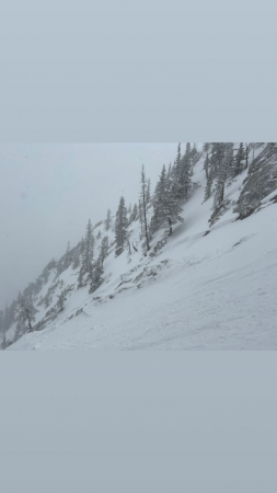
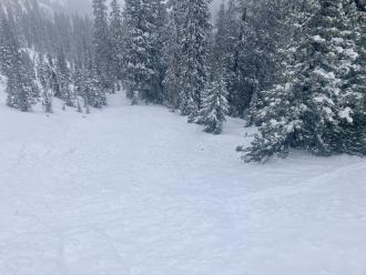
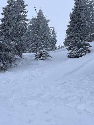
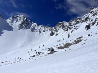
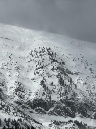
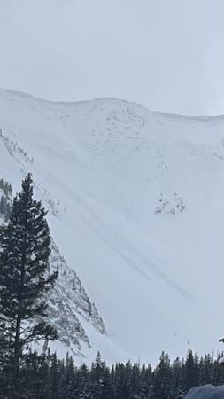
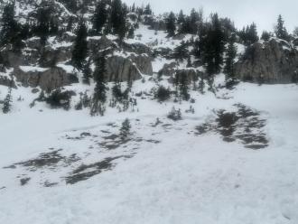
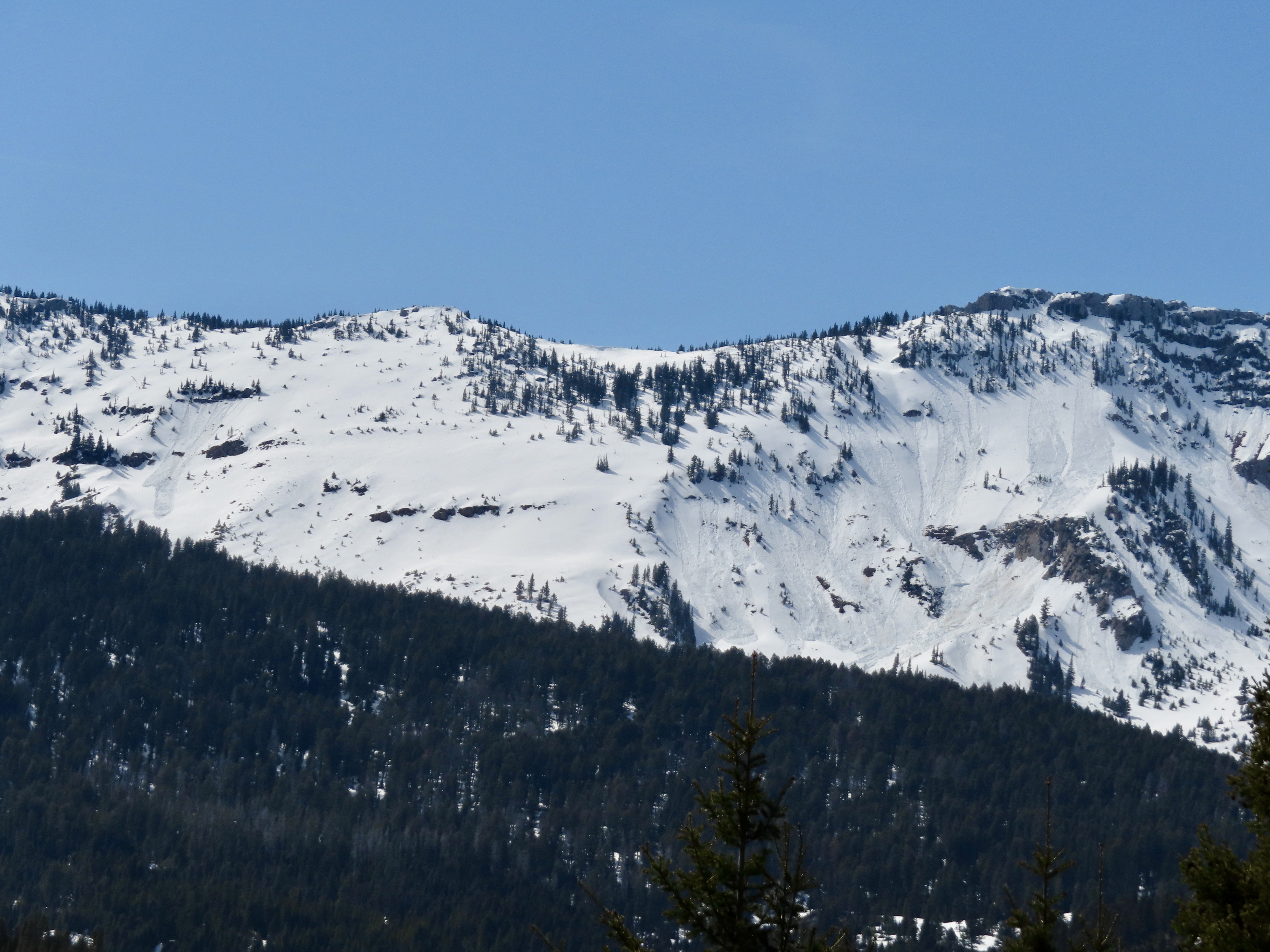
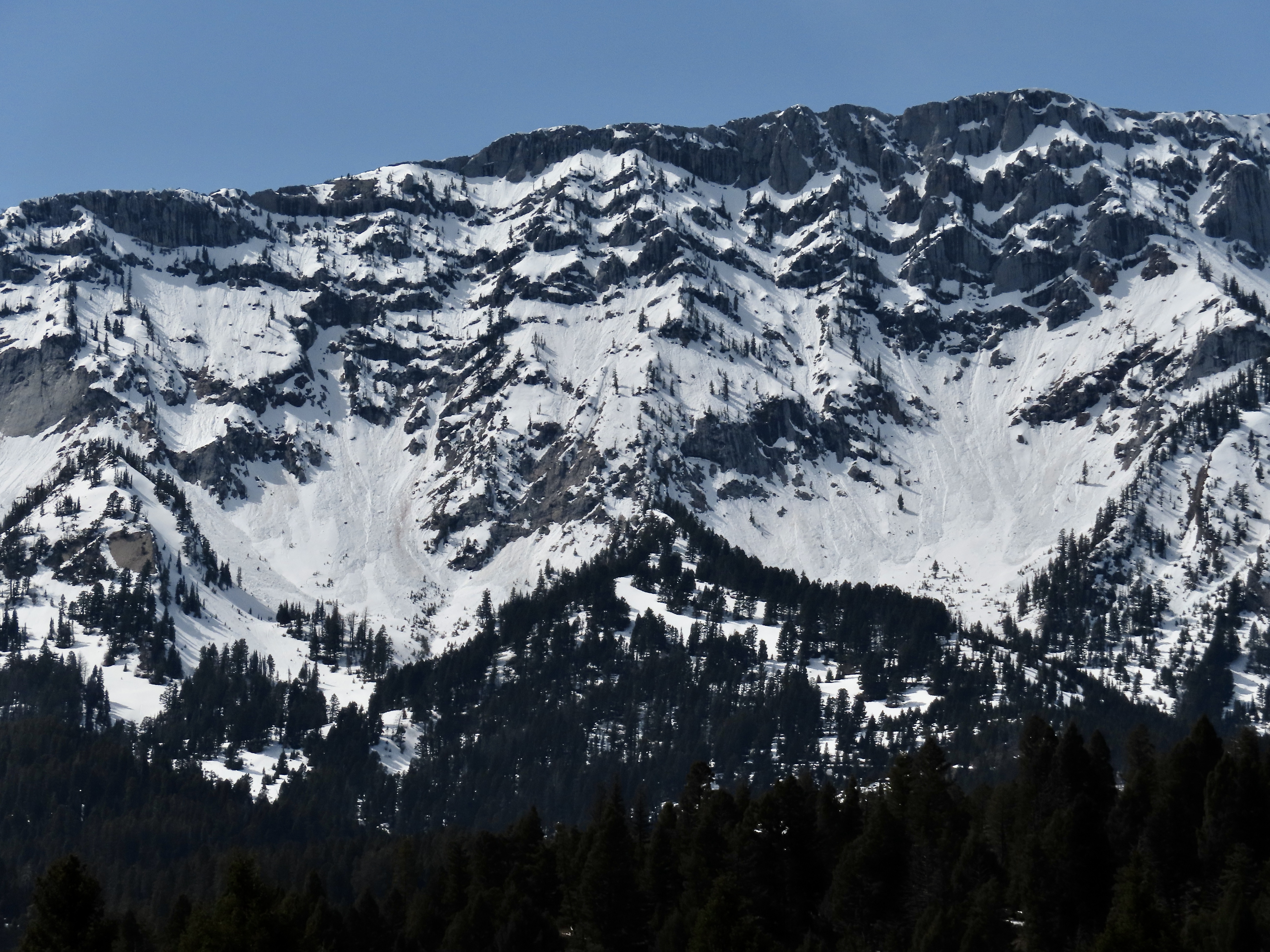
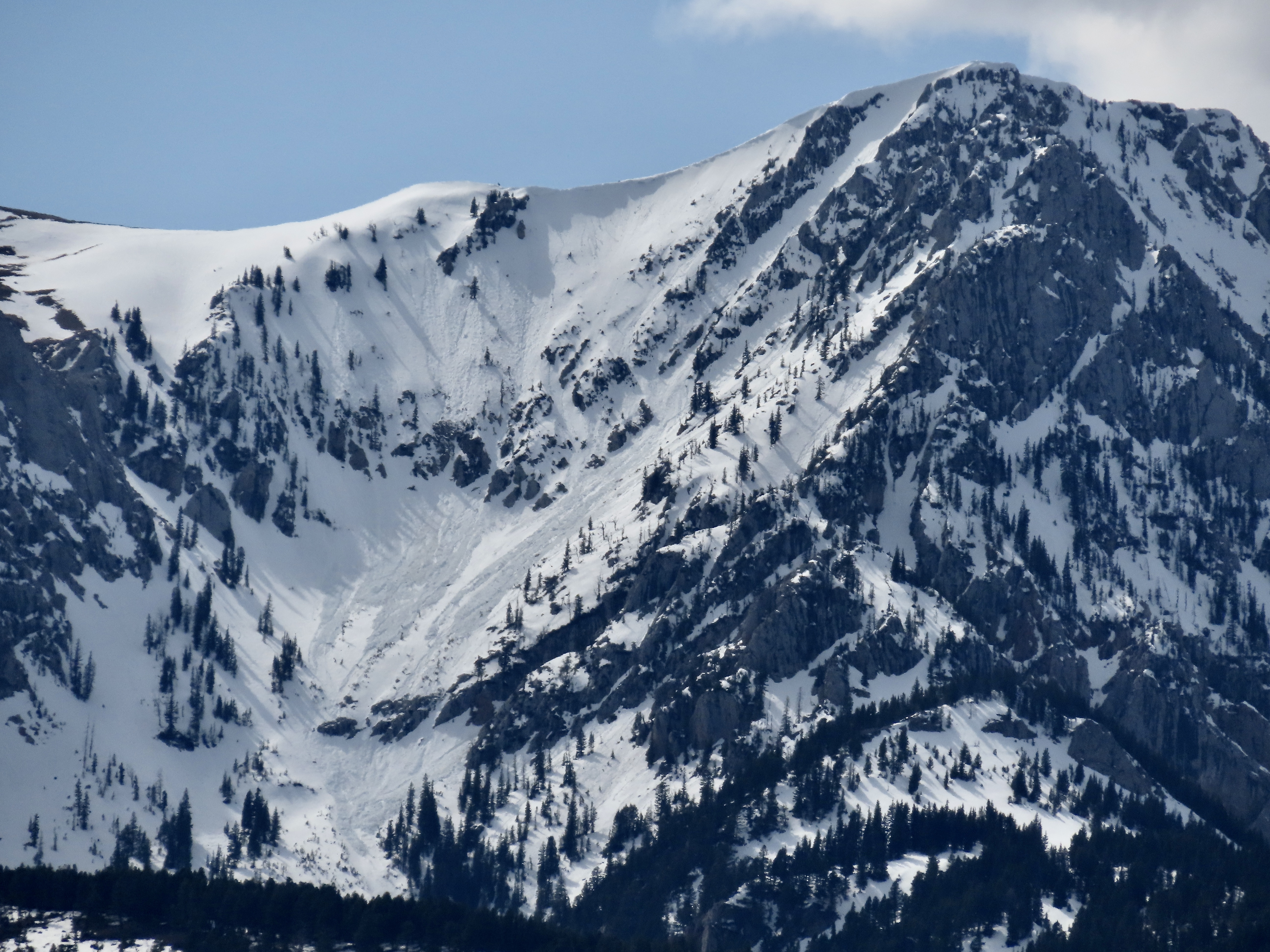
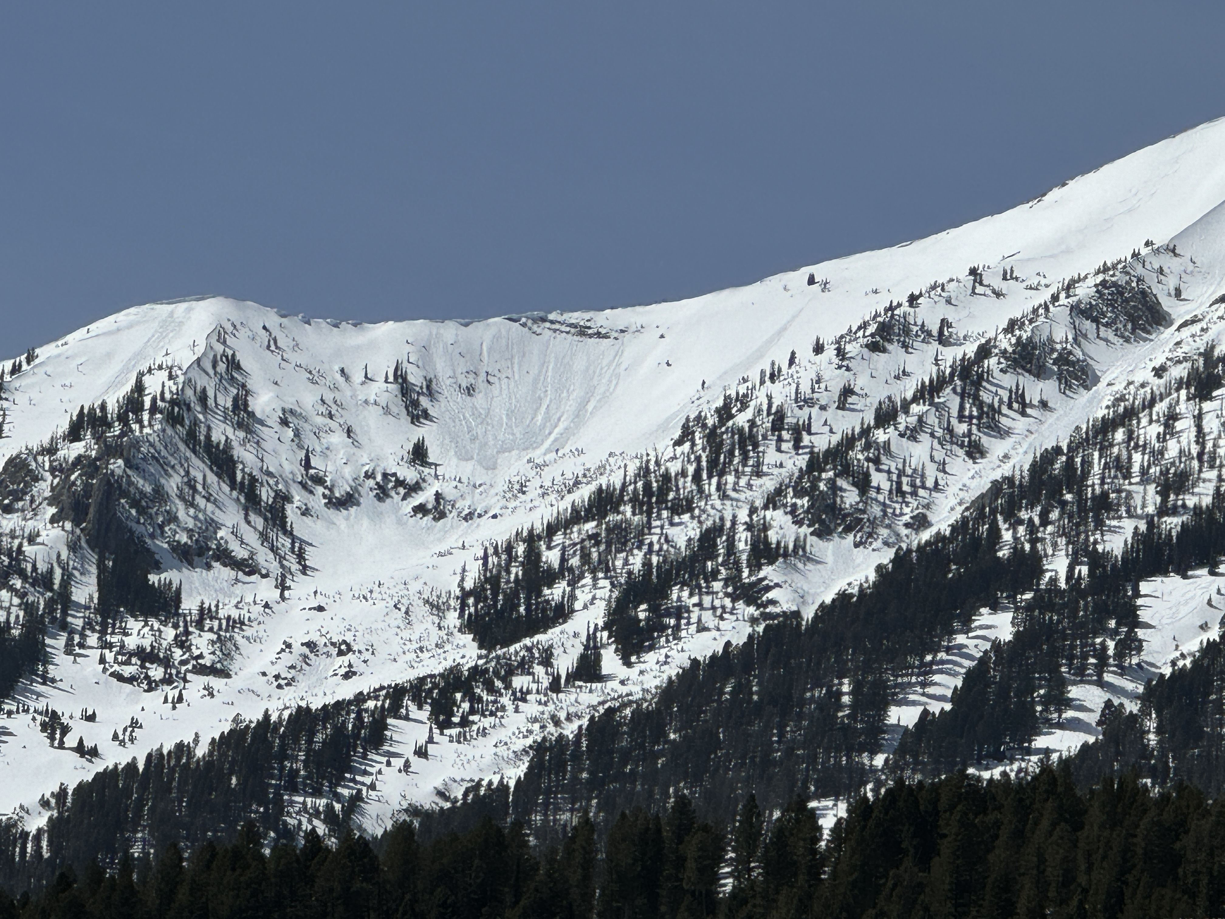
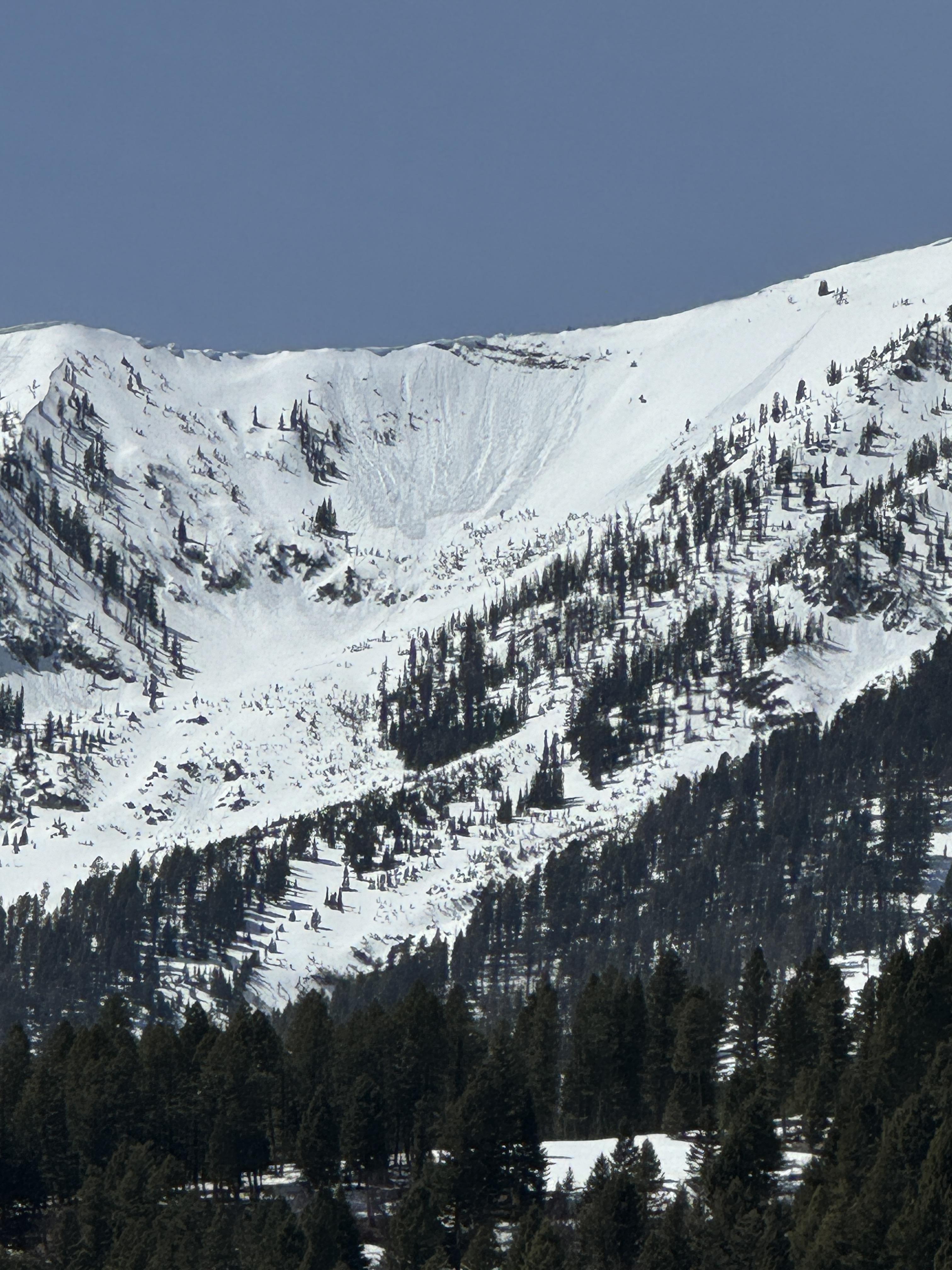
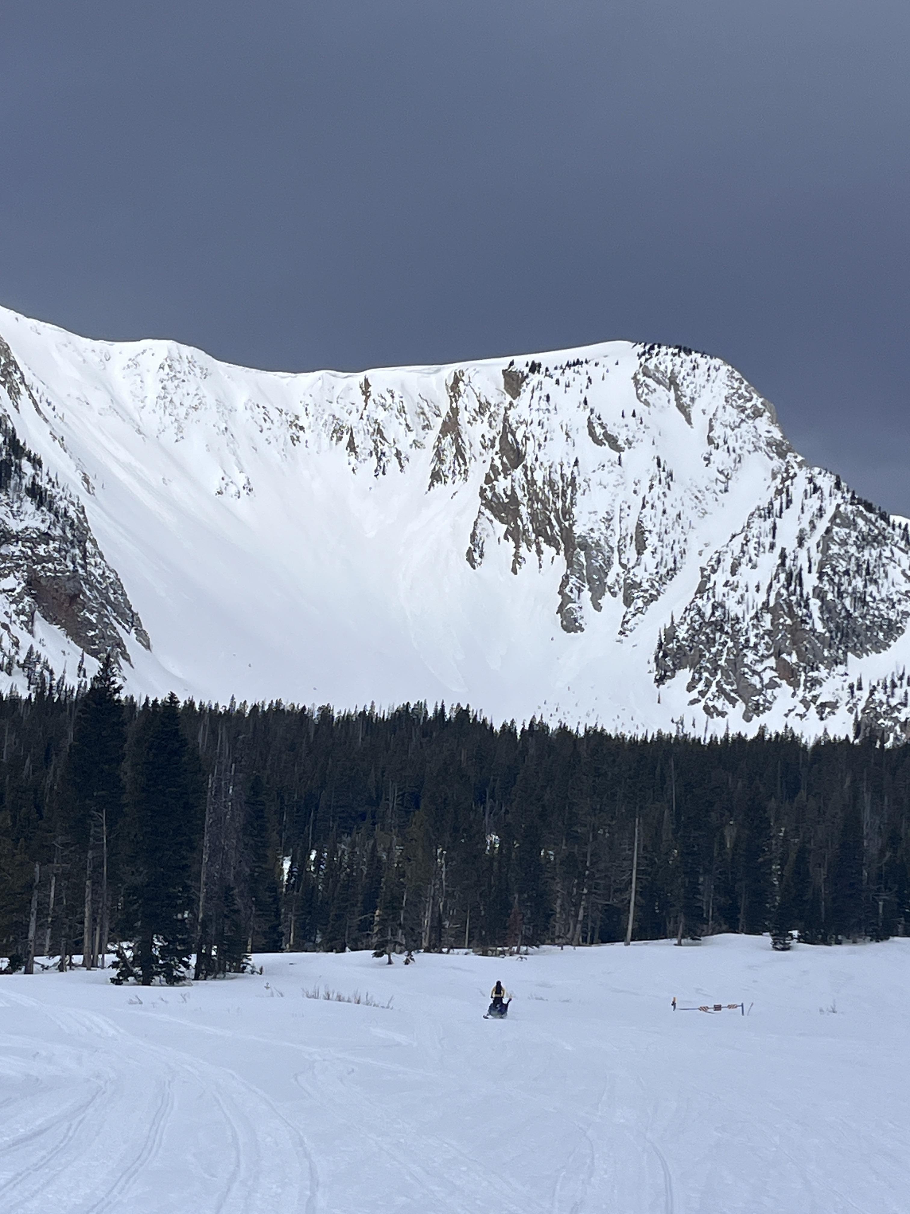
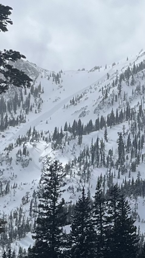
On 4/13/24 There were many loose wet avalanches that ran over the last 1-3 days. They appeared to involved the upper 6-12" of the snowpack. Photo: GNFAC
-
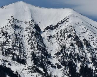
On 4/13/24 There were many loose wet avalanches that ran over the last 1-3 days. They appeared to involved the upper 6-12" of the snowpack. Photo: GNFAC
-

On 4/13/24 There were many loose wet avalanches that ran over the last 1-3 days. They appeared to involved the upper 6-12" of the snowpack. Photo: GNFAC
-
On 4/13/24 There were many loose wet avalanches that ran over the last 1-3 days. They appeared to involved the upper 6-12" of the snowpack. Photo: GNFAC
-
On 4/13/24 There were many loose wet avalanches that ran over the last 1-3 days. They appeared to involved the upper 6-12" of the snowpack. Photo: GNFAC
-

On 4/13/24 There were many loose wet avalanches that ran over the last 1-3 days. They appeared to involved the upper 6-12" of the snowpack. Photo: GNFAC
-
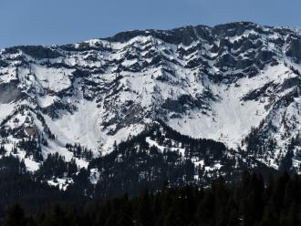
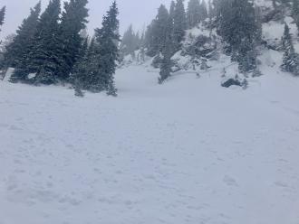
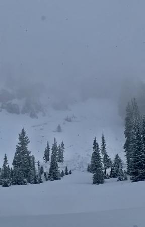
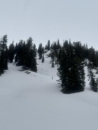
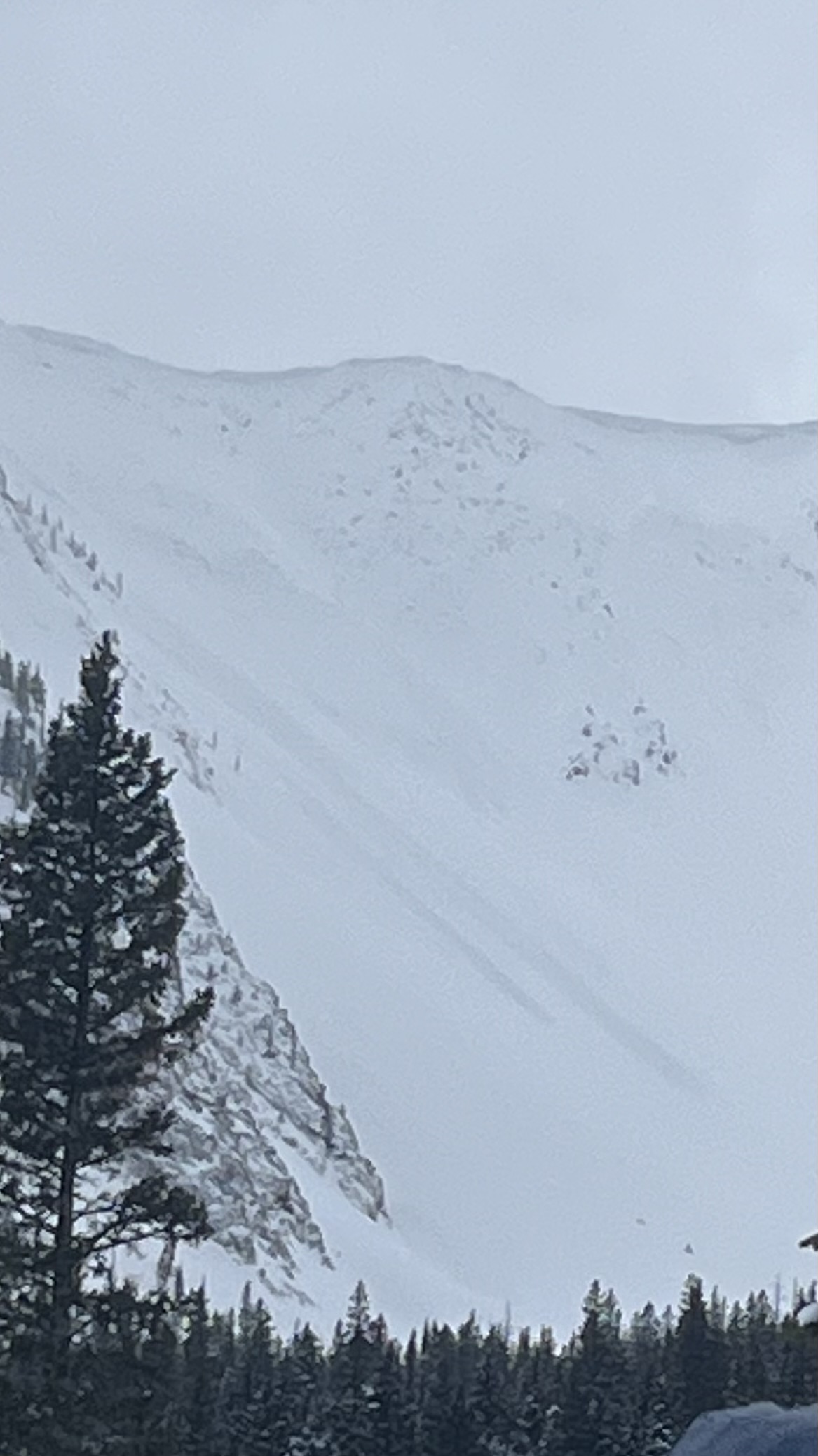
Driving home from Bridger Bowl, I spotted a number of wet, loose avalanches in Argentina Bowl. It was 1:30 PM when I saw them, and the sun was still blazing. I would expect there was more activity as the afternoon progressed. Photo: GNFAC
-
Driving home from Bridger Bowl, I spotted a number of wet, loose avalanches in Argentina Bowl. It was 1:30 PM when I saw them, and the sun was still blazing. I would expect there was more activity as the afternoon progressed. Photo: GNFAC
-
From IG message: “Rode the banana today.. lots of fast moving sluff. Had a mid elevation pocket pop. New snow seemed to have bonded well, the spot that did pop had formed into 12” slab below rock face.”
-
From IG message: “Rode the banana today.. lots of fast moving sluff. Had a mid elevation pocket pop. New snow seemed to have bonded well, the spot that did pop had formed into 12” slab below rock face.”
-

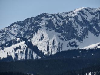
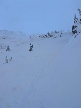
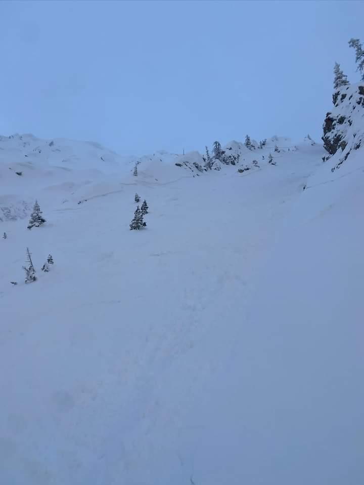
Skiers triggered this avalanche on a north-facing slope near the Anger Lake basin. The crown was 4-18 inches deep and propagated the entire width of the gully ~40 feet and ran the entire length of the gully ~500 vertical feet. The skier was able to ski out of the avalanche right as it broke and was not carried. Photo: Anonymous
-
The largest skier-triggered avalanche that we saw today. The crown extended out of frame below steep rocks. This avalanche broke ~1' deep within the recent storm snow. R2/D2. Photo: GNFAC
-
The largest skier-triggered avalanche that we saw today. The crown extended out of frame below steep rocks. This avalanche broke ~1' deep within the recent storm snow. R2/D2. Photo: GNFAC
-
The largest skier-triggered avalanche that we saw today. The crown extended out of frame below steep rocks. This avalanche broke ~1' deep within the recent storm snow. R2/D2. Photo: GNFAC
-
One of several skier-triggered avalanches that broke within the recent storm snow, ~1' deep. R2/D1.5. Photo: GNFAC
-
One of several skier-triggered avalanches that broke within the recent storm snow, ~1' deep. R2/D1.5. Photo: GNFAC
-
Riders saw this recent storm slab avalanche while riding near Fairy Lake. This avalanche was triggered by riders not in their group. Photo: Anonymous
-
Skiers in the Love Chutes triggered this avalanche after a ski cut produced no results. Further down the chute, the first skier triggered an 18" wind slab avalanche. They were carried 200' before self-arresting and were uninjured. Photo: Anonymous
-

Skiers in the Love Chutes triggered this avalanche after a ski cut produced no results. Further down the chute, the first skier triggered an 18" wind slab avalanche. They were carried 200' before self-arresting and were uninjured. Photo: Anonymous
-
A skier triggered a small avalanche on a steep north-facing pitch at the Throne, but it did not run far. Photo: GNFAC
-
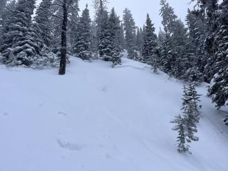
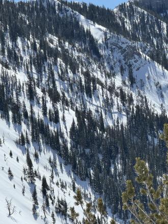
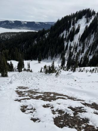
While ski touring in Frazier Basin we saw at least 12 recent loose wet avalanches on east and south aspects. Most of them started near exposed rocks and entrained the upper 6" of wet snow. Photo: GNFAC
-

Loose wet avalanches on the east face of the October Bowl from 04/02/2024. Photo: GNFAC
-
A large slab avalanche behind the Nose. Photo: GNFAC
-
From IG: Very touchy on Hollywood wall this morning. All slopes easily propagated 4-6” deep on a firm bed surface. Most were less than 50’ wide with the exception of the slide in the couloir which propagated down the entire couloir, maybe 500’ wide, and ran through the exits into the main bowl.
-

From IG: Very touchy on Hollywood wall this morning. All slopes easily propagated 4-6” deep on a firm bed surface. Most were less than 50’ wide with the exception of the slide in the couloir which propagated down the entire couloir, maybe 500’ wide, and ran through the exits into the main bowl.
-
There was a small wind-slab release out of Gibbs (I think), I suspect skier triggered, but I could make out a track. Photo: GNFAC
-

On our drive home we saw, what I assume were, natural wind-slab avalanches on Quarter Saddle (looked like a cornice collapse) and in Argentina Bowl. Bridger Peak was obscured by heavy wind-loading. Photo: GNFAC
-
On our drive home we saw, what I assume were, natural wind-slab avalanches on Quarter Saddle (looked like a cornice collapse) and in Argentina Bowl. Bridger Peak was obscured by heavy wind-loading. Photo: GNFAC
-
The wind was transporting significant amounts of the recent snow at high elevations. This is Naya Nuki loading as seen from the Ramp. Photo: GNFAC
-
The wind was transporting significant amounts of the recent snow at high elevations. This is Saddle Peak loading as seen from the Ramp. Photo: GNFAC
-
Skiers in Frazier Basin triggered several small wind slabs and saw widespread cracking on NW-facing terrain. Photo: C. Bayles
-
From obs: "Saw small avalanches on almost every wind loaded slope out of fairy lake. The one we spotted in the pomp twins had a defined crown roughly 100ft across." J. Alford
-
From obs: "Saw small avalanches on almost every wind loaded slope out of fairy lake. The one we spotted in the pomp twins had a defined crown roughly 100ft across." J. Alford
-
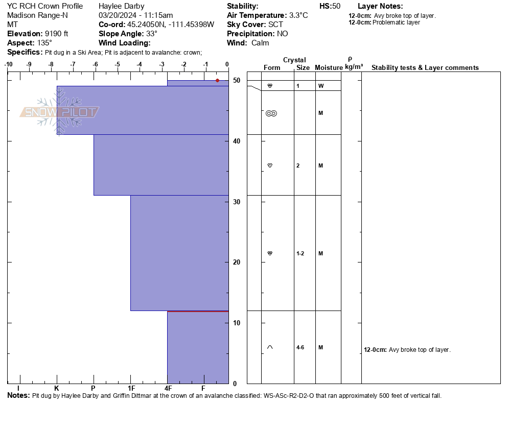
Skiers on 03/24/2024 observed this avalanche at the Playground that happened on 03/20/24. Photo: A. Newman
-
From obs. 3/23/24: "...Natural wet slab avalanche in the Playground, just North of Texas Meadows. It seemed to have been triggered from a wet loose avalanche that released from the cliffband above...." Photo: D. Sandberg
-
From obs. 3/23/24: "...Natural wet slab avalanche in the Playground, just North of Texas Meadows. It seemed to have been triggered from a wet loose avalanche that released from the cliffband above...." Photo: D. Sandberg
-
From obs 3/23/24: "...Also observed wet loose activity in S facing run off Texas (first run to the W of the summit)-photo attached. ..." Photo: D. Sandberg
-
From obs.: "Walked out the north gate of Bridger to the playground. Just north of Texas meadows observed a slide that ran sometime earlier in the week on a E aspect. Seems to have been triggered naturally by a loose wet coming out of the steep rocky terrain above. Ran about 200 feet was about 50-60 feet wide and crown was roughly 2-3 feet deep. Snow around the slide and on similar aspects was wet in the top 40 cms or so." Photo: C. Bayles


Videos- Bridgers
WebCams
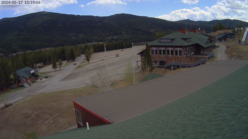
Bridger Base Area
Ridge, Looking North
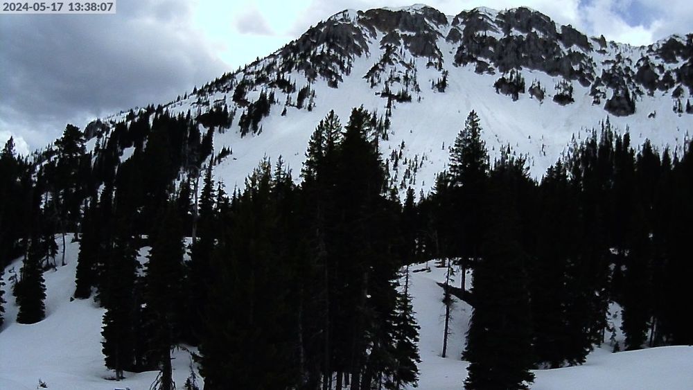
Alpine Apron


Weather Forecast Bridgers
Extended Forecast for10 Miles NNE Bozeman MT
-
Today

Mostly Sunny
High: 34 °F
-
Tonight

Mostly Clear
and BreezyLow: 16 °F
-
Saturday
Becoming
SunnyHigh: 43 °F
-
Saturday
Night
Mostly Clear
Low: 27 °F
-
Sunday
Mostly Sunny
then Chance
Rain and
WindyHigh: 54 °F
-
Sunday
NightChance
Rain/Snow and
Windy then
Chance Snow
and BlusteryLow: 26 °F
-
Monday
Mostly Sunny
High: 45 °F
-
Monday
NightMostly Clear
Low: 27 °F
-
Tuesday
Mostly Sunny
High: 54 °F
The Last Word
We began our daily forecasts on December 7. 130 daily forecasts and 464 reported avalanches later, we wrapped up our daily forecasting season on April 14th. While avalanches remain a concern until the snow is in the rivers, read our SEASON SUMMARY to look back at the heart of the 2023-24 avalanche year.